Banner Fork Coal Company, Kentucky

Last updated
Banner Fork Coal Company
USA Kentucky location map.svg
Red pog.svg
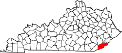
Banner Fork Coal Company
Location within the state of Kentucky
Usa edcp location map.svg
Red pog.svg
Banner Fork Coal Company
Banner Fork Coal Company (the United States)
Coordinates: 36°47′51″N83°24′7″W / 36.79750°N 83.40194°W / 36.79750; -83.40194 Coordinates: 36°47′51″N83°24′7″W / 36.79750°N 83.40194°W / 36.79750; -83.40194
Country United States
State Kentucky
County Harlan
Elevation
1,234 ft (376 m)
Time zone UTC-5 (Eastern (EST))
  Summer (DST) UTC-4 (EDT)
GNIS feature ID2565534 [1]

Banner Fork Coal Company was an unincorporated community and coal town in Harlan County, Kentucky, United States.

Related Research Articles

Perry County, Kentucky U.S. county in Kentucky

Perry County is a county located in the U.S. state of Kentucky. As of the 2010 census, the population was 28,712. Its county seat is Hazard. The county was founded in 1820. Both the county and county seat are named for Commodore Oliver Hazard Perry, a naval hero in the War of 1812.

McCreary County, Kentucky U.S. county in Kentucky

McCreary County is a county located in the U.S. state of Kentucky. As of the 2010 census, the population was 18,306. Its county seat is Whitley City. The county is named for James B. McCreary, a Confederate war hero and two-time Governor of Kentucky. During his second term as Governor, McCreary County was created by the Legislature and was named in his honor.

Harlan County, Kentucky U.S. county in Kentucky

Harlan County is a county located in southeastern Kentucky. As of the 2010 census, the population was 29,278. Its county seat is Harlan.

Breathitt County, Kentucky U.S. county in Kentucky

Breathitt County is a county located in the eastern Appalachian portion of the U.S. state of Kentucky. As of the 2010 census, the population was 13,878. Its county seat is Jackson, Kentucky. The county was formed in 1839 and was named for John Breathitt, who was Governor of Kentucky from 1832 to 1834. Breathitt County was a prohibition or dry county, until a public vote in July 2016 that allowed alcohol sales.

Cumberland, Kentucky City in Kentucky, United States

Cumberland is a home rule-class city in Harlan County, Kentucky, in the United States. The population according to the 2010 Census was 2,237, down from 2,611 at the 2000 census.

Harlan, Kentucky City in Kentucky, United States

Harlan is a home rule-class city in and the county seat of Harlan County, Kentucky, United States. The population was 1,745 at the 2010 census, down from 2,081 at the 2000 census.
Vicco, Kentucky City in Kentucky, United States

Vicco is a home rule-class city in Perry and Knott counties, Kentucky, United States. The population was 334 at the 2010 census. On January 16, 2013, Vicco became the smallest city in the United States to pass an ordinance outlawing discrimination based on sexual orientation.

Big Sandy River (Ohio River tributary) river in Kentucky, USA

The Big Sandy River is a tributary of the Ohio River, approximately 29 miles (47 km) long, in western West Virginia and northeastern Kentucky in the United States. The river forms part of the boundary between the two states along its entire course. Via the Ohio River, it is part of the Mississippi River watershed.

Kentucky River river in the United States of America

The Kentucky River is a tributary of the Ohio River, 260 miles (418 km) long, in the U.S. Commonwealth of Kentucky. The river and its tributaries drain much of the central region of the state, with its upper course passing through the coal-mining regions of the Cumberland Mountains, and its lower course passing through the Bluegrass region in the north central part of the state. Its watershed encompasses about 7,000 square miles (18,000 km2). It supplies drinking water to about one-sixth of the population of the Commonwealth of Kentucky.

Big South Fork Scenic Railway Heritage and tourist railway in McCreary County, Kentucky, US

36°41′55″N84°28′35″W

Stone, Kentucky Unincorporated community in Kentucky, United States

Stone is an unincorporated community and coal town in Pike County, Kentucky, United States. It was established in 1912. Stone was a mining community named for Galen Stone, head of the Pond Creek Coal Company which was based in Stone. In 1922 the Pond Creek Coal Company was sold to Fordson Coal Company, which was a subsidiary of Ford Motor Company. In 1936 Fordson sold the mine at Stone to Eastern Coal Company.

McCreary County Museum United States historic place

Constructed in 1907, the McCreary County Museum is housed in the former Stearns Coal and Lumber Company corporate headquarters in Stearns, Kentucky. The building served as the company's office headquarters in the Southern United States, and maintains the company president's office as an exhibit. The town where the museum is located was called the Stearns Empire of the South, and the museum continues to preserve and display the area's history from the Indian and pioneer times into the town's peak at the height of the coal and lumber industry boom. The exhibits include significant coverage of Appalachian life in McCreary County, including an exhibit on moonshine.

Blue Heron, Kentucky Coal town in Kentucky, United States

Blue Heron, also known as Mine 18, is a former coal mining community or coal town on the banks of the Big South Fork of the Cumberland River in McCreary County, Kentucky, United States, that has been recreated and is maintained as an interpretive history area in the Big South Fork National River and Recreation Area.

Barthell, Kentucky Coal town in Kentucky, United States

Barthell is a former coal town in McCreary County, Kentucky, United States. It was established in 1902 and was the first of 18 mining camps to be built by the Stearns Coal and Lumber Company. It now serves as an open-air history museum, which is open from April through Thanksgiving.

Panther, Daviess County, Kentucky Unincorporated community in Kentucky, United States

Panther is an unincorporated community located in western Daviess County, Kentucky, United States. It is home of Brushy Fork Baptist Church and the Leet's store. It is near the former location of Green Coal Company.

Cromona, Kentucky Unincorporated community in Kentucky, United States

Cromona is a small unincorporated community located in the mountains of Eastern Kentucky in Letcher County, Kentucky, United States. The Cromona post office has operated since 1916. Cromona is actually known as Haymond by the local residents. However, for reasons that are obscure, the post office was given a different name, Cromona. It was built as a coal town in 1916, and was named for the president of the Elk Horn Coal Corporation, Thomas S. Haymond. The population of Haymond was 502 as of the 2010 census.

Farraday, Kentucky Unincorporated community in Kentucky, United States

Farraday is an unincorporated community and coal town in Letcher County, Kentucky, United States. The now-defunct post office was located on Thornton Creek, a tributary of the North Fork of the Kentucky River.

Ages, Kentucky Census-designated place in Kentucky, United States

Ages is an unincorporated coal town and census-designated place (CDP) in Harlan County, Kentucky, United States.

Coxton, Kentucky Census-designated place in Kentucky, United States

Coxton is an unincorporated coal town and census-designated place (CDP) in Harlan County, Kentucky, United States. Their post office is closed. The community was listed as a CDP in 2014, so no population figures are available from the 2010 census.

London micropolitan area, Kentucky Micropolitan area in London, KY.

The London, Kentucky micropolitan area is made up of three counties in the Eastern Coalfield region of Kentucky. Before 2013, the area was officially known as the Corbin-London, KY Combined Statistical Area, and consisted of the Corbin Micropolitan Statistical Area and the London Micropolitan Statistical Area. The Corbin micropolitan area consisted of Whitley County, and the London micropolitan area consisted of Laurel County.

References