It is also the name of the sand dune system on the Swan Coastal Plain known as the Bassendean Dune System.[3][4]
History
In 1829, the land along the Swan River was allotted to British settlers as they arrived in the newly created Swan River Colony. James Henty and his brothers were granted 2,000 acres upon which they grazed their livestock and built a mud-brick homestead. They called their property Stoke Farm. In 1832, the Henty brothers sold the farm to the Colonial Secretary, Peter Broun who renamed the homestead Bassendean.[5]
Over the years the Bassendean property became incorporated into the suburb of West Guildford and in 1922, West Guildford was renamed Bassendean.[6] Flooding in 1929 caused severe damage, especially to the primary school oval.[7]
In December 1934, Bassendean Road Board held a referendum, seeking approval to borrow funds for the improvement of an area, known as Hays Swamp, on the edge of the townsite. The development would include a bowling green with floodlights, a croquet lawn, Bassendean Oval, tennis courts and provisions for other sports.[8]
Rail heritage
Bassendean is home to the Western Australian Rail Transport Museum which opened in 1974.[9] The display has a collection of steam and diesel locomotives, some of which have been restored to operational condition. Also as part of the collection are a number of carriages and other equipment associated including the Zanthus station and a signal box from Perth station.[10] The West Australian Model Railway Club is also housed within the complex.[11] The display's centrepiece is a working scale model featuring engine characters from the children's series Thomas the Tank Engine and Friends.
45 Bassendean Town Centre to Bayswater Station – serves Parker Street, James Street, Old Perth Road, Devon Road, North Road, Hyland Street, West Road, Reid Street and Kenny Street[13]
Bassendean has had an involvement in railway rolling stock construction and maintenance since Commonwealth Engineering opened a plant in 1951.[18] It closed in the 1980s, with Goninan later taking it over.[19][20]
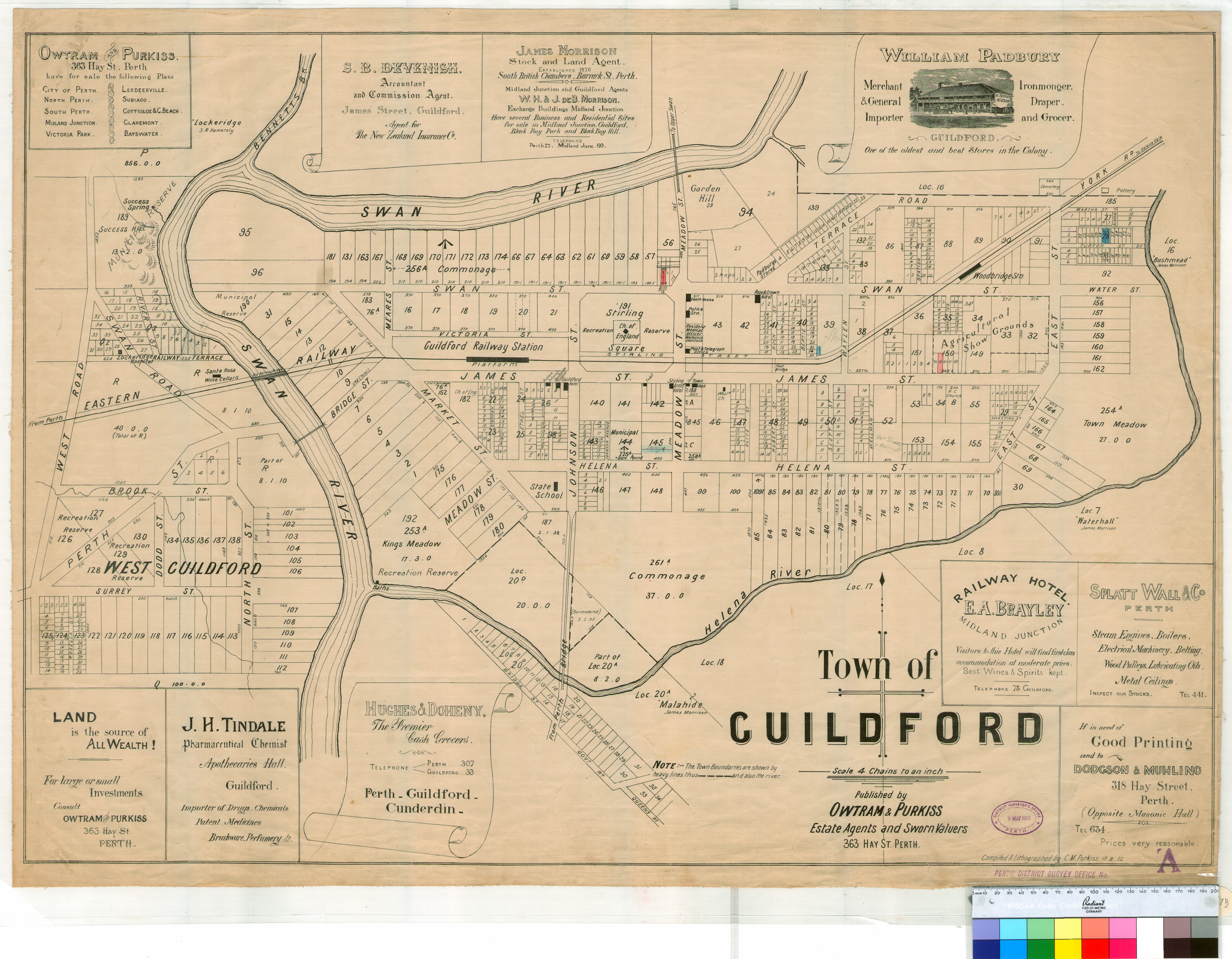
↑ "Town of Guildford"(pdf). State Records Office of Western Australia. Perth, WA: Government of Western Australia, Department for Culture and the Arts. 10 August 1902. Retrieved 27 January 2016.
↑ Bassett, Marnie (1954). The Hentys, and Australian colonial tapestry. London: Cambridge University Press.
↑ "History". Town of Bassendean – Home by the Swan. Town of Bassendean. Archived from the original on 28 February 2015. Retrieved 10 April 2015.
↑ "FLOODED SCHOOLGROUND". The Daily News. Perth, WA: National Library of Australia. 16 May 1929. p.6 Edition: HOME (FINAL) EDITION. Retrieved 11 April 2015.
This page is based on this Wikipedia article Text is available under the CC BY-SA 4.0 license; additional terms may apply. Images, videos and audio are available under their respective licenses.

