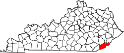
Baxter, Kentucky

Last updated
Baxter, Kentucky
USA Kentucky location map.svg
Red pog.svg
Baxter
Usa edcp location map.svg
Red pog.svg
Baxter
Coordinates: 36°51′35″N83°19′51″W / 36.85972°N 83.33083°W / 36.85972; -83.33083 Coordinates: 36°51′35″N83°19′51″W / 36.85972°N 83.33083°W / 36.85972; -83.33083
Country United States
State Kentucky
County Harlan
Elevation
[1]
1,211 ft (369 m)
Time zone UTC-5 (Eastern (EST))
  Summer (DST) UTC-4 (EDT)
ZIP codes
40806
GNIS feature ID486480 [1]

Baxter is an unincorporated community in Harlan County, Kentucky, United States.

The community sits at the confluence of Martin's Fork with Clover Fork to form the Cumberland River. [2]

Related Research Articles

Harlan County, Kentucky County in Kentucky, United States

Harlan County is a county located in southeastern Kentucky. Its county seat is Harlan. Alcohol status is classified as a moist county—a county in which alcohol sales are prohibited, but containing a "wet" city, in this case Cumberland, where package alcohol sales are allowed. In the city of Harlan, restaurants seating 100+ may serve alcoholic beverages.

Cumberland, Kentucky City in Kentucky, United States

Cumberland is a home rule-class city in Harlan County, Kentucky, in the United States. The population according to the 2010 Census was 2,237, down from 2,611 at the 2000 census.

Evarts, Kentucky City in Kentucky, United States

Evarts is a home rule-class city in Harlan County, Kentucky, in the United States. The post office was opened on February 9, 1855, and named for one of the area's pioneer families. The city was formally incorporated by the state assembly in 1921. The population was 962 at the 2010 census.

Harlan, Kentucky City in Kentucky, United States

Harlan is a home rule-class city in and the county seat of Harlan County, Kentucky, United States. The population was 1,745 at the 2010 census, down from 2,081 at the 2000 census.

Cumberland River River in Kentucky and Tennessee, United States

The Cumberland River is a major waterway of the Southern United States. The 688-mile-long (1,107 km) river drains almost 18,000 square miles (47,000 km2) of southern Kentucky and north-central Tennessee. The river flows generally west from a source in the Appalachian Mountains to its confluence with the Ohio River near Paducah, Kentucky, and the mouth of the Tennessee River. Major tributaries include the Obey, Caney Fork, Stones, and Red rivers.

U.S. Route 119 (US 119) is a spur of US 19. It is a north–south route that was an original United States highway of 1926. It is Corridor G of the Appalachian Development Highway System (ADHS) east of US 23 and KY 80 in Kentucky to Interstate 64 at Charleston, West Virginia.

The Highlands, Louisville

The Highlands is an area in Louisville, Kentucky which contains a high density of nightclubs, eclectic businesses, and many upscale and fast food restaurants. It is centered along a three-mile (5 km) stretch of Bardstown Road and Baxter Avenue and is so named because it sits atop a ridge between the middle and south forks of Beargrass Creek. The commercial area extends from the intersection of Bardstown Road and Taylorsville Road/Trevillian Way in the south, to the intersection of Baxter Avenue and Lexington Road in the north, a length of 3.2 miles (5.1 km). A 12-mile (800 m) section of the nearby Barret Avenue also contains many similar businesses. The residential area is separated from other adjacent areas like Germantown and Crescent Hill by the south and north forks of Beargrass Creek. The middle fork runs through Cherokee Park, and the south fork divides Germantown from Tyler Park, after flowing past several cemeteries and undeveloped forests downstream from Joe Creason Park. Due to its large collection of night clubs and restaurants, it is locally known as "Restaurant Row".

Martins Fork Lake

Martins Fork Lake is a 340-acre (1.4 km2) reservoir in Harlan County, Kentucky. The lake was impounded from the Martins Fork in 1979 by the United States Army Corps of Engineers. It is named for James Martin, an early pioneer in the area.

Harlan County High School (HCHS) is a public high school located in the unincorporated community of Rosspoint, Kentucky, served by the post office of another unincorporated community, Baxter. The school opened in August 2008 to replace the three previously separate public high schools in the Harlan County district: Evarts High School, James A. Cawood, and Cumberland High School. The school has been met with mixed criticism, with praises for its unique architecture, design and educational value.

Green Wix Unthank was an American attorney and United States District Judge of the United States District Court for the Eastern District of Kentucky, from 1980 to 1988, when he took senior status. A veteran of World War II, he went to college after the war and also earned his law degree. He served as a judge of Harlan County Court, had a private practice for several years, and also served as an Assistant United States Attorney for the Eastern District of Kentucky.

Cranks is an unincorporated community in southeastern Harlan County, Kentucky, United States, near the Virginia state line. Elevation ranges from 1,683 to 2,933 feet above sea level. U.S. Route 421 is the main route of travel through this community.

Cawood is a census-designated place (CDP) and coal town in Harlan County, Kentucky, United States. The population was 731 at the 2010 census.

Ages is an unincorporated coal town and census-designated place (CDP) in Harlan County, Kentucky, United States.

Coxton is an unincorporated coal town and census-designated place (CDP) in Harlan County, Kentucky, United States. Their post office is closed. The community was listed as a CDP in 2014, so no population figures are available from the 2010 census.

Smith is an unincorporated community in Harlan County, Kentucky, United States. The community lies along Kentucky State Route 987 and the Martins Fork of the Cumberland River. Smith is also home to Martins Fork Lake. The lake was constructed by the US Army Corps of Engineers as part of several flood control projects along the Cumberland River. The dam was complete and functional in November 1978. Until the early 1970s the community was served by Smith Elementary School. When plans were being made for construction to Martins Fork Lake, the school was closed and students were sent to nearby Cawood Elementary. The community post office was closed in the early 1990s. The community today is served by four churches. Pace Chapel, New Riverside Baptist Church, Full-Gospel Pentecostal Church and Faith-Holiness Church.

Banner Fork Coal Company was an unincorporated community and coal town in Harlan County, Kentucky, United States.

The Clover Fork is a 30-mile (48 km) tributary of the Cumberland River, draining a section of the Appalachian Mountains in Harlan County, southeast Kentucky in the United States. The river's confluence with the Martin's Fork at Harlan marks the official beginning of the Cumberland River.

The Poor Fork is a 45-mile (72 km) tributary of the Cumberland River in Letcher and Harlan Counties, southeast Kentucky, in the United States. The river flows from its source at Flat Gap in the Appalachian Mountains, on the Kentucky–Virginia border, generally southwest to its confluence about a mile (1.6 km) north of Harlan.

Major flooding inundated Southeast Kentucky from February 6-7, 2020, as the result of an extremely heavy rain event.

References

  1. 1 2 U.S. Geological Survey Geographic Names Information System: Baxter, Kentucky
  2. Harlan, KY, 7.5 Minute Topographic Quadrangle, USGS, 1954 (1977 rev.)

Further reading