Billings | |
|---|---|
| Township of Billings | |
 | |
 Billings  Billings | |
| Coordinates: 45°54′N82°15′W / 45.900°N 82.250°W | |
| Country | Canada |
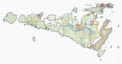
| Province | Ontario |
| District | Manitoulin |
| Incorporated | 1884 |
| Government | |
| • Type | Township |
| • Mayor | Bryan William Barker |
| • MP | Jim Belanger (Conservative) |
| • MPP | Bill Rosenberg (PC) |
| Area | |
| • Land | 208.81 km2 (80.62 sq mi) |
| Population (2021) [1] | |
• Total | 753 |
| • Density | 3.6/km2 (9.3/sq mi) |
| Time zone | UTC-5 (EST) |
| • Summer (DST) | UTC-4 (EDT) |
| Postal code | P0P 1J0 |
| Area codes | 705, 249 |
| Website | www |
Billings is a township in the Canadian province of Ontario, as well as the name of a community within that township.
Contents
Located in the Manitoulin District, the township had a population of 753 in the 2021 Canadian census. It is named after Elkanah Billings. [2]
