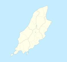
The Isle of Man TT Mountain Course or TT Course is a street and public rural road circuit located in the Isle of Man, used for motorcycle racing. The motorcycle TT Course is used principally for the Isle of Man TT Races and also the separate event of the Isle of Man Festival of Motorcycling for the Manx Grand Prix and Classic TT Races held in September of each year. The start-line for the Isle of Man TT Mountain Course is located on Glencrutchery Road in the town of Douglas, Isle of Man.
Charles Archibald Cecil Birkin was an English motorcycle racer, brother of Tim Birkin, one of the "Bentley Boys" of the 1920s.

Signpost Corner, Isle of Man is a former temporary motor-cycle race signal station, located on the A18 Snaefell Mountain Road at the road junction with the A39 Hillberry Road / B11 Avondale Road in the parish of Onchan in the Isle of Man.

Handley's Corner is situated just before the 12th Milestone road-side marker, measured from the startline at the TT Grandstand, on the Snaefell Mountain Course used for the Isle of Man TT races on the primary A3 road, in the parish of Michael, in the Isle of Man.

Creg-ny-Baa is located between the 3rd Milestone and 4th Milestone of the primary A18 Snaefell Mountain Road and the road junction with the secondary B12 'Creg-ny-Baa Back-Road', in the parish of Kirk Onchan in the Isle of Man.

The 11th Milestone, Isle of Man is situated adjacent to the 13th Milestone on the primary A3 Castletown to Ramsey Road which forms the boundary between the parishes of Kirk German and Kirk Michael in the Isle of Man.
The Verandah, Isle of Man is a series of four bends which motorcyclists negotiate at high speed during road racing on the Snaefell Mountain Course on the Isle of Man.

Governor's Bridge is a hairpin bend adjacent to a road junction on the primary A18 Mountain Road in the parish of Onchan in the Isle of Man, with a sudden drop in elevation leading to Governor's Dip, followed by a left-hand bend and finally a right exiting on to the main Glencrutchery Road.
The Four Inch Course was a road-racing circuit first used for the 1908 Tourist Trophy Race for cars, held on public roads closed for racing by an Act of Tynwald. The name of the course derives from the regulations for the 1908 Tourist Trophy adopted by the Royal Automobile Club, which limited the competitors' engines to a cylinder-diameter of four inches. The Four-Inch Course was adopted by the Auto-Cycle Club for the 1911 Isle of Man TT Races. The Four-Inch Course was subsequently known as the Snaefell Mountain Course or Mountain Course when used for motor-cycle racing.
Rhencullen including Birkin's Bend is situated adjacent to the 17th milestone of the TT course, on the primary A3 Castletown to Ramsey road in the Isle of Man.

Kate's Cottage, Isle of Man is a cottage and one of the named corners of the Snaefell Mountain Course used in Grand Prix-style motorcycle racing along public roadways of the Isle of Man. It has been asserted in the Isle of Man's program of Registered Buildings that the cottage was built by 1869.

Sarah's Cottage is situated between the 11th milestone and 12th milestones on Creg Willey’s Hill on the primary A3 Castletown to Ramsey Road in the parish of Kirk German in the Isle of Man.
Ballacraine is located between the 7th and 8th milestones of the TT course, at the junction of the A1 Douglas to Peel and A3 Castletown to Ramsey primary roads in the parish of German in the Isle of Man. It is now at the east end of the ribbon development of St. John's village. At the junction is the former public house, the Ballacraine Inn, now a private residence.
Gorse Lea is situated between the 6th Milestone and 7th Milestones on the primary A1 Douglas to Peel road in the parish of German in the Isle of Man.
Ballagarraghyn is a farm situated between the 7th milestone and 8th Milestone road-side markers on the primary A1 Douglas to Peel road in the parish of German in the Isle of Man.
Glen Helen or Lambfell Glen) is one of a series of eighteen Manx National Glens owned and maintained by the Forestry Amenity and Lands Directorate of the Isle of Man Department of Environment, Food and Agriculture.

Ballaugh Bridge is located on the primary A3 Castletown to Ramsey road and adjacent to the road junctions with the A10 Ballaugh to Ramsey coast road and the tertiary C37 Ballaugh Glen Road in the parish of Ballaugh in the Isle of Man.

Ballacrye is situated adjacent to the 19th Milestone of the TT Course, on the primary A3 Castletown to Ramsey road at the junction with the B9 Ballacrye Road, in the parish of Ballaugh in the Isle of Man.

Glen Duff is situated adjacent to the 23rd road milestone on the A3 Castletown to Ramsey road with the junction with the B14 Bernaharra Road in the parish of Kirk Christ Lezayre in the Isle of Man.

Ballagarey is located between the third and fourth milemarkers used for recognition of the Snaefell Mountain Course road-racing circuit on the primary A1 Douglas to Peel road, in the parish of Marown in the Isle of Man.
This page is based on this
Wikipedia article Text is available under the
CC BY-SA 4.0 license; additional terms may apply.
Images, videos and audio are available under their respective licenses.


