Russian is an East Slavic language, which is official in the Russian Federation, Belarus, Kazakhstan and Kyrgyzstan, as well as being widely used throughout Eastern Europe, the Baltic states, the Caucasus and Central Asia. It was the de facto language of the Soviet Union until its dissolution on 25 December 1991. Although, nowadays, nearly three decades after the breakup of the Soviet Union, Russian is used in official capacity or in public life in all the post-Soviet nation-states, as well as in Israel and Mongolia, the rise of state-specific varieties of this language tends to be strongly denied in Russia, in line with the Russian World ideology.
The classification system of the types of inhabited localities in Russia, the former Soviet Union, and some other post-Soviet states has certain peculiarities compared with the classification systems in other countries.
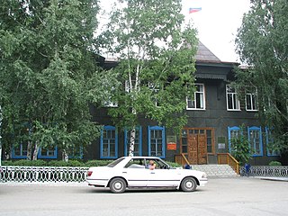
As of 2010, one rural locality in Altai Krai bears this name:
Altai Krai is a federal subject of Russia. It borders with, clockwise from the west, Kazakhstan, Novosibirsk and Kemerovo Oblasts, and the Altai Republic. The krai's administrative center is the city of Barnaul. As of the 2010 Census, the population of the krai was 2,419,755.
Pospelikhinsky District is an administrative and municipal district (raion), one of the fifty-nine in Altai Krai, Russia. It is located in the southern central part of the krai. The area of the district is 2,423 square kilometers (936 sq mi). Its administrative center is the rural locality of Pospelikha. Population: 24,788 (2010 Census); 28,065 (2002 Census); 28,560 (1989 Census). The population of Pospelikha accounts for 50.4% of the district's total population.
Arkhangelsk Oblast is a federal subject of Russia. It includes the Arctic archipelagos of Franz Josef Land and Novaya Zemlya, as well as the Solovetsky Islands in the White Sea. Arkhangelsk Oblast also has administrative jurisdiction over Nenets Autonomous Okrug. Including Nenetsia, Arkhangelsk Oblast has an area of 587,400 km2. Its population was 1,227,626 as of the 2010 Census.
Kholmogorsky District is an administrative district (raion), one of the twenty-one in Arkhangelsk Oblast, Russia. Municipally, it is incorporated as Kholmogorsky Municipal District. It is located in the center of the oblast and borders with Pinezhsky District in the east, Vinogradovsky District in the southeast, the territory of the town of oblast significance of Mirny in the south, Plesetsky District in the southwest, and with Primorsky District in the northwest. The area of the district is 16,827 square kilometers (6,497 sq mi). Its administrative center is the rural locality of Kholmogory. District's population: 25,061 (2010 Census); 30,797 (2002 Census); 35,891 (1989 Census). The population of Kholmogory accounts for 16.6% of the district's total population.
Kotlassky District is an administrative district (raion), one of the twenty-one in Arkhangelsk Oblast, Russia. As a municipal division, it is incorporated as Kotlassky Municipal District. It is located in the southeast of the oblast and borders with Krasnoborsky District in the north, Lensky District in the northeast, Vilegodsky District in the east, Luzsky District of Kirov Oblast and Velikoustyugsky District of Vologda Oblast in the south, and with Ustyansky District in the west. The area of the district is 6,300 square kilometers (2,400 sq mi). Its administrative center is the town of Kotlas. Population: 21,005 (2010 Census); 24,964 (2002 Census); 32,800 (1989 Census).
Krasnoborsky District is an administrative district (raion), one of the twenty-one in Arkhangelsk Oblast, Russia. Municipally, it is incorporated as Krasnoborsky Municipal District. It is located in the southeast of the oblast and borders with Verkhnetoyemsky District in the north, Udorsky District of the Komi Republic in the northeast, Lensky District in the east, Kotlassky District in the south, and with Ustyansky District in the west. Its administrative center is the rural locality of Krasnoborsk. District's population: 13,815 (2010 Census); 17,144 (2002 Census); 20,491 (1989 Census). The population of Krasnoborsk accounts for 34.5% of the district's total population.
Irkutsk Oblast
As of 2010, one rural locality in Irkutsk Oblast bears this name:
Irkutsk Oblast is a federal subject of Russia, located in southeastern Siberia in the basins of the Angara, Lena, and Nizhnyaya Tunguska Rivers. The administrative center is the city of Irkutsk. It had a population of 2,428,750 at the 2010 Census.
This article includes a list of related items that share the same name (or similar names). If an internal link incorrectly led you here, you may wish to change the link to point directly to the intended article.
This page is based on this Wikipedia article Text is available under the CC BY-SA 4.0 license; additional terms may apply. Images, videos and audio are available under their respective licenses.
Related Research Articles
Ivanovo is the name of several inhabited localities in Russia.
Shilovo is the name of several inhabited localities in Russia.
Pavlovo is the name of several inhabited localities in Russia.
Safonovo is the name of several inhabited localities in Russia.
Bor is the name of several inhabited localities in Russia.
Zarechye is the name of several inhabited localities in Russia.
Kamenka is the name of several inhabited localities in Russia.
Ustye is the name of several rural localities in Russia:
Markovo is the name of several rural localities in Russia.
Peski is the name of several inhabited localities in Russia.
Ruchyi is the name of several rural localities in Russia.
Zapolye is the name of several rural localities in Russia.
Pustoshka is the name of se verá la inhabited localities in Russia.
Bykovo is the name of several inhabited localities in Russia.
Pestovo is the name of several inhabited localities in Russia.
Zaozerye is the name of several rural localities in Russia.
Borisovo is the name of several rural localities in Russia.
Vorontsovo is the name of several rural localities in Russia.
Kozlovo is the name of several inhabited localities in Russia.
Vystavka is the name of several rural localities in Russia.