Soletsky District

Last updated
Soletsky District
Солецкий район(Russian)
Location of Soletsky District (Novgorod Oblast).svg
Location of Soletsky District in Novgorod Oblast
Coordinates: 58°07′N30°19′E / 58.117°N 30.317°E / 58.117; 30.317 Coordinates: 58°07′N30°19′E / 58.117°N 30.317°E / 58.117; 30.317
Coat of Arms of Soletsky rayon (Novgorod oblast).png
Flag of Soletsky rayon.png
Coat of arms
Flag
Location
Country Russia
Federal subject Novgorod Oblast [1]
Administrative structure (as of April 2012)
Administrative center town of  Soltsy [1]
Administrative divisions: [2]
Towns of district significance 1
Settlements 3
Inhabited localities: [2]
Cities/towns 1
Rural localities 172
Municipal structure (as of September 2011)
Municipally incorporated asSoletsky Municipal District [3]
Municipal divisions: [3]
Urban settlements1
Rural settlements3
Statistics
Area 1,400 km2 (540 sq mi) [4]
Population (2010 Census) 15,714 inhabitants [5]
 Urban64.2%
 Rural35.8%
Density 11.22/km2 (29.1/sq mi) [6]
Time zone MSK (UTC+03:00) [7]
EstablishedOctober 1, 1927 [8]
Official website
Soletsky District on WikiCommons

Soletsky District (Russian : Солецкий район) is an administrative [1] and municipal [3] district (raion), one of the twenty-one in Novgorod Oblast, Russia. It is located in the west of the oblast and borders with Shimsky District in the north, Volotovsky District in the east, Dnovsky District of Pskov Oblast in the south, Porkhovsky District of Pskov Oblast in the southwest, and with Strugo-Krasnensky District of Pskov Oblast in the west. The area of the district is 1,400 square kilometers (540 sq mi). [4] Its administrative center is the town of Soltsy. [1] Population: 15,714(2010 Census); [5] 18,626 (2002 Census); [9] 20,011(1989 Census). [10] The population of Soltsy accounts for 64.2% of the district's total population. [5]

Russian language East Slavic language

Russian is an East Slavic language, which is official in the Russian Federation, Belarus, Kazakhstan and Kyrgyzstan, as well as being widely used throughout Eastern Europe, the Baltic states, the Caucasus and Central Asia. It was the de facto language of the Soviet Union until its dissolution on 25 December 1991. Although, nowadays, over two decades after the breakup of the Soviet Union, Russian is used in official capacity or in public life in all the post-Soviet nation-states, as well as in Israel and Mongolia, the rise of state-specific varieties of this language tends to be strongly denied in Russia, in line with the Russian World ideology.

A raion is a type of administrative unit of several post-Soviet states. The term is from the French "rayon", which is both a type of a subnational entity and a division of a city, and is commonly translated in English as "district".

Administratively, Novgorod Oblast is divided into three cities and towns of oblast significance and twenty-one districts.

Contents

Geography

Soletsky District lies in the basin of the Shelon River, one of the principal tributaries of Lake Ilmen. Major tributaries of the Shelon inside the district are the Mshaga and the Sitnya (both left), the Lemenka, and the Koloshka (both right). The area of the district is almost flat, with some hills. Forests occupy 7,910 square kilometers (3,050 sq mi), with 94% of the forests being temperate deciduous. [11]

Drainage basin Area of land where precipitation collects and drains off into a common outlet

A drainage basin is any area of land where precipitation collects and drains off into a common outlet, such as into a river, bay, or other body of water. The drainage basin includes all the surface water from rain runoff, snowmelt, and nearby streams that run downslope towards the shared outlet, as well as the groundwater underneath the earth's surface. Drainage basins connect into other drainage basins at lower elevations in a hierarchical pattern, with smaller sub-drainage basins, which in turn drain into another common outlet.

Shelon River river in Russia, tributary of Lake Ilmen

The Shelon is a river in the northwest part of European Russia, in Dedovichsky, Porkhovsky, and Dnovsky Districts of Pskov Oblast and Soletsky and Shimsky Districts of Novgorod Oblast. The Shelon is one of the principal tributaries of Lake Ilmen. It has a length of 248 kilometres (154 mi) and drains a basin of 9,710 square kilometres (3,750 sq mi). The towns of Porkhov and Soltsy, as well as urban-type settlements of Dedovichi and Shimsk, are located on the banks of the Shelon River. The principal tributaries of the Shelon are the Sudoma (left), the Belka (right), the Polonka (right), the Uza (left), the Udokha (left), the Sitnya (left), and the Mshaga (left).

Tributary stream or river that flows into a main stem river or lake

A tributary or affluent is a stream or river that flows into a larger stream or main stem river or a lake. A tributary does not flow directly into a sea or ocean. Tributaries and the main stem river drain the surrounding drainage basin of its surface water and groundwater, leading the water out into an ocean.

History

Soltsy was first mentioned in a chronicle in 1390 and in the following years played an important role as an intermediate station on the trade route connecting Novgorod and Pskov. In 1471, the army of Ivan III won an important battle over Novgorod on the Shelon River, next to Soltsy. This battle facilitated the submergence of Novgorod by the Grand Duchy of Moscow, and Soltsy eventually fell under its control as well. [11] In the course of the administrative reform carried out in 1708 by Peter the Great, the area was included into Ingermanland Governorate (known since 1710 as Saint Petersburg Governorate). In 1727, separate Novgorod Governorate was split off, and in 1772, Pskov Governorate (Pskov Viceroyalty between 1777 and 1796) was established. In 1776, Porkhovsky Uyezd was transferred from Novgorod Governorate to Pskov Governorate. Soltsy was the seat of Soletskaya Volost of Porkhovsky Uyezd. The area was split between Porkhovsky Uyezd of Pskov Governorate and Starorussky Uyezd of Novgorod Governorate.

Veliky Novgorod City in Novgorod Oblast, Russia

Veliky Novgorod, also known as Novgorod the Great, or Novgorod Veliky, or just Novgorod, is one of the oldest and most important historic cities in Russia, which serves as the administrative center of Novgorod Oblast. It is situated on the M10 federal highway connecting Moscow and St. Petersburg. The city lies along the Volkhov River just downstream from its outflow from Lake Ilmen. UNESCO recognized Novgorod as a World Heritage site in 1992. Population: 218,717 (2010 Census); 216,856 (2002 Census); 229,126 (1989 Census).

Pskov City in Pskov Oblast, Russia

Pskov is a city and the administrative center of Pskov Oblast, Russia, located about 20 kilometers (12 mi) east from the Estonian border, on the Velikaya River. Population: 203,279 (2010 Census); 202,780 (2002 Census); 203,789 (1989 Census).

Ivan III of Russia Grand Prince of Moscow

Ivan III Vasilyevich, also known as Ivan the Great, was a Grand Prince of Moscow and "Grand Prince of all Rus'". Sometimes referred to as the "gatherer of the Russian lands", he tripled the territory of his state, ended the dominance of the Mongols/Tatars over Russia by defeating the Golden Horde, renovated the Moscow Kremlin, and laid the foundations of the Russian state. He was one of the longest-reigning Russian rulers in history.

In August 1927, the governorates and uyezds were abolished. Soletsky District, with the administrative center in Soltsy, [12] was established within Novgorod Okrug of Leningrad Oblast effective October 1, 1927. [8] It included parts of former Porkhovsky and Starorussky Uyezds. [12] Simultaneously, Soltsy was granted town status.[ citation needed ] On July 23, 1930, the okrugs were abolished, and the districts were directly subordinated to the oblast. [13] On September 20, 1931, Utorgoshsky District was abolished and merged into Soletsky District. [14] On January 1, 1932, a part of abolished Volotovsky District was merged into Soletsky District, but this was reverted on February 15, 1935 when Volotovsky District was re-established. [15] Also on February 15, 1935, Shimsky District was established with parts of Soletsky District transferred to it, [16] and Utorgoshsky District, previously merged into Soletsky District, was re-established as well. [14] Between July 1941 and February 1944, Soletsky District was occupied by German troops. [12] On July 5, 1944, Soletsky District was transferred to newly established Novgorod Oblast, [12] where it remained ever since. On February 1, 1963, the district was transformed into Soletsky Rural District [17] in the course of the Nikita Khrushchev's abortive administrative reform. At the same time a part of abolished Shimsky District was transferred to Soletsky Rural District. [18] On January 12, 1965, Soletsky Rural District was transformed into a regular district. [17] On February 1, 1973, Shimsky District was re-established, and parts of Soletsky District were transferred to it. [18]

Leningrad Oblast First-level administrative division of Russia

Leningrad Oblast is a federal subject of Russia. It was established on August 1, 1927, although it was not until 1946 that the oblast's borders had been mostly settled in their present position. The oblast was named after the city of Leningrad. Unlike the city, the oblast retains the name of Leningrad.

Volotovsky District District in Novgorod Oblast, Russia

Volotovsky District is an administrative and municipal district (raion), one of the twenty-one in Novgorod Oblast, Russia. It is located in the southwest of the oblast and borders with Shimsky District in the north, Starorussky District in the east, Poddorsky District in the south, Dedovichsky District of Pskov Oblast in the southwest, Dnovsky District of Pskov Oblast in the west, and with Soletsky District in the northwest. The area of the district is 995 square kilometers (384 sq mi), which makes it the smallest district in the oblast.= Its administrative center is the rural locality of Volot. District's population: 5,493 (2010 Census); 6,106 ; 7,058 (1989 Census). The population of Volot accounts for 40.7% of the district's total population.

Abolished districts

Effective October 1, 1927, [8] Volotovsky District with the administrative center in the settlement of Volot was also established as a part of Novgorod Okrug of Leningrad Oblast. [15] It included parts of former Starorussky Uyezd. [15] On January 1, 1932, Volotovsky District was abolished and split between Soletsky, Starorussky, Dnovsky, and Dedovichsky Districts. [15] On February 15, 1935, the district was re-established. [15]

Volot, Volot Settlement, Volotovsky District, Novgorod Oblast Settlement in Novgorod Oblast, Russia

Volot is a rural locality and the administrative center of Volotovsky District of Novgorod Oblast, Russia, located in the west of the oblast on the banks of the Psizha River. It also serves as the administrative center of Volot Settlement, one of the three settlements into which the district is administratively divided. Municipally, it is the administrative center of Volot Rural Settlement. Population: 2,236 (2010 Census); 2,329 (2002 Census); 2,485 (1989 Census).

Starorussky District District in Novgorod Oblast, Russia

Starorussky District is an administrative and municipal district (raion), one of the twenty-one in Novgorod Oblast, Russia. It is located in the southwest of the oblast and borders with Parfinsky District in the east, Demyansky and Maryovsky Districts in the southeast, Poddorsky District in the southwest, Volotovsky District in the west, and with Shimsky District in the northwest. From the north, the district is limited by Lake Ilmen. The area of the district is 3,111 square kilometers (1,201 sq mi). Its administrative center is the town of Staraya Russa. Population: 15,063 (2010 Census); 16,214 ; 18,505 (1989 Census).

Dedovichsky District District in Pskov Oblast, Russia

Dedovichsky District is an administrative and municipal district (raion), one of the twenty-four in Pskov Oblast, Russia. It is located in the east of the oblast and borders with Dnovsky District in the north, Volotovsky District of Novgorod Oblast in the northeast, Poddorsky District, also of Novgorod Oblast, in the east, Bezhanitsky District in the south, Novorzhevsky District in the southwest, and with Porkhovsky District in the west. The area of the district is 2,188 square kilometers (845 sq mi). Its administrative center is the urban locality of Dedovichi. Population: 14,692 (2010 Census); 17,881 ; 18,948 (1989 Census). The population of Dedovichi accounts for 59.9% of the district's total population.

On February 15, 1935, Shimsky District with the administrative center in the selo of Shimsk was also established, as a part of Novgorod Okrug of Leningrad Oblast. [16] It included parts of Novgorodsky, Soletsky, and Starorussky Districts. [16] On July 5, 1944, the district was transferred to newly established Novgorod Oblast. [16] On February 1, 1963, Shimsky District was abolished and split between Soletsky and Starorussky Rural Districts. [18] On February 1, 1973, the district was re-established. [18]

Shimsky District District in Novgorod Oblast, Russia

Shimsky District is an administrative and municipal district (raion), one of the twenty-one in Novgorod Oblast, Russia. It is located in the west of the oblast and borders with Batetsky District in the north, Novgorodsky District in the northeast, Starorussky District in the southeast, Volotovsky District in the south, Soletsky District in the southwest, Strugo-Krasnensky and Plyussky Districts, both of Pskov Oblast, in the west, and with Luzhsky District of Leningrad Oblast in the northwest. The area of the district is 1,836 square kilometers (709 sq mi). Its administrative center is the urban locality of Shimsk. Population: 11,750 (2010 Census); 13,312 ; 13,477 (1989 Census). The population of Shimsk accounts for 33.1% of the district's total population.

Another district established effective October 1, 1927 was Utorgoshsky District, which was a part of Luga Okrug of Leningrad Oblast and had its administrative center in the railway station of Utorgosh. [14] It included parts of former Luzhsky Uyezd of Petrograd Governorate. [14] On September 20, 1931, Utorgoshsky District was abolished and merged into Soletsky District. [14] On February 15, 1935, it was re-established, and on July 5, 1944 transferred to newly established Novgorod Oblast. [19] On December 10, 1962, the district was abolished and merged into Soletsky Rural District. [20] After a number of administrative transformations, its territory ended up divided between Soletsky and Shimsky Districts.

Economy

Industry

The main branches of industry in the district are electronic industry and food industry. [11]

Agriculture

Agriculture is the main branch of economy of the district. As of 2011, there were nine large-scale farms and twenty mid-scale private farms. The main agricultural specializations in Soletsky District are meat, milk, and eggs production. [11]

Transportation

The railway connecting St. Petersburg and Nevel via Dno crosses the district from north to south, running close to Soltsy. The railway connecting Bologoye to Pskov via Staraya Russa crosses the southern tip of the district; however, there are no significant stations on this line within the district.

Soltsy is connected by roads to Veliky Novgorod via Shimsk, to Staraya Russa via Volot, and to Dno.

The Shelon is navigable downstream of Soltsy; however, there is no passenger navigation.

Culture and recreation

Saint Ilia Cathedral in Soltsy Ilyinky sobor Soltsy.jpg
Saint Ilia Cathedral in Soltsy

The district contains 2 cultural heritage monuments of federal significance and additionally 137 objects classified as cultural and historical heritage of local significance, 51 of which are in Soltsy. [21] The federal monuments are the archaeological site "Gorodok" in the village of Gorodok [ clarification needed ] and the Saint Ilia Cathedral in Soltsy.

The Soletsky District Museum is located in the town of Soltsy. It exhibits collections of local interest. [22]

Related Research Articles

Staraya Russa Town in Novgorod Oblast, Russia

Staraya Russa is a town in Novgorod Oblast, Russia, located on the Polist River, 99 kilometers (62 mi) south of Veliky Novgorod, the administrative center of the oblast. Its population has steadily decreased over the past years, going from 41,538 recorded in the 1989 Census to 35,511 in the 2002 Census to 31,809 in the 2010 Census.

Soltsy Town in Novgorod Oblast, Russia

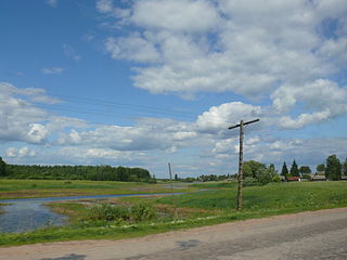
Soltsy is a town and the administrative center of Soletsky District in Novgorod Oblast, Russia, located on the left bank of the Shelon River, 78 kilometers (48 mi) southwest of Veliky Novgorod, the administrative center of the oblast. Population: 10,086 (2010 Census); 11,264 (2002 Census); 11,782 (1989 Census).

Batetsky District District in Novgorod Oblast, Russia

Batetsky District is an administrative and municipal district (raion), one of the twenty-one in Novgorod Oblast, Russia. It is located in the northwest of the oblast and borders with Luzhsky District of Leningrad Oblast in the northwest, Novgorodsky District in the east, and with Shimsky District in the south. The area of the district is 1,600 square kilometers (620 sq mi). Its administrative center is the rural locality of Batetsky. District's population: 6,335 (2010 Census); 6,996 ; 7,622 (1989 Census). The population of the administrative center accounts for 35.6% of the district's total population.

Demyansky District District in Novgorod Oblast, Russia

Demyansky District is an administrative and municipal district (raion), one of the twenty-one in Novgorod Oblast, Russia. It is located in the south of the oblast and borders with Krestetsky District in the north, Valdaysky District in the northeast, Firovsky District of Tver Oblast in the southeast, Ostashkovsky District of Tver Oblast in the south, Maryovsky District in the southwest, Starorussky District in the west, and with Parfinsky District in the northwest. The area of the district is 3,200 square kilometers (1,200 sq mi). Its administrative center is the urban locality of Demyansk. Population: 13,001 (2010 Census); 16,020 ; 18,488 (1989 Census). The population of Demyansk accounts for 41.3% of the district's total population.

Maryovsky District District in Novgorod Oblast, Russia

Maryovsky District is an administrative and municipal district (raion), one of the twenty-one in Novgorod Oblast, Russia. It is located in the south of the oblast and borders with Demyansky District in the north, Ostashkovsky and Penovsky Districts of Tver Oblast in the southeast, Andreapolsky District of Tver Oblast and Kholmsky District in the southwest, Poddorsky District in the west, and with Starorussky District in the northwest. The area of the district is 1,800 square kilometers (690 sq mi). Its administrative center is the rural locality of Maryovo. District's population: 4,673 (2010 Census); 5,711 ; 6,835 (1989 Census). The population of Maryovo accounts for 49.2% of the district's total population.

Moshenskoy District District in Novgorod Oblast, Russia

Moshenskoy District is an administrative and municipal district (raion), one of the twenty-one in Novgorod Oblast, Russia. It is located in the east of the oblast and borders with Khvoyninsky District in the north, Pestovsky District in the east, Lesnoy District of Tver Oblast in the southeast, Udomelsky District of Tver Oblast in the south, and with Borovichsky District in the west. The area of the district is 2,568 square kilometers (992 sq mi). Its administrative center is the rural locality of Moshenskoye. Population: 7,309 (2010 Census); 9,486 ; 10,679 (1989 Census). The population of Moshenskoye accounts for 34.3% of the district's total population.

Novgorodsky District District in Novgorod Oblast, Russia

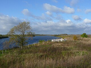
Novgorodsky District is an administrative and municipal district (raion), one of the twenty-one in Novgorod Oblast, Russia. It is located in the southwest of the oblast and borders with Tosnensky District of Leningrad Oblast in the north, Chudovsky District in the northeast, Malovishersky District in the east, Krestetsky District in the southeast, Shimsky District in the southwest, Batetsky District in the west, and with Luzhsky District of Leningrad Oblast in the northwest. In the south, the district is limited by Lake Ilmen. The area of the district is 4,600 square kilometers (1,800 sq mi). Its administrative center is the city of Veliky Novgorod. Population: 57,673 (2010 Census); 58,622 ; 55,491 (1989 Census). In terms of both area and population, this is the largest district in Novgorod Oblast.

Parfinsky District District in Novgorod Oblast, Russia

Parfinsky District is an administrative and municipal district (raion), one of the twenty-one in Novgorod Oblast, Russia. It is located in the center of the oblast and borders with Krestetsky District in the north, Demyansky District in the southeast, and with Starorussky District in the southwest. The area of the district is 1,591 square kilometers (614 sq mi). Its administrative center is the urban locality of Parfino. Population: 14,395 (2010 Census); 16,485 ; 17,650 (1989 Census). The population of Parfino accounts for 52.0% of the total district's population.

Poddorsky District District in Novgorod Oblast, Russia

Poddorsky District is an administrative and municipal district (raion), one of the twenty-one in Novgorod Oblast, Russia. It is located in the southwest of the oblast and borders with Volotovsky District in the north, Starorussky District in the northeast, Maryovsky District in the east, Kholmsky District in the south, Bezhanitsky District of Pskov Oblast in the southwest, and with Dedovichsky District of Pskov Oblast in the northwest. The area of the district is 2,952 square kilometers (1,140 sq mi). Its administrative center is the rural locality of Poddorye. District's population: 4,645 (2010 Census); 5,610 ; 6,820 (1989 Census). The population of Poddorye accounts for 40.0% of the district's total population.

Dnovsky District is an administrative and municipal district (raion), one of the twenty-four in Pskov Oblast, Russia. It is located in the east of the oblast and borders with Soletsky District of Novgorod Oblast in the northeast, Volotovsky District, also of Novgorod Oblast, in the east, Dedovichsky District in the south, and with Porkhovsky District in the west. The area of the district is 1,194 square kilometers (461 sq mi). Its administrative center is the town of Dno. Population: 13,341 (2010 Census); 16,048 ; 20,110 (1989 Census). The population of Dno accounts for 67.9% of the district's total population.

Porkhovsky District is an administrative and municipal district (raion), one of the twenty-four in Pskov Oblast, Russia. It is located in the central and northeastern parts of the oblast and borders with Strugo-Krasnensky District in the north, Soletsky District of Novgorod Oblast in the northeast, Dnovsky District in the east, Dedovichsky District in the southeast, Novorzhevsky District in the south, Ostrovsky District in the southwest, and with Pskovsky District in the west. The area of the district is 3,190 square kilometers (1,230 sq mi). Its administrative center is the town of Porkhov. Population: 21,568 (2010 Census); 28,470 ; 35,015 (1989 Census). The population of Porkhov accounts for 49.2% of the district's total population.

Strugo-Krasnensky District District in Pskov Oblast, Russia

Strugo-Krasnensky District is an administrative and municipal district (raion), one of the twenty-four in Pskov Oblast, Russia. It is located in the northeast of the oblast and borders with Plyussky District in the north, Shimsky and Soletsky Districts of Novgorod Oblast in the east, Porkhovsky District in the south, Pskovsky District in the west, and with Gdovsky District in the northwest. The area of the district is 3,090.1 square kilometers (1,193.1 sq mi). Its administrative center is the urban locality of Strugi Krasnye. Population: 13,466 (2010 Census); 16,579 ; 16,293 (1989 Census). The population of Strugi Krasnye accounts for 62.7% of the district's total population.

References

Notes

  1. 1 2 3 4 Law #559-OZ
  2. 1 2 Resolution #121
  3. 1 2 3 Law #399-OZ
  4. 1 2 Солецкий район Новгородской области (in Russian). Портал Интернет-издательства PDG. Retrieved June 20, 2012.
  5. 1 2 3 Russian Federal State Statistics Service (2011). "Всероссийская перепись населения 2010 года. Том 1" [2010 All-Russian Population Census, vol. 1]. Всероссийская перепись населения 2010 года (2010 All-Russia Population Census) (in Russian). Federal State Statistics Service . Retrieved June 29, 2012.
  6. The value of density was calculated automatically by dividing the 2010 Census population by the area specified in the infobox. Please note that this value is only approximate as the area specified in the infobox does not necessarily correspond to the area of the entity proper or is reported for the same year as the population.
  7. Правительство Российской Федерации. Федеральный закон №107-ФЗ от 3 июня 2011 г. «Об исчислении времени», в ред. Федерального закона №271-ФЗ от 03 июля 2016 г. «О внесении изменений в Федеральный закон "Об исчислении времени"». Вступил в силу по истечении шестидесяти дней после дня официального опубликования (6 августа 2011 г.). Опубликован: "Российская газета", №120, 6 июня 2011 г. (Government of the Russian Federation. Federal Law #107-FZ of June 31, 2011 On Calculating Time , as amended by the Federal Law #271-FZ of July 03, 2016 On Amending Federal Law "On Calculating Time". Effective as of after sixty days following the day of the official publication.).
  8. 1 2 3 Snytko et al., p. 85
  9. Russian Federal State Statistics Service (May 21, 2004). "Численность населения России, субъектов Российской Федерации в составе федеральных округов, районов, городских поселений, сельских населённых пунктов – районных центров и сельских населённых пунктов с населением 3 тысячи и более человек" [Population of Russia, Its Federal Districts, Federal Subjects, Districts, Urban Localities, Rural Localities—Administrative Centers, and Rural Localities with Population of Over 3,000](XLS). Всероссийская перепись населения 2002 года [All-Russia Population Census of 2002] (in Russian). Retrieved August 9, 2014.
  10. Demoscope Weekly (1989). "Всесоюзная перепись населения 1989 г. Численность наличного населения союзных и автономных республик, автономных областей и округов, краёв, областей, районов, городских поселений и сёл-райцентров" [All Union Population Census of 1989: Present Population of Union and Autonomous Republics, Autonomous Oblasts and Okrugs, Krais, Oblasts, Districts, Urban Settlements, and Villages Serving as District Administrative Centers]. Всесоюзная перепись населения 1989 года [All-Union Population Census of 1989] (in Russian). Институт демографии Национального исследовательского университета: Высшая школа экономики [Institute of Demography at the National Research University: Higher School of Economics]. Retrieved August 9, 2014.
  11. 1 2 3 4 Наш район (in Russian). Администрация Солецкого муниципального района Новгородской области. Retrieved June 20, 2012.
  12. 1 2 3 4 Snytko et al., pp. 134–135
  13. Snytko et al., pp. 87–88
  14. 1 2 3 4 5 Snytko et al., pp. 140–141
  15. 1 2 3 4 5 Snytko et al., pp. 100–101
  16. 1 2 3 4 Snytko et al., p. 147
  17. 1 2 Snytko et al., pp. 226–227
  18. 1 2 3 4 Snytko et al., pp. 246–247
  19. Snytko et al., p. 140
  20. Snytko et al., p. 235
  21. Памятники истории и культуры народов Российской Федерации (in Russian). Russian Ministry of Culture. Retrieved 2 June 2016.
  22. Солецкий краеведческий музей (in Russian). narod.ru. Retrieved June 20, 2012.

Sources