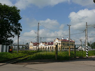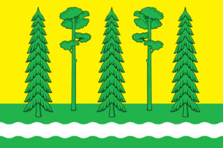
Demyansk is an urban locality and the administrative center of Demyansky District of Novgorod Oblast, Russia, located along the Yavon River. Municipally, it is incorporated as Demyanskoye Urban Settlement, the only urban settlement in the district. Population: 5,365 (2010 Census); 5,825 (2002 Census); 5,999 (1989 Soviet census).

Chudovo is a town and the administrative center of Chudovsky District in Novgorod Oblast, Russia, located on the Kerest River. Population: 15,397 (2010 Census); 17,434 (2002 Census); 17,982 (1989 Soviet census).
Kholm is a town and the administrative center of Kholmsky District in Novgorod Oblast, Russia, located at the confluence of the Lovat and Kunya Rivers, 77 kilometers (48 mi) north of Toropets, 93 kilometers (58 mi) southwest of Staraya Russa, and 201 kilometers (125 mi) south of Veliky Novgorod, the administrative center of the oblast. Population: 3,830 (2010 Census); 4,325 (2002 Census); 4,849 (1989 Soviet census).

Okulovka is a town and the administrative center of Okulovsky District in Novgorod Oblast, Russia, located in the Valdai Hills, on the Peretna River, 140 kilometers (87 mi) east of Veliky Novgorod, the administrative center of the oblast. Population: 12,464 (2010 Census); 14,470 (2002 Census); 17,197 (1989 Soviet census).

Pestovo is a town and the administrative center of Pestovsky District in Novgorod Oblast, Russia, located in the Valdai Hills on the Mologa River. Population: 15,903 (2010 Census); 15,990 (2002 Census); 15,941 (1989 Soviet census).

Soltsy is a town and the administrative center of Soletsky District in Novgorod Oblast, Russia, located on the left bank of the Shelon River, 78 kilometers (48 mi) southwest of Veliky Novgorod, the administrative center of the oblast. Population: 10,086 (2010 Census); 11,264 (2002 Census); 11,782 (1989 Soviet census).
Khvoynaya is an urban locality and the administrative center of Khvoyninsky District of Novgorod Oblast, Russia, located at the confluence of the Pes and Talka Rivers. Municipally, it is incorporated as Khvoyninskoye Urban Settlement, the only urban settlement in the district. Population: 6,394 (2010 Census); 6,791 (2002 Census); 7,583 (1989 Soviet census).

Uglovka is an urban locality in Okulovsky District of Novgorod Oblast, Russia, located on the Moscow – Saint Petersburg Railway. Municipally, it is incorporated as Uglovskoye Urban Settlement in Okulovsky Municipal District, one of the three urban settlements in the district. Population: 3,064 (2010 Census); 3,553 (2002 Census); 4,041 (1989 Soviet census).
Moshenskoye is a rural locality and the administrative center of Moshenskoy District of Novgorod Oblast, Russia, in the east of the oblast, on the Uver River. Municipally, it is the administrative center of Moshenskoye Rural Settlement. Population: 2,505 (2010 Census); 2,760 (2002 Census); 3,000 (1989 Soviet census).

Borovichsky District is an administrative and municipal district (raion), one of the twenty-one in Novgorod Oblast, Russia. It is located in the east of the oblast and borders with Khvoyninsky District in the north, Moshenskoy District in the east, Udomelsky District of Tver Oblast in the southeast, Bologovsky District of Tver Oblast in the south, Okulovsky District in the west, and with Lyubytinsky District in the northwest. The area of the district is 3,100 square kilometers (1,200 sq mi). Its administrative center is the town of Borovichi. Population: 15,675 (2010 Census); 19,085 ; 21,648 (1989 Soviet census).

Demyansky District is an administrative and municipal district (raion), one of the twenty-one in Novgorod Oblast, Russia. It is located in the south of the oblast and borders with Krestetsky District in the north, Valdaysky District in the northeast, Firovsky District of Tver Oblast in the southeast, Ostashkovsky District of Tver Oblast in the south, Maryovsky District in the southwest, Starorussky District in the west, and with Parfinsky District in the northwest. The area of the district is 3,200 square kilometers (1,200 sq mi). Its administrative center is the urban locality of Demyansk. Population: 13,001 (2010 Census); 16,020 ; 18,488 (1989 Soviet census). The population of Demyansk accounts for 41.3% of the district's total population.

Khvoyninsky District is an administrative and municipal district (raion), one of the twenty-one in Novgorod Oblast, Russia. It is located in the northeast of the oblast and borders with Boksitogorsky District of Leningrad Oblast in the north, Chagodoshchensky District of Vologda Oblast in the northeast, Pestovsky District in the southeast, Moshenskoy District in the south, Borovichsky District in the southwest, and with Lyubytinsky District in the west. The area of the district is 3,200 square kilometers (1,200 sq mi). Its administrative center is the urban locality of Khvoynaya. Population: 15,552 (2010 Census); 17,173 ; 19,649 (1989 Soviet census). The population of Khvoynaya accounts for 41.1% of the district's total population.

Lyubytinsky District is an administrative and municipal district (raion), one of the twenty-one in Novgorod Oblast, Russia. It is located in the northeast of the oblast and borders with Tikhvinsky District of Leningrad Oblast in the north, Boksitogorsky District of Leningrad Oblast in the northeast, Khvoyninsky District in the east, Borovichsky District in the southeast, Okulovsky District in the southwest, Malovishersky District in the west, and with Kirishsky District of Leningrad Oblast in the northwest. The area of the district is 4,500 square kilometers (1,700 sq mi). Its administrative center is the urban locality of Lyubytino. Population: 9,744 (2010 Census); 12,432 ; 15,263 (1989 Soviet census). The population of Lyubytino accounts for 28.8% of the district's total population.

Malovishersky District is an administrative and municipal district (raion), one of the twenty-one in Novgorod Oblast, Russia. It is located in the north of the oblast and borders with Kirishsky District of Leningrad Oblast in the north, Lyubytinsky District in the east, Okulovsky District in the southeast, Krestetsky District in the south, Novgorodsky District in the west, and with Chudovsky District in the northwest. The area of the district is 3,280.98 square kilometers (1,266.79 sq mi). Its administrative center is the town of Malaya Vishera. Population: 17,785 (2010 Census); 21,713 ; 25,167 (1989 Soviet census). The population of Malaya Vishera accounts for 70.1% of the district's total population.

Moshenskoy District is an administrative and municipal district (raion), one of the twenty-one in Novgorod Oblast, Russia. It is located in the east of the oblast and borders with Khvoyninsky District in the north, Pestovsky District in the east, Lesnoy District of Tver Oblast in the southeast, Udomelsky District of Tver Oblast in the south, and with Borovichsky District in the west. The area of the district is 2,568 square kilometers (992 sq mi). Its administrative center is the rural locality of Moshenskoye. Population: 7,309 (2010 Census); 9,486 ; 10,679 (1989 Soviet census). The population of Moshenskoye accounts for 34.3% of the district's total population.

Okulovsky District is an administrative and municipal district (raion), one of the twenty-one in Novgorod Oblast, Russia. It is located in the center of the oblast and borders with Lyubytinsky District in the northeast, Borovichsky District in the east, Bologovsky District of Tver Oblast in the southeast, Valdaysky District in the southwest, Krestetsky District in the west, and with Malovishersky District in the northwest. The area of the district is 2,500 square kilometers (970 sq mi). Its administrative center is the town of Okulovka. Population: 25,808 (2010 Census); 31,153 ; 36,852 (1989 Soviet census). The population of Okulovka accounts for 48.3% of the district's total population.

Pestovsky District is an administrative and municipal district (raion), one of the twenty-one in Novgorod Oblast, Russia. It is located in the east of the oblast and borders with Chagodoshchensky District of Vologda Oblast in the north, Ustyuzhensky District of Vologda Oblast in the northeast, Sandovsky District of Tver Oblast in the southeast, Lesnoy District of Tver Oblast in the south, Moshenskoy District in the west, and with Khvoyninsky District in the northwest. The area of the district is 2,120 square kilometers (820 sq mi). Its administrative center is the town of Pestovo. Population: 21,676 (2010 Census); 23,931 ; 25,331 (1989 Soviet census). The population of Pestovo accounts for 73.4% of the district's total population.

Lyubytino is an urban locality and the administrative center of Lyubytinsky District of Novgorod Oblast, Russia, located on the Msta River. Municipally, it serves as the administrative center of Lyubytinskoye Urban Settlement, one of the two urban settlements in the district. Population: 2,807 (2010 Census); 3,300 (2002 Census); 3,474 (1989 Soviet census).
Kulotino is an urban locality in Okulovsky District of Novgorod Oblast, Russia, located on the Peretna River a few kilometers northeast of the town of Okulovka. Municipally, along with seventeen rural localities, it is incorporated as Kulotinskoye Urban Settlement in Okulovsky Municipal District, one of the three urban settlements in the district. Population: 2,942 (2010 Census); 3,430 (2002 Census); 4,304 (1989 Soviet census).

Pankovka is an urban locality in Novgorodsky District of Novgorod Oblast, Russia, located on the right bank of the Veryazha River, southwest of and immediately adjacent to Veliky Novgorod. Municipally, it is incorporated as Pankovskoye Urban Settlement in Novgorodsky Municipal District, one of the four urban settlements in the district. Population: 9,603 (2010 Census); 10,057 (2002 Census); 6,939 (1989 Soviet census).


