Starorussky District

Last updated
Starorussky District

Старорусский район
Kamenka reka 1.jpg
The Kamenka River in Starorussky District, a tributary of the Porusya
Flag of Starorussky rayon (Novgorod oblast).svg
Flag
Location of Starorussky District in Novgorod Oblast
Coordinates: 58°16′N34°07′E / 58.267°N 34.117°E / 58.267; 34.117 Coordinates: 58°16′N34°07′E / 58.267°N 34.117°E / 58.267; 34.117
Country Russia
Federal subject Novgorod Oblast [1]
EstablishedOctober 1, 1927 [2]
Administrative center Staraya Russa [1]
Area
[3]
  Total3,111 km2 (1,201 sq mi)
Population
  Total15,063
  Estimate 
(2018) [5]
42,747
  Density4.8/km2 (13/sq mi)
   Urban
0%
   Rural
100%
Administrative structure
   Administrative divisions 7 Settlements
   Inhabited localities [6] 287 Rural localities
Municipal structure
   Municipally incorporated asStarorussky Municipal District [7]
   Municipal divisions [7] 1 Urban settlements, 7 Rural settlements
Time zone UTC+3 (MSK Blue pencil.svg [8] )
OKTMO ID49639000
Website http://www.admrussa.ru/

Starorussky District (Russian : Старору́сский райо́н) is an administrative [1] and municipal [7] district (raion), one of the twenty-one in Novgorod Oblast, Russia. It is located in the southwest of the oblast and borders with Parfinsky District in the east, Demyansky and Maryovsky Districts in the southeast, Poddorsky District in the southwest, Volotovsky District in the west, and with Shimsky District in the northwest. From the north, the district is limited by Lake Ilmen. The area of the district is 3,111 square kilometers (1,201 sq mi). [3] Its administrative center is the town of Staraya Russa (which is not administratively a part of the district). [1] Population: 15,063(2010 Census); [4] 16,214 (2002 Census); [9] 18,505(1989 Census). [10]

Russian language East Slavic language

Russian is an East Slavic language, which is official in the Russian Federation, Belarus, Kazakhstan and Kyrgyzstan, as well as being widely used throughout Eastern Europe, the Baltic states, the Caucasus and Central Asia. It was the de facto language of the Soviet Union until its dissolution on 25 December 1991. Although, nowadays, over two decades after the breakup of the Soviet Union, Russian is used in official capacity or in public life in all the post-Soviet nation-states, as well as in Israel and Mongolia, the rise of state-specific varieties of this language tends to be strongly denied in Russia, in line with the Russian World ideology.

A raion is a type of administrative unit of several post-Soviet states. The term is from the French "rayon", which is both a type of a subnational entity and a division of a city, and is commonly translated in English as "district".

Administratively, Novgorod Oblast is divided into three cities and towns of oblast significance and twenty-one districts.

Contents

Geography

The whole area of Starorussky District lies in the basin of Lake Ilmen. The two biggest rivers are the Polist with the right tributary the Porusya, and the Lovat, with the left tributary the Redya. The Lovat and the Polist form a joint river delta with the Pola River. The western part of the delta lies within the district. The southern shore of Lake Ilmen is a part of Starorussky District as well.

Drainage basin Area of land where precipitation collects and drains off into a common outlet

A drainage basin is any area of land where precipitation collects and drains off into a common outlet, such as into a river, bay, or other body of water. The drainage basin includes all the surface water from rain runoff, snowmelt, and nearby streams that run downslope towards the shared outlet, as well as the groundwater underneath the earth's surface. Drainage basins connect into other drainage basins at lower elevations in a hierarchical pattern, with smaller sub-drainage basins, which in turn drain into another common outlet.

Lake Ilmen lake in Novgorod Oblast, Russia

Lake Ilmen is a large lake in the Novgorod Oblast of Russia. It's a historically important lake, which formed a vital part of the trade route from the Varangians to the Greeks. The city of Novgorod - which is a major trade center of the route - lies six kilometers below the lake's outflow.

Polist River river in Russia

The Polist is a river in Bezhanitsky District of Pskov Oblast and in Poddorsky and Starorussky District, as well as in the town of Staraya Russa of Novgorod Oblast of Russia. It is technically a tributary of the Lovat River though it forms a common river delta with the Lovat and the Pola at the mouth of the Lovat in Lake Ilmen. It is 176 kilometres (109 mi) long, and the area of its basin 3,630 square kilometres (1,400 sq mi). The principal tributaries of the Polist are the Kholynya River (left) and the Porusya River (left). The town of Staraya Russa is located on the banks of the Polist.

History

The Lovat River was a part of the trade route from the Varangians to the Greeks, one of the oldest trading routes passing through Rus'. Staraya Russa was first mentioned in the 1167 chronicle as Rusa. [11] The area belonged to the Novgorod Republic. After the fall of Novgorod in 1483, it was annexed by the Grand Duchy of Moscow. Between 1611 and 1615, during the Ingrian War, it was occupied by Swedish troops. [11]

Lovat River river in Belarus and Russia, tributary of Lake Ilmen

The Lovat is a river in Vitebsk Oblast of Belarus, Usvyatsky, Velikoluksky, and Loknyansky Districts, as well as of the city of Velikiye Luki, of Pskov Oblast and Kholmsky, Poddorsky, Starorussky, and Parfinsky Districts of Novgorod Oblast in Russia. The source of the Lovat is Lake Lovatets in northeastern Belarus, and the Lovat is a tributary of Lake Ilmen. Its main tributaries are the Loknya (left), the Kunya (right), the Polist (left), the Redya (left), and the Robya (right) Rivers. The towns of Velikiye Luki and Kholm, as well as the urban-type settlement of Parfino, are located on the banks of the Lovat.

Trade route from the Varangians to the Greeks

The trade route from the Varangians to the Greeks was a medieval trade route that connected Scandinavia, Kievan Rus' and the Eastern Roman Empire. The route allowed merchants along its length to establish a direct prosperous trade with the Empire, and prompted some of them to settle in the territories of present-day Belarus, Russia and Ukraine. The majority of the route comprised a long-distance waterway, including the Baltic Sea, several rivers flowing into the Baltic Sea, and rivers of the Dnieper river system, with portages on the drainage divides. An alternative route was along the Dniestr river with stops on the Western shore of Black Sea. These more specific sub-routes are sometimes referred to as the Dnieper trade route and Dniestr trade route, respectively.

Novgorod Republic former country

The Novgorod Republic or Novgorodian Rus' was a medieval East Slavic state from the 12th to 15th centuries, stretching from the Baltic Sea to the northern Ural Mountains, including the city of Novgorod and the Lake Ladoga regions of modern Russia. Citizens referred to their city-state as "His Majesty Lord Novgorod the Great", or more often as "Lord Novgorod the Great". The Republic prospered as the easternmost port of the Hanseatic League and its Slavic, Baltic and Finnic people were much influenced by the culture of the Viking-Varangians and Byzantine people.

In the course of the administrative reform carried out in 1708 by Peter the Great, the area was included into Ingermanland Governorate (known since 1710 as Saint Petersburg Governorate). In 1727, separate Novgorod Governorate was split off. In 1776, Staraya Russa became the administrative center of Starorussky Uyezd of Novgorod Viceroyalty. In 1796, the viceroyalty was transformed into Novgorod Governorate. In the 1820s, military settlements were organized in Staraya Russa and around, in accordance with the project designed by Aleksey Arakcheyev, an influential statesman. As it was inconvenient to have both civil and military administration in Staraya Russa, the uyezd was subsequently abolished in 1824. The town of Staraya Russa and some adjacent territories were directly subordinated to the Defense Ministry. The military settlements were proven inefficient, in particular, in 1831, the area participated in the Cholera Riots.[ clarification needed ] They were abolished in 1856. In 1857, Starorussky Uyezd was re-established. [12]

The administrative division reform of 1708 was carried out by Russian Tsar Peter the Great in an attempt to improve the manageability of the vast territory of Russia. Prior to the reform, the country was subdivided into uyezds and volosts, and in the 17th century the number of the uyezds was 166.

Peter the Great Tsar and 1st Emperor, founder of the Russian Empire

Peter the Great, Peter I or Peter Alexeyevich ruled the Tsardom of Russia and later the Russian Empire from 7 May [O.S. 27 April] 1682 until his death in 1725, jointly ruling before 1696 with his elder half-brother, Ivan V. Through a number of successful wars, he expanded the Tsardom into a much larger empire that became a major European power and also laid the groundwork for the Russian navy after capturing ports at Azov and the Baltic Sea. He led a cultural revolution that replaced some of the traditionalist and medieval social and political systems with ones that were modern, scientific, Westernised and based on the Enlightenment. Peter's reforms made a lasting impact on Russia, and many institutions of Russian government trace their origins to his reign. He is also known for founding and developing the city of Saint Petersburg, which remained the capital of Russia until 1917.

Saint Petersburg Governorate governorate of the Russian Empire

Saint Petersburg Governorate, or Government of Saint Petersburg, was an administrative division of the Tsardom of Russia, the Russian Empire, and the Russian SFSR, which existed in 1708–1927.

In August 1927, the governorates and uyezds were abolished. Starorussky District, with the administrative center in the town of Staraya Russa, [13] was established within Novgorod Okrug of Leningrad Oblast effective October 1, 1927. [2] It included parts of former Starorussky Uyezd. [13] On July 23, 1930, the okrugs were abolished, and the districts were directly subordinated to the oblast. [14] On September 20, 1931, Podgoshchsky District was abolished and merged into Starorussky District. [15] On January 1, 1932, a part of abolished Volotovsky District was merged into Starorussky District; this was reverted on February 15, 1935. [16] On September 19, 1939, Staraya Russa was elevated in status to that of a town under oblast jurisdiction and thus ceased to be a part of the district. [13] Between August 1941 and February 19, 1944, Starorussky District was occupied by German troops. [13] On July 5, 1944, Starorussky District was transferred to newly established Novgorod Oblast, [13] where it remained ever since. On July 22, 1961, a part of abolished Zaluchsky District was merged into Starorussky District. [17] On February 1, 1963, the district was transformed into Starorussky Rural District [18] in the course of the Nikita Khrushchev's abortive administrative reform. This was reverted on January 12, 1965. [18] On December 13, 1968, Parfinsky District was split from Starorussky District. [18] Also, in the mid-1960s, parts of Volotovsky and Polavsky Districts were transferred to Starorussky District and then back. Polavsky District in the end was split between Parfinsky and Demyansky Districts.

Leningrad Oblast First-level administrative division of Russia

Leningrad Oblast is a federal subject of Russia. It was established on August 1, 1927, although it was not until 1946 that the oblast's borders had been mostly settled in their present position. The oblast was named after the city of Leningrad. Unlike the city, the oblast retains the name of Leningrad.

Volotovsky District District in Novgorod Oblast, Russia

Volotovsky District is an administrative and municipal district (raion), one of the twenty-one in Novgorod Oblast, Russia. It is located in the southwest of the oblast and borders with Shimsky District in the north, Starorussky District in the east, Poddorsky District in the south, Dedovichsky District of Pskov Oblast in the southwest, Dnovsky District of Pskov Oblast in the west, and with Soletsky District in the northwest. The area of the district is 995 square kilometers (384 sq mi), which makes it the smallest district in the oblast.= Its administrative center is the rural locality of Volot. District's population: 5,493 (2010 Census); 6,106 ; 7,058 (1989 Census). The population of Volot accounts for 40.7% of the district's total population.

Nazi Germany The German state from 1933 to 1945, under the dictatorship of Adolf Hitler

Nazi Germany is the common English name for Germany between 1933 and 1945, when Adolf Hitler and his Nazi Party (NSDAP) controlled the country through a dictatorship. Under Hitler's rule, Germany was transformed into a totalitarian state that controlled nearly all aspects of life via the Gleichschaltung legal process. The official name of the state was Deutsches Reich until 1943 and Großdeutsches Reich from 1943 to 1945. Nazi Germany is also known as the Third Reich, meaning "Third Realm" or "Third Empire", the first two being the Holy Roman Empire (800–1806) and the German Empire (1871–1918). The Nazi regime ended after the Allies defeated Germany in May 1945, ending World War II in Europe.

Abolished districts

Effective October 1, 1927, [2] Podgoshchsky District with the administrative center in the selo of Podgoshchi was also established, as a part of Novgorod Okrug of Leningrad Oblast. [15] It included parts of Starorussky Uyezd. [15] On September 20, 1931, Podgoshchsky District was abolished and merged into Starorussky District. [15]

Also effective October 1, 1927, [2] Volotovsky District with the administrative center in the settlement of Volot was established, as a part of Novgorod Okrug of Leningrad Oblast. [16] It included parts of Starorussky Uyezd. [16] On January 1, 1932, Volotovsky District was abolished and split between Soletsky, Starorussky, Dnovsky, and Dedovichsky Districts. [16] On February 15, 1935, the district was re-established. [16]

Another district established effective October 1, 1927 [2] as a part of Novgorod Okrug of Leningrad Oblast was Zaluchsky District, with the administrative center in the selo of Zaluchye. [19] It included parts of Starorussky Uyezd. [19] Between August 1941 and February 1943, Zaluchsky District was occupied by German troops. [19] On July 5, 1944, Zaluchsky District was transferred to newly established Novgorod Oblast. [19] On July 22, 1961, Zaluchsky District was abolished and split between Starorussky and Molvotitsky Districts. [17]

Administrative and municipal status

Within the framework of administrative divisions, Starorussky District is one of the twenty-one in the oblast. [1] The town of Staraya Russa serves as its administrative center, despite being incorporated separately as a town of oblast significance—an administrative unit with the status equal to that of the districts [1] (and which, in addition to Staraya Russa, also includes two rural localities). [6]

As a municipal division, the district is incorporated as Starorussky Municipal District, with the town of oblast significance of Staraya Russa being incorporated within it as Staraya Russa Urban Settlement. [7]

Economy

Industry

Most industrial enterprises are concentrated in the town of Staraya Russa, which is administratively not a part of the district. In the district proper, there are several timber industry enterprises.

Agriculture

The district specializes in fishing in Lake Ilmen as well as cattle breeding with subsequent meat and milk production. [20]

Transportation

A railway which connects Bologoye and Pskov via Staraya Russa runs through the district from east to west.

Staraya Russa is connected by roads with Novgorod, Demyansk, and Bezhanitsy via Kholm. There are also local roads.

Lake Ilmen is navigable; however, there is no passenger navigation.

Culture and recreation

Morozov granary in the village of Borisovo, preserved as a monument of culture Ambar Morozova S.I. d. Borisovo (foto 1).JPG
Morozov granary in the village of Borisovo, preserved as a monument of culture

The district contains 8 cultural heritage monuments of federal significance and additionally 130 objects classified as cultural and historical heritage of local significance. [21] The monuments under federal protection include:

Related Research Articles

Staraya Russa Town in Novgorod Oblast, Russia

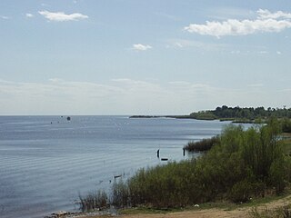
Staraya Russa is a town in Novgorod Oblast, Russia, located on the Polist River, 99 kilometers (62 mi) south of Veliky Novgorod, the administrative center of the oblast. Its population has steadily decreased over the past years, going from 41,538 recorded in the 1989 Census to 35,511 in the 2002 Census to 31,809 in the 2010 Census.

Demyansk Urban-type settlement in Novgorod Oblast, Russia

Demyansk is an urban locality and the administrative center of Demyansky District of Novgorod Oblast, Russia, located along the Yavon River. Municipally, it is incorporated as Demyanskoye Urban Settlement, the only urban settlement in the district. Population: 5,365 (2010 Census); 5,825 (2002 Census); 5,999 (1989 Census).

Kholm, Kholmsky District, Novgorod Oblast Town in Novgorod Oblast, Russia

Kholm is a town and the administrative center of Kholmsky District in Novgorod Oblast, Russia, located at the confluence of the Lovat and Kunya Rivers, 77 kilometers (48 mi) north of Toropets, 93 kilometers (58 mi) southwest of Staraya Russa, and 201 kilometers (125 mi) south of Veliky Novgorod, the administrative center of the oblast. Population: 3,830 (2010 Census); 4,325 (2002 Census); 4,849 (1989 Census).

Pestovo, Pestovsky District, Novgorod Oblast Town in Novgorod Oblast, Russia

Pestovo is a town and the administrative center of Pestovsky District in Novgorod Oblast, Russia, located in the Valdai Hills on the Mologa River. Population: 15,903 (2010 Census); 15,990 (2002 Census); 15,941 (1989 Census).

Soltsy Town in Novgorod Oblast, Russia

Soltsy is a town and the administrative center of Soletsky District in Novgorod Oblast, Russia, located on the left bank of the Shelon River, 78 kilometers (48 mi) southwest of Veliky Novgorod, the administrative center of the oblast. Population: 10,086 (2010 Census); 11,264 (2002 Census); 11,782 (1989 Census).

Parfino Work settlement in Novgorod Oblast, Russia

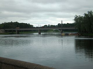
Parfino is an urban locality and the administrative center of Parfinsky District of Novgorod Oblast, Russia, located along the Lovat River, 20 kilometers (12 mi) east of Staraya Russa. Municipally, it is incorporated as Parfinskoye Urban Settlement, the only urban settlement in the district. Population: 7,492 (2010 Census); 8,446 (2002 Census); 8,299 (1989 Census).

Demyansky District District in Novgorod Oblast, Russia

Demyansky District is an administrative and municipal district (raion), one of the twenty-one in Novgorod Oblast, Russia. It is located in the south of the oblast and borders with Krestetsky District in the north, Valdaysky District in the northeast, Firovsky District of Tver Oblast in the southeast, Ostashkovsky District of Tver Oblast in the south, Maryovsky District in the southwest, Starorussky District in the west, and with Parfinsky District in the northwest. The area of the district is 3,200 square kilometers (1,200 sq mi). Its administrative center is the urban locality of Demyansk. Population: 13,001 (2010 Census); 16,020 ; 18,488 (1989 Census). The population of Demyansk accounts for 41.3% of the district's total population.

Khvoyninsky District District in Novgorod Oblast, Russia

Khvoyninsky District is an administrative and municipal district (raion), one of the twenty-one in Novgorod Oblast, Russia. It is located in the northeast of the oblast and borders with Boksitogorsky District of Leningrad Oblast in the north, Chagodoshchensky District of Vologda Oblast in the northeast, Pestovsky District in the southeast, Moshenskoy District in the south, Borovichsky District in the southwest, and with Lyubytinsky District in the west. The area of the district is 3,200 square kilometers (1,200 sq mi). Its administrative center is the urban locality of Khvoynaya. Population: 15,552 (2010 Census); 17,173 ; 19,649 (1989 Census). The population of Khvoynaya accounts for 41.1% of the district's total population.

Krestetsky District District in Novgorod Oblast, Russia

Krestetsky District is an administrative and municipal district (raion), one of the twenty-one in Novgorod Oblast, Russia. It is located in the center of the oblast and borders with Malovishersky District in the north, Okulovsky District in the northeast, Valdaysky District in the southeast, Demyansky District in the south, Parfinsky District in the southwest, and with Novgorodsky District in the northwest. The area of the district is 2,790.63 square kilometers (1,077.47 sq mi). Its administrative center is the urban locality of Kresttsy. Population: 12,940 (2010 Census); 15,667 ; 16,957 (1989 Census). The population of Kresttsy accounts for 67.4% of the district's total population.

Maryovsky District District in Novgorod Oblast, Russia

Maryovsky District is an administrative and municipal district (raion), one of the twenty-one in Novgorod Oblast, Russia. It is located in the south of the oblast and borders with Demyansky District in the north, Ostashkovsky and Penovsky Districts of Tver Oblast in the southeast, Andreapolsky District of Tver Oblast and Kholmsky District in the southwest, Poddorsky District in the west, and with Starorussky District in the northwest. The area of the district is 1,800 square kilometers (690 sq mi). Its administrative center is the rural locality of Maryovo. District's population: 4,673 (2010 Census); 5,711 ; 6,835 (1989 Census). The population of Maryovo accounts for 49.2% of the district's total population.

Novgorodsky District District in Novgorod Oblast, Russia

Novgorodsky District is an administrative and municipal district (raion), one of the twenty-one in Novgorod Oblast, Russia. It is located in the southwest of the oblast and borders with Tosnensky District of Leningrad Oblast in the north, Chudovsky District in the northeast, Malovishersky District in the east, Krestetsky District in the southeast, Shimsky District in the southwest, Batetsky District in the west, and with Luzhsky District of Leningrad Oblast in the northwest. In the south, the district is limited by Lake Ilmen. The area of the district is 4,600 square kilometers (1,800 sq mi). Its administrative center is the city of Veliky Novgorod. Population: 57,673 (2010 Census); 58,622 ; 55,491 (1989 Census). In terms of both area and population, this is the largest district in Novgorod Oblast.

Parfinsky District District in Novgorod Oblast, Russia

Parfinsky District is an administrative and municipal district (raion), one of the twenty-one in Novgorod Oblast, Russia. It is located in the center of the oblast and borders with Krestetsky District in the north, Demyansky District in the southeast, and with Starorussky District in the southwest. The area of the district is 1,591 square kilometers (614 sq mi). Its administrative center is the urban locality of Parfino. Population: 14,395 (2010 Census); 16,485 ; 17,650 (1989 Census). The population of Parfino accounts for 52.0% of the total district's population.

Poddorsky District District in Novgorod Oblast, Russia

Poddorsky District is an administrative and municipal district (raion), one of the twenty-one in Novgorod Oblast, Russia. It is located in the southwest of the oblast and borders with Volotovsky District in the north, Starorussky District in the northeast, Maryovsky District in the east, Kholmsky District in the south, Bezhanitsky District of Pskov Oblast in the southwest, and with Dedovichsky District of Pskov Oblast in the northwest. The area of the district is 2,952 square kilometers (1,140 sq mi). Its administrative center is the rural locality of Poddorye. District's population: 4,645 (2010 Census); 5,610 ; 6,820 (1989 Census). The population of Poddorye accounts for 40.0% of the district's total population.

Shimsky District District in Novgorod Oblast, Russia

Shimsky District is an administrative and municipal district (raion), one of the twenty-one in Novgorod Oblast, Russia. It is located in the west of the oblast and borders with Batetsky District in the north, Novgorodsky District in the northeast, Starorussky District in the southeast, Volotovsky District in the south, Soletsky District in the southwest, Strugo-Krasnensky and Plyussky Districts, both of Pskov Oblast, in the west, and with Luzhsky District of Leningrad Oblast in the northwest. The area of the district is 1,836 square kilometers (709 sq mi). Its administrative center is the urban locality of Shimsk. Population: 11,750 (2010 Census); 13,312 ; 13,477 (1989 Census). The population of Shimsk accounts for 33.1% of the district's total population.

Soletsky District District in Novgorod Oblast, Russia

Soletsky District is an administrative and municipal district (raion), one of the twenty-one in Novgorod Oblast, Russia. It is located in the west of the oblast and borders with Shimsky District in the north, Volotovsky District in the east, Dnovsky District of Pskov Oblast in the south, Porkhovsky District of Pskov Oblast in the southwest, and with Strugo-Krasnensky District of Pskov Oblast in the west. The area of the district is 1,400 square kilometers (540 sq mi). Its administrative center is the town of Soltsy. Population: 15,714 (2010 Census); 18,626 ; 20,011 (1989 Census). The population of Soltsy accounts for 64.2% of the district's total population.

Valdaysky District District in Novgorod Oblast, Russia

Valdaysky District is an administrative and municipal district (raion), one of the twenty-one in Novgorod Oblast, Russia. It is located in the southeast of the oblast and borders with Okulovsky District in the north, Bologovsky District of Tver Oblast in the east, the territory of the closed administrative-territorial formation of Ozyorny of Tver Oblast in the southeast, Firovsky District of Tver Oblast in the south, Demyansky District in the southwest, and with Krestetsky District in the northwest. The area of the district is 2,701.63 square kilometers (1,043.11 sq mi). Its administrative center is the town of Valday. Population: 26,476 (2010 Census); 29,943 ; 32,373 (1989 Census). The population of Valday accounts for 60.8% of the district's total population.

Poddorye Selo in Novgorod Oblast, Russia

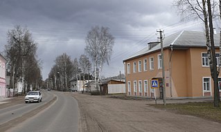
Poddorye is a rural locality and the administrative center of Poddorsky District of Novgorod Oblast, Russia, located in the southwest of the oblast, on the Redya River, a left tributary of the Lovat River. Municipally, it is the administrative center of Poddorskoye Rural Settlement. Population: 1,860 (2010 Census); 1,957 (2002 Census); 2,122 (1989 Census).

Volot, Volot Settlement, Volotovsky District, Novgorod Oblast Settlement in Novgorod Oblast, Russia

Volot is a rural locality and the administrative center of Volotovsky District of Novgorod Oblast, Russia, located in the west of the oblast on the banks of the Psizha River. It also serves as the administrative center of Volot Settlement, one of the three settlements into which the district is administratively divided. Municipally, it is the administrative center of Volot Rural Settlement. Population: 2,236 (2010 Census); 2,329 (2002 Census); 2,485 (1989 Census).

Pankovka Urban-type settlement in Novgorod Oblast, Russia

Pankovka is an urban locality in Novgorodsky District of Novgorod Oblast, Russia, located on the right bank of the Veryazha River, southwest of and immediately adjacent to Veliky Novgorod. Municipally, it is incorporated as Pankovskoye Urban Settlement in Novgorodsky Municipal District, one of the four urban settlements in the district. Population: 9,603 (2010 Census); 10,057 (2002 Census); 6,939 (1989 Census).

References

Notes

  1. 1 2 3 4 5 6 Law #559-OZ
  2. 1 2 3 4 5 Snytko et al., p. 85
  3. 1 2 Новгородская область. Старорусский муниципальный район (in Russian). Retrieved May 25, 2012.|first1= missing |last1= in Authors list (help)
  4. 1 2 Russian Federal State Statistics Service (2011). "Всероссийская перепись населения 2010 года. Том 1" [2010 All-Russian Population Census, vol. 1]. Всероссийская перепись населения 2010 года [2010 All-Russia Population Census] (in Russian). Federal State Statistics Service.
  5. "26. Численность постоянного населения Российской Федерации по муниципальным образованиям на 1 января 2018 года". Federal State Statistics Service. Retrieved 23 January 2019.
  6. 1 2 Resolution #121
  7. 1 2 3 4 Law #377-OZ
  8. "Об исчислении времени". Официальный интернет-портал правовой информации (in Russian). 3 June 2011. Retrieved 19 January 2019.
  9. Russian Federal State Statistics Service (21 May 2004). "Численность населения России, субъектов Российской Федерации в составе федеральных округов, районов, городских поселений, сельских населённых пунктов – районных центров и сельских населённых пунктов с населением 3 тысячи и более человек" [Population of Russia, Its Federal Districts, Federal Subjects, Districts, Urban Localities, Rural Localities—Administrative Centers, and Rural Localities with Population of Over 3,000](XLS). Всероссийская перепись населения 2002 года [All-Russia Population Census of 2002] (in Russian).
  10. "Всесоюзная перепись населения 1989 г. Численность наличного населения союзных и автономных республик, автономных областей и округов, краёв, областей, районов, городских поселений и сёл-райцентров" [All Union Population Census of 1989: Present Population of Union and Autonomous Republics, Autonomous Oblasts and Okrugs, Krais, Oblasts, Districts, Urban Settlements, and Villages Serving as District Administrative Centers]. Всесоюзная перепись населения 1989 года [All-Union Population Census of 1989] (in Russian). Институт демографии Национального исследовательского университета: Высшая школа экономики [Institute of Demography at the National Research University: Higher School of Economics]. 1989 via Demoscope Weekly.
  11. 1 2 Энциклопедия Города России. Moscow: Большая Российская Энциклопедия. 2003. p. 440. ISBN   5-7107-7399-9.
  12. Snytko et al., p. 28
  13. 1 2 3 4 5 Snytko et al., pp. 135–138
  14. Snytko et al., pp. 87–88
  15. 1 2 3 4 Snytko et al., pp. 128–129
  16. 1 2 3 4 5 Snytko et al., pp. 100–101
  17. 1 2 Snytko et al., p. 180
  18. 1 2 3 Snytko et al., pp. 231–233
  19. 1 2 3 4 Snytko et al., pp. 104–105
  20. Итоги социально-экономического развития Старорусского муниципального района за 2011 год. admrussa.ru (in Russian). Администрация Старорусского муниципального района. 2012. Retrieved May 25, 2012.
  21. Памятники истории и культуры народов Российской Федерации (in Russian). Russian Ministry of Culture. Retrieved 2 June 2016.
  22. Городище "Городок" (in Russian). ФГУП ГИВЦ Минкультуры России. Retrieved May 25, 2012.

Sources