The suburb is most well known for being an ethnic enclave of Assyrian and other Iraqi ethnic groups living in Sydney. Furthermore, Bossley Park was Australia's most Catholic suburb in 2018, with 49.9% of residents being adherents of Catholicism.[2]
History
Bossley Park was named after John Brown Bossley (1810–72), an English chemist who purchased a large block of land on Smithfield Road. He named his property Edensor after a village in Derbyshire, England. When the area north of Edensor was subdivided in 1890, it became known as Bossley Park. The public school was built in 1890 and a post office in 1895. The area that is now Bossley Park used be called "Box Country" as it contained tall eucalypt forests with Eucalyptus moluccana being spread out in grassy savannas, and therefore early settlers found the region to be favorable land for sheep and cattle grazing.[3]
After World War II, Bossley Park received many migrants from Italy, who have since played a large role in the local community. Bossley Park and its surrounding suburbs were rural areas until the 1970s, when they were developed into a residential settlement.[4]
Demographics
According to the 2021 census of population, there were 15,492 residents in Bossley Park.[1]
41.4% of people were born in Australia. The most common other countries of birth were Iraq (22.4%), Italy (3.5%), Vietnam (3.8%), Syria (2.8%) and Philippines (1.8%). 29.9% of people only spoke English at home. Other languages spoken at home included Neo-Aramaic (Sureth) (23.1%), Arabic (10.5%), Italian (4.5%), and Vietnamese (4.4%).[1]
The most common responses for religion in Bossley Park were Catholic (49.3%), Assyrian Apostolic (8.0%), No religion (8.0%), Buddhism (6.4%), and not stated (5.8%). Christianity was the largest religious group reported overall (78.8%).[1]
Education
Bossley Park has a number of government schools including Bossley Park High School, Bossley Park Public School and Prairievale Public School. There is also the Catholic run Mary Immaculate Primary School.[5][6][7]
Bossley Park residents are predominantly Catholic (Latin and Eastern), Assyrian Orthodox and Anglican.
St Thomas Chaldean & Assyrian Church, built in 2006
Sport and recreation
The Marconi Stallions football club was founded in the area by Italian immigrants in the 1960s with the Marconi Stadium being built there in 1972 along with ongoing development of the licensed club. The eastern boundary of the suburb is adjacent to a large recreational park Wetherill Park Nature Reserve. Orphan School Creek winds through the suburb's southern fringes in Comanche Park, and walking paths run parallel to the creek.
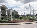
Club Marconi
Climate
Like most of Sydney, Bossley Park has a humid subtropical climate (Cfa) with warm to hot summers and cool winters. Most of the precipitation falls in the first four months of the year, with fewer rainfall amount during the middle of the year.
This page is based on this Wikipedia article Text is available under the CC BY-SA 4.0 license; additional terms may apply. Images, videos and audio are available under their respective licenses.