At the 1972 Summer Olympics in Munich, 38 events in athletics were contested, 24 for men and 14 for women. There were a total number of 1324 participating athletes from 104 countries.
The Rugby Central Shopping Centre is a two storey shopping precinct in the town centre of Rugby, Warwickshire, England, managed by EFM Facilities Ltd. The precinct includes clothes stores, game shops, thrift stores and food outlets. There is a large multi-storey car park at the rear and the towns main bus stops are at the front of the centre.

Nanzhuangtou was a Neolithic site near Lake Baiyangdian in Xushui County, Hebei, China. The site was discovered under a peat bog. Over 47 pieces of pottery were discovered at the site. Nanzhuangtou is also the earliest Neolithic site yet discovered in northern China. There is evidence that the people at Nanzhuangtou domesticated the dog. Stone grinding slabs and rollers and bone artifacts were also discovered at the site. It is one of the earliest sites showing evidence of millet cultivation dating to 10,500 BP. Pottery can also be dated to 10,200 BP.

The Light is a leisure and retail centre in central Leeds in West Yorkshire, England. It occupies the rectangular space between The Headrow on the south, St Anne's Street on the north, Cookridge Street on the west, and Albion Street. Two former streets divide it: Upper Fountaine Street (east-west) and Cross Fountaine Street (north-south) now covered with a glass roof. It incorporates two listed buildings Permanent House and the Headrow Buildings.
Đơn Dương is a district (huyện) of Lâm Đồng Province in the Central Highlands region of Vietnam.
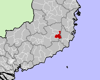
Dąbrówka is a village in the administrative district of Gmina Kwilcz, within Międzychód County, Greater Poland Voivodeship, in west-central Poland.
The Battle of Rheinberg took place on 12 June 1758 in Rheinberg, Germany during the Seven Years' War. A French force under the command of Comte de Clermont and an Anglo-German force under the command of the Duke of Brunswick fought a largely indecisive battle. It was a precursor to the more decisive Battle of Krefeld nine days later.
The IGEPv2 board is a low-power, fanless single-board computer based on the OMAP 3 series of ARM-compatible processors. It is developed and produced by Spanish corporation ISEE and is the second IGEP platform in the series. The IGEPv2 is open hardware, licensed under a Creative Commons Attribution-Non Commercial-ShareAlike 3.0 unported license.

Gainford Hall is a privately owned Jacobean manor house at Gainford, County Durham. It is a Grade I listed building but as of 2014 is registered as a Building at Risk.
Kostenica is a village in the municipality of Prokuplje, Serbia. According to the 2002 census, the village has a population of 289 people.
The University College of Management Studies is a private university college in Accra and Kumasi, Ghana. The school is affiliated with the School of Business of Kwame Nkrumah University of Science and Technology, Kumasi and the University of Education Winneba, Kumasi Campus.

The Kiel FK 166 was a single-seat prototype "exercise" biplane built by Kiel Flugzeugbau in the 1930s.
The Messerschmitt P.1092 was a series of Messerschmitt experimental aircraft for the Luftwaffe during the Second World War. Several designs for single- and twin-engined aircraft were drafted under the same designation.
Kümbet is a village in the District of Gölpazarı, Bilecik Province, Turkey. As of 2010 it had a population of 98 people.

The George Inn is a Grade II-listed 18th-century public house on the Isle of Portland, Dorset, England. It is situated within the village of Easton, at the west end of the hamlet of Reforne. The pub is located close to St George's Church and St George's Centre.
Karshalevo is a village in Kyustendil Municipality, Kyustendil Province, south-western Bulgaria.
Camp Township is a township in Polk County, in the U.S. state of Iowa.
Aydınyayla is a village in Alaplı District, Zonguldak Province, Turkey.

Woodhill Cemetery is a historic cemetery located in Franklin, Ohio. It is publicly owned and operated by the Franklin Township Department of Public Works.
Castor Township is an inactive township in Madison County, in the U.S. state of Missouri.


