Estanzuela is a municipality in the Guatemalan department of Zacapa. It is a small town. Estanzuela was a passing place for Spaniards looking to go farther west to the ocean. A group of these Spaniards decided to rest for a while, and thought Estanzuela to be the perfect location. As they went through the surroundings they saw that it was good land to harvest, so they decided to stay. At first it was called "La Estancia". It is said that its second name was "La Estanzuelita," a Spanish diminutive of Estancia, which is translated to a resting place. Later, the name developed to today name Estanzuela.

Fiemme Valley is a valley in the Trentino province, i.e. the southern half of the Trentino-Alto Adige/Südtirol region, in northern Italy, located in the Dolomites mountain region.

The Battle in the Bay of Matanzas was a naval battle during the Eighty Years' War in which a Dutch squadron was able to defeat and capture a Spanish treasure fleet.
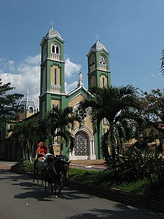
Restrepo is a town and municipality in the Meta Department, Colombia.
Corail is an arrondissement of the Grand'Anse department, located in southwestern Haiti. As of 2015, the population was 131,561 inhabitants. Postal codes in the Anse d'Hainault Arrondissement start with the number 73.
Sumprabum Township is a township of Putao District in the Kachin State of Burma. The principal town is Sumprabum.

Nowe Jankowice is a village in the administrative district of Gmina Łasin, within Grudziądz County, Kuyavian-Pomeranian Voivodeship, in north-central Poland. It lies approximately 7 kilometres (4 mi) north-east of Łasin, 27 km (17 mi) east of Grudziądz, and 69 km (43 mi) north-east of Toruń.
Wanda is a town in the Zabré Department of Boulgou Province in south-eastern Burkina Faso. As of 2005, the town has a population of 1,389.
Krępa Kościelna is a village in the administrative district of Gmina Lipsko, within Lipsko County, Masovian Voivodeship, in east-central Poland. It lies approximately 7 kilometres (4 mi) west of Lipsko and 125 km (78 mi) south of Warsaw.
Pokrzywnica is a village in the administrative district of Gmina Szydłowo, within Piła County, Greater Poland Voivodeship, in west-central Poland. It lies approximately 4 kilometres (2 mi) west of Szydłowo, 12 km (7 mi) west of Piła, and 87 km (54 mi) north of the regional capital Poznań.
Ostoje is a village in the administrative district of Gmina Jutrosin, within Rawicz County, Greater Poland Voivodeship, in west-central Poland. It lies approximately 10 kilometres (6 mi) south of Jutrosin, 21 km (13 mi) east of Rawicz, and 94 km (58 mi) south of the regional capital Poznań.
Mirostowice Dolne is a village in the administrative district of Gmina Żary, within Żary County, Lubusz Voivodeship, in western Poland. It lies approximately 8 kilometres (5 mi) south of Żary and 49 km (30 mi) south-west of Zielona Góra.
Bukowie is a village in the administrative district of Gmina Wilków, within Namysłów County, Opole Voivodeship, in south-western Poland. It lies approximately 8 kilometres (5 mi) north-west of Wilków, 14 km (9 mi) north-west of Namysłów, and 60 km (37 mi) north-west of the regional capital Opole.
Zieleniewo is a village in the administrative district of Gmina Kołobrzeg, within Kołobrzeg County, West Pomeranian Voivodeship, in north-western Poland. It lies approximately 2 kilometres (1 mi) south of Kołobrzeg and 104 km (65 mi) north-east of the regional capital Szczecin.
Tétouan is a province in the Moroccan region of Tanger-Tetouan-Al Hoceima. Its population in 2004 was 613,506

Grobiņa Municipality is a municipality in Courland, Latvia. The municipality was formed in 2009 by merging Bārta parish, Gavieze parish, Grobiņa parish, Medze parish and the town of Grobiņa with the administrative centre being Grobiņa.

Oggaz District is a district of Mascara Province, Algeria.
Paraíso is a corregimiento in Boquerón District, Chiriquí Province, Panama. It has a land area of 36.4 square kilometres (14.1 sq mi) and had a population of 429 as of 2010, giving it a population density of 11.8 inhabitants per square kilometre (31/sq mi). Its population as of 1990 was 190; its population as of 2000 was 248.
Playa Chiquita is a corregimiento in Santa Isabel District, Colón Province, Panama with a population of 169 as of 2010. Its population as of 1990 was 184; its population as of 2000 was 187.

Berettyóújfalu is a district in south-eastern part of Hajdú-Bihar County. Berettyóújfalu is also the name of the town where the district seat is found. The district is located in the Northern Great Plain Statistical Region. This district is a part of Bihar historical and geographical region.


