Bow Brook, Hampshire

Last updated

Bow Brook
Bow Brook passes under Vyne Road (geograph 3318247).jpg
Bow Brook looking upstream from the iron bridge dated 1831 at Beaurepaire Mill.
Location
Country England
Counties Hampshire
Physical characteristics
Source 
  location Ramsdell
  coordinates 51°18′31″N1°09′39″W / 51.3087°N 1.1609°W / 51.3087; -1.1609
Mouth River Loddon
  location
Sherfield on Loddon
  coordinates
51°19′32″N1°01′55″W / 51.3256°N 1.0319°W / 51.3256; -1.0319 Coordinates: 51°19′32″N1°01′55″W / 51.3256°N 1.0319°W / 51.3256; -1.0319
Basin features
Tributaries 
  rightVyne Brook
Bow Brook
BSicon uexCONTg.svg
River Loddon
BSicon uexSTR+l.svg
BSicon uexABZgr.svg
Bow Brook
BSicon uexSTR.svg
BSicon uexSTRl.svg
BSicon uexCONTgeq.svg
River Loddon
BSicon uexABZgl.svg
BSicon BUILDING.svg
Sewage Treatment Works
BSicon uexSKRZ-Eu.svg
Bow Bridge, Sherfield on Loddon
BSicon uexABZgl.svg
BSicon uexSTR+r.svg
BSicon CONTgq.svg
BSicon uxmKRZu.svg
BSicon uxmKRZu.svg
BSicon CONTfq.svg
Reading–Basingstoke line
BSicon uexABZg+l.svg
BSicon uexSTRr.svg
BSicon uexSKRZ-Eu.svg
Lock's Bridge, Cufaude Lane
BSicon uexSKRZ-Eu.svg
Beaurepaire Mill Bridge
BSicon uexSTR+l.svg
BSicon uexABZgr.svg
BSicon uexSTR.svg
BSicon uxMILL.svg
Beaurepaire Mill
BSicon uexSTRl.svg
BSicon uxWEIRl.svg
BSicon uexSTRq.svg
BSicon uexSTR+r.svg
Vyne Stream
BSicon uexSTR.svg
BSicon uexSKRZ-Eu.svg
bridge
BSicon uexSTR.svg
BSicon uexRESVGe.svg
The Lake, Vyne Park
BSicon uexSTR.svg
BSicon uexABZgl.svg
BSicon BUILDING.svg
Sewage Treatment Works
BSicon uexSTR.svg
BSicon uexABZgl.svg
BSicon uexSTR+r.svg
BSicon uexSTR.svg
BSicon uxWEIRf.svg
BSicon uxMILL.svg
weir and Vyne Mill
BSicon uexSTR.svg
BSicon uexFABZgl+l.svg
BSicon uexKBHFeq.svg
BSicon uexBHF.svg
Mill Head
BSicon uexSTR.svg
BSicon uexSKRZ-Au.svg
BSicon uexKHSTe.svg
A340 Aldermaston Road Bridge
BSicon uexSTR.svg
BSicon uexKHSTe.svg
source of Wey Brook
BSicon uexSTR+l.svg
BSicon uexABZgr.svg
Old Ponds
BSicon uexSKRZ-Eu.svg
BSicon uexSTR.svg
Boars's Bridge
BSicon uexSKRZ-Eu.svg
BSicon uexSTR.svg
Silchester Road Bridge
BSicon uexKHSTe.svg
BSicon uexSTR.svg
sources near Pamber Green
BSicon uexSKRZ-Au.svg
A340 Aldermaston Road Bridge
BSicon uexABZgl.svg
BSicon uexSTRq.svg
BSicon uexKHSTeq.svg
source in Monk Sherborne Wood
BSicon uexSTR+l.svg
BSicon uexABZlr.svg
BSicon uexSTR+r.svg
BSicon uexSTR.svg
BSicon FEATURE.svg
BSicon uexSTR.svg
Pamber Priory
BSicon uexSKRZ-Eu.svg
bridges
BSicon uexABZgl.svg
BSicon uexSTR+r.svg
BSicon uexABZgl.svg
BSicon uexKHSTeq.svg
springs in Trenchmead Copse
BSicon uexSKRZ-Eu.svg
2 bridges + Brocas Bridge
BSicon uexSTR.svg
BSicon uexKHSTe.svg
BSicon uexABZgl.svg
BSicon uexKHSTeq.svg
springs
BSicon uexSKRZ-Eu.svg
BSicon uexSTR.svg
West Heath bridge
BSicon uexKHSTe.svg
BSicon uexSTR.svg
sources near Ramsdell
BSicon uexSKRZ-Eu.svg
Ramsdell Bridge
BSicon uexBHF.svg
pond
BSicon uexBHF.svg
pond
BSicon uexKBHFe.svg
pond

Bow Brook is a small river in the English county of Hampshire, which is a tributary of the River Loddon. Contributary streams rise near Ramsdell and Sherborne St John, and after flowing through rural countryside, it joins the Loddon near Sherfield on Loddon. Historically is has powered at least two watermills.

Contents

Route

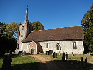
Bow Brook rises as a series of streams to the west of Pamber End. Sections are marked as drains, and so the channel may be engineered. One begins near West Heath, and passes under two roads to reach Clapperhill Copse. A second follows a similar course, but further to the south, passing under one road to join the first. They flow to the east, and along the northern edge of the site of Pamber Priory. A third stream begins at three ponds to the west of Ramsdell, and it joined by two more streams, before it passes beneath Brocas Bridge and another bridge to flow along the southern and eastern edges of the priory site. [1] The priory was founded during the reign of Henry I by Henry de Port, and was an alien priory, under the supervision of St Vigor Carasy, Normandy. Because it was under foreign control, it was suppressed in 1446, and responsibility for the site eventually passed to The Queen's College, Oxford, to whom it still belongs. Parts of the priory church, dating from the 12th and 13th centuries, survive as the Priory Church of the Holy Trinity, Our Lady, and St John the Baptist. It is in the parish of Monk Sherborne, and is a grade I listed structure. [2] The adjacent farm house and barn are grade II listed structures. [3]

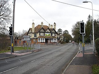
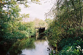
Another stream which rises in Monk Sherborne Wood flows northwards to join the main stream as it passes under the A340 Aldermaston Road. Beyond the bridge it passes through woodland, known as Pamderend Gully Copse and Pamderend Moor Gully Copse. A tributary which also rises in Monk Sherborne Wood joins from the south, and another which begins as a spring in Cranes Copse joins close to a ford where a track crosses the river. This was also the point at which a Roman road crossed the river. In Wiltshire's Gully Copse, a stream which is known as Old Ponds joins from the north. This begins as two branches near Pamber Green, which join to flow eastwards under a bridge at Little Loddon, and Boar's Bridge before turning to the south to join Bow Brook. This continues through woodland, and passes over a weir at Tumbling Bay, to reach Beaurepaire Mill. [1] The square mill building was built in the 1870s or 1880s for the Beaurepaire estate, but has now been converted into a house. [4] The rather larger mill house dates from the same time, although it was extended in the 20th century. [5] The river continues beneath a bridge dated 1831, which consists of five elliptical cast-iron girders supporting plates on which the roadway is constructed. The ballustrades are made of wrought iron, and the abutments are of brick and stone. [6]

Shortly afterwards, the river is crossed by the course of another Roman road, and passes beneath Lock's Bridge to enter Bramley Training Area. This was the Bramley Ordnance Depot between 1917 and 1987, when it was used to store ammunition, and was also the home of the Royal Army Ordnance Corps School of Ammunition from 1922 to 1974. [7] The channel splits into two, and joins up again after both routes have passed under the Great Western Railway line connecting Basingstoke and Reading, which bisects the training area. The depot had its own internal standard-gauge railway network, which crossed Bow Brook four times to the west of the main line railway, and another four times to the east. [8] The Brook then curves around the southern edge of a mound on which the earthworks for Bulls Down Camp stand. This was an Iron Age hillfort, covering 10 acres (4 ha), which has never been excavated archaeologically, and is a scheduled monument. [9] The river then passes along the north-western edge of Sherfield on Loddon, passes a sewage treatment works on its right bank, and joins the Loddon. [1]

Vyne Stream is a tributary of Bow Brook, which rises from springs in the south-easterly part of Sherborne St John. It passes under Vyne Road, and forms a large pond, known as Mill Head. Wey Brook, which rises from springs on both sides of the A340 road to the north-west of Sherborne St John, supplies water to watercress beds and flows eastwards to join Mill Head. Its outflow powered a watermill, beyond which the river turns to the north and passes a sewage treatment works on the right bank. [1] It then enters The Vyne, a large area of parkland which was recorded as having a manor house and chapel in 1362. It was inherited by William Sandys in 1496, who became the Lord Chamberlain to Henry VIII in 1523. Much of the park became part of the estate at around that time. John Chute inherited the estate in 1754, and was probably responsible for enlarging the lake. When the owner Charles Chaloner died in 1956, the estate, which consists of 10 hectares (25 acres) of gardens, 35 hectares (86 acres) of parkland and 55 hectares (140 acres) of woodland, was given to the National Trust. [10] At its southern end, the lake is crossed by a three-arched bridge, constructed from red bricks with cast iron parapets in 1840. [11] At the bottom end of the lake is a weir with a small lake beyond, and the Vyne Stream heads northwards, passing under Morgaston Road, to reach the mill pond at Beaurepaire Mill. [1]

Milling

Bow Brook and its tributaries have been used to provide power for milling since at least the time of the Domesday Book in 1086. The Manor of Sherborne St John was owned by Hugh de Port at that time, and contained three mills worth 27 shillings and sixpence (£1.37). One of them, probably that located where Beaurepaire Mill stands, was given to Bartholomew Pecche by William de St. John, and was subsequently given to Monk Sherborne Priory by Henry de Port, when he founded it in 1130. The priory received a mark of silver each year from the mill, as well as having all of their corn ground at no charge, but de Port's grandson Adam obtained the mill again, by exchanging it for all the tithes from his mills in Sherborne. In 1302, two mills and a fishpond were mentioned in Sherborne St John, one of which was at the site of the present mill building, next to the Mill Head fishpond, while the second was probably on the Wey Brook to the north of the village, where there is evidence of a mill pool. The Beaurepaire Mill appears on an estate plan dating from 1613 in its present location. [12] Both Beaurepaire Mill, now a Grade II listed building, [13] and Sherborne St John Mill were marked as corn mills in 1872-73 and again in 1911, [14] though the former was converted to domestic accommodation in the 1870s. [13]

Water quality

The Environment Agency measure water quality of the river systems in England. Each is given an overall ecological status, which may be one of five levels: high, good, moderate, poor and bad. There are several components that are used to determine this, including biological status, which looks at the quantity and varieties of invertebrates, angiosperms and fish, and chemical status, which compares the concentrations of various chemicals against known safe concentrations. Chemical status is rated good or fail. [15]

The water quality of the Bow Brook system was as follows in 2019.

SectionEcological
Status
Chemical
Status
Overall
Status
LengthCatchmentChannel
Bow Brook (Pamber End to Bramley) [16] Poor Fail Poor 9.0 miles (14.5 km)6.97 square miles (18.1 km2)
Vyne Stream [17] Moderate Fail Moderate 4.6 miles (7.4 km)4.88 square miles (12.6 km2)heavily modified
Bow Brook (Bramley to Sherfield Green) [18] Moderate Fail Moderate 3.4 miles (5.5 km)3.75 square miles (9.7 km2)

Reasons for the water quality being less than good include the discharge of sewage effluent, physical barriers to the movement of fish caused by modifications to the channel for land drainage and milling, and runoff of water from agricultural land. In addition, Vyne Stream is affected by groundwater abstraction, the impounding of water, and the presence of the invasive North American signal crayfish.

Bibliography

Related Research Articles

River Coquet

The River Coquet runs through the county of Northumberland, England, discharging into the North Sea on the east coast at Amble. It rises in the Cheviot Hills on the border between England and Scotland, and follows a winding course across the landscape. The upper reaches are bordered by the Otterburn Ranges military training ground, and are crossed by a number of bridges built in the 20th century. It passes a number of small villages and hamlets, and feeds one of the lakes created by extraction of gravel that form the Caistron Nature Reserve, before reaching the town of Rothbury, where it is crossed by a grade II listed bridge. Below the town is Thrum Mill, the restoration of which was featured on Channel 4 television.

River Blackwater (River Loddon) Tributary of the River Loddon in England

The River Blackwater is a tributary of the Loddon in England and sub-tributary of the Thames. It rises at two springs in Rowhill Nature Reserve between Aldershot, Hampshire and Farnham, Surrey. It curves a course north then west to join the Loddon in Swallowfield civil parish, central Berkshire. Part of the river splits Hampshire from Surrey; a smaller part does so as to Hampshire and Berkshire.

River Ryton

The River Ryton is a tributary of the River Idle. It rises close to the Chesterfield Canal near Kiveton Park, and is joined by a series of tributaries near Lindrick Common in the Metropolitan Borough of Rotherham, South Yorkshire, England. Most of its course is in Nottinghamshire, flowing through the town of Worksop. It meanders northwards to join the River Idle near the town of Bawtry on the South Yorkshire-Nottinghamshire border.

River Loddon

The River Loddon is a tributary of the River Thames in southern England. It rises at Basingstoke in Hampshire and flows northwards for 28 miles (45 km) to meet the Thames at Wargrave in Berkshire. Together, the Loddon and its tributaries drain an area of 400 square miles (1,036 km2).

Foudry Brook

Foudry Brook is a small stream in southern England. It rises from a number of springs near the Hampshire village of Baughurst, and flows to the east and then the north, to join the River Kennet to the south of Reading. The upper section is called Silchester Brook, and beyond that, Bishop's Wood Stream. The underlying geology is chalk, covered by a layer of clay, and so it has the characteristics of a clay stream, experiencing rapid increases in level after heavy rain due to run-off from the surrounding land. It passes a number of listed buildings and scheduled monuments, including the site of the Roman town of Calleva Atrebatum or Silchester.

Burghfield Human settlement in England

Burghfield is a village and large civil parish in West Berkshire, England, with a boundary with Reading. Burghfield can trace its history back to before the Domesday book, and was once home to three manors: Burghfield Regis, Burghfield Abbas and Sheffield. Since the 1980s the population of Burghfield has nearly doubled with the construction of many new housing estates, dependent for its employment on, for instance, Reading, Newbury and Basingstoke and M4 corridor which bisects the edge of the area.

Sherborne St John Human settlement in England

Sherborne St John is a village and civil parish near Basingstoke in the English county of Hampshire.

The Cut, Berkshire

The Cut is a river in England that rises in North Ascot, Berkshire. It flows for around 14 miles (23 km), through the rural Northern Parishes of Winkfield, Warfield and Binfield in Bracknell Forest on its way down to Bray, where it meets the River Thames just above Queens Eyot Island on the reach below Bray Lock, having been joined by the Maidenhead Waterways.

Pamber Priory

Pamber Priory is a Church of England parish church and former priory, then known as West Sherborne Priory or Monk Sherborne Priory, at Monk Sherborne in the English county of Hampshire.

West End Brook

West End Brook is a small stream in southern England. It rises near the Hampshire village of Tadley. Its name is probably related to the parish, and village, it passes through for some of its course: Mortimer West End.

River Hart

The River Hart is a tributary of the River Whitewater in north Hampshire, England. It rises at Ashley Head spring in Crondall and flows north to meet the Whitewater at Bramshill.

Oldcotes Dyke

Oldcotes Dyke is the name of the final section of a river system that drains parts of north Nottinghamshire and the Metropolitan Borough of Rotherham in South Yorkshire, England. Historically, it has supported milling, with seven water mills drawing their power from its water, and ran through the grounds of the Cistercian Roche Abbey. It is a tributary of the River Ryton.

St James Church, Bramley

The Church of St James in Bramley, Hampshire, England was built in the Norman period and has been added to since. It is a Grade I listed building.

Twyford Brook

Twyford Brook is a small English river in the county of Berkshire. It drains a rural area to the east of Twyford, starting at the foot of the M4 motorway embankment, and is a tributary of the River Loddon. It was once part of a larger river system, draining the area now occupied by the new town of Bracknell. Because of issues with flooding, a new channel was cut to carry the water to the River Thames at Bray. The new channel and the river upstream from there is now known as The Cut, and the old channel became known as Twyford Brook.

River Lyde (Hampshire)

The River Lyde or Lyde River is a small river in the English county of Hampshire. It rises near Mapledurwell, where the water is used in watercress beds before entering the main channel. It flows in a generally northerly direction, and used to supply power to watermills along its route. Near Sherfield on Loddon it joins the River Loddon, which is a tributary of the River Thames.

Fleet Brook

Fleet Brook is a small river in northern Hampshire, England and tributary of the River Hart.

Barkham Brook

Barkham Brook is a small river in the English county of Berkshire. It has sources to the north and west of Finchampstead in the Wokingham Borough, flows past the village of Barkham, and joins the River Loddon to the west of Winnersh.

References

  1. 1 2 3 4 5 Ordnance Survey, 1:2500 map
  2. Historic England. "Priory Church of the Holy Trinity, Our Lady, and St John the Baptist (1092954)". National Heritage List for England . Retrieved 7 July 2020.
  3. Historic England. "Pamber Priory Farmhouse (1179288)". National Heritage List for England . Retrieved 7 July 2020.
  4. Historic England. "Beaurepaire Mill (1259258)". National Heritage List for England . Retrieved 7 July 2020.
  5. Historic England. "Beaurepaire Mill House (1259259)". National Heritage List for England . Retrieved 7 July 2020.
  6. Historic England. "Beaurepaire Mill Bridge (1237131)". National Heritage List for England . Retrieved 7 July 2020.
  7. "Ammunition Depots". British Army units from 1945 on. Archived from the original on 24 April 2019. Retrieved 6 July 2020.
  8. Ordnance Survey, 1:10,000 map, 1989-91
  9. Historic England. "Bulls Down camp Bramley (1001944)". National Heritage List for England . Retrieved 7 July 2020.
  10. Historic England. "The Vyne, Sherborne St John (1000870)". National Heritage List for England . Retrieved 7 July 2020.
  11. Historic England. "Iron Bridge (1339572)". National Heritage List for England . Retrieved 7 July 2020.
  12. Page 1911, pp. 158-171.
  13. 1 2 Historic England (28 January 1997). "Beaurepaire Mill  (Grade II) (1259258)". National Heritage List for England .
  14. Ordnance Survey, 1:2500 maps, 1872-73 and 1911
  15. "Glossary (see Biological quality element; Chemical status; and Ecological status)". Catchment Data Explorer. Environment Agency. 17 February 2016.
  16. "Bow Brook (Pamber End to Bramley)". Catchment Data Explorer. Environment Agency.
  17. "Vyne Stream". Catchment Data Explorer. Environment Agency.
  18. "Bow Brook (Bramley to Sherfield Green)". Catchment Data Explorer. Environment Agency.

External sources