River Hart

Last updated

River Hart
River Hart - geograph.org.uk - 141085.jpg
Just upstream of treated wastewater outfall of Hartley Wintney sewage treatment works
Hampshire UK relief location map.jpg
Red pog.svg
Mouth of the Hart (into the Whitewater)
EtymologyA hart a deer
Location
Country England
Counties Hampshire
Districts / Boroughs Hart
Physical characteristics
Source 
  location Crondall, Hampshire, United Kingdom
  coordinates 51°14′07″N0°51′33″W / 51.23524°N 0.85920°W / 51.23524; -0.85920
  elevation85 metres (279 ft)
Mouth River Whitewater
  location
Hart, Hampshire
  coordinates
51°20′32″N0°56′13″W / 51.34224°N 0.93683°W / 51.34224; -0.93683 Coordinates: 51°20′32″N0°56′13″W / 51.34224°N 0.93683°W / 51.34224; -0.93683
  elevation
46 metres (151 ft)
Basin features
ProgressionHart, Whitewater, Blackwater, Loddon, Thames
Tributaries 
  right Fleet Brook

The River Hart is a tributary of the River Whitewater in north Hampshire, England. It rises at Ashley Head spring in Crondall and flows north to meet the Whitewater at Bramshill. [1] [2] [3]

Contents

The Hart district of Hampshire is named after the river.

Route

River Hart
BSicon uexCONTg.svg
River Whitewater
BSicon uexABZgl.svg
BSicon uexSTR+r.svg
River Hart
BSicon uexCONTfaq.svg
BSicon uexSTRr.svg
BSicon uexSTR.svg
River Whitewater
BSicon uexSKRZ-Eu.svg
Lea Bridge, Hazeley
BSicon uexSKRZ-Eu.svg
High Bridge, Bramshill Park
BSicon BUILDING.svg
BSicon uexABZgr.svg
Sewage Treatment Works
BSicon uexSKRZ-Au.svg
A30 Hartford Bridge
BSicon uexSTR+l.svg
BSicon uexABZgr.svg
tributary
BSicon uexSTR.svg
BSicon uexABZgl.svg
BSicon uexSTRq.svg
BSicon uexCONTgeq.svg
Fleet Brook
BSicon uexSKRZ-Au.svg
A323 Fleet Road Bridge
BSicon uexSTR.svg
BSicon uexSTR.svg
BSicon uexKHSTe.svg
BSicon uexSTR.svg
Springs
BSicon uexSKRZ-Bu.svg
UK-Motorway-icon.svg M3 motorway
BSicon CONTgq.svg
BSicon STRq.svg
BSicon uxmKRZu.svg
BSicon STRq.svg
BSicon CONTfq.svg
South West railway
BSicon uexSKRZ-Eu.svg
Pale Lane Bridge
BSicon uexSKRZ-Eu.svg
Pilcot Bridge
BSicon uxMILL.svg
Pilcot Mill
BSicon uexSTR+l.svg
BSicon uexABZgr.svg
tributary
BSicon uexSTR.svg
BSicon uexSKRZ-Eu.svg
Crookham Bridge
BSicon uCONTgq.svg
BSicon uxKRZu.svg
BSicon uxKRZu.svg
BSicon uSTRq.svg
BSicon uCONTfq.svg
Basingstoke Canal
BSicon uxMILL.svg
BSicon uexSTR.svg
Itchel Mill
BSicon uexSKRZ-Au.svg
A287 Bridges
BSicon uexKHSTe.svg
BSicon uexSTR.svg
Itchel Mill Springs
BSicon uexSKRZ-Eu.svg
Hyde Lane Bridge
BSicon uexSKRZ-Eu.svg
Redlands Lane Bridge
BSicon uexKHSTe.svg
Ashley Head (spring)

The Hart rises at a series of springs at about 85 metres (279 ft) elevation on Crondall golf course. From the main spring at Ashley Head, it flows northwards, hemmed in by housing, and is crossed by Redlands Lane, before passing under the drive of East Bridge House, [4] an early 19th-century mansion with older core recognised and protected in the mainstream, starting category [5] It passes Marsh Farm Business Centre (to right then fields, then passes under the Basingstoke Canal near Crookham Wharf. After running along the backs of housing on Crondall Road, it passes under the road, to be joined by a stream on its left bank. [4]

The tributary begins at some springs and ponds known as Itchel Mill Springs. The outlet flows under the A287 road to reach the site of the mill [4] demolished in 1945; a modern house has replaced the mill cottage. [6] Beyond this, it threads its way through Coxmoor Farm, under the Basingstoke Canal and across Peatmoor Copse, where it is joined by another small stream, to reach the main channel of the Hart.

After, is Pilcot Mill at Dogmersfield, a two-storey millhouse from the 18th century, last used for milling in 1928. [7] Its mill cottage has 17th and 18th century elements. [8] On the downstream side of Pilcot Bridge is a large timber-framed house of even date known as Catherine of Aragon (House). [9]

Pilcot farm is on the left bank, and then the river passes often tree-lined through fields west of Fleet, where ditches add to it. The channel splits into two to pass under the South West Main Line embankment, fields being drained up to about the M3 motorway. A key ditch begins across the latter, and runs beside the main channel on its left bank. Both are crossed by the A323 Fleet Road, and are controlled by sluices as they enter Elvetham Park. [4]

The park was created in the 14th century. It was re-landscaped in 1591 for Edward Seymour, 1st Earl of Hertford to entertain Elizabeth I with four days of lavish festivities. Courtiers were offered a booklet describing the entertainment. [10] In the 18th and early 19th centuries the park was extended and planting took place in some areas, while ornamental and formal gardens were added in the later 19th and early 20th centuries. The original Elvetham House burnt down in 1840, and was replaced by the grade II* listed Elvetham Hall built between 1859 and 1862 by Samuel Sanders Teulon. Additions were made to the building in 1901 and 1911–12, while the grounds include a Norman-style church building erected in 1840 by Henry Roberts. The river runs through the park, separating Elvetham Park to the south-east from New Park, to the north-west. A lake was constructed in 1871, to the north-east of the hall, but this had become overgrown with vegetation by the 1980s, and a weir and bypass channel were built, so that the river could be diverted around it to allow it to be dredged. [11] Teulon also built a bridge over the river, with two segmental brick arches and wrought iron gates. [12]

As the river leaves, it is joined by the Fleet Brook on its right bank. Hartford Bridge carries the A30 road over the river at the small village of Hartfordbridge. Shortly afterwards, Hartley Wintney sewage works outfall is received. The Hart continues through wooded countryside, [4] and enters the grade I listed Bramshill Park. Its original 2,500 acres (1,000 ha) of land was enclosed by Thomas Foxley in 1347 as a deer park, and he later built the house. Diplomat, Edward, Lord Zouche of Harringworth, bought it in 1605, and built a mansion between 1605 and 1612, incorporating part of the house. The park was landscaped in the 17th century, and in the late 18th and early 19th centuries, the river widened to form the Broad Water. The estate was sold in 1952, and parts of it became a Police Training College. The site was given a grade I, top, listing, having an early 17th-century water garden. Its associated mansion is one of three Jacobean buildings known to include two state apartments, one for the king and another for the queen. [13] Within the park is a grade I listed bridge crossing the river, built in the early 19th century in Jacobean style, with two red-brick arches and stone dressing. [14] After leaving the park, the river is crossed by Plough Lane at Lea Bridge, and then joins the River Whitewater, on its right bank. [4]

Milling

There is clear evidence for two water mills on the Hart, both of which were corn mills in 1871. [15] Only Pilcot Mill at Dogmersfield survives. It is a small building with three storeys, constructed with a timber frame and brick infill. A mill in Dogmersfield was mentioned in the Domesday Book, compiled in 1086, but it was probably a little further downstream at a building known as Pilcot and more recently, Catherine of Aragon. There are records for a mill at there from the 15th, 16th and 17th centuries. The surviving mill dates from the 18th century, and the last record of it being used dates from 1928. In the 1980s, Anne and Geoff Finnigan owned the mill, and by the late 1980s, a considerable amount of restoration had been carried out. The mill was powered by an external Poncelet wheel, a more efficient form of undershot water wheel, but its condition in 2013 was poor. Internally, all of the machinery and two pairs of stones are still in situ. There is evidence that water power was supplemented by an engine, the base for which can still be seen. Because the river was prone to flooding, there are two bypass channels running parallel to the wheel pit. [16] [7]

There have also been mills at Crondall, below Itchel Mill Springs. There was a mill there in 1068, when it was valued at three shillings (15p), but by 1327 it was described as "an utter ruin and of no value". Two water mills were mentioned in 1653, and three grist mills under a single roof in 1773. The final mill building was erected some time before 1850, and was demolished in 1945. The adjacent mill house has been replaced by a modern residence. The mill was always seasonal, as the mill pond was fed by a spring, which was dry for part of the year. Generally, the pond filled in February each year, and milling could take place for several months afterwards. [17]

Water quality

Environment Agency staff measure rivers' water quality. Each is given an overall ecological status, one of five levels: high, good, moderate, poor and bad. Components of determination include biological status (the quantity and varieties of invertebrates, angiosperms and fish), and chemical status, which compares the concentrations of various chemicals against known safe concentrations. Chemical status is rated good or fail. [18]

The water quality of the Hart system was as follows in 2019.

SectionEcological StatusChemical StatusOverall StatusLengthCatchment
Hart (Crondall to Elvetham) [19] Poor Fail Poor 6.8 miles (10.9 km)17.35 square miles (44.9 km2)
Hart (Elvetham to Hartley Wintney) [20] Poor Fail Poor 4.8 miles (7.7 km)4.60 square miles (11.9 km2)

Reasons for the quality being less than good include: discharge from sewage treatment works; runoff from agricultural land; physical barriers such as weirs and impounding of the water which prevent the free migration of fish and other species; runoff from roads; and leaching from landfill sites.

Bibliography

Related Research Articles

Fleet, Hampshire Human settlement in England

Fleet is a town and civil parish in the Hart district of Hampshire, England, centred 38.2 miles (61.5 km) WSW of London and 13 miles (21 km) east of Basingstoke. It is the major town of Hart District, and has large technology business areas, fast rail links to London, and is well connected to the M3. The Fleet built-up area population of 42,835 includes the contiguous parishes of Church Crookham, Crookham Village, Dogmersfield, and Elvetham Heath. The town has a prominent golf club, an annual half marathon, an athletics club, and four football clubs. The nearby service station on the motorway is named for the town.

Hart District Non-metropolitan district in England

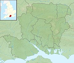
Hart is a local government district in Hampshire, England, named after the River Hart. Its council is based in Fleet. It was formed on 1 April 1974 under the Local Government Act 1972, as a merger of the urban district of Fleet, and the Hartley Wintney Rural District. It was named the best place to live in the UK in the 2017 Halifax quality of life study.

River Meden river in Nottinghamshire, England

The River Meden is a river in Nottinghamshire, England. Its source lies just north of Huthwaite, near the Derbyshire border, and from there it flows north east through Pleasley and Warsop before merging temporarily with the River Maun near Bothamsall. The rivers divide after a short distance and go on separately to a point near Markham Moor where they once more combine to form the River Idle.

River Rother, West Sussex River in Hampshire and West Sussex, England

The River Rother flows from Empshott in Hampshire, England, to Stopham in West Sussex, where it joins the River Arun. At 52 kilometres (32 mi) long, most of the river lies within West Sussex except for the first 10 kilometres (6.2 mi) which lie in Hampshire. The upper river, from its source to Midhurst, has been used to power watermills, with the earliest recorded use being in 1086, when the Domesday survey was conducted. Although none are still operational, many of the buildings which housed the mills still exist, and in some cases, still retain their milling machinery. This upper section is also noted for a number of early bridges, which have survived since their construction in the fifteenth, sixteenth and seventeenth centuries.

River Blackwater (River Loddon) Tributary of the River Loddon in England

The River Blackwater is a tributary of the Loddon in England and sub-tributary of the Thames. It rises at two springs in Rowhill Nature Reserve between Aldershot, Hampshire and Farnham, Surrey. It curves a course north then west to join the Loddon in Swallowfield civil parish, central Berkshire. Part of the river splits Hampshire from Surrey; a smaller part does so as to Hampshire and Berkshire.

Hartley Wintney Human settlement in England

Hartley Wintney is a large village and civil parish in the Hart district of Hampshire, England. It lies about 3 miles (5 km) northwest of Fleet and 8 miles (13 km) east of Basingstoke. The parish includes the smaller contiguous village of Phoenix Green as well as the hamlets of Dipley, Elvetham, Hartfordbridge, and West Green.

Foudry Brook River in Hampshire and Berkshire, England

Foudry Brook is a small stream in southern England. It rises from a number of springs near the Hampshire village of Baughurst, and flows to the east and then the north, to join the River Kennet to the south of Reading. The upper section is called Silchester Brook, and beyond that, Bishop's Wood Stream. The underlying geology is chalk, covered by a layer of clay, and so it has the characteristics of a clay stream, experiencing rapid increases in level after heavy rain due to run-off from the surrounding land. It passes a number of listed buildings and scheduled monuments, including the site of the Roman town of Calleva Atrebatum or Silchester.

North East Hampshire (UK Parliament constituency)

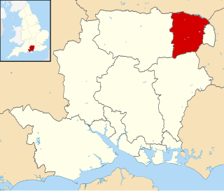
North East Hampshire is a constituency represented in the House of Commons of the UK Parliament by Ranil Jayawardena, a Conservative.

Crondall Human settlement in England

Crondall is a village and large civil parish in the north east of Hampshire in England, in a similar location to the Crondall Hundred surveyed in the Domesday Book of 1086. The village is on the gentle slopes of the low western end of the North Downs range, and has the remains of a Roman villa. Despite the English Reformation, Winchester Cathedral held the chief manors representing much of its land from 975 until 1861. A large collection of Anglo-Saxon and Merovingian coins found in the parish has become known as the Crondall Hoard.

River Perry river in Shropshire, England

The River Perry is a river in Shropshire, England. It rises near Oswestry and flows south to meet the River Severn above Shrewsbury. Along its 24 miles (39 km) length, its level drops by some 320 feet (95 m). The channel has been heavily engineered, both to enable water mills to be powered by it, and to improve the drainage of the surrounding land. There were at least seven corn mills in the 1880s, and the last one remained operational until 1966. The middle section of the river crosses Baggy Moor, where major improvements were made in 1777 to drain the moor. The scheme was one of the largest to enclose and improve land in North Shropshire, and the quality of the reclaimed land justified the high cost. A section of the river bed was lowered in the 1980s, to continue the process.

Samuel Sanders Teulon was a 19th-century English Gothic Revival architect, noted for his use of polychrome brickwork and the complex planning of his buildings.

Bramshill House Grade I listed English country house in Hart, United Kingdom

Bramshill House, in Bramshill, northeast Hampshire, England, is one of the largest and most important Jacobean prodigy house mansions in England. It was built in the early 17th century by the 11th Baron Zouche of Harringworth but was partly destroyed by fire a few years later. The design shows the influence of the Italian Renaissance, which became popular in England during the late 16th century. The house was designated a Grade I listed building in 1952.

Dogmersfield Human settlement in England

Dogmersfield is a small village lying between the towns of Fleet and Hartley Wintney in Hampshire, England. The M3 motorway and railway stations at Fleet and Winchfield provide routes to London.

River Whitewater River in Hampshire, England

The River Whitewater rises at springs near Bidden Grange Farm between Upton Grey and Greywell in Hampshire, England. It flows northeast and is a tributary of the River Blackwater near Swallowfield. Its headwaters flow over chalk and there is little pollution making the River Whitewater rich in wildlife. It was noted on Jansson's map of Hampshire of 1646.

Oldcotes Dyke

Oldcotes Dyke is the name of the final section of a river system that drains parts of north Nottinghamshire and the Metropolitan Borough of Rotherham in South Yorkshire, England. Historically, it has supported milling, with seven water mills drawing their power from its water, and ran through the grounds of the Cistercian Roche Abbey. It is a tributary of the River Ryton.

Elvetham Hall

Elvetham Hall is a hotel in Hampshire, England, in the parish of Hartley Wintney about 2 miles (3 km) northwest of Fleet. The building is a High Victorian Gothic Revival English country house and a Grade II* listed building. It stands in a landscaped park that is Grade II listed.

River Lyde (Hampshire) River in Hampshire, England

The River Lyde or Lyde River is a small river in the English county of Hampshire. It rises near Mapledurwell, where the water is used in watercress beds before entering the main channel. It flows in a generally northerly direction, and used to supply power to watermills along its route. Near Sherfield on Loddon it joins the River Loddon, which is a tributary of the River Thames.

Bow Brook, Hampshire River in Hampshire, England

Bow Brook is a small river in the English county of Hampshire, which is a tributary of the River Loddon. Contributary streams rise near Ramsdell and Sherborne St John, and after flowing through rural countryside, it joins the Loddon near Sherfield on Loddon. Historically is has powered at least two watermills.

Fleet Brook River in northern Hampshire, England

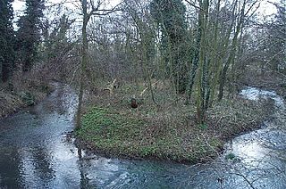
Fleet Brook is a small river in northern Hampshire, England and tributary of the River Hart.

References

  1. Ordnance Survey of Great Britain
  2. "River Hart - Flood Warning Area Detail". Environment Agency. Retrieved 30 January 2015.
  3. "River Hart, Hampshire". Explore Britain. Retrieved 30 January 2015.
  4. 1 2 3 4 5 6 Ordnance Survey, 1:2500 map
  5. Historic England. "Eastbridge House (1092379)". National Heritage List for England . Retrieved 10 July 2020.
  6. Vaidya 2013, p. 77.
  7. 1 2 Historic England. "Pilcot Mill (1339833)". National Heritage List for England . Retrieved 10 July 2020.
  8. Historic England. "Mill Cottage (1092326)". National Heritage List for England . Retrieved 10 July 2020.
  9. Historic England. "Catherine of Aragon (1092324)". National Heritage List for England . Retrieved 10 July 2020.
  10. British Library 1591.
  11. Historic England. "Elvetham Hall (1000250)". National Heritage List for England . Retrieved 10 July 2020.
  12. Historic England. "Elvetham Hall Bridge (1319752)". National Heritage List for England . Retrieved 10 July 2020.
  13. Historic England. "Bramshill Park (1000165)". National Heritage List for England . Retrieved 10 July 2020.
  14. Historic England. "High Bridge (1091941)". National Heritage List for England . Retrieved 10 July 2020.
  15. Ordnance Survey, 1:2500 map, 1871
  16. Vaidya 2013, pp. 78-79.
  17. Vaidya 2013, pp. 76-77.
  18. "Glossary (see Biological quality element; Chemical status; and Ecological status)". Catchment Data Explorer. Environment Agency. 17 February 2016. UKOpenGovernmentLicence.svg Text was copied from this source, which is available under an Open Government Licence v3.0. © Crown copyright.
  19. "Hart (Crondall to Elvetham)". Catchment Data Explorer. Environment Agency.
  20. "Hart (Elvetham to Hartley Wintney)". Catchment Data Explorer. Environment Agency.

External sources