The River Witham is a river almost entirely in the county of Lincolnshire in the east of England. It rises south of Grantham close to South Witham at SK8818, passes through the centre of Grantham, passes Lincoln at SK9771 and at Boston, TF3244, flows into The Haven, a tidal arm of The Wash, near RSPB Frampton Marsh. The name "Witham" seems to be extremely old and of unknown origin. Archaeological and documentary evidence shows the importance of the Witham as a navigable river from the Iron Age onwards. From Roman times it was navigable to Lincoln, from where the Fossdyke was constructed to link it to the River Trent. The mouth of the river moved in 1014 following severe flooding, and Boston became important as a port.

The River Hamble is located in south Hampshire, England. It rises near Bishop's Waltham and flows for 10.1 km (6.3 mi) through Botley, Bursledon, and Lower Swanwick before entering Southampton Water between Hamble Common and Warsash.
The River Douglas, also known as the River Asland or Astland, flows through parts of Lancashire and Greater Manchester in North West England. It is a tributary of the River Ribble and has several tributaries, the major ones being the River Tawd and the River Yarrow.
The River Test is a chalk stream in Hampshire in the south of England. It rises at Ashe near Basingstoke and flows southwards for 40 miles (64 km) to Southampton Water. Settlements on the Test include the towns of Stockbridge and Romsey. Below the village of Longparish, the river is broadly followed by the Test Way, a long-distance footpath.

The River Arun is a river in the English county of West Sussex. At 37 miles (60 km) long, it is the longest river entirely in Sussex and one of the longest starting in Sussex after the River Medway, River Wey and River Mole. From the series of small streams that form its source in the area of St Leonard's Forest in the Weald, the Arun flows westwards through Horsham to Nowhurst where it is joined by the North River. Turning to the south, it is joined by its main tributary, the western River Rother, and continues through a gap in the South Downs to Arundel to join the English Channel at Littlehampton. It is one of the faster flowing rivers in England, and is tidal as far inland as Pallingham Quay, 25.5 miles (41.0 km) upstream from the sea at Littlehampton. The Arun gives its name to the Arun local government district of West Sussex.

The River Itchen in Hampshire, England, rises to the south of New Alresford and flows 26 miles (42 km) to meet Southampton Water below the Itchen Bridge. The Itchen Navigation was constructed in the late 17th and early 18th centuries to enable barges to reach Winchester from Southampton Docks, but ceased to operate in the mid-19th century and is largely abandoned today.

The River Meon is a chalk stream in Hampshire in the south of England. It rises at East Meon then flows 34 km (21 mi) in a generally southerly direction to empty into the Solent at Hill Head near Stubbington. Above Wickham, the river runs through the South Downs National Park.

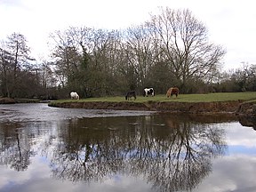
The Beaulieu River, formerly known as the River Exe, is a small river draining much of the central New Forest in Hampshire, southern England. The river has many small upper branches and its farthest source is 8 miles (13 km) from its 4 miles (6 km)-long tidal estuary. Unusually, the river, including its bed, is owned by Lord Montagu of Beaulieu.

The Lymington branch line is a railway that runs from Brockenhurst to Lymington Pier, both in the New Forest. The railway line is around 9 km (5.6 mi) long, and is single track throughout its length. It diverges from the South West Main Line at Lymington Junction; and, at Lymington Pier, trains connect with Wightlink ferry services to Yarmouth, on the Isle of Wight. The Lymington branch line is electrified using the 750 V DC third-rail system as is usual in the former Southern Region of British Railways.

The Little Don River also known as the Porter, is a tributary of the River Don in South Yorkshire, England. Arising on the Langsett Moors in the northern Peak District, the Little Don River feeds the Langsett and Underbank Reservoirs. It runs through the town of Stocksbridge before joining the River Don.

The River Perry is a river in Shropshire, England. It rises near Oswestry and flows south to meet the River Severn above Shrewsbury. Along its 24 miles (39 km) length, its level drops by some 320 feet (95 m). The channel has been heavily engineered, both to enable water mills to be powered by it, and to improve the drainage of the surrounding land. There were at least seven corn mills in the 1880s, and the last one remained operational until 1966. The middle section of the river crosses Baggy Moor, where major improvements were made in 1777 to drain the moor. The scheme was one of the largest to enclose and improve land in North Shropshire, and the quality of the reclaimed land justified the high cost. A section of the river bed was lowered in the 1980s, to continue the process.

This River Blackwater drains small parts of the English counties of Hampshire and Wiltshire. It is a tributary of the River Test.
The River Roach is a river that flows entirely through the English county of Essex. It is one of four main streams that originate in the Rayleigh Hills to the west, and flow east. They then flow towards the centre of the Rochford Basin, a circular feature which may have been caused by an asteroid impact in the Late Oligocene or Early Miocene periods. To the east of Rochford, the river becomes tidal, and is governed by the Crouch Harbour Authority. It joins the River Crouch between Wallasea Island and Foulness Island. To the west of Rochford, there is some doubt as to which of the four streams is officially the Roach.
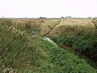
The River Foulness is a river in the East Riding of Yorkshire, England. Its name is derived from Old English fūle[n] ēa, meaning “dirty water”. Maintenance responsibilities for the river transferred from the Environment Agency to the Market Weighton Drainage Board on 1 October 2011. Market Weighton Drainage Board subsequently amalgamated with the Lower Ouse Internal Drainage Board on 1 April 2012 to create the Ouse and Humber Drainage Board. The river discharges into the Humber Estuary via Market Weighton Canal. Water levels within the river, its tributaries and the canal are managed and controlled by the Environment Agency. The river lies in an area known as the Humberhead Levels.
The River Slea is a tributary of the south branch of the River Wey in Hampshire.

The Corfe River is one of the four main rivers flowing into Poole Harbour in the county of Dorset, England. It is just under 9 km (6 mi) long.

Pilhill Brook is a 9.9-kilometre-long (6.2 mi) tributary of the River Anton in Hampshire, England. It is a chalk stream, known for its trout fishing.

Hurst Castle and Lymington River Estuary is a 1,077.3-hectare (2,662-acre) biological and geological Site of Special Scientific Interest near Lymington in Hampshire. It is a Nature Conservation Review site and two areas are Geological Conservation Review sites. Three areas are local nature reserves, Boldre Foreshore, Sturt Pond and Lymington and Keyhaven Marshes; the latter site is managed by the Hampshire and Isle of Wight Wildlife Trust. Part of it is North Solent National Nature Reserve. It is part of Solent and Southampton Water Ramsar site and Special Protection Area. Parts of it are in Solent Maritime and Solent and Isle of Wight Lagoons Special Areas of Conservation.

Lymington and Keyhaven Marshes is a 738-hectare (1,820-acre) nature reserve which stretches from Keyhaven along the south coast across the Lymington River in Hampshire. It is managed by the Hampshire and Isle of Wight Wildlife Trust. It is part of Solent and Southampton Water Ramsar site and Special Protection Area. Some areas are part of two Special Areas of Conservation, Solent and Isle of Wight Lagoons and Solent Maritime and Solent. It is also part of Hurst Castle and Lymington River Estuary, which is a Site of Special Scientific Interest, and of North Solent Marshes Nature Conservation Review site, Grade 2. Two areas are Geological Conservation Review sites, and two are Local Nature Reserves, Boldre Foreshore and Lymington-Keyhaven Marshes.

Fleet Brook is a small river in northern Hampshire, England and tributary of the River Hart.