Brackenhill Light Railway

Last updated

Brackenhill Light Railway
Brackenhill Light Railway - geograph.org.uk - 1052463.jpg
Brackenhill Light Railway at Barnsley Bridge on the A628 (looking west)
Overview
StatusClosed
Stations1 (Ackworth Moor Top)
Service
Type Light railway
Operator(s)
History
Opened1 July 1914 (1914-07-01)
Closed1 January 1962 (1962-01-01)
Technical
Line length2.5 miles (4 km)
Number of tracks1
Track gauge 1,435 mm (4 ft 8+12 in) standard gauge

The Brackenhill Light Railway was a short railway line in the West Riding of Yorkshire, England. [i] Whilst the line was promoted independently, it was worked by the North Eastern Railway from 1914 to 1923, thereafter being worked by the LNER, then British Railways until closure in 1962.

Contents

History

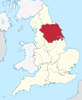
The light railway left the Swinton & Knottingley route south of the River Went bridge, about 8 miles (13 km) south of Burton Salmon Junction at what was known as Brackenhill Junction. [1] [2] The line was used for freight traffic only, connecting with a goods station known as Ackworth Moor Top, which was on an east-facing 0.25-mile (0.40 km) spur and so required a reversal, and a coal mine at Hemsworth. [3] [4] It also forwarded grinding and scythe-sharpening stones from the quarries around Ackworth Moor Top. [5]

The branch ran for 2.5 miles (4 km) from Brackenhill Junction to Hemsworth Colliery. [6] [7] The line terminated at Hemsworth colliery, but the colliery had been rail connected to the West Riding and Grimsby line in the Fitzwilliam area before the building of the Brackenhill Light Railway. [8] [9] [10] Ackworth Moor Top station was at the 2-mile (3.2 km) point west of Brackenhill Junction. It had a fan of three sidings, a crane capable of handling 10-tonne (11-ton) loads, a weighbridge and a loop. [11]

The line was promoted by the Yorkshire District Light Railway Syndicate Limited, gaining approval under the Light Railways Act 1896 from the Board of Trade with an order dated 19 March 1901, [12] [13] but was not opened until July 1914. [14] Delays in purchasing land for the line required an extension, which was submitted in November 1903, and granted in 1904. [15] Another extension was sought in 1907 and this too, was granted. [16]

The line was built to a standard-gauge, and was nominally independent as it declined a working agreement with other railway companies. [17] The NER were interested in the line from the outset, but wished to avoid a Board of Trade approval for working the line, so it remained an independent railway. [18] However, in reality, services along the line were worked by the NER between 1914 and 1923, then at the Grouping by the LNER. [19] [20] Although it was designated as a light railway, it was able to handle some of the heavier locomotives, especially on coal traffic between Hemsworth Colliery and Gascoigne Wood. [21] Locomotives and stock were provided by the NER (later LNER), and steam engines were sourced from Selby Shed, but when this closed in 1959, the remaining three years of the light railway's life saw locomotives work the line based at York shed. [3]

The line was last used in December 1961, and formal closure came on 1 January 1962. [22] [23]

Notes

  1. The area is now West Yorkshire.

References

  1. Kelman, Leanne (2016). Railway Track Diagrams Book 2: Eastern (4 ed.). Frome: Trackmaps. 35, 40. ISBN   978-0-9549866-8-1.
  2. Cookson & Chapman 2003, p. i.
  3. 1 2 Smith, Martin (1994). Britain's light railways. Shepperton: Ian Allan. p. 41. ISBN   0-7110-2223-2.
  4. Joy 1978, p. 224.
  5. "Ackworth Moor Top Quarry" (PDF). wyorksgeologytrust.org. Retrieved 29 January 2025.
  6. Body, Geoffrey (1985). Railways of the Eastern Region. Wellingborough: P. Stephens. p. 167. ISBN   0850597129.
  7. Kennedy, Andrew (December 2022). "The Grouping – 100 years on". Steam days. No. 400. Horncastle: Mortons Media Group. p. 16. ISSN   0269-0020.
  8. Grant, Donald J. (2017). Directory of the railway companies of Great Britain. Kibworth Beauchamp: Matador. p. 62. ISBN   9781785893537.
  9. "Hemsworth Colliery". nmrs.org.uk. Retrieved 22 June 2025.
  10. "View map: Ordnance Survey, SE41 - B//* (includes: Ackworth; Badsworth; East Hardwick; Hemsworth; Hessle and Hill Top; North Elm... - Ordnance Survey 1:25,000 maps of Great Britain, 1945-1969". maps.nls.uk. Retrieved 22 June 2025. Located at SE417153
  11. Cookson & Chapman 2003, p. 74.
  12. "Returns, Reports, Etc - Hansard - UK Parliament". hansard.parliament.uk. Retrieved 22 June 2025.
  13. Slater, J. N., ed. (September 1978). "Why and wherefore: Brackenhill Light Railway". Railway Magazine. Vol. 124, no. 929. London: IPC Transport Press. p. 467.
  14. Cookson & Chapman 2003, p. 6.
  15. "No. 27629". The London Gazette . 27 November 1903. p. 7766.
  16. Body, Geoffrey (1985). Railways of the Eastern Region volume 2; Northern operating area. Wellingborough: Patrick Stephens. p. 167. ISBN   0850597129.
  17. Awdry, Christopher (1990). Encyclopaedia of British railway companies. Wellingborough: Stephens. p. 119. ISBN   1-85260-049-7.
  18. Joy 1978, p. 225.
  19. Foster, Richard (11 August 2021). "A century of railway politics". Rail. No. 937. Peterborough: Bauer Media. p. 43. ISSN   0953-4563.
  20. Grant, Donald J. (2017). Directory of the railway companies of Great Britain. Kibworth Beauchamp: Matador. p. 63. ISBN   9781785893537.
  21. Cookson, Peter; Farline, John E. (1995). L N E R lines in the Yorkshire Ridings. Oldham: Challenger Publications. p. 24. ISBN   1899624066.
  22. Joy 1978, p. 283.
  23. Cookson & Chapman 2003, p. 17.

Sources