Pilmoor, Boroughbridge and Knaresborough Railway

Last updated

Pilmoor, Boroughbridge and Knaresborough Railway
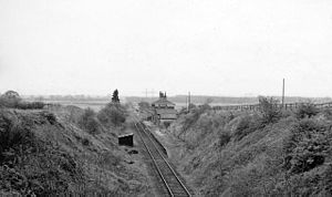
Brafferton Station (remains) - geograph.org.uk - 1878425.jpg
Remains of Brafferton station in 1961
Overview
StatusClosed
Locale North Yorkshire
Termini
Stations3
Service
TypeHeavy Rail
Operator(s) North Eastern Railway
London North Eastern Railway
British Rail
History
Opened1847
Closed1964
Technical
Line length14 miles (23 km) (1875–1950)
11 miles (18 km) (1950–1964)
Number of tracks1
Track gauge 4 ft 8+12 in (1,435 mm)

The Pilmoor, Boroughbridge and Knaresborough Railway was a railway line in North Yorkshire, England, that connected Pilmoor on the East Coast Main Line with the towns of Boroughbridge and Knaresborough. [1] The first part of the branch headed south-westwards from the East Coast Main Line and terminated at Boroughbridge. In 1875, the branch was extended again to meet the line at Knaresborough.

Contents

Opening

The line originally ran only between Pilmoor and Boroughbridge from its opening in 1847 until 1875 when the section from Boroughbridge to Knaresborough opened. [2] The original intent had been to link Boroughbridge, a coaching town on the Great North Road, with the main line between York and Darlington (what would become the East Coast Main Line [ECML]). The junction at Pilmoor had no road access, and was merely intended as an interchange point between the two lines. [3]

When the extension line to Knaresborough was being surveyed, it was determined that there would not be enough clearance over the roads to Dishforth and Catterick Bridge, so a spur was built just north of Boroughbridge station which allowed the line the space to gain enough height to clear these roads. This necessitated moving Boroughbridge station onto the new formation. [4] A planned connection over the East Coast Main Line between the Pilmoor, Boroughbridge and Knaresborough Railway and the Thirsk and Malton Line never opened, even though the embankments were built for the line and a bridge erected over the main line. The embankment later hosted its own signal array, which was used to test the eyesight of engine drivers. [5] The bridge was demolished during the widening of the ECML in 1933. [6]

During the Second World War, a rail connected depot for the Air Ministry was opened between Brafferton and Pilmoor. The section from Pilmoor to the Air Ministry siding was removed in 1953. [7]

Stations and services

The line had three intermediate stations, at Brafferton, Boroughbridge and Staveley. The station at Staveley was called Copgrove and Staveley on its opening in 1875. [8] It was renamed Copgrove in 1881 after the nearby Copgrove village to avoid confusion with Staveley in Derbyshire. [9] Though the line extended from Pilmoor to Knaresborough, most services worked from and to Harrogate. The line was 14 miles (23 km) long, but the distance between the two termini was 17 miles (27 km). [note 1] [12]

The timetable for 1882, shows four out and back workings between Harrogate and Pilmoor, with one early morning service from Boroughbridge to Pilmoor, and a balance working of the last service of the day from Pilmoor terminating at Boroughbridge. [13] The locomotive shed at Boroughbrige from the original terminating branch was retained in 1886 to accommodate the overnighting of the stock for the first and last trains of the day to and from Boroughbridge. [14] By 1888, services were running at five per day along the whole line. [15]

In 1910, services were five each way, with an extra mid-afternoon service between Harrogate and Boroughbridge. [10] By 1950, like other rural lines in the area (the Thirsk and Malton being an example), the branch only saw two trains per day both ways, though services were more frequent on Saturdays, being bolstered to three per day. [16]

Closure

An attempt was made to cut costs in 1936, for the three to six trains a day, by replacing traditional signalling with staff and ticket at all stations. [17] The line closed for passengers in 1950, with the branch being closed completely between Brafferton and Pilmoor, shortening it to 10 miles 821 yards (16.844 km), and a restricted speed of 25 miles per hour (40 km/h). [18] Thereafter, trains were worked up and down the branch from Knaresborough only. [19] Pilmoor station, by this time cut off from the branch, closed on 5 May 1958. [20] The rest of the line was closed completely in 1964. [21]

Notes

  1. Harrogate 0 miles, Starbeck 2.25 miles (3.62 km), Knaresborough 3.75 miles (6.04 km), Copgrove 7.5 miles (12.1 km), Boroughbridge 11 miles (18 km), Brafferton 14.5 miles (23.3 km), and Pilmoor 17 miles (27 km). [10] [11]

Related Research Articles

<span class="mw-page-title-main">Knaresborough railway station</span> Railway station in North Yorkshire, England

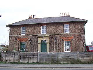
Knaresborough railway station is a Grade II listed station serving the town of Knaresborough in North Yorkshire, England. It is located on the Harrogate Line 16.75 miles (27 km) west of York and is operated by Northern Trains, who provide all passenger train services.
<span class="mw-page-title-main">Weaverthorpe railway station</span> Disused railway station in North Yorkshire, England

Weaverthorpe railway station was a minor railway station serving the village of Sherburn in North Yorkshire, England. Located on the York to Scarborough Line it was opened on 5 July 1845 by the York and North Midland Railway. It closed to passengers on 22 September 1930.

<span class="mw-page-title-main">Milby</span> Hamlet and civil parish in North Yorkshire, England

Milby is a hamlet and civil parish in the Harrogate district of North Yorkshire, England. It is situated to the immediate north of Boroughbridge.

<span class="mw-page-title-main">Staveley, North Yorkshire</span> Village and civil parish in North Yorkshire, England

Staveley is a village and civil parish in the Harrogate district of North Yorkshire, England. It is situated 4 miles (6.4 km) north of Knaresborough and near the A1(M) motorway. In the 2001 census, the village had a population of 444, which had risen to 450 by the time of the 2011 census. In 2015, North Yorkshire County Council estimated the population to have dropped to 440.

<span class="mw-page-title-main">Staithes railway station</span> Former railway station in the North Riding of Yorkshire, England

Staithes railway station was a railway station on the Whitby Redcar and Middlesbrough Union Railway, serving the villages of Staithes and Dalehouse in North Yorkshire, England. It was opened on 3 December 1883.

<span class="mw-page-title-main">Helmsley railway station</span> Disused railway station in North Yorkshire, England

Helmsley railway station served the market town of Helmsley in North Yorkshire from 1871 until 1964, although the regular passenger service ceased in 1953. Helmsley station was nearly 15 miles (24 km) from pilmoor station on the East Coast Main Line, and 12 miles (19 km) from Pickering.

<span class="mw-page-title-main">Husthwaite Gate railway station</span> Disused railway station in North Yorkshire, England

Husthwaite Gate railway station is a disused railway station in North Yorkshire, England. It served the nearby village of Husthwaite.

<span class="mw-page-title-main">Nidd Valley Railway</span> Disused railway line in Yorkshire, England

The Nidd Valley Railway was a 11.5-mile (18.5 km) long single track branch railway line that ran along the valley of the River Nidd in North Yorkshire, England. Built by the North Eastern Railway, it ran from Ripley Junction, on the Harrogate to Ripon Line, to Pateley Bridge via five intermediate stations, Ripley Valley, Hampsthwaite, Birstwith, Darley, and Dacre.

<span class="mw-page-title-main">Leeds Northern Railway</span>

The Leeds Northern Railway (LNR), originally the Leeds and Thirsk Railway, was an English railway company that built and opened a line from Leeds to Stockton via Harrogate and Thirsk. In 1845 the Leeds and Thirsk Railway received permission for a line from Leeds to Thirsk, part of which opened in 1848, but problems building the Bramhope Tunnel delayed trains operating into Leeds until 1849.

<span class="mw-page-title-main">Pilmoor railway station</span> Disused railway station in North Yorkshire, England

Pilmoor railway station was in North Yorkshire, England, from 1847 to 1958, at the junction of the Great North of England Railway and the Pilmoor, Boroughbridge and Knaresborough Railway, about 6 miles (10 km) south-southeast of Thirsk at the southern edge of the civil parish of Sessay. The scattered settlement of Pilmoor, from which its name was derived, is located southwest of it.

The East and West Yorkshire Junction Railway was a railway company established in 1846 between the Leeds and Thirsk Railway at Knaresborough and the York, Newcastle and Berwick Railway near York, England. The company merged into the York and North Midland Railway in 1852.

<span class="mw-page-title-main">Thirsk and Malton line</span> Former railway line in Yorkshire, England

The Thirsk and Malton line was a railway line that ran from a triangular junction on what is now the East Coast Main Line and served eight villages between Thirsk and Malton in North Yorkshire, England. The line was built after a protracted process due to inefficiencies and financial problems suffered by the then York and North Midland Railway.
<span class="mw-page-title-main">Gilling and Pickering line</span> Former railway line in Yorkshire, England

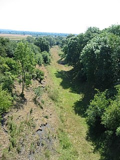
The Gilling and Pickering line (G&P) was a railway line that ran from Gilling to Pickering in North Yorkshire, England.

<span class="mw-page-title-main">Brafferton railway station</span> Disused railway station in North Yorkshire, England

Brafferton railway station served Brafferton, North Yorkshire, England, from 1847 to 1964 on the Pilmoor, Boroughbridge and Knaresborough Railway.

<span class="mw-page-title-main">Boroughbridge railway station</span> Disused railway station in North Yorkshire, England

Boroughbridge railway station served the town of Boroughbridge, North Yorkshire, England from 1847 to 1964 on the Pilmoor, Boroughbridge and Knaresborough Railway. The original station was a terminus with an east facing line, heading towards Pilmoor Junction on the East Coast Main Line. In 1875, the line was extended westwards to meet the line at Knaresborough.

<span class="mw-page-title-main">Copgrove railway station</span> Disused railway station in North Yorkshire, England

Copgrove railway station served the village of Copgrove, North Yorkshire, England from 1875 to 1964 on the Pilmoor, Boroughbridge and Knaresborough Railway.

<span class="mw-page-title-main">Goldsborough railway station</span> Disused railway station in North Yorkshire, England

Goldsborough railway station served the village of Goldsborough, North Yorkshire, England from 1850 to 1965 on the Harrogate line. The station was over 13 miles (21 km) west of York railway station, and nearly 3 miles (4.8 km) east of Knaresborough.
<span class="mw-page-title-main">Masham railway station</span> Disused railway station in North Yorkshire, England

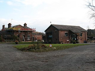
Masham railway station was the terminus of the Melmerby to Masham branch line serving the town of Masham in North Yorkshire, England. It was on the eastern side of the River Ure, so as such, was actually in Burton-on-Ure. The line operated between 1875 and 1931 for passenger traffic, but was retained for minimal freight train use until 1963.
<span class="mw-page-title-main">Railways in Northallerton</span> About the railways in Northallerton, North Yorkshire, England

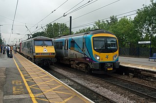
The network of railways in Northallerton, North Yorkshire, England, was constructed by three companies whose lines through the town were built between 1841 and 1852. They were all amalgamated into the North Eastern Railway (NER) which in turn was subsumed into the London and North Eastern Railway in 1923 and British Rail in 1948. British Rail closed two lines, the Wensleydale line in 1954 and a section of the Leeds Northern Railway to Harrogate in 1969. The Wensleydale line was retained as a freight branch and resurrected as a heritage railway in 2003 but the line to Harrogate closed completely. Despite closures and rationalisation, the station still is at a major junction on the East Coast Main Line.

<span class="mw-page-title-main">Monk Fryston railway station</span> Disused railway station in North Yorkshire England

Monk Fryston railway station was a railway station serving the village of Monk Fryston in North Yorkshire, England. Previously, Milford Junction and Old Junction served as an interchange between the Leeds and Selby and the York and North Midland Lines, however when they closed in the early 1900s, Monk Fryston was opened to cover for this loss of interchange. Though the station had four tracks through it, it only ever had two platforms. The station closed to passengers in 1959, and then completely in 1964.
References

  1. Burgess, Neil (2011). The lost railways of Yorkshire's North Riding. Catrine: Stenlake. p. 20. ISBN   978-1840335-55-2.
  2. "Boroughbridge_121108.pdf" (PDF). Harrogate Borough Council. 12 November 2008. p. 6. Archived from the original (PDF) on 4 March 2016. Retrieved 1 January 2016.
  3. Hoole, K. (1973). North-East England. Newton Abbot: David and Charles. p. 74. ISBN   0715358944.
  4. Hoole, Ken (1977). Railways in Yorkshire 3; the North Riding. Skipton: Dalesman. p. 56. ISBN   0 85206 418 7.
  5. Chapman 2011, p. 86.
  6. Hoole, K. (1973). Forgotten Railways North-East England. Newton Abbot: David and Charles. p. 73. ISBN   0715358944.
  7. Rogers, James (2000). The railways of Harrogate and district. Willerby: North Eastern Railway Association. p. 93. ISBN   1-873513-33-X.
  8. Cobb, M. H. (2003). The railways of Great Britain - a historical atlas. Ian Allan. p. 411. ISBN   0-7110-3003-0 . Retrieved 3 January 2016.
  9. Howat 1991, p. 42.
  10. 1 2 Thomas, David St John, ed. (1968). Bradshaw's April 1910 railway guide; a new edition of the April 1910 issue of Bradshaw's General Railway and Steam Navigation Guide for Great Britain and Ireland. Newton Abbot: David and Charles. p. 705. ISBN   0715342460.
  11. Yonge, John (2006). British Rail track diagrams (3 ed.). Bradford on Avon: Quail Map Company. 42D. ISBN   0-9549866-2-8.
  12. Body, Geoffrey (1989). Railways of the Eastern Region. Wellingborough: P. Stephens. p. 98. ISBN   1-85260-072-1.
  13. 1882 Bradshaw's Guide No. 591 Timetable at the Internet Archive
  14. Addeyman, John F., ed. (2020). North Eastern Railway Engine Sheds. North Eastern Railway Association. p. 40. ISBN   978-1911360-26-1.
  15. 1888 Brad 10 at the Internet Archive
  16. Chapman 2011, p. 83.
  17. Railway Magazine June 1936 p. 402
  18. Chapman 2011, p. 81.
  19. Hoole, K. (1965). A regional history of the railways of Great Britain. Vol. 4, North East England. Newton Abbot: David & Charles. p. 109. ISBN   0-7153-6439-1.
  20. Railway Magazine June 1958 p. 433
  21. Suggitt, Gordon (2005). Lost railways of North and East Yorkshire. Newbury: Countryside Books. p. 33. ISBN   978-1-85306-918-5.

Sources