
Vienna is a town in Fairfax County, Virginia, United States. As of the 2020 U.S. census, Vienna has a population of 16,473. Significantly more people live in ZIP codes with the Vienna postal addresses, bordered approximately by Interstate 66 on the south, Interstate 495 on the east, Route 7 to the north, and Hunter Mill Road to the west, than in the town itself.

Wolf Trap is a census-designated place (CDP) in Fairfax County, Virginia, United States. The population was 16,131 at the 2010 census. Wolf Trap National Park for the Performing Arts is located in the CDP.
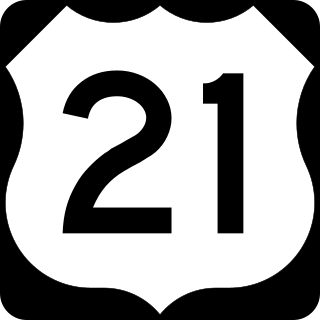
U.S. Route 21 or U.S. Highway 21 (US 21) is a major north–south United States Numbered Highway in the Southeastern United States that travels 394 miles (634 km). The southern terminus is in Hunting Island State Park, South Carolina, 14.4 miles (23.2 km) south of the junction with US 21 Business and South Carolina Highway 802 (SC 802) in Beaufort. The northern terminus is in Wytheville, Virginia at an interchange with Interstate 81 (I-81) and US 52. Despite the "1" indicating that it is a major north-south highway, U.S. 21 only travels through three states, and is no longer a cross-country route as it has been replaced with Interstate 77 in both Ohio and West Virginia. It also has the second-shortest length of all of the major north-south routes, just behind U.S. 91. The route travels through the states of South Carolina, North Carolina, and Virginia. It also connects through major Southeastern cities such as Columbia, South Carolina and Charlotte, North Carolina. The northern portion of the road travels parallel to I-77 in northern South Carolina and North Carolina. The road also has three interchanges with I-26 in Lexington and Calhoun counties in South Carolina.

U.S. Route 522 is a spur route of US 22 in the states of Virginia, West Virginia, Maryland, and Pennsylvania. The U.S. Highway travels in a north-south direction, and runs 308.59 miles (496.63 km) from US 60 near Powhatan, Virginia, to its northern terminus at US 11 and US 15 near Selinsgrove, Pennsylvania. US 522 serves many small cities and towns in the Piedmont, Blue Ridge Mountains, and northern Shenandoah Valley of Virginia. The highway serves the Virginia communities of Goochland, Mineral, Culpeper, the town of Washington, and Front Royal and the independent city of Winchester. US 522 then follows the Ridge-and-Valley Appalachians north and then east through the Eastern Panhandle of West Virginia, a 2-mile-wide (3.2 km) stretch of Western Maryland, and South Central Pennsylvania to its terminus in the Susquehanna Valley. The highway serves Berkeley Springs, West Virginia; Hancock, Maryland; and the Pennsylvania communities of McConnellsburg, Mount Union, Lewistown, and Middleburg.
North River Mills is a historic unincorporated community in Hampshire County in the U.S. state of West Virginia. North River Mills is located between Capon Bridge and Slanesville on Cold Stream Road at its intersection with North River Road. The village of North River Mills lies along the eastern banks of North River from which it takes its name.
Johnsons Mill is an unincorporated community in eastern Morgan County in the U.S. state of West Virginia on Johnson's Mill Road. It is centrally located between three other small rural hamlets along Sleepy Creek and is named for the "Johnson's Mill" that once operated here.

Mill Creek is a 14.0-mile-long (22.5 km) tributary stream of the South Branch Potomac River, belonging to the Potomac River and Chesapeake Bay watersheds. The stream is located in Hampshire County in West Virginia's Eastern Panhandle. Mill Creek flows into the South Branch west of Romney Bridge near Vanderlip along the Northwestern Turnpike.

In the U.S. state of Virginia, U.S. Route 220 (US 220) is a major north-south state highway that extends from the North Carolina state line through Roanoke to the West Virginia state line. South of Roanoke, US 220 is a four-lane highway within the proposed Interstate 73 (I-73) corridor. US 220 narrows to two lanes north of Roanoke, connecting to I-64 near Clifton Forge and then paralleling the Appalachian Mountains north-northeasterly in the direction of Cumberland, Maryland.

State Route 84 is a primary state highway in the U.S. state of Virginia. Known as Mill Gap Road, the state highway runs 14.94 miles (24.04 km) from the West Virginia state line near Mill Gap, where the highway continues west as West Virginia Route 84, east to U.S. Route 220 at Vanderpool.

State Route 39 is a primary state highway in the U.S. state of Virginia. The state highway runs 59.17 miles (95.22 km) from the West Virginia state line near Mountain Grove, where the highway continues as West Virginia Route 39, east to U.S. Route 11 in East Lexington. SR 39 connects Lexington with several communities formed around hot springs in Bath County. In Rockbridge County, the state highway passes through the town of Goshen and Goshen Pass, a gorge formed by the Maury River.

Difficult Run is a 15.9-mile-long (25.6 km) tributary stream of the Potomac River in Northern Virginia in the United States. The area has had many historical uses dating back to the early 1800s. Today, the area is used recreationally by visitors interested in the watershed's variety of options including hiking, biking, fishing, boating, climbing, and bird watching. The wildlife at Difficult Run is vast as 163 different species can be seen depending on the season. There are 41 different soil types found on the trail and alongside the stream. The stream is part of the greater 57.7- square-mile Drainage basin, or watershed, located in the north-central portion of Fairfax County and drains directly to the Potomac River.

State Route 206 is a primary state highway in the U.S. state of Virginia. Known as Dahlgren Road, the state highway runs 11.04 miles (17.77 km) from SR 3 at Arnolds Corner east to SR 604 at the entrance to the Naval Surface Warfare Center Dahlgren Division in Dahlgren in eastern King George County.
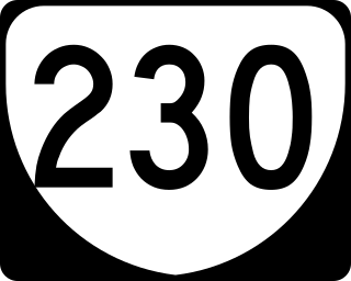
State Route 230 is a primary state highway in the U.S. state of Virginia. The state highway runs 20.58 miles (33.12 km) from U.S. Route 33 Business in Stanardsville east to US 15 at Madison Mills. SR 230 is the main east–west highway of Madison County. Through its connections with US 29 and US 15, the state highway links the county seat of Madison with Standardsville and Orange, the county seats of Greene County and Orange County, respectively.

State Route 235 is a primary state highway in the U.S. state of Virginia. The state highway runs 5.05 miles (8.13 km) between intersections with U.S. Route 1 in Fort Belvoir and Hybla Valley. SR 235 forms a southeast loop off of US 1 through the community of Mount Vernon in southeastern Fairfax County, connecting US 1 with Mount Vernon, the plantation home of George Washington, and the southern end of the George Washington Memorial Parkway.

The Great Indian Warpath (GIW)—also known as the Great Indian War and Trading Path, or the Seneca Trail—was that part of the network of trails in eastern North America developed and used by Native Americans which ran through the Great Appalachian Valley. The system of footpaths extended from what is now upper New York to deep within Alabama. Various Native peoples traded and made war along the trails, including the Catawba, numerous Algonquian tribes, the Cherokee, and the Iroquois Confederacy. The British traders' name for the route was derived from combining its name among the northeastern Algonquian tribes, Mishimayagat or "Great Trail", with that of the Shawnee and Delaware, Athawominee or "Path where they go armed".
Mouth of Wilson is an unincorporated community, in Grayson County in the U.S. state of Virginia, just north of the North Carolina state line. The community lies in the Blue Ridge Highlands section of the Blue Ridge Mountains which are part of what is considered the 'Middle Appalachian Mountains' on the western banks of the New River, where the Big Wilson Creek empties its waters. The main road through the area is U.S. Route 58; other major roads include Virginia Route 16 and Virginia Route 93.

The North River is a tributary of the Cacapon River, belonging to the Potomac River and Chesapeake Bay watersheds. The river is located in Hampshire and Hardy counties in the U.S. state of West Virginia's Eastern Panhandle. The mouth of the North River into the Cacapon is located at Forks of Cacapon. From its headwaters to its mouth, the North River spans 52.4 miles (84.3 km) in length.


