
Hampshire County is a county in the U.S. state of West Virginia. As of the 2020 census, the population was 23,093. Its county seat is Romney, West Virginia's oldest town (1762). The county was created by the Virginia General Assembly in 1754, from parts of Frederick and Augusta Counties (Virginia) and is the state's oldest county. The county lies in both West Virginia's Eastern Panhandle and Potomac Highlands regions.

Fairfax County, officially the County of Fairfax, is a county in the Commonwealth of Virginia. It is part of Northern Virginia and borders both the city of Alexandria and Arlington County and forms part of the suburban ring of Washington, D.C., the nation's capital. The county is predominantly suburban in character with some urban and rural pockets.

Annandale is a census-designated place (CDP) in Fairfax County, Virginia. The population of the CDP was 43,363 as of the 2020 United States Census. It is home to the oldest and largest branch of the Northern Virginia Community College system, and to one of the D.C. area's Koreatowns.

Burke is an unincorporated section of Fairfax County, Virginia, United States, traditionally defined as the area served by the Burke post office. Burke includes two census-designated places: the Burke CDP, population 42,312 in 2020 and the Burke Centre CDP, population 17,518 in 2020.

Clifton is an incorporated town located in southwestern Fairfax County, Virginia, United States, with a population of 282 at the time of the 2010 census, up from 185 at the 2000 census.

Great Falls is a census-designated place in Fairfax County, Virginia, United States. The population as of the 2010 census was 15,427, an increase of 80.5% from the 2000 census.

McLean is an unincorporated community and census-designated place in Fairfax County, Virginia, United States. The population of the community was 50,773 at the 2020 census. It is located between the Potomac River and Vienna within the Washington metropolitan area.

State Route 620 in Fairfax and Loudoun Counties, Virginia is a secondary state highway. The entire length of SR 620 is also known as Braddock Road. SR 620 also has a short concurrency with SR 659 / Union Mill Road in Centreville.

The Fairfax County Public Schools system (FCPS) is a school division in the U.S. commonwealth of Virginia. It is a branch of the Fairfax County government which administers public schools in Fairfax County and the City of Fairfax. FCPS's headquarters is located in the Gatehouse Administration Center in Merrifield, an unincorporated section of the county near the city of Falls Church; the headquarters has a Falls Church address but is not within the city limits.

State Route 244 is a primary state highway in the U.S. state of Virginia. Known as Columbia Pike, the state highway runs 8.25 miles (13.28 km) from SR 236 in Annandale east to SR 27 and Interstate 395 (I-395) at The Pentagon in Arlington. SR 244 is a major southwest–northeast thoroughfare in northeastern Fairfax County and eastern Arlington County, connecting Annandale with SR 7 at Bailey's Crossroads and SR 120 in the multicultural Westmont neighborhood of Arlington.
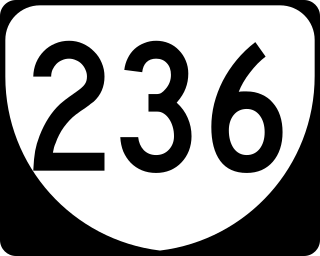
State Route 236 is a primary state highway in the U.S. state of Virginia. The state highway runs 15.63 miles (25.15 km) from U.S. Route 29 and US 50 in Fairfax east to SR 400 in Alexandria. SR 236 is a major suburban arterial highway that connects the independent cities of Fairfax and Alexandria via Annandale in Fairfax County. The state highway is known as Main Street in City of Fairfax, Little River Turnpike in Fairfax County, where the highway meets Interstate 495 (I-495), and Duke Street in Alexandria, where the road has junctions with I-395 and US 1.

South Riding is a census-designated place and planned community in Loudoun County, Virginia, United States. The South Riding homeowner association was founded in January 1995 to provide services to the community. Neighboring U.S. Route 50 and State Route 28 provide access to the Dulles/Reston/Tysons Corner technology corridor and other major employment centers in Northern Virginia and Washington, D.C.

Difficult Run is a 15.9-mile-long (25.6 km) tributary stream of the Potomac River in Northern Virginia in the United States. The area has had many historical uses dating back to the early 1800s. Today, the area is used recreationally by visitors interested in the watershed's variety of options including hiking, biking, fishing, boating, climbing, and bird watching. The wildlife at Difficult Run is vast as 163 different species can be seen depending on the season. There are 41 different soil types found on the trail and alongside the stream. The stream is part of the greater 57.7- square-mile Drainage basin, or watershed, located in the north-central portion of Fairfax County and drains directly to the Potomac River.

Oak Hill is a suburban unincorporated community located in Fairfax County, Virginia, United States.

Hollindale is an unincorporated community in Fort Hunt, Fairfax County, Virginia, United States close to the George Washington Memorial Parkway in ZIP code 22306. As of 2013, it had 945 residents. Mount Vernon Presbyterian Church and Hollin Meadows Elementary School are located within the community. Hollindale is set along the hilly woodlands across from the Potomac. It was built around several estates and on what used to be Sherwood Dairy Farm, and is adjacent to the Hollin Hills community. It is dominated by mid-century modern homes, colonials, and Tudors.
Doveville is an unincorporated community in Fairfax County, in the U.S. state of Virginia. It lies along Virginia State Highway 236, west of Annandale, east of the independent city of Fairfax and southwest of Merrifield. Immediately to the south is Rutherford and immediately to the north is Mantua. Numerous parks are located nearby, including Long Branch Stream Valley Park to the south, Daniels Run Park to the west and Woodburn Road Park and Accotink Stream Valley Park to the northeast.

Kings Park is a census-designated place (CDP) in the eastern United States in Fairfax County, Virginia, southwest of Washington D.C. The population as of the 2010 census was 4,333.

The Holmes Run Trail is a partially paved trail that travels through parks northwest along Holmes Run from Cameron Run in Alexandria, Virginia to Annandale Road in Fairfax County, Virginia. The trail travels near the sides of the stream with multiple bridges, some of which are only about a foot higher than the water. The trail consists of two sections that are separated by Lake Barcroft near Columbia Pike in Fairfax County.
Long Branch is a census-designated place in Fairfax County, Virginia, bordering the city of Fairfax. The population as of the 2010 census was 7,593.

Wakefield is a census-designated place in Fairfax County, Virginia, United States. The population as of the 2010 census was 11,275. The current Wakefield area was built in the 1950-60's.


