Demographics
Historical population| Census | Pop. | Note | %± |
|---|
| 1990 | 40 | | — |
|---|
| 2000 | 77 | | 92.5% |
|---|
| 2010 | 90 | | 16.9% |
|---|
| 2020 | 87 | | −3.3% |
|---|
| 2022 (est.) | 86 | [4] | −1.1% |
|---|
|
2010 census
As of the census of 2010, there were 90 people, 32 households, and 24 families residing in the city. The population density was 1,125.0 inhabitants per square mile (434.4/km2). There were 34 housing units at an average density of 425.0 per square mile (164.1/km2). The racial makeup of the city was 100.0% White.
There were 32 households, of which 50.0% had children under the age of 18 living with them, 56.3% were married couples living together, 15.6% had a female householder with no husband present, 3.1% had a male householder with no wife present, and 25.0% were non-families. 18.8% of all households were made up of individuals, and 6.2% had someone living alone who was 65 years of age or older. The average household size was 2.81 and the average family size was 3.17.
The median age in the city was 31.3 years. 32.2% of residents were under the age of 18; 10.1% were between the ages of 18 and 24; 26.8% were from 25 to 44; 25.6% were from 45 to 64; and 5.6% were 65 years of age or older. The gender makeup of the city was 54.4% male and 45.6% female.
2000 census
As of the census of 2000, there were 77 people, 27 households, and 19 families residing in the city. The population density was 980.9 inhabitants per square mile (378.7/km2). There were 29 housing units at an average density of 369.4 per square mile (142.6/km2). The racial makeup of the city was 100.00% White.
There were 27 households, out of which 40.7% had children under the age of 18 living with them, 66.7% were married couples living together, 3.7% had a female householder with no husband present, and 29.6% were non-families. 22.2% of all households were made up of individuals, and 11.1% had someone living alone who was 65 years of age or older. The average household size was 2.85 and the average family size was 3.47.
In the city, the population was spread out, with 31.2% under the age of 18, 6.5% from 18 to 24, 41.6% from 25 to 44, 10.4% from 45 to 64, and 10.4% who were 65 years of age or older. The median age was 34 years. For every 100 females, there were 120.0 males. For every 100 females age 18 and over, there were 112.0 males.
The median income for a household in the city was $53,333, and the median income for a family was $60,000. Males had a median income of $32,292 versus $23,750 for females. The per capita income for the city was $18,024. There were no families and 1.2% of the population living below the poverty line, including no one under 18 and 20.0% of those over 64.

Stutsman County is a county in the U.S. state of North Dakota. As of the 2020 census, the population was 21,593. Its county seat is Jamestown.

Hettinger is a city in, and the county seat of, Adams County, North Dakota, United States. The population was 1,074 at the 2020 census.

Esmond is a city in Benson County, North Dakota, United States. The population was 91 at the 2020 census. Esmond was founded in 1901.

Lincoln is a city in Burleigh County, North Dakota, United States. It is a suburb of adjacent Bismarck, and also a core city of the Bismarck-Mandan Metropolitan Statistical Area. The population was 4,257 at the 2020 census, making it the 14th most populous city in North Dakota. Lincoln was founded in 1977.

Ayr is a city in Cass County, North Dakota, United States. The population was 11 at the 2020 census. Ayr was founded in 1883.

Fort Ransom is a city in Ransom County, North Dakota, United States. The population was 91 at the 2020 census. Fort Ransom was founded in 1880 with the first merchants arriving in 1878.
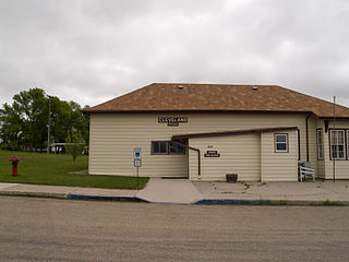
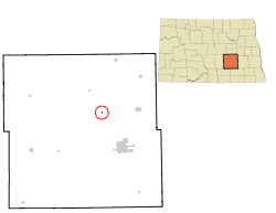
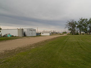
Cleveland is a city in Stutsman County, North Dakota, United States. The population was 57 at the 2020 census.

Courtenay is a city in Stutsman County, North Dakota, United States. The population was 36 at the 2020 census. Courtenay was founded in 1893.

Kensal is a city in Stutsman County, North Dakota, United States. The population was 146 at the 2020 census. Kensal was founded in 1892.

Medina is a town in Stutsman County, North Dakota, United States. The population was 264 at the 2020 census. Medina was founded in 1899.

Montpelier is a city in Stutsman County, North Dakota, United States. The population was 85 at the 2020 census. Montpelier was founded in 1885.
Pingree is a city in Stutsman County, North Dakota, United States. The population was 41 at the 2020 census. Pingree was founded in 1882.

Spiritwood Lake is a city in Stutsman County, North Dakota, United States. The population was 97 at the 2020 census.

Streeter is a city in Stutsman County, North Dakota, United States. The population was 149 at the 2020 census. Founded in 1905, Streeter celebrated its centennial in July 2005 with a weekend festival.

Woodworth is a city in Stutsman County, North Dakota, United States. The population was 44 at the 2020 census.

Wagner is a city in Charles Mix County, South Dakota, United States. The population was 1,490 at the 2020 census. The city is served by Wagner Municipal Airport as well as YST Transit buses.

Clear Lake is a city in and the county seat of Deuel County, South Dakota, United States. The population was 1,218 at the 2020 census.

Parkston is a city in Hutchinson County, South Dakota, United States. The population was 1,567 at the 2020 census.

Garretson is a city in Minnehaha County, South Dakota, United States. The city had a population of 1,228 at the 2020 census.

Hartford is a suburban American city in Minnehaha County, South Dakota, a few miles northwest of Sioux Falls. Its population was 3,354 at the 2020 census.
This page is based on this
Wikipedia article Text is available under the
CC BY-SA 4.0 license; additional terms may apply.
Images, videos and audio are available under their respective licenses.