Civic is the city centre or central business district of Canberra. "Civic" is a common name for the district, but it is also called Civic Centre, City Centre, Canberra City and Canberra, and its official division name is City.

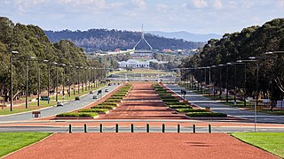
Anzac Parade, a significant road and thoroughfare in the Australian capital Canberra, is used for ceremonial occasions and is the site of many major military memorials.

The Dickson Centre, located in the suburb of Dickson, is a group centre in the inner northern suburbs of Canberra.

Gus's cafe is a cafe located in Civic, Canberra, Australia. It opened in 1969 and later became the first outdoor pavement cafe in Canberra. It is one of the oldest and best known cafes in Canberra and one of the first European-style cafes in Australia. It has both outdoor and indoor dining areas.

Glebe Park is a public park on the eastern side of Civic, Canberra, Australia. The park is bounded by Coranderrk, Ballumbir, Akuna, and Bunda Streets, and to the south, the National Convention Centre.

Aranda is a suburb in the district of Belconnen, in the Australian capital city of Canberra. Located at the western foot of Black Mountain and bounded on two sides by nature park, the suburb is characterised by its bush setting. During the planning and development of the suburb, a large proportion of large native trees – predominantly eucalypts – were left in place.

Northbourne Avenue is a major road in Canberra, Australia. It extends from City Hill in the south to the Federal Highway in the north.

Canberra Centre is a large shopping centre located in the northern section of the Canberra City Centre, Australian Capital Territory, Australia, being the second largest centre in the Australian Capital Territory, behind Westfield Belconnen. It opened on 6 March 1963 as the Monaro Mall, becoming the first in Australia to contain three floors and be fully enclosed, though would later expand to cover a substantial outdoor component on Garema Place. It was designated an Australian Capital Historic Site in 1997. It underwent a $220 million redevelopment and became the Canberra Centre in 1989. It was the first shopping centre in Canberra to have a car park operated by Car Park Ticket Machines. As at December 2020, Canberra Centre was 94,259 m² in size with over 403 retailers.

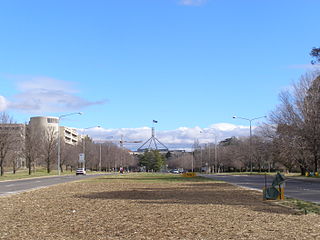
Commonwealth Avenue is a major road in Canberra, Australian Capital Territory, Australia. It connects Civic with South Canberra. Specifically, it runs between City Hill and Capital Hill.

City Walk is a paved outdoor pedestrian area in Civic, Canberra. It was formed by the closure to traffic of Alinga Street between East Row in the east and Binara Street in the south-west. Pedestrians can walk almost the whole way without having to cross any roads with cars on them, except for Akuna Street.

Kings Avenue is a road in Canberra which goes between New Parliament House, across Lake Burley Griffin at the Kings Avenue Bridge, to Russell near the Australian-American Monument..

Parkes Way is a major road in Canberra, Australia, which runs east–west between Kings Avenue and the Glenloch Interchange. At Glenloch Interchange it intersects with William Hovell Drive, Tuggeranong Parkway and Caswell Drive. The road is freeway standard from the Commonwealth Avenue overpass to Glenloch Interchange. Parkes Way is named for prominent Australian federalist, Sir Henry Parkes.

London Circuit is a road in Canberra, Australia, which surrounds City Hill in Civic, the city centre. It has a hexagonal shape, and intersects with several main roads such as Northbourne Avenue, Edinburgh Avenue, Akuna Street, Constitution Avenue and Commonwealth Avenue.

Mort Street is a road in Civic, the city centre of Canberra, Australia. It passes through the city centre's main bus interchange, and continues into the commercial precinct in the suburb of Braddon.

Garema Place is a paved outdoor area in Civic, Canberra, Australia, with a number of shops, restaurants and cafes with outdoor dining. As a central point within the CBD, many community events including protests and festivals are held at the location.

Tuggeranong Parkway is an 11-kilometre-long (6.8 mi) major highway in Canberra, Australia. Often referred to as "The Parkway" by locals, Tuggeranong Parkway links Civic to the southern Canberra metro district of Tuggeranong, and is a bypass road to the Woden Valley-Weston Creek district of Canberra. It also links to the Glenloch Interchange, where roads such as Caswell Drive connect to Belconnen.

Belconnen Way is a major road in Canberra, Australia. It connects William Hovell Drive and Kingsford Smith Drive in the west to Barry Drive and Fairfax Street, providing access to Civic and the Inner North via Belconnen Town Centre. In addition to being used as an alternate route to the city by commuters from the northern suburbs, it provides the primary connection to the Belconnen Town Center. Along with Barry Drive, Belconnen Way was constructed in stages between 1965 and 1971 as a single carriageway road. It was progressively duplicated as the district's traffic and population grew. A connection to Gungahlin Drive forms the largest signalized and overpass intersection in Canberra, constructed during the Gungahlin Drive Extension works and opening in 2011.

Ginninderra Drive is a major arterial road in the northern suburbs of Canberra, the capital city of Australia. The road provides an important access corridor to facilities including the Australian Institute of Sport, Canberra Stadium, the University of Canberra and Belconnen Town Centre. It is built to a dual carriageway standard carrying two or three traffic lanes in each direction for most of its length, with a speed limit of 80 km/h (50 mph). A short section from Charnwood to Dunlop is single carriageway with a speed limit of 60 km/h (37 mph). The first section of the road, connecting Lyneham with the new suburb of Evatt opened to traffic in October 1976.

State Circle is a circular road surrounding Capital Hill in the centre of Canberra, Australia's capital city. It is the outermost of the three concentric roads on the hill, with Capital Circle and Parliament Drive located within State Circle. Capital Circle is a bi-directional four-lane road with most intersections being signalised and at-grade. The speed limit is 70 km/h.

Petrie Plaza is a pedestrian mall located in the Canberra City Centre City Centre, Australian Capital Territory, Australia, being the largest centre within the Australian Capital Territory.


