Burnside, Kentucky

Last updated

Burnside, Kentucky
Burnside United Methodist Church.jpg
Pulaski County Kentucky Incorporated and Unincorporated areas Burnside Highlighted 2111278.svg
Location of Burnside in Pulaski County, Kentucky.
Coordinates: 36°59′12″N84°36′12″W / 36.98667°N 84.60333°W / 36.98667; -84.60333
Country United States
State Kentucky
County Pulaski
Area
[1]
  Total9.00 sq mi (23.30 km2)
  Land3.79 sq mi (9.82 km2)
  Water5.21 sq mi (13.48 km2)
Elevation
[2]
722 ft (220 m)
Population
 (2020)
  Total694
  Density183.07/sq mi (70.69/km2)
Time zone UTC-5 (Eastern (EST))
  Summer (DST) UTC-4 (EDT)
ZIP code
42519
Area code 606
FIPS code 21-11278
GNIS feature ID2403957 [2]

Burnside is a home rule-class city in Pulaski County, Kentucky, in the United States. The population was 611 at the 2010 census. In 2004, Burnside became the only town in Pulaski County or any adjoining county to allow the sale of alcoholic beverages in qualified establishments. Since then, Burnside has annexed about eight miles of shoreline along Lake Cumberland in order to include Lee's Ford Marina on Fishing Creek, allowing it to sell alcohol.

Contents

On August 28, 2007, Burnside voters again approved the sale of alcoholic beverages in restaurants that seat at least 100 people and derive at least 70% of their gross receipts from the sale of food, by a vote of 227–104. The petition for the election was started by two Pulaski County clergymen in an attempt to reverse Burnside's "moist" status.

On October 15, 2013, the City of Burnside voted to go fully "wet" by a count of 123–39.

History

The community was originally settled at the juncture of the Cumberland River and its South Fork. It was called Point Isabel, allegedly for a woman who jumped off a nearby cliff after breaking off a relationship. In 1890, the town was renamed for Civil War General Ambrose Burnside, who established a camp there during the war.

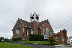
Burnside was a center for shipping by rail and steamboat packet. Its lumber mills sent products around the world. The town boasted retail stores, saloons, a post office, restaurants, churches, a bank, hotels, and even Burnside Academy the first Wesleyan preparatory school in the state.

In the early 1950s, the entire town was relocated to higher ground due to the impounding of Lake Cumberland. The town had once been a thriving community. American author Harriette Simpson Arnow who was known for her book The Dollmaker lived in Burnside as a child.

Burnside is one of several places that lay claim to be home to the first Boy Scout troop in the United States. In 1908, two years before the Boy Scouts of America was officially organized, Mrs. Myra Greeno Bass organized a local troop of 15 boys, using official Boy Scout materials she had acquired from England. A sign at the edge of town declares Burnside "Birthplace of Boy Scouts in America", and an official state historical society marker commemorates the troop. [3]

Geography

According to the United States Census Bureau, the city has a total area of 2.1 square miles (5.4 km2), of which, 1.7 square miles (4.4 km2) of it is land and 0.4 square miles (1.0 km2) of it (18.75%) is water.

Demographics

Historical population
CensusPop.Note
1910 1,117
1920 1,078−3.5%
1930 914−15.2%
1940 880−3.7%
1950 615−30.1%
1960 575−6.5%
1970 5861.9%
1980 77532.3%
1990 695−10.3%
2000 637−8.3%
2010 611−4.1%
2020 69413.6%
U.S. Decennial Census [4]

As of the census [5] of 2000, there were 637 people, 287 households, and 200 families residing in the city. The population density was 378.3 inhabitants per square mile (146.1/km2). There were 348 housing units at an average density of 206.7 per square mile (79.8/km2). The racial makeup of the city was 99.37% White, 0.16% Native American, and 0.47% from two or more races. Hispanic or Latino of any race were 0.31% of the population.

There were 287 households, out of which 23.3% had children under the age of 18 living with them, 59.2% were married couples living together, 8.4% had a female householder with no husband present, and 30.0% were non-families. 25.4% of all households were made up of individuals, and 10.5% had someone living alone who was 65 years of age or older. The average household size was 2.22 and the average family size was 2.64.

In the city the population was spread out, with 17.3% under the age of 18, 6.0% from 18 to 24, 22.8% from 25 to 44, 37.0% from 45 to 64, and 17.0% who were 65 years of age or older. The median age was 47 years. For every 100 females, there were 94.2 males. For every 100 females age 18 and over, there were 91.6 males.

The median income for a household in the city was $30,781, and the median income for a family was $34,583. Males had a median income of $25,556 versus $19,375 for females. The per capita income for the city was $20,339. About 11.7% of families and 13.8% of the population were below the poverty line, including 18.4% of those under age 18 and 11.5% of those age 65 or over.

Education

Burnside has a lending library, a branch of the Pulaski County Public Library. [6]

Climate

The climate in this area is characterized by hot, humid summers and generally mild to cool winters. According to the Köppen Climate Classification system, Burnside has a humid subtropical climate, abbreviated "Cfa" on climate maps. [7]

Notable people

Related Research Articles

<span class="mw-page-title-main">Russell County, Kentucky</span> County in Kentucky, United States

Russell County is a county located in the U.S. Commonwealth of Kentucky. As of the 2020 census, the population was 17,991. Its county seat is Jamestown and its largest city is Russell Springs. The county was formed on December 14, 1825, from portions of Adair, Cumberland and Wayne Counties and is named for William Russell.

<span class="mw-page-title-main">Pulaski County, Kentucky</span> County in Kentucky, United States

Pulaski County is a county in the U.S. Commonwealth of Kentucky. As of the 2020 census, the population was 65,034. Its county seat is Somerset. The county was founded in December 1798 from land given by Lincoln and Green Counties and named for Polish patriot Count Casimir Pulaski. Pulaski County comprises the Somerset, KY Micropolitan Statistical Area. Somerset's population is just over 11,000, but the Micropolitan Area for Somerset/Pulaski County is over 65,000.

<span class="mw-page-title-main">Fayette, Alabama</span> City in and county seat of Fayette County, Alabama

Fayette is a city and the county seat of Fayette County, Alabama, United States. The population was 4,619 at the 2010 census, down from 4,922 at the 2000 census.

<span class="mw-page-title-main">Pineville, Kentucky</span> City in Kentucky, United States

Pineville is a home rule-class city in Bell County, Kentucky, United States. It is the seat of its county. The population was 1,732 as of the 2010 census. It is located on a small strip of land between the Cumberland River and Pine Mountain.

<span class="mw-page-title-main">Albany, Kentucky</span> City in Kentucky, United States

Albany is a home rule-class city in Clinton County, Kentucky, in the United States. The population was 2,033 at the 2010 census. It is the county seat of Clinton County. It is located on U.S. Route 127, about 6 miles (10 km) north of the Tennessee border.

<span class="mw-page-title-main">Burkesville, Kentucky</span> City in Kentucky, United States

Burkesville is a home rule-class city in Cumberland County, Kentucky, in the United States. Nestled among the rolling foothills of Appalachia and bordered by the Cumberland River to the south and east, it is the seat of its county. The population was 1,521 at the 2010 census.

<span class="mw-page-title-main">Benham, Kentucky</span> City in Kentucky, United States

Benham is a home rule-class city in Harlan County, Kentucky, in the United States. The city was formally incorporated by the General Assembly in 1961. The population was 512 at the 2020 census, up from 500 at the 2010 census.

<span class="mw-page-title-main">Cumberland, Kentucky</span> City in Kentucky, United States

Cumberland is a home rule-class city in Harlan County, Kentucky, in the United States. The population according to the 2010 Census was 2,237, down from 2,611 at the 2000 census. The city sits at the confluence of Looney Creek and the Poor Fork Cumberland River.

<span class="mw-page-title-main">Grand Rivers, Kentucky</span> City in Kentucky, United States

Grand Rivers is a home rule-class city in Livingston County, Kentucky, in the United States. The population was 382 at the 2010 census, up from 343 in 2000. It is part of the Paducah micropolitan area.

<span class="mw-page-title-main">Kuttawa, Kentucky</span> City in Kentucky, United States

Kuttawa is a home rule-class city in Lyon County, Kentucky, in the United States. The population was 649 as of the 2010 census, up from 596 in 2000.

<span class="mw-page-title-main">Stearns, Kentucky</span> Census-designated place in Kentucky, United States

Stearns is an unincorporated community and census-designated place (CDP) in McCreary County, Kentucky, United States. The population was 1,365 at the 2020 census. It was founded by Justus Smith Stearns.

<span class="mw-page-title-main">Edmonton, Kentucky</span> City in Kentucky, United States

Edmonton is a home rule-class city in and the county seat of Metcalfe County, Kentucky, United States. It is part of the Glasgow Micropolitan Statistical Area. The population was 1,671 at the 2020 census.

<span class="mw-page-title-main">Ferguson, Kentucky</span> City in Kentucky, United States

Ferguson is a home rule-class city just south of downtown Somerset in Pulaski County, Kentucky, United States. It had a population of 924 as of the 2010 census, up from 881 in 2000.

<span class="mw-page-title-main">Somerset, Kentucky</span> City in Kentucky, United States

Somerset is a home rule-class city in Pulaski County, Kentucky, United States. The city population was 11,924 according to the 2020 census. It is the seat of Pulaski County.

<span class="mw-page-title-main">Sturgis, Kentucky</span> City in Kentucky, United States

Sturgis is a home rule-class city in Union County, Kentucky, United States. The population was 1,898 at the 2010 census. Located in northwest Kentucky, the city was founded in 1890 and named for Samuel Sturgis, who owned the land now occupied by the city.

<span class="mw-page-title-main">Williamsburg, Kentucky</span> City in Kentucky, United States

Williamsburg is a home rule-class city in and the county seat of Whitley County, on the southeastern border of Kentucky, United States. The population was 5,326 at the 2020 census. Developed along the Cumberland River, the city was founded in 1818 and named after William Whitley.

<span class="mw-page-title-main">Dover, Tennessee</span> City in Tennessee, United States

Dover is a city in and the county seat of Stewart County, Tennessee, 67 miles (108 km) west-northwest of Nashville on the Cumberland River. Fort Donelson National Cemetery is in Dover. The population was 1,442 at the 2000 census and the 2010 census showed a population of 1,417.

<span class="mw-page-title-main">Pulaski, Virginia</span> Town in Virginia, United States

Pulaski is a town in Pulaski County, Virginia, United States. The population was 9,086 at the 2010 census. It is the county seat of Pulaski County.

<span class="mw-page-title-main">New Cumberland, West Virginia</span> City in West Virginia, United States

New Cumberland is a city in and the county seat of Hancock County, West Virginia, United States, along the Ohio River. The population was 1,020 as of the 2020 census. It is part of the Weirton–Steubenville metropolitan area and is located near the Mountaineer Casino, Racetrack and Resort.

<span class="mw-page-title-main">Eubank, Kentucky</span> City in Kentucky, United States

Eubank is a home rule-class city in Pulaski and Lincoln counties in southern Kentucky. The population was 319 at the 2010 census.

References

  1. "2020 U.S. Gazetteer Files". United States Census Bureau. Retrieved March 18, 2022.
  2. 1 2 U.S. Geological Survey Geographic Names Information System: Burnside, Kentucky
  3. "First Boy Scout Troop Historical Marker" . Retrieved July 8, 2012.
  4. "Census of Population and Housing". Census.gov. Retrieved June 4, 2015.
  5. "U.S. Census website". United States Census Bureau . Retrieved January 31, 2008.
  6. "Kentucky Public Library Directory". Kentucky Department for Libraries and Archives. Archived from the original on January 11, 2019. Retrieved June 7, 2019.
  7. Climate Summary for Burnside, Kentucky