Cactus, California

Last updated

Coordinates: 32°51′44″N114°53′49″W / 32.86222°N 114.89694°W / 32.86222; -114.89694

Geographic coordinate system Coordinate system

A geographic coordinate system is a coordinate system that enables every location on Earth to be specified by a set of numbers, letters or symbols. The coordinates are often chosen such that one of the numbers represents a vertical position and two or three of the numbers represent a horizontal position; alternatively, a geographic position may be expressed in a combined three-dimensional Cartesian vector. A common choice of coordinates is latitude, longitude and elevation. To specify a location on a plane requires a map projection.

Cactus
Unincorporated community
California Locator Map with US.PNG
Red pog.svg
Cactus
Location in California
Usa edcp location map.svg
Red pog.svg
Cactus
Cactus (the US)
Coordinates: 32°51′44″N114°53′49″W / 32.86222°N 114.89694°W / 32.86222; -114.89694
Country United States
State California
County Imperial County
Elevation [1] 394 ft (120 m)

Cactus is an unincorporated community in Imperial County, California. [1] It is located on the Southern Pacific Railroad 4.5 miles (7.2 km) northwest of Ogilby, [2] at an elevation of 394 feet (120 m). [1]

Unincorporated area Region of land not governed by own local government

In law, an unincorporated area is a region of land that is not governed by a local municipal corporation; similarly an unincorporated community is a settlement that is not governed by its own local municipal corporation, but rather is administered as part of larger administrative divisions, such as a township, parish, borough, county, city, canton, state, province or country. Occasionally, municipalities dissolve or disincorporate, which may happen if they become fiscally insolvent, and services become the responsibility of a higher administration. Widespread unincorporated communities and areas are a distinguishing feature of the United States and Canada. In most other countries of the world, there are either no unincorporated areas at all, or these are very rare; typically remote, outlying, sparsely populated or uninhabited areas.
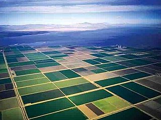
Imperial County, California County in California ----, United States

Imperial County is a county in the U.S. state of California. As of the 2010 census, the population was 174,528. The county seat is El Centro. Established in 1907 from a division of San Diego County, it was last county to be formed in California.

California State of the United States of America

California is a state in the Pacific Region of the United States. With 39.6 million residents, California is the most populous U.S. state and the third-largest by area. The state capital is Sacramento. The Greater Los Angeles Area and the San Francisco Bay Area are the nation's second and fifth most populous urban regions, with 18.7 million and 8.8 million residents respectively. Los Angeles is California's most populous city, and the country's second most populous, after New York City. California also has the nation's most populous county, Los Angeles County, and its largest county by area, San Bernardino County. The City and County of San Francisco is both the country's second-most densely populated major city after New York City and the fifth-most densely populated county, behind only four of the five New York City boroughs.

A post office operated in Cactus for a time in 1883, and from 1885 to 1886. [2] Cactus was originally a railroad construction camp. [2]

Related Research Articles

Yuma Desert

The Yuma Desert is a lower-elevation section of the Sonoran Desert in the southwestern United States and the northwest of Mexico. It lies in the Salton basin. The desert contains areas of sparse vegetation and has notable areas of sand dunes. With an average rainfall less than 8 inches (200 mm) each year, this is among the harshest deserts in North America. Human presence is sparse throughout, the largest city being Yuma, Arizona, on the Colorado River and the border of California.

Plaster City, California Unincorporated community in California, United States

Plaster City is an unincorporated community in Imperial County in the U.S. state of California. It is located 17 miles (27 km) west of El Centro, at an elevation of 105 feet.

Ogilby, California Ghost town in California, United States

Ogilby is a ghost town in Imperial County, California, United States. Ogilby is located on the Southern Pacific Railroad 42 miles (68 km) east of El Centro, and 3.8 miles (6.1 km) north of Interstate 8 on County Road S34. The name is official for federal use, and a feature ID number of 252950 has been assigned. Ogilby is defined by the US Geological Survey as a populated place at 356 feet (109 m) AMSL elevation. NAD27 latitude and longitude are listed at 32°49′01″N114°50′20″W on the "Ogilby, California" 7.5-minute quadrangle (map). It is included in the Imperial County Air Pollution Control District. It lies at an elevation of 364 feet (111 m).

Comertown, Montana human settlement in United States of America

Comertown is an unincorporated community in northeastern Sheridan County, Montana, United States. Founded in 1913, it was established as a station stop on the Soo Line Railroad branch line to Whitetail. It is centered at 48°53′49″N104°15′0″W and located at an altitude of 2,270 feet (692 m).

Shippee, California Unincorporated community in California, United States

Shippee is an unincorporated community in Butte County, California. It lies at an elevation of 131 feet. It is 7.5 miles (12.1 km) west-northwest of Oroville on the Sacramento Northern Railroad and the Northern Electric Railroad.

Elliot, California Former settlement in California, United States

Elliot is a former settlement in Alameda County, California. It was located on the Southern Pacific Railroad 4 miles (6.4 km) west of Livermore, at an elevation of 374 feet. It still appeared on maps as of 1906.

South Camanche Shore, California Unincorporated community in California, United States

South Camanche Shore is an unincorporated community in Calaveras County, California. It lies at an elevation of 443 feet.

Araz Junction, California Unincorporated community in California, United States

Araz Junction is an unincorporated community in Imperial County, California. It is located on the Southern Pacific Railroad 2.5 miles (4 km) east-northeast of Pilot Knob, at an elevation of 203 feet. It is located within the Fort Yuma Indian Reservation.

Clyde, Imperial County, California Unincorporated community in California, United States

Clyde is an unincorporated community in Imperial County, California. It is located on the Southern Pacific Railroad 7 miles (11 km) northwest of Ogilby, at an elevation of 394 feet.

Dunes, California Unincorporated community in California, United States

Dunes is an unincorporated community in Imperial County, California. It is located on the Southern Pacific Railroad 3.5 miles (5.6 km) southeast of Ogilby, at an elevation of 331 feet.

Obregon, California Unincorporated community in California, United States

Obregon is an unincorporated community in Imperial County, California. It is located 4 miles (6.4 km) northeast of Ogilby, at an elevation of 663 feet. Obregon was a mining town in the Cargo Muchacho Mountains located near the American Girl Mine. The town was abandoned in 1939, when the mine was closed.

Rico, California Unincorporated community in California, United States

Rico is an unincorporated community in Imperial County, California. It is located on the Holton Interurban Railroad 1.25 miles (2 km) west-southwest of Holtville, at an elevation of 20 feet below sea level.

Ross Corner, California Unincorporated community in California, United States

Ross Corner is an unincorporated community in Imperial County, California. It is located 2 miles (3 km) west-southwest of Bard on County Route S24, at an elevation of 131 feet.

Ruthven, California Unincorporated community in California, United States

Ruthven is an unincorporated community in Imperial County, California. It is located on the Southern Pacific Railroad 4.5 miles (7.2 km) southeast of Glamis, at an elevation of 377 feet.

Sandia, California Unincorporated community in California, United States

Sandia is an unincorporated community in Imperial County, California. It is located on a former branch of the Southern Pacific Railroad 5.25 miles (8.4 km) north-northwest of Holtville, at an elevation of 82 feet below sea level.

Araz, California Former settlement in California, United States

Araz is a former settlement in Imperial County, California. It was located on the Southern Pacific Railroad 8.5 miles (14 km) west-southwest of Bard.

Potholes is a former gold camp and settlement in Imperial County, California. The settlement was located on the railroad line 4 miles (6.4 km) northeast of Bard along the Colorado River near the site of the Laguna Dam.

Colorado is a former settlement in Imperial County, California. It was located near the current site of Winterhaven. Colorado still appeared on maps as of 1905.

Hedges, later renamed Tumco, is a locale, a ghost town, site of a former mining town, in Imperial County, California. It lies at an elevation of 617 feet / 188 meters along the Tumco Wash in the Cargo Muchacho Mountains. Nearby is the Hedges Cemetery at an elevation of 643 feet / 196 meters, at 32°53′04″N114°49′52″W.

Frisco is an unincorporated community in Stoddard County, in the U.S. state of Missouri.

References

  1. 1 2 3 U.S. Geological Survey Geographic Names Information System: Cactus, California
  2. 1 2 3 Durham, David L. (1998). California's Geographic Names: A Gazetteer of Historic and Modern Names of the State. Clovis, Calif.: Word Dancer Press. p. 1400. ISBN   1-884995-14-4.