Paymaster Landing, California

Last updated

Coordinates: 33°14′45″N114°41′23″W / 33.24583°N 114.68972°W / 33.24583; -114.68972

Geographic coordinate system Coordinate system

A geographic coordinate system is a coordinate system that enables every location on Earth to be specified by a set of numbers, letters or symbols. The coordinates are often chosen such that one of the numbers represents a vertical position and two or three of the numbers represent a horizontal position; alternatively, a geographic position may be expressed in a combined three-dimensional Cartesian vector. A common choice of coordinates is latitude, longitude and elevation. To specify a location on a plane requires a map projection.

Paymaster Landing
Unincorporated community
California Locator Map with US.PNG
Red pog.svg
Paymaster Landing
Location in California
Usa edcp location map.svg
Red pog.svg
Paymaster Landing
Paymaster Landing (the US)
Coordinates: 33°14′45″N114°41′23″W / 33.24583°N 114.68972°W / 33.24583; -114.68972
Country United States
State California
County Imperial County
Elevation [1] 213 ft (65 m)

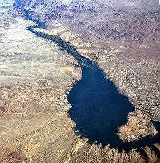
Paymaster Landing is an unincorporated community in Imperial County, California. [1] It is located on the Colorado River 13 miles (21 km) south of Palo Verde, [2] at an elevation of 213 feet (65 m). [1]

Unincorporated area Region of land not governed by own local government

In law, an unincorporated area is a region of land that is not governed by a local municipal corporation; similarly an unincorporated community is a settlement that is not governed by its own local municipal corporation, but rather is administered as part of larger administrative divisions, such as a township, parish, borough, county, city, canton, state, province or country. Occasionally, municipalities dissolve or disincorporate, which may happen if they become fiscally insolvent, and services become the responsibility of a higher administration. Widespread unincorporated communities and areas are a distinguishing feature of the United States and Canada. In most other countries of the world, there are either no unincorporated areas at all, or these are very rare; typically remote, outlying, sparsely populated or uninhabited areas.

Imperial County, California County in California ----, United States

Imperial County is a county in the U.S. state of California. As of the 2010 census, the population was 174,528. The county seat is El Centro. Established in 1907 from a division of San Diego County, it was last county to be formed in California.

California State of the United States of America

California is a state in the Pacific Region of the United States. With 39.6 million residents, California is the most populous U.S. state and the third-largest by area. The state capital is Sacramento. The Greater Los Angeles Area and the San Francisco Bay Area are the nation's second- and fifth-most populous urban regions, with 18.7 million and 9.7 million residents respectively. Los Angeles is California's most populous city, and the country's second-most populous, after New York City. California also has the nation's most populous county, Los Angeles County, and its largest county by area, San Bernardino County. The City and County of San Francisco is both the country's second-most densely populated major city after New York City and the fifth-most densely populated county, behind only four of the five New York City boroughs.

Related Research Articles

Grand Lake, Oakland, California Neighborhood of Oakland in Alameda, California, United States

Grand Lake, or the Grand Lake District, is a neighborhood in Oakland, California, United States. The neighborhood is located in the northeast corner of Lake Merritt, where Grand Avenue and Lakeshore Avenue pass under Interstate 580. It borders Adams Point to the west, Trestle Glen/Crocker Highlands to the east, and the city of Piedmont to the north. It lies at an elevation of 52 feet.

Chemehuevi Indian Tribe of the Chemehuevi Reservation federally recognized tribe

The Chemehuevi Indian Tribe of the Chemehuevi Reservation is a federally recognized tribe of Chemehuevi people, who are the southernmost branch of Southern Paiute people.

There are over a dozen lakes named Mud Lake within the U.S. state of Montana.

Lost Lake Resort, California Unincorporated community in California, United States

Lost Lake is a desert community located along the west shore of the Colorado River. It also lies along U.S. Route 95 near the northeast extent of Riverside County. Official U.S. Geological Survey feature ID is 245216 and NAD27 coordinates for the community are 34°00′44″N114°28′27″W. The community lies at the foot of Riverside Mountain, 34°00′49″N114°30′45″W, with a summit measuring 2,127 feet. The community is named for a lake, Lost Lake, located at 34°01′20″N114°28′21″W.

Picacho, California Unincorporated community in California, United States

Picacho is an unincorporated community in Imperial County, California. It is located on the Colorado River 29 miles (47 km) south-southeast of Palo Verde, at an elevation of 203 feet.

Morgans Landing, California Unincorporated community in California, United States

Morgans Landing is an unincorporated community in Yolo County, California. It lies at an elevation of 10 feet.

Riverview, Yolo County, California Unincorporated community in California, United States

Riverview is an unincorporated community in Yolo County, California. It lies on the west bank of the Sacramento River, on the Sacramento Northern and the Oakland, Antioch and Eastern Railroads 5 miles (8.0 km) south-southwest of West Sacramento, at an elevation of 16 feet.

Havasu Lake, California human settlement in United States of America

Havasu Lake is an unincorporated community in San Bernardino County, California, United States, located on Lake Havasu on the Chemehuevi Reservation in the Mojave Desert. The community serves as the seat of the tribal government of the Chemehuevi Indian Tribe and is home to the Havasu Landing Casino.

Merrills Landing, California Unincorporated community in California, United States

Merrills Landing is an unincorporated community in Butte County, California, on the Sacramento River. It lies at an elevation of 177 feet.

Marklee Village, California Unincorporated community in California, United States

Marklee Village is an unincorporated community in Alpine County, California. It lies at an elevation of 5653 feet.

Bard, California Unincorporated community in California, United States

Bard is an unincorporated community in Imperial County, California, United States, located along County Route S24. It lies at an elevation of 138 feet. Bard is home to the Imperial Date Gardens.

Imperial Gables, California Unincorporated community in California, United States

Imperial Gables is an unincorporated community in Imperial County, California. It is located 12.5 miles (20 km) northeast of Glamis, at an elevation of 1283 feet.

Araz, California Former settlement in California, United States

Araz is a former settlement in Imperial County, California. It was located on the Southern Pacific Railroad 8.5 miles (14 km) west-southwest of Bard.

North Grove, Saskatchewan human settlement in Saskatchewan, Canada

North Grove is a community in Saskatchewan, Canada.

Rock Creek is an unincorporated community in Rock Creek Township, Jefferson County, Kansas, United States. It lies along 110th Road near its intersection with K-4. K-4 used to run along Rock Creek Road and originally cut through Rock Creek, but years later the highway was widened and rebuilt just east of Rock Creek. The community is located at 39°14′45″N95°32′14″W, at an elevation of 1,099 feet (335 m).

Indian River (Manistique River tributary) tributary of the Manistique River on the Upper Peninsula of Michigan in the United States

Indian River is a 59.1-mile-long (95.1 km) tributary of the Manistique River on the Upper Peninsula of Michigan in the United States. It rises out of Hovey Lake at 46°17′36″N86°42′20″W on Hiawatha National Forest land in Alger County and flows south and east through a lake district and on through Schoolcraft County. The river flows into the 8,659 acre (35 km²) Indian Lake at 46°17′36″N86°42′20″W and flows out at 45°59′30″N86°17′15″W. It then flows east and south about 2.5 miles where it merges with the Manistique River, which then flows through Manistique and into Lake Michigan at 45°56′56″N86°14′45″W.

Rice Valley Wilderness

The Rice Valley Wilderness is a wilderness area near Blythe and Rice in the Mojave Desert region of California, managed by the Bureau of Land Management.

Clip, or Clip Landing, was a steamboat landing and mill settlement in Yuma County, Arizona Territory. The site in the present day is a ghost town, on the east bank of the Colorado River in La Paz County, Arizona. The settlement was located 70 miles up river from Yuma. It lies at an elevation of 223 feet, just south of Clip Wash, and the road to the Clip Mine at the top of the wash, 8 miles southeast of the mill.

Arthur, Indiana Unincorporated community in Indiana, United States

Arthur is an unincorporated community in Patoka Township, Pike County, in the U.S. state of Indiana.

References

  1. 1 2 3 U.S. Geological Survey Geographic Names Information System: Paymaster Landing, California
  2. Durham, David L. (1998). California's Geographic Names: A Gazetteer of Historic and Modern Names of the State. Clovis, Calif.: Word Dancer Press. p. 1453. ISBN   1-884995-14-4.