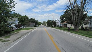
Coordinates: 33°06′41″N115°37′28″W / 33.11139°N 115.62444°W
A geographic coordinate system is a coordinate system that enables every location on Earth to be specified by a set of numbers, letters or symbols. The coordinates are often chosen such that one of the numbers represents a vertical position and two or three of the numbers represent a horizontal position; alternatively, a geographic position may be expressed in a combined three-dimensional Cartesian vector. A common choice of coordinates is latitude, longitude and elevation. To specify a location on a plane requires a map projection.
Fondo | |
---|---|
Unincorporated community | |
Coordinates: 33°06′41″N115°37′28″W / 33.11139°N 115.62444°W | |
Country | United States |
State | California |
County | Imperial County |
Elevation [1] | -203 ft (-62 m) |
Fondo is an unincorporated community in Imperial County, California. [1] It is located on the Southern Pacific Railroad 6.5 miles (10 km) west of Calipatria, [2] at an elevation of 203 feet (62 m) below sea level. [1]
In law, an unincorporated area is a region of land that is not governed by a local municipal corporation; similarly an unincorporated community is a settlement that is not governed by its own local municipal corporation, but rather is administered as part of larger administrative divisions, such as a township, parish, borough, county, city, canton, state, province or country. Occasionally, municipalities dissolve or disincorporate, which may happen if they become fiscally insolvent, and services become the responsibility of a higher administration. Widespread unincorporated communities and areas are a distinguishing feature of the United States and Canada. In most other countries of the world, there are either no unincorporated areas at all, or these are very rare; typically remote, outlying, sparsely populated or uninhabited areas.
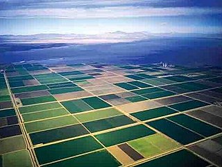
Imperial County is a county in the U.S. state of California. As of the 2010 census, the population was 174,528. The county seat is El Centro. Established in 1907 from a division of San Diego County, it was last county to be formed in California.
California is a state in the Pacific Region of the United States. With 39.6 million residents, California is the most populous U.S. state and the third-largest by area. The state capital is Sacramento. The Greater Los Angeles Area and the San Francisco Bay Area are the nation's second and fifth most populous urban regions, with 18.7 million and 9.7 million residents respectively. Los Angeles is California's most populous city, and the country's second most populous, after New York City. California also has the nation's most populous county, Los Angeles County, and its largest county by area, San Bernardino County. The City and County of San Francisco is both the country's second-most densely populated major city after New York City and the fifth-most densely populated county, behind only four of the five New York City boroughs.
Located on the northeastern side of the Salton Sea, the Salton Sea State Recreation Area offers hunting, fishing, swimming, and camping to visitors.
Oregon Jack Provincial Park is a provincial park in British Columbia, Canada located in the Clear Range west of Ashcroft. It protects the limestone canyon of Oregon Jack Creek, at the head of which is a waterfall named the Notch, above which is included a wetland area. The site was an important First Nations site and there are pictographs, culturally modified trees and a site known as the Three Sisters Rock Shelter.
Bloomer is a former settlement in Butte County, California, United States. It was located 5.5 miles (8.9 km) north-northwest from Bidwell's Bar on the Western Pacific Railroad, at an elevation of 902 feet, and was inundated by Lake Oroville.
Amos is an unincorporated community in Imperial County, California. It is located on the Southern Pacific Railroad 15 miles (24 km) east of Calipatria, at an elevation of 262 feet.
Bernice is a former settlement in Imperial County, California, USA. It was located on the Southern Pacific Railroad 1.25 miles (2.0 km) south-southeast of Calipatria, at an elevation of 171 feet below sea level. Bernice still appeared on maps in 1947.
Bertram is an unincorporated community in Imperial County, California. It is located on the Southern Pacific Railroad 24 miles (39 km) northwest of Calipatria, at an elevation of 187 feet below sea level.
Butlers is a former settlement in Imperial County, California. It was located on the Southern Pacific Railroad 10.5 miles (17 km) southeast of Calipatria, at an elevation of 102 feet below sea level. Butlers still appeared on maps as of 1947.
Frink is an unincorporated community in Imperial County, California. It is located on the Southern Pacific Railroad 18 miles (29 km) north-northwest of Calipatria, at an elevation of 171 feet below sea level.
Hovley is an unincorporated community in Imperial County, California. It is located on the Southern Pacific Railroad 8.5 miles (14 km) south of Calipatria, at an elevation of 138 feet below sea level.
Iris is an unincorporated community in Imperial County, California. It is located on the Southern Pacific Railroad 8 miles (13 km) northeast of Calipatria, at an elevation of 82 feet.
Mesquite is an unincorporated community in Imperial County, California. It is located on the Union Pacific railroad 3 miles (4.8 km) northwest of Glamis, at an elevation of 299 feet. It lends its name to the nearby Mesquite Mine.
Mundo is an unincorporated community in Imperial County, California. It is located on the Southern Pacific Railroad 7.5 miles (12 km) southeast of Frink, at an elevation of 190 feet below sea level.
Munyon is an unincorporated community in Imperial County, California. It is located on a former branch of the Southern Pacific Railroad 8 miles (13 km) southeast of Calipatria, at an elevation of 108 feet below sea level.
Pope is an unincorporated community in Imperial County, California. It is located on the Southern Pacific Railroad 4.5 miles (7.2 km) west of Frink, at an elevation of 197 feet below sea level.
Rockwood is an unincorporated community in Imperial County, California. It is located on the Southern Pacific Railroad 5.25 miles (8.4 km) south of Calipatria, at an elevation of 154 feet below sea level.
Tortuga is an unincorporated community in Imperial County, California. It is located on the Southern Pacific Railroad 10.5 miles (17 km) east-northeast of Calipatria, at an elevation of 187 feet. The name Tortuga means "turtle" in Spanish.
Verdant is an unincorporated community in Imperial County, California. It is located on the Southern Pacific Railroad 2.5 miles (4 km) west-southwest of Calipatria, at an elevation of 197 feet below sea level.
Wister is an unincorporated community in Imperial County, California. It is located on the Southern Pacific Railroad 4.25 miles (6.8 km) southeast of Frink, at an elevation of 197 feet below sea level.
Pancoastburg is an unincorporated community and census-designated place (CDP) in Madison Township, Fayette County, Ohio, United States. It is located at 39°37′28″N83°15′56″W, along Ohio State Route 207, about 6 miles (10 km) south of Mount Sterling. As of the 2010 census the population of Pancoastburg was 87.
West Fork is an unincorporated community in Pittsylvania County, in the U.S. state of Virginia.
![]() | This Imperial County, California-related article is a stub. You can help Wikipedia by expanding it. |