Related Research Articles

The Bridge River is an approximately 120 kilometres (75 mi) long river in southern British Columbia. It flows south-east from the Coast Mountains. Until 1961, it was a major tributary of the Fraser River, entering that stream about six miles upstream from the town of Lillooet; its flow, however, was near-completely diverted into Seton Lake with the completion of the Bridge River Power Project, with the water now entering the Fraser just south of Lillooet as a result.

The Bendor Range is a small but once-famous subrange of the Pacific Ranges of the Coast Mountains, about It is approximately 7,000 square kilometres (2,700 sq mi) in area and about 40 km long and about 18 km at its widest. It lies between Anderson Lake on the southeast and the Carpenter Lake Reservoir or the Bridge River Power Project on the north, with the gold-rich valley of Cadwallader Creek on its southwest.

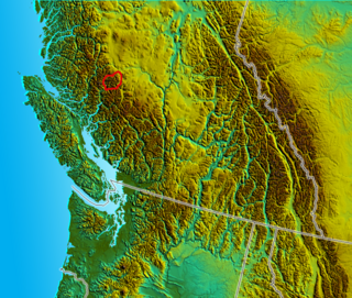
The Niut Range is 3600 km2 in area. It is a subrange of the Pacific Ranges of the Coast Mountains of British Columbia, although in some classifications it is considered part of the Chilcotin Ranges. The Niut is located in the angle of the Homathko River and its main west fork, Mosley Creek. It is isolated, island-like, by those rivers from its neighbour ranges, as both streams have their source on the Chilcotin Plateau in behind the range. Razorback Mountain is its highest peak.

The Shulaps Range is a subrange of the Chilcotin Ranges subset of the Pacific Ranges of the Coast Mountains in southwest-central British Columbia. The range is 55 km NW–SE and 15 km SW–NE and 2,970 km2 (1,150 sq mi) in area.

The Dickson Range is a subrange of the Chilcotin Ranges subset of the Pacific Ranges of the Coast Mountains in southwest-central British Columbia. It is located just west of the town of Gold Bridge between the valley of Slim Creek to the north and Downton Lake Reservoir to the south. At its eastern foot is Gun Lake; its western limit is at a pass between Slim Creek and Nichols Creek near the pass which separates the Bridge River basin from that of the Lord River, which feeds the Taseko Lakes.
The Birkenhead River, formerly known as the Portage River, the Pole River and the Mosquito River, is a major tributary of the Lillooet River, which via Harrison Lake and the Harrison River is one of the major tributaries of the lower Fraser River. It is just over 50 km long from its upper reaches in the unnamed ranges south of Bralorne, British Columbia ; their western area towards the named Bendor Range east of Bralorne is sometimes called the Cadwallader Ranges.

Birkenhead Lake Provincial Park is a provincial park in British Columbia, Canada, located in the Lillooet Country region. The park lies north of the communities of Squamish, Whistler and Pemberton, and immediately northwest of Birkenhead Peak and Gates Lake at the community of Birken.
McGillivray Creek is a creek located in the Interior of British Columbia, in the Lillooet Country.

Gold Bridge is an unincorporated community in the Bridge River Country of British Columbia, Canada. Although numbering only around 40 inhabitants, Gold Bridge is the service and supply centre for the upper basin of the Bridge River Valley, which includes recreation-residential areas at the Gun Lakes, Tyaughton Lake, Marshall Creek, and Bralorne; and the nearby ghost towns of Brexton and Pioneer Mine.

The Lil'wat First Nation, a.k.a. the Lil'wat Nation or the Mount Currie Indian Band, is a First Nation band government located in the southern Coast Mountains region of the Interior of the Canadian province of British Columbia. It is a member of the Lillooet Tribal Council, which is the largest grouping of band governments of the St'at'imc or Stl'atl'imx people. Other St'at'imc governments include the smaller In-SHUCK-ch Nation on the lower Lillooet River to the southwest, and the independent N'quatqua First Nation at the near end of Anderson Lake from Mount Currie, which is the main reserve of the Lil'wat First Nation, and also one of the largest Indian reserves by population in Canada.
Cadwallader Creek is an important tributary of the Hurley River in the Bridge River Country of the British Columbia Interior, Canada, most notable for its role as the home of the Bralorne and Pioneer Mines and associated gold claims and workings. Less than twenty miles in length, the creek is joined by Noel Creek within the area of the town of Bralorne, and just below Bralorne joins the Hurley River just above Hurley Falls and that river's ten-mile canyon prior to its own confluence with the Bridge River near the town Gold Bridge. Standard Creek, a short tributary of Cadwallader Creek near its upper end, connects via McGillvray Pass to the creek of the same name and, on Anderson Lake far below, the resort townlet of McGillivray Falls. One-time plans to build a cog railway to the mines from the Pacific Great Eastern at McGillivary Falls were never fulfilled.

Bralorne is a historic Canadian gold mining community in the Bridge River District of British Columbia, some 130 km on dirt roads west of the town of Lillooet.
The Nazko First Nation is a First Nations government of the Dakelh people in the north-central Interior of British Columbia. Its reserves are located around the community of Nazko, British Columbia, which is 120 km west of Quesnel and southwest of Prince George.
McGillivray Pass is a mountain pass in the Pacific Ranges of southwestern British Columbia, Canada, located about 30 miles west of the town of Lillooet and immediately west of the upper end of Anderson Lake, above the former resort community of McGillivray. The pass connects the head of McGillivray Creek with the head of Standard Creek, a tributary of Cadwallader Creek and was used as a route by prospectors, miners and hunters heading for the upper Bridge River Country beyond the pass.
Norrish Creek is a tributary of the Fraser River. It is located in the Douglas Ranges, the southernmost subrange of the Pacific Ranges of the Coast Mountains of British Columbia, Canada to the north of Nicomen Island. Local residents refer to it as "Suicide Creek." It was named after William Henry Norrish a pioneer Scottish Canadian farmer.
Birkenhead Peak, commonly known as Mount Birkenhead and sometimes Birkenhead Mountain or Mount Birken is a mountain in the Gates Valley region of the Lillooet Country of the South-Central Interior of British Columbia, Canada. Located approximately midway between the towns of Lillooet (NE) and Pemberton-Mount Currie, the mountain's very high prominence separates it from the adjoining Cadwallader Range by the pass between Blackwater Creek and Birkenhead Lake.
Mission Ridge, also known as Mission Mountain, is a ridge in the Bridge River-Lillooet Country of the South-Central Interior of British Columbia, Canada, extending westward from the town of Lillooet along the north side of Seton Lake to Mission Pass, which is immediately above and to the north of the lakeside community of Shalalth. The road over the pass is also known as Mission Mountain, which is short for "Mission Mountain Road". Mission Creek lies on the north side of the pass, and is a tributary of the Bridge River, the lower reaches of which lie on the north side of the ridge, and which was the only road access into the upper Bridge River Country before the construction of a road through the Bridge River Canyon in the mid-1950s opened that region up to road access from the lower Bridge River valley and the town of Lillooet via the community of Moha. Most, or virtually all, of the ridge, is Indian Reserves, notably Slosh 1, under the administration of the Seton Lake Indian Band, and Bridge River 1, which is under the administration of the Bridge River Indian Band. Parts of the ridge's eastern end are in reserves controlled by the Lillooet Indian Band, including its final spires above Lillooet, which were dubbed St. Mary's Mount by the Reverend Lundin Brown in the 1860s, though that name never stuck and is ungazetted.
The Lillooet Land District is one of the 59 cadastral subdivisions of British Columbia, which were created by the Lands Act of the Colony of British Columbia in 1859, defined as "a territorial division with legally defined boundaries for administrative purposes". The land district's boundaries came to be used as the boundary of the initial Lillooet riding for the provincial Legislature from 1871, when the colony became a province. In addition to use in descriptions of land titles and lot surveys, the Land District was also the basis of the Lillooet Mining District.

Mount Sloan is a 2,720-metre (8,924-foot) mountain summit located in British Columbia, Canada.

Mount Shadowfax is a 2,315-metre (7,595-foot) mountain summit in southwest British Columbia, Canada.