
The Ball Range is a mountain range on the Continental Divide between Vermilion Pass and Red Earth Pass in Kootenay National Park, Canada. The range is named after John Ball, a politician who helped secure funding for the Palliser expedition.

The Bare Range is a mountain range of the Canadian Rockies, located south of the Red Deer River valley in Banff National Park, Canada. The range is named for the "bareness" of or lack of trees on the gentle slopes of the range.

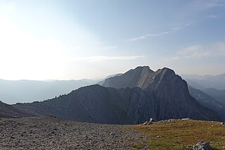
The Blue Range is a mountain range of the Canadian Rockies, located on the Continental Divide in Banff National Park, Canada. The range was so named on account of its blueish colour when viewed from afar. Mount Alcantara is the highest point in the range.

The Beaverfoot Range is a mountain range of the Canadian Rockies, located in southeastern British Columbia. The range extends from Cedared Creek near Spillimacheen north to the Kicking Horse River.

The Palliser Range is a mountain range of the Canadian Rockies that lies in the extreme southeast corner of Banff National Park, Alberta, Canada.

The Massive Range is a mountain range of the Canadian Rockies, located in the southwestern area of the Bow River valley in Banff National Park, Canada.
The Fiddle Range is a mountain range of the Canadian Rockies located south of Highway 16 on the east border of Jasper National Park, Canada.

Crowsnest Range is a mountain range of the Rocky Mountains in southwestern Alberta and southeastern British Columbia, Canada.

The Challenger Mountains are a mountain range on Ellesmere Island in Nunavut, Canada. The range is the most northern range in the world and of the Arctic Cordillera. The highest mountain in the range is Commonwealth Mountain 2,225 m (7,300 ft). The United States Range is immediately to the east of the Challenger Mountains.

The Stokes Range is a mountain range on Bathurst Island, Nunavut, Canada. The range is one of the northernmost ranges in the world and of the Arctic Cordillera. Its highest point is 412 m (1,352 ft) at Stokes Mountain.
The Countess of Dufferin Range is a small subrange of the Kitimat Ranges, running along the east side of Grenville Channel on the south side of Lowe Inlet in British Columbia, Canada.
The Bunster Range are a small mountain range in southwestern British Columbia, Canada, located west of Powell Lake. It has an area of 290 km2 and is a subrange of the Pacific Ranges which in turn form part of the Coast Mountains.
The Calliope Range are a small low mountain range in southwestern British Columbia, Canada, located on the western end of Broughton Island and northeast of Port McNeill. It has an area of 15 km2 and is a subrange of the Pacific Ranges which in turn form part of the Coast Mountains.
The Unwin Range is a small mountain range in southwestern British Columbia, Canada, located on the eastern end of Homfray Channel. It has an area of 142 square kilometres (55 sq mi) and is a subrange of the Pacific Ranges which in turn form part of the Coast Mountains.
The Nicholl Range is a small mountain range in southwestern British Columbia, Canada, located between Seymour Inlet and Belize Inlet. It has an area of 21 km2 and is a subrange of the Pacific Ranges which in turn form part of the Coast Mountains.
The Gastineau Range is a small mountain range in southwestern British Columbia, Canada, located west of the Brem River. It has an area of 107 km2 and is a subrange of the Pacific Ranges which in turn form part of the Coast Mountains.
The Franklyn Range is a small mountain range in southwestern British Columbia, Canada, located on the west side of the entrance to Loughborough Inlet, north of Johnstone Strait northeast of Sayward. It has an area of 44 km2 and is a subrange of the Pacific Ranges which in turn form part of the Coast Mountains.
The Earle Range is a small mountain range in southwestern British Columbia, Canada, located on the east side of the south end of Prince of Wales Reach. It has an area of 158 km2 and is a subrange of the Pacific Ranges which in turn form part of the Coast Mountains.

The Sundance Range is a mountain range in the Canadian Rockies, south of the town of Banff. It is located on the Continental Divide, which forms the boundary between British Columbia and Alberta in this region.
Mount Skook Davidson, 2,382 metres (7,815 ft), is a mountain in the Kechika Ranges of the Cassiar Mountains in far northern British Columbia, Canada. It overlooks the "Diamond J Ranch", which was founded by John Ogilvie Davidson also known as "Skook" Davidson or "Skookum" Davidson because of his stature. Davidson was a notable local pioneer who worked as a land surveyor before taking up packing, guiding, and ranching in this area. He helped discover and select the route for the Alaska Highway.
