
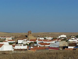
Higuera de Vargas is a municipality in the province of Badajoz, Extremadura, Spain. It has a population of 2,011 and an area of 67.6 km².
Almendral is a municipality located in the province of Badajoz, Extremadura, Spain. According to the 2004 census (INE), the municipality has a population of 1352 inhabitants.

Arroyo de San Serván is a municipality located in the province of Badajoz, Extremadura, Spain. According to the 2012 census (INE), the municipality has a population of 4267 inhabitants. The town's first census was held in 1842, as part of Badajoz.
Calzadilla de los Barros is a municipality located in the province of Badajoz, Extremadura, Spain. According to the 2005 census (INE), the municipality has a population of 1174 inhabitants.
Entrín Bajo is a municipality located in the province of Badajoz, Extremadura, Spain. According to the 2005 census (INE), the municipality has a population of 605 inhabitants.
Esparragalejo is a municipality of Spain in the province of Badajoz, autonomous region of Extremadura.

La Garrovilla is a municipality located in the province of Badajoz, Extremadura, Spain. According to the 2010 census (INE), the municipality has a population of 2490 inhabitants.

Higuera la Real is a municipality located in the province of Badajoz, Extremadura, Spain. According to the 2005 census (INE), the municipality has a population of 2505 inhabitants.

La Lapa is a municipality located in the province of Badajoz, Extremadura, Spain. According to the 2006 census (INE), the municipality has a population of 314 inhabitants.

Puebla de la Reina is a municipality located in the province of Badajoz, Extremadura, Spain. According to the 2005 census (INE), the municipality has a population of 912 inhabitants.

Puebla de Obando is a municipality located in the province of Badajoz, Extremadura, Spain. According to the 2005 census (INE), the municipality has a population of 2033 inhabitants. It is the birthplace of former Real Madrid and now Deportivo Alavés goalkeeper, Fernando Pacheco Flores.

Puebla del Prior is a municipality located in the province of Badajoz, Extremadura, Spain. According to the 2006 census (INE), the municipality has a population of 563 inhabitants.

Salvaleón is a municipality located in the province of Badajoz, Extremadura, Spain. According to the 2005 census (INE), the municipality has a population of 2172 inhabitants.

San Pedro de Mérida is a municipality located in the province of Badajoz, Extremadura, Spain. According to the 2005 census (INE), the municipality has a population of 845 inhabitants.

Valencia de las Torres is a municipality located in the province of Badajoz, Extremadura, Spain. According to the 2005 census (INE), the municipality has a population of 724 inhabitants.
Valverde de Leganés is a municipality located in the province of Badajoz, Extremadura, Spain. According to the 2005 census (INE), the municipality has a population of 3894 inhabitants.
Alconera is a Spanish municipality in the province of Badajoz, Extremadura. It has a population of 735 (2007) and an area of 32.7 km².
Barcarrota is a Spanish municipality in the province of Badajoz, Extremadura. It has a population of 3,664 (2007) and an area of 136.1 km².
Capilla is a Spanish municipality in the province of Badajoz, Extremadura. It has a population of 189 (2007) and an area of 147 km2.

Feria is a Spanish municipality in the province of Badajoz, Extremadura. It has a population of 1,369 (2007) and an area of 73.7 km2 (28 sq mi).

