Castuera | |
|---|---|
Municipality | |
 Remains of the cross that presided over the entrance to the Castuera concentration camp | |
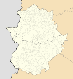
Location of Castuera within Extremadura | |
| Coordinates: 38°43′23″N5°32′40″W / 38.72306°N 5.54444°W | |
| Country | |
| Autonomous Community | |
| Province | Badajoz |
| Comarca | La Serena |
| Area | |
• Total | 432 km2 (167 sq mi) |
| Elevation (AMSL) | 512 m (1,680 ft) |
| Population (2018) [1] | |
• Total | 5,921 |
| • Density | 14/km2 (35/sq mi) |
| Time zone | UTC+1 (CET) |
| • Summer (DST) | UTC+2 (CEST (GMT +2)) |
| Postal code | 06420 |
| Area code | +34 (Spain) + 924 (Badajoz) |
| Website | www.castuera.es |
Castuera is a municipality in the province of Badajoz, Extremadura, Spain. According to the 2014 census, [2] the municipality has a population of 6,255 inhabitants.

