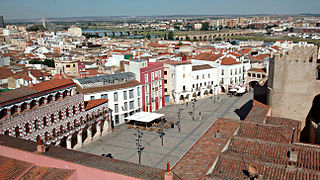
Badajoz is the capital of the Province of Badajoz in the autonomous community of Extremadura, Spain. It is situated close to the Portuguese border, on the left bank of the river Guadiana. The population in 2011 was 151,565.

Toledo is a province of central Spain, in the western part of the autonomous community of Castile–La Mancha. It is bordered by the provinces of Madrid, Cuenca, Ciudad Real, Badajoz, Cáceres, and Ávila. Its capital is the city of Toledo.
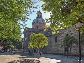
Talavera de la Reina is a city and municipality of Spain, part of the autonomous community of Castile–La Mancha. Its population of 83,303 makes it the second most populated municipality of the province of Toledo and the fourth largest in the region.
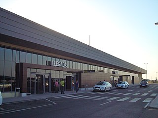
Badajoz Airport is an airport located 13 km (8.1 mi) east of Badajoz, a city in Extremadura, Spain, and 45 km (28 mi) west of Mérida, Spain, the capital of the same Autonomous Community. The airport is connected with both cities by the Autovía A-5 motorway. The airport shares its runway and control tower with the Talavera la Real Air Base, an air base of the Spanish Air and Space Force, named for the nearby municipality of Talavera la Real. It is currently the only airport in Extremadura.

Pueblonuevo del Guadiana, also shortened as Pueblonuevo, is a Spanish town and municipality in the province of Badajoz, Extremadura. It has a population of 2,046 and an area of 30,95 km².
Esparragalejo is a municipality of Spain in the province of Badajoz, autonomous region of Extremadura.

Garlitos is a municipality located in the province of Badajoz, Extremadura, Spain. As of 2018, the municipality has a population of 599 inhabitants.

La Garrovilla is a municipality located in the province of Badajoz, Extremadura, Spain. According to the 2010 census (INE), the municipality has a population of 2490 inhabitants.

Higuera la Real is a municipality located in the province of Badajoz, Extremadura, Spain. According to the 2005 census (INE), the municipality has a population of 2505 inhabitants.

La Lapa is a municipality located in the province of Badajoz, Extremadura, Spain. According to the 2006 census (INE), the municipality has a population of 314 inhabitants.

Puebla de la Reina is a municipality located in the province of Badajoz, Extremadura, Spain. According to the 2005 census (INE), the municipality has a population of 912 inhabitants.

Puebla de Obando is a municipality located in the province of Badajoz, Extremadura, Spain. According to the 2005 census (INE), the municipality has a population of 2033 inhabitants. It is the birthplace of former Real Madrid and now Deportivo Alavés goalkeeper, Fernando Pacheco Flores.

Mejorada is a village located in the province of Toledo, Castile-La Mancha, Spain. According to the 2017 census (INE), the municipality has a population of 2,809 inhabitants.
Barcarrota is a Spanish municipality in the province of Badajoz, Extremadura. It has a population of 3,664 (2007) and an area of 136.1 km².

Puebla de la Calzada is a Spanish municipality in the province of Badajoz, Extremadura. It has a population of 5,685 (2007) and an area of 14.2 km².

Tierra de Badajoz is a comarca in the province of Badajoz in the autonomous community of Extremadura, western Spain. The majority of its population, amounting to around 177,000 inhabitants, lives in the capital, the municipality of Badajoz, and the immediate surrounding area.

Abenójar is a municipality in Ciudad Real Province, Castile-La Mancha, Spain. It has a population of 1,314 inhabitants as of 2022 and spans across an area of 42,368 hectares.
Félix Barderas Sierra, commonly known as Felines, is a Spanish retired footballer who played as a left winger, and a current manager.
Guadiana, is a Spanish town and municipality of the Province of Badajoz, in the autonomous community of Extremadura. The municipality covers an area of 30.05 square kilometres (11.60 sq mi) and as of 2015 had a population of 2,527 people.


