Esparragosa de la Serena is a municipality in the province of Badajoz, Extremadura, Spain. It has a population of 1,108 and an area of 21.66 km².

San Vicente de Alcántara is a municipality in the province of Badajoz, Extremadura, Spain. It has a population of 5,788 and an area of 275 km².
La Roca de la Sierra is a municipality in the province of Badajoz, Extremadura, Spain. It has a population of 1,579 and an area of 108.58 km2. It is the location of the Monastery of San Isidro de Loriana, a Bien de Interes Cultural in a state of ruin.
Helechosa de los Montes is a municipality in the province of Badajoz, Extremadura, Spain. According to the 2021 census (INE), It has a population of 612 inhabitants and an area of 309 km2.

Aljucén is a municipality located in the province of Badajoz, Extremadura, Spain. According to the 2006 census (INE), the municipality has a population of 247 inhabitants.
Calzadilla de los Barros is a municipality located in the province of Badajoz, Extremadura, Spain. According to the 2005 census (INE), the municipality has a population of 1174 inhabitants.
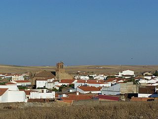
La Codosera is a municipality located in the province of Badajoz, Extremadura, Spain. According to the 2006 census (INE), the municipality has a population of 2,269 inhabitants. It is located close to the international border with Portugal at the eastern end of the Serra de São Mamede.
Fuente del Arco is a municipality located in the province of Badajoz, Extremadura, Spain. According to the 2005 census (INE), the municipality has a population of 754 inhabitants.
Garbayuela is a municipality located in the province of Badajoz, Extremadura, Spain. According to the 2006 census (INE), the municipality had a population of 531.

Montemolín is a municipality located in the province of Badajoz, Extremadura, Spain. According to the 2005 census (INE), the municipality has a population of 1582 inhabitants.

Puebla de Obando is a municipality located in the province of Badajoz, Extremadura, Spain. According to the 2005 census (INE), the municipality has a population of 2033 inhabitants. It is the birthplace of former Real Madrid and now Deportivo Alavés goalkeeper, Fernando Pacheco Flores.

Santa Amalia is a municipality located in the province of Badajoz, Extremadura, Spain. According to the 2018 census (INE), the municipality has a population of 4,059 inhabitants.

Talarrubias is a municipality located in the province of Badajoz, Extremadura, Spain. According to the 2005 census (INE), the municipality has a population of 3216 inhabitants.
Valencia del Ventoso is a municipality located in the province of Badajoz, Extremadura, Spain. According to the 2006 census (INE), the municipality has a population of 2,325 inhabitants.

Villar de Rena is a municipality located in the province of Badajoz, Extremadura, Spain. According to the 2006 census (INE), the municipality has a population of 1506 inhabitants.

Acedera is a Spanish municipality in the province of Badajoz, Extremadura. It has a population of 842 (2007) and an area of 82.5 km2.
Navalvillar de Pela is a Spanish municipality in the province of Badajoz, Extremadura. It has a population of 4,816 (2007) and an area of 251.2 km2.
Rena is a Spanish municipality in the province of Badajoz, Extremadura. It has a population of 650 (2007) and an area of 10.8 km².

Villar del Rey is a Spanish municipality in the province of Badajoz, Extremadura. It has a population of 2,540 (2007) and an area of 98.9 km2.

Villarta de los Montes is a Spanish municipality in the province of Badajoz, Extremadura. It has a population of 595 (2007) and an area of 123.3 km².