Castilblanco

Last updated
Castilblanco
Bandera de Castilblanco Badajoz.svg
Escudo de Castilblanco.svg
Spain Extremadura location map.svg
Red pog.svg
Castilblanco
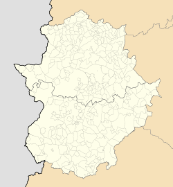
Location of Castilblanco within Extremadura
Coordinates: 39°18′20″N05°06′37″W / 39.30556°N 5.11028°W / 39.30556; -5.11028 Coordinates: 39°18′20″N05°06′37″W / 39.30556°N 5.11028°W / 39.30556; -5.11028
Country Flag of Spain.svg  Spain
Autonomous community Flag of Extremadura with COA.svg  Extremadura
Province Badajoz
Founded12th century
Government
  Type Mayor–council
  BodyAyuntamiento de Castilblanco
   Mayor Rafael Delgado (PSOE)
Area
  Total1,316 km2 (508 sq mi)
Elevation
501 m (1,644 ft)
Population
 (2018) [1]
  Total972
  Density0.74/km2 (1.9/sq mi)
Demonym(s) castilblanqueño (m), castilblanqueña (f)
Time zone UTC+1 (CET)
  Summer (DST) UTC+2 (CEST)
Postal code
06680
Website www.castilblanco.es

Castilblanco is a municipality located in the province of Badajoz, Extremadura, Spain. According to the 2005 census (INE), the municipality has a population of 1146 inhabitants.

Contents

Toponymy

Engraving with a hypothetical shape of the original fortress. Fortaleza templaria de Castilblanco.jpg
Engraving with a hypothetical shape of the original fortress.

There is no accord about the origins of the name of Castilblanco, but it is known that it is related to an ancient castle located where the San Cristóbal church is located nowadays. It is not known who built the castle. They could have been Arabs or Christians in the beginnings of 12th century, during the Reconquista. Many historians argue both that Castilblanco was a Templar enclave and that it would have been known as castillo blanco (white castle) or castillo de los blancos because of the colour of the robe that the Templars wore. [2]

Symbols

The official symbol of Castilblanco is its coat of arms. Within it there are represented a castle -in memory of the town's origins- an oak and olive -the most common trees in the surroundings-, the villa declaration -by which Castilblanco got sovereignty in 1554- and a rock-rose flower, in memory of the comarca of La Jara (The Rock-Rose), to which Castilblanco belonged until its incorporation to the province of Badajoz after the fall of the Old Regime.

The coat of arms was approved by a decree of the Extremadura Government in 1986, and it is officially described as follows:

Escudo Cuartelado, trayendo: 1ª, de gules, un castillo árabe de plata. 2ª de plata, un olivo de sinople. 3ª, también de plata, una encina de sinople. 4ª, de azur, una cartela de plata con la leyenda "Declaración de Villa por Carlos I, año de 1554", en letras de sable. Sobre el todo una flor de jara. Al timbre, corona mural de villa. [3]

Physical geography

Location

The municipality is located within the comarca of La Siberia, which borders with the provinces of Cáceres, Ciudad Real and Toledo. The town is built on a hill southern the Guadalupe Range -which belongs to the Toledo Mountains- and between the Guadiana and Guadalupe rivers. The town belongs to the judicial district of Herrera del Duque.

Orography

The urban area is located on a hill which rises above the surroundings countryside. The northern area of the municipality consists of a wide raña soil, undermined by narrow valleys with north-south orientation. These valleys are formed by the streams which flow north. These empty into both the Guadiana and Guadalupe rivers. The eastern area of the municipality has the most irregular relief, while both the western and southern countryside consists generally of fields with gentle slopes.

At the boundaries of the municipality are located several ranges which are visible from the urban centre. These ranges belong to the Toledo Mountains, which surround the town on the northern, eastern and southern sides. The ranges located north of the municipality are highest in altitude. Amongst these the highest are the Guadalupe Range, the Altamira Range and the Villuercas Range. The latter reaches 1600 meters. The land extending to the east is very irregular although it is of lower altitudes (around 700 meters at its highest points). In this area there highlight some ranges like Rinconada Range, Palomera Range and Umbría Range. The southern boundary of the municipality, where both the Guadiana and Guadalupe rivers converge, is also a mountainous terrain bounded by the ranges of Barbas de Oro, Pastillos, Chimenea, Escorial, Villares y Golondrinos. All these ranges are of similar altitudes as those to the east.

History

In April 1556 Castilblanco was granted the formal title of Villa (town) by King Carlos I, at the request of the Archbishop of Toledo. The population at that time totaled 296 households. Castilblanco had previously been considered an extension of neighboring Talavera.

In December 1931, eight months after the establishment of the Second Spanish Republic, Castilblanco was the scene of a violent and unexpected incident. At the time it was a pueblo (village) of about 900 reasonably prosperous inhabitants and had no record of political or social unrest. Permission was however refused by the authorities when local socialist leaders proposed a demonstration (the second of two) against the civil governor of Badajoz. The socialist rally went ahead and the Civil Guard detachment based in the village intervened to disperse it at the instructions of the mayor of the municipality. A crowd of villagers confronted the civil guards who, as elsewhere in rural Spain, were resented as an unpopular and repressive force deliberately recruited from outside the region where they were stationed. After a shot was fired, the four civil guards present were knifed to death and their bodies mutilated. It was not possible to identify the actual killers, although six villagers were subsequently sentenced to life imprisonment. [4] The incident was the first of a series of disturbances that led up to the outbreak of the Spanish Civil War in 1936.

Notes

  1. Municipal Register of Spain 2018. National Statistics Institute.
  2. Andando por Castilblanco: Historia
  3. DOE núm. 64 MARTES, 5 DE AGOSTO DE 1986 Orden de 22 de julio de 1986, por la que se aprueba el Escudo Heráldico Municipal para el Ayuntamiento de Castilblanco.
  4. Hugh Thomas, pages 74-75 "The Spanish Civil War", Penguin Books 2003

Related Research Articles

<span class="mw-page-title-main">Badajoz</span> Municipality in Extremadura, Spain

Badajoz is the capital of the Province of Badajoz in the autonomous community of Extremadura, Spain. It is situated close to the Portuguese border, on the left bank of the river Guadiana. The population in 2011 was 151,565.

<span class="mw-page-title-main">Extremadura</span> Autonomous community of Spain

Extremadura is an autonomous community of Spain. Its capital city is Mérida, and its largest city is Badajoz. Located in the central-western part of the Iberian Peninsula, it is crossed from east to west by the Tagus and Guadiana rivers. The autonomous community is formed by the two largest provinces of Spain: Cáceres and Badajoz. Extremadura is bordered by Portugal to the west and by the autonomous communities of Castile and León (north), Castilla–La Mancha (east) and Andalusia (south).

<span class="mw-page-title-main">Mérida, Spain</span> Municipality in Extremadura, Spain

Mérida is a city and municipality of Spain, part of the Province of Badajoz, and capital of the autonomous community of Extremadura. Located in the western-central part of the Iberian Peninsula at 217 metres above sea level, the city is crossed by the Guadiana and Albarregas rivers. The population was 60,119 in 2017.

<span class="mw-page-title-main">Province of Ciudad Real</span> Province of Spain

The province of Ciudad Real is a province in the southwestern part of the autonomous community of Castile-La Mancha, Spain. It is bordered by the provinces of Cuenca, Albacete, Jaén, Córdoba, Badajoz, and Toledo. It is partly located in the old natural region of La Mancha. Its capital is Ciudad Real. It is the third largest province by area in all of Spain, after Cáceres and Badajoz. The historic comarca Campo de Calatrava is located in the center of the province.

<span class="mw-page-title-main">Province of Badajoz</span> Province of Spain

The province of Badajoz is a province of western Spain located in the autonomous community of Extremadura. It was formed in 1833. It is bordered by the provinces of Cáceres in the north, Toledo, Ciudad Real in the east, Córdoba in the south-east, Seville, and Huelva in the south and Portugal in the west.

<span class="mw-page-title-main">Olivenza</span> Municipality in Extremadura, Spain

Olivenza or Olivença is a town in southwestern Spain, near the Portuguese border. It is a municipality belonging to the province of Badajoz, and to the wider autonomous community of Extremadura.

<span class="mw-page-title-main">Logrosán</span> Municipality in Extremadura, Spain

Logrosán is a municipality within the province of Cáceres in Extremadura, Spain. It is the capital of the administrative and commercial sub-area of Don Benito-Villanueva. Logrosán was an important and growing community in the first half of the 20th century. The area was once home to a population of over 8,000 due to its large role in the Mining industry during the 19th and 20th centuries. It is currently administered by the City Council of Logrosán.

<span class="mw-page-title-main">Pueblonuevo del Guadiana</span> Municipality in Extremadura, Spain

Pueblonuevo del Guadiana, also shortened as Pueblonuevo, is a Spanish town and municipality in the province of Badajoz, Extremadura. It has a population of 2,046 and an area of 30,95 km².

<span class="mw-page-title-main">Retamal de Llerena</span> Place in Extremadura, Spain

Retamal de Llerena is a municipality located in the province of Badajoz, Extremadura, Spain. According to the 2008 census (INE), it has a population of 497 people.

<span class="mw-page-title-main">Coat of arms of Extremadura</span> Coat of arms of a Spanish autonomous community

The coat of arms of the Extremadura is described in the Title I of the Spanish Law 4 of June 3, 1985, the Law of the coat of arms, flag and regional day of Extremadura.

<span class="mw-page-title-main">Sierra Suroeste</span> Comarca in Extremadura, Spain

Sierra Suroeste is a comarca located in southwestern province of Badajoz in the autonomous community of Extremadura, western Spain. Its capital and largest city is Jerez de los Caballeros.

<span class="mw-page-title-main">La Siberia</span> Comarca in Extremadura, Spain

La Siberia is a comarca in the northeastern portion of the province of Badajoz in the autonomous community of Extremadura, Spain. Its capital is the municipality of Herrera del Duque. The comarca is bordered to the north by the provinces of Cáceres and Toledo, on the west by Las Vegas Altas comarca, on the south by La Serena comarca, and on the east by the province of Ciudad Real. The district contains 18 municipalities with a combined area of 2,943 km2 (1,136 sq mi) and a population of 29,214 people.

<span class="mw-page-title-main">Montes de Toledo</span>

The Montes de Toledo are one of the main systems of mountain ranges in the Iberian Peninsula. They divide the drainage basin of the Tagus from the basin of the Guadiana. The highest peak is 1,603 m (5,259 ft) high La Villuerca.

<span class="mw-page-title-main">Las Villuercas</span> Comarca in Extremadura, Spain

Las Villuercas is a comarca located in the province of Cáceres, western Spain. It belongs to the Autonomous Community of Extremadura.

<span class="mw-page-title-main">Sierra de Villuercas</span>

Sierra de Villuercas or Sierra de las Villuercas, also known as Sierra de Guadalupe after nearby Guadalupe town, is a mountain range in the greater Montes de Toledo range, Spain. It is located in province of Cáceres, autonomous community of Extremadura.

<span class="mw-page-title-main">Battle of the Merida pocket</span>

The battle of the Mérida pocket, also known as the closing of the Mérida pocket, was an action that took place during the Spanish Civil War in July 1938 in La Serena zone of Badajoz Province. A swift and decisive operation, it was masterminded and carried out by the Francoist military and ended up becoming a bloodbath for the Republican troops.

<span class="mw-page-title-main">Tierra de Barros</span> Comarca in Extremadura, Spain

Tierra de Barros is a comarca in the province of Badajoz, Extremadura, Spain. Its capital and administrative center is Almendralejo. The comarca contains 15 municipalities and 74,872 inhabitants.

<span class="mw-page-title-main">Sierra de Montánchez</span>

Sierra de Montánchez is a mountain range in the greater Montes de Toledo range, Spain. It is named after nearby Montánchez town, the capital of the Tierra de Montánchez comarca, located on its slopes. This range gives its name to the Mancomunidad Integral Sierra de Montánchez.

<span class="mw-page-title-main">Sierra de San Pedro</span>

Sierra de San Pedro is a mountain range in the greater Montes de Toledo range, Spain. It is named after Saint Peter the apostle and rises in the limits of Cáceres and Badajoz Provinces, in the western part of the autonomous community of Extremadura close to its border with Portugal. This range gives its name to the Sierra de San Pedro - Los Baldíos comarca.

Guadiana, is a Spanish town and municipality of the Province of Badajoz, in the autonomous community of Extremadura. The municipality covers an area of 30.05 square kilometres (11.60 sq mi) and as of 2015 had a population of 2,527 people.