Calape | |
---|---|
Municipality of Calape | |
Center of Calape | |
Map of Bohol with Calape highlighted | |
Location within the Philippines | |
Coordinates: 9°53′N123°53′E / 9.88°N 123.88°E Coordinates: 9°53′N123°53′E / 9.88°N 123.88°E | |
Country | |
Region | Central Visayas (Region VII) |
Province | Bohol |
District | 1st District |
Founded | 1802 |
Barangays | 33 (see Barangays) |
Government | |
• Type | Sangguniang Bayan |
• Mayor | Nelson N. Yu |
• Vice Mayor | Sulpicio N. Yu Jr. |
• Congressman | Edgardo M. Chatto |
• Electorate | 22,474 voters (2019) |
Area | |
• Total | 75.36 km2 (29.10 sq mi) |
Population (2015 census) [3] | |
• Total | 30,863 |
• Density | 410/km2 (1,100/sq mi) |
• Households | 7,396 |
Economy | |
• Income class | 3rd municipal income class |
• Poverty incidence | 22.7% (2015) [4] |
• Revenue | ₱100,984,244.84 (2016) |
Time zone | UTC+8 (PST) |
ZIP code | 6328 |
PSGC | |
IDD : area code | +63 (0)38 |
Climate type | tropical monsoon climate |
Native languages | Boholano dialect Cebuano Tagalog |
Patron saint | Vincent Ferrer |
Calape, officially the Municipality of Calape (Cebuano : Lungsod sa Calape; Tagalog : Bayan ng Calape), is a 3rd class municipality in the province of Bohol, Philippines. According to the 2015 census, it has a population of 30,863 people. [3]
Located 41 kilometres (25 mi) north of Tagbilaran, the first settlers of Calape were said to be migrants from Cebu, and from other municipalities of Bohol.
Its name is derived from cape, referring to either a species of rattan or to the local varietal of coffee, Kape Barako, both of which still grow abundantly there to this day. [5]
By the time Spaniards arrived, there was already a native settlement in Calape. In 1802, the Spanish governor of Cebu established it as an independent municipality.
In 1957, Abucayan Norte was created from the sitios of Cabulihan and Cabinong, and Abucayan Sur from the sitios of Rama and Bino. The sitios of Binogawan, Masonoy, Bentig, Cahayag, and Lawis were also constituted into barrios.
The town center faces the Cebu Strait on the western side of Bohol Island, about 41 kilometres (25 mi) from Tagbilaran. The jurisdiction of Calape includes the islands of Pangangan (eight barangays) and Mantatao, as well as two uninhabited islets, Poom Island and Basihan Island.
There are four rivers that flow through the territory: Tultugan and Liboron Rivers that drain into Calape Bay, and Calunasan and Abucayan Norte Rivers that drain into Tipcan Bay.
Most of the coastal area is a fairly level plain that gradually rises into rolling hills of coralline limestone. The highest point in Calape is Mount Candungao in the eastern portion of the town, with an elevation of 150 metres (500 ft) above sea level. [6]
Calape comprises 33 barangays, of which 18 are coastal.
PSGC | Barangay | Population | ±% p.a. | |||
---|---|---|---|---|---|---|
2015 [3] | 2010 [7] | |||||
071210001 | Abucayan Norte | 4.5% | 1,402 | 1,326 | 1.07% | |
071210002 | Abucayan Sur | 3.0% | 912 | 786 | 2.87% | |
071210003 | Banlasan | 2.4% | 736 | 755 | −0.48% | |
071210004 | Bentig | 6.3% | 1,949 | 1,797 | 1.56% | |
071210005 | Binogawan | 1.4% | 428 | 466 | −1.61% | |
071210006 | Bonbon | 4.2% | 1,296 | 1,222 | 1.13% | |
071210007 | Cabayugan | 3.0% | 920 | 880 | 0.85% | |
071210008 | Cabudburan | 1.6% | 507 | 548 | −1.47% | |
071210009 | Calunasan | 2.3% | 718 | 798 | −1.99% | |
071210010 | Camias | 1.5% | 468 | 505 | −1.44% | |
071210011 | Canguha | 1.0% | 300 | 283 | 1.12% | |
071210012 | Catmonan | 4.4% | 1,354 | 1,221 | 1.99% | |
071210013 | Desamparados (Poblacion) | 2.5% | 786 | 880 | −2.13% | |
071210014 | Kahayag | 1.7% | 530 | 512 | 0.66% | |
071210015 | Kinabag‑an | 2.1% | 639 | 511 | 4.35% | |
071210016 | Labuon | 1.8% | 542 | 562 | −0.69% | |
071210017 | Lawis | 2.1% | 635 | 617 | 0.55% | |
071210018 | Liboron | 4.7% | 1,453 | 1,434 | 0.25% | |
071210019 | Lo‑oc | 1.5% | 458 | 506 | −1.88% | |
071210020 | Lomboy | 1.6% | 488 | 490 | −0.08% | |
071210021 | Lucob | 4.6% | 1,431 | 1,330 | 1.40% | |
071210022 | Madangog | 2.3% | 724 | 622 | 2.93% | |
071210023 | Magtongtong | 2.1% | 639 | 404 | 9.12% | |
071210024 | Mandaug | 4.4% | 1,358 | 1,451 | −1.25% | |
071210025 | Mantatao | 2.8% | 849 | 967 | −2.45% | |
071210027 | Sampoangon | 1.3% | 407 | 373 | 1.67% | |
071210028 | San Isidro | 7.1% | 2,195 | 2,412 | −1.78% | |
071210029 | Santa Cruz (Poblacion) | 8.4% | 2,590 | 2,401 | 1.45% | |
071210030 | Sojoton | 1.6% | 491 | 664 | −5.59% | |
071210031 | Talisay | 1.5% | 470 | 415 | 2.40% | |
071210032 | Tinibgan | 2.2% | 685 | 733 | −1.28% | |
071210033 | Tultugan | 2.9% | 900 | 830 | 1.55% | |
071210034 | Ulbujan | 5.2% | 1,603 | 1,445 | 2.00% | |
Total | 30,863 | 30,146 | 0.45% |
Climate data for Calape, Bohol | |||||||||||||
---|---|---|---|---|---|---|---|---|---|---|---|---|---|
Month | Jan | Feb | Mar | Apr | May | Jun | Jul | Aug | Sep | Oct | Nov | Dec | Year |
Average high °C (°F) | 28 (82) | 28 (82) | 29 (84) | 31 (88) | 31 (88) | 30 (86) | 30 (86) | 30 (86) | 30 (86) | 29 (84) | 29 (84) | 28 (82) | 29 (85) |
Average low °C (°F) | 23 (73) | 23 (73) | 23 (73) | 23 (73) | 24 (75) | 24 (75) | 24 (75) | 24 (75) | 24 (75) | 24 (75) | 24 (75) | 23 (73) | 24 (74) |
Average precipitation mm (inches) | 98 (3.9) | 82 (3.2) | 96 (3.8) | 71 (2.8) | 104 (4.1) | 129 (5.1) | 101 (4.0) | 94 (3.7) | 99 (3.9) | 135 (5.3) | 174 (6.9) | 143 (5.6) | 1,326 (52.3) |
Average rainy days | 18.0 | 14.1 | 17.1 | 16.8 | 23.7 | 25.7 | 25.8 | 23.3 | 24.2 | 25.9 | 24.0 | 20.6 | 259.2 |
Source: Meteoblue (Use with caution: this is modeled/calculated data, not measured locally.) [8] |
|
| ||||||||||||||||||||||||||||||||||||||||||||||||
Source: Philippine Statistics Authority [3] [7] [9] [10] |
92% of Calape's population is Roman Catholic. The remaining 8% is divided among other religious groups.
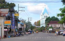
Tagbilaran, officially the City of Tagbilaran, is a component city and capital of the province of Bohol, Philippines. According to the 2015 census, it has a population of 105,051 people.
Asturias, officially the Municipality of Asturias, is a 3rd class municipality in the province of Cebu, Philippines. According to the 2015 census, it has a population of 47,857 people.
Pilar, officially the Municipality of Pilar, is a 5th class municipality in the province of Cebu, Philippines. According to the 2015 census, it has a population of 11,308 people.
Larena, officially the Municipality of Larena, is a 5th class municipality in the province of Siquijor, Philippines. According to the 2015 census, it has a population of 13,847 people.
Alicia, officially the Municipality of Alicia, is a 4th class municipality in the province of Bohol, Philippines. According to the 2015 census, it has a population of 23,517 people.
Antequera, officially the Municipality of Antequera, is a 4th class municipality in the province of Bohol, Philippines. According to the 2015 census, it has a population of 14,425 people.
Baclayon, officially the Municipality of Baclayon, is a 4th class municipality in the province of Bohol, Philippines. According to the 2015 census, it has a population of 20,591 people.
Bien Unido, officially the Municipality of Bien Unido, is a 4th class municipality in the province of Bohol, Philippines. According to the 2015 census, it has a population of 27,115 people.
Buenavista, officially the Municipality of Buenavista, is a 4th class municipality in the province of Bohol, Philippines. According to the 2015 census, it has a population of 27,261 people.
Dauis, officially the Municipality of Dauis, is a 4th class municipality in the province of Bohol, Philippines. According to the 2015 census, it has a population of 45,663 people.
Jagna, officially the Municipality of Jagna, is a 3rd class municipality in the province of Bohol, Philippines. According to the 2015 census, it has a population of 33,892 people.
Loay, officially the Municipality of Loay, is a 5th class municipality in the province of Bohol, Philippines. According to the 2015 census, it has a population of 16,691 people.
Loon, officially the Municipality of Loon, is a 2nd class municipality in the province of Bohol, Philippines which was established in 1753. According to the 2015 census, it has a population of 43,034 people.
Mabini, officially the Municipality of Mabini, is a 4th class municipality in the province of Bohol, Philippines. According to the 2015 census, it has a population of 27,171 people.
Sagbayan, officially the Municipality of Sagbayan, is a 4th class municipality in the province of Bohol, Philippines. According to the 2015 census, it has a population of 22,339 people.
San Miguel, officially the Municipality of San Miguel, is a 4th class municipality in the province of Bohol, Philippines. According to the 2015 census, it has a population of 24,135 people.
Sierra Bullones, officially the Municipality of Sierra Bullones, is a 3rd class municipality in the province of Bohol, Philippines. According to the 2015 census, it has a population of 24,745 people.
Sikatuna, officially the Municipality of Sikatuna, is a 5th class municipality in the province of Bohol, Philippines. According to the 2015 census, it has a population of 6,726 people.
Tubigon, officially the Municipality of Tubigon, is a 1st class municipality in the province of Bohol, Philippines. According to the 2015 census, it has a population of 45,893 people.
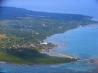
Central Visayas is an administrative region in the Philippines, numerically designated as Region VII. It consists of four provinces and three highly urbanized cities. Major islands are the eponymous Cebu, Bohol, and Siquijor, together with the eastern part of Negros. The regional center and largest city is Cebu City. The region is dominated by the native speakers of four Visayan languages: Cebuano, Bantayanon, Boholano, and Porohanon. The land area of the region is 15,895.66 km2 (6,137.35 sq mi), and with a population of 7,396,898 inhabitants, it is the second most populous region in the Visayas.
Wikimedia Commons has media related to Calape, Bohol . |