Alburquerque | |
|---|---|
| Municipality of Alburquerque | |
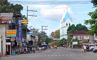
 Sta Monica church | |
 Flag | |
 Map of Bohol with Alburquerque highlighted | |
OpenStreetMap  | |
 Alburquerque Location within the Philippines | |
| Coordinates: 9°36′38″N123°57′18″E / 9.610447°N 123.954889°E | |
| Country | Philippines |
| Region | Central Visayas |
| Province | Bohol |
| District | 1st district |
| Founded | 9 June 1868 |
| Barangays | 11 (see Barangays) |
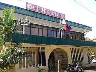
| Government | |
| • Type | Sangguniang Bayan |
| • mayor of Alburquerque [*] | Don Ritchie P. Bualan, CPA |
| • Vice Mayor | Engr. Juan Cayetano "Bong" G. Doria Jr. |
| • Representative | Edgardo M. Chatto |
| • Municipal Council | Members |
| • Electorate | 7,775 voters (2022) |
| Area | |
| • Total | 26.98 km2 (10.42 sq mi) |
| Elevation | 42 m (138 ft) |
| Highest elevation | 272 m (892 ft) |
| Lowest elevation | 0 m (0 ft) |
| Population (2020 census) [3] | |
| • Total | 11,246 |
| • Density | 420/km2 (1,100/sq mi) |
| • Households | 2,589 |
| Demonyms | Alburanon Alburquerqueño |
| Economy | |
| • Income class | 5th municipal income class |
| • Poverty incidence | 16.91 % (2021) [4] |
| • Revenue | ₱ 76.99 million (2020), 32.96 million (2012), 36.06 million (2013), 40.46 million (2014), 45.4 million (2015), 49.48 million (2016), 55.72 million (2017), 64.4 million (2018), 67.48 million (2019) |
| • Assets | ₱ 228.1 million (2020), 49.45 million (2012), 56.27 million (2013), 62.03 million (2014), 82.82 million (2015), 107.1 million (2016), 133.1 million (2017), 144.1 million (2018), 171.2 million (2019) |
| • Expenditure | ₱ 61.25 million (2020), 30.18 million (2012), 29.55 million (2013), 30.62 million (2014), 33.8 million (2015), 41.84 million (2016) |
| • Liabilities | ₱ 43.66 million (2020), 12.47 million (2012), 15.06 million (2013), 15.28 million (2014), 26.64 million (2015), 43.04 million (2016), 55.54 million (2017), 44.69 million (2018), 49.34 million (2019) |
| Service provider | |
| • Electricity | Bohol 1 Electric Cooperative (BOHECO 1) |
| Time zone | UTC+8 (PST) |
| ZIP code | 6302 |
| PSGC | |
| IDD : area code | +63 (0)38 |
| Native languages | Boholano dialect Cebuano Tagalog |
| Patron saint | Monica of Hippo |
| Website | www |
Alburquerque, officially the Municipality of Alburquerque ( /ˈælbɜːrˌkɜːrki/ AL-bur-ker-ke; Cebuano : Munisipalidad sa Alburquerque; Tagalog : Bayan ng Alburquerque), is a 5th class municipality in the province of Bohol, Philippines. It had a population of 11,246 people at the time of the 2020 census. [3]
Contents
- Etymology
- History
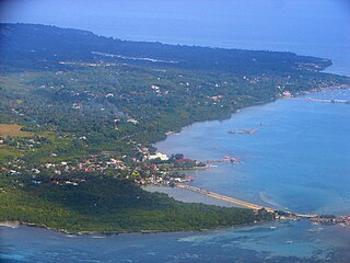
- Geography
- Physiography
- Rivers and river basins
- Climate
- Barangays
- Demographics
- Economy
- Cottage industries
- Tourism
- Municipal Marine Sanctuary
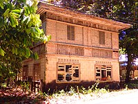
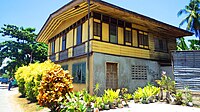
- Heritage
- Church and convent
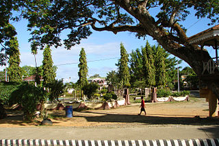
- Local government
- Infrastructure
- Waterworks
- Education
- Notes
- References
- Sources
- External links
The town is colloquially known as "Albur" for short. [5]
Formerly, Alburquerque had one of the longest and heaviest pythons in captivity, with a length of 23 ft (7.0 m), weighing 620 lb (280 kg) and with a girth of 34 in (860 mm). This female python died in 2013, [6] but the mounted creature is still exhibited.