Jagna

Last updated
Jagna
Municipality of Jagna
Jagna Bohol 2.jpg
Jagna Town Hall
Flag of Jagna, Bohol.png
Ph seal Jagna, Bohol.png
Ph locator bohol jagna.png
Map of Bohol with Jagna highlighted
OpenStreetMap
Jagna
Philippines location map (square).svg
Red pog.svg
Jagna
Location within the Philippines
Coordinates: 9°39′N124°22′E / 9.65°N 124.37°E / 9.65; 124.37
Country Philippines
Region Central Visayas
Province Bohol
District 3rd district
Founded 29 September 1631
Barangays 33 (see Barangays)
Government
[1]
  Type Sangguniang Bayan
   Mayor Mark Louie R. Monungolh
   Vice Mayor Derrick C. Virtudazo
   Representative Kristine Alexie B. Tutor
   Municipal Council
Members
  • Bonifacio J. Virtudes, Jr.
  • Jema Pagulon-Virtudes
  • Rodrigo B. Lloren
  • Anthony R. Aniscal
  • Gevelo B. Aceron
  • Emmanuel Jude S. Bernido
  • Yvonne G. Acera
  • Alfeo S. Tadena, Jr.
  • NBCOMELEC [2]
   Electorate 24,536 voters (2025)
Area
[3]
  Total
168.49 km2 (65.05 sq mi)
Elevation
106 m (348 ft)
Highest elevation
641 m (2,103 ft)
Lowest elevation
0 m (0 ft)
Population
 (2024 census) [4]
  Total
36,674
  Density220/km2 (560/sq mi)
   Households
8,381
Economy
   Income class 3rd municipal income class
   Poverty incidence
37.56
% (2021) [5]
   Revenue 224.4 million (2022)
   Assets 415.5 million (2022)
   Expenditure 180.3 million (2022)
   Liabilities 71.78 million (2022)
Service provider
  ElectricityBohol 2 Electric Cooperative (BOHECO 2)
Time zone UTC+8 (PST)
ZIP code
6308
PSGC
IDD : area code +63(0)38
Native languages Boholano dialect
Cebuano
Tagalog

Jagna, officially the Municipality of Jagna (Cebuano : Munisipalidad sa Jagna; Tagalog : Bayan ng Jagna), is a municipality in the province of Bohol, Philippines. According to the 2020 census, it has a population of 35,832 people. [6]

Contents

The town celebrates St. Michael's festival on September 29. [7] Highlights are cultural activities such as parades and street dancing. The month of May is also of interest, especially to returning Jagna-born Filipinos from across the islands and abroad. Celebrations of barangay fiestas occur almost every day.

History

On January 24, 1744, an Italian Jesuit curate in-charge of the town parish was killed by a native insurgent known to be Francisco Dagohoy. This event signaled the beginning of the Dagohoy Rebellion – the longest uprising in Philippine history.

The Lonoy Massacre in 1901 was a bloody American surprise attack launched on Filipino insurgents – the latter being led by Captain Gregorio Caseñas [a] – which killed over 400, in the Philippine–American War. It was fought in the mountain village of Lonoy, north of the town proper.

A major earthquake devastated the town in 1990. The local residents were evacuated to the nearby hills for a few days, as local authorities warned of a possible tsunami that might hit the coastal area. However, such event did not happen. Some damage occurred to the church bell tower by the earthquake but has been completely repaired.

Jagna has a new market; the last one burned down in 1998 and a temporary market was set up in the grass field across the church. The new market is in operation – built on the site of the previous one that burned down. A recreational plaza is on the grass field that was once the temporary market area.

Geography

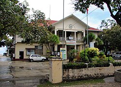
Jagna is located on the southern coast of Bohol. It is one of the commercial trading centers of the province with daily market and port operations. Of interest to visitors is the town church built during the Spanish era, with its ceiling frescoes and baroque architecture. A waterfall and a spring reservoir can be found on the highlands, accessible by road travel north. A marine sanctuary zone has been set up by the local government just off the shore. A double reef is protected inside the sanctuary zone and marked off by buoys to restrict access from fishers.

Like Tagbilaran, Jagna is a port town. Ferries travel daily to and from other islands. Routes to Mindanao are available via Cagayan de Oro and Butuan. The island of Camiguin is visible from Jagna and a ferry operates from Jagna to the port of Balbagon in peak seasons. Jagna is 68 kilometres (42 mi) from Tagbilaran.

Barangays

Map of Jagna showing its barangays Map of Jagna.png
Map of Jagna showing its barangays

Jagna is politically subdivided into 33 barangays. Each barangay consists of puroks and some have sitios.

PSGC Barangay Population ±% p.a.
2024 [8] 2010 [9]
071225001 Alejawan 2.2% 817 843 −0.22%
071225002 Balili 3.4% 1,233 1,263 −0.17%
071225003 Boctol 3.0% 1,103 1,023 0.53%
071225005 Bunga Ilaya 2.7% 994 816 1.39%
071225006 Bunga Mar 4.0% 1,459 1,385 0.37%
071225004 Buyog 0.9% 344 386 −0.80%
071225007 Cabungaan 3.7% 1,344 1,179 0.92%
071225008 Calabacita 3.9% 1,419 1,362 0.29%
071225009 Cambugason 2.9% 1,071 993 0.53%
071225010 Canipol 1.4% 505 511 −0.08%
071225014 Canuba 1.0% 378 343 0.68%
071225015 Canupao 5.6% 2,067 2,037 0.10%
071225011 Canjulao 7.8% 2,870 2,752 0.29%
071225012 Cantagay 2.5% 915 834 0.65%
071225013 Cantuyoc 2.3% 830 884 −0.44%
071225016 Faraon 1.6% 581 547 0.42%
071225017 Ipil 0.9% 321 319 0.04%
071225018 Kinagbaan 1.3% 466 436 0.47%
071225019 Laca 0.7% 257 316 −1.44%
071225020 Larapan 2.1% 778 764 0.13%
071225021 Lonoy 3.5% 1,286 1,259 0.15%
071225022 Looc 2.0% 740 865 −1.09%
071225023 Malbog 2.9% 1,078 1,031 0.31%
071225024 Mayana 6.1% 2,235 1,482 2.92%
071225025 Naatang 1.6% 583 580 0.04%
071225026 Nausok 1.0% 349 348 0.02%
071225027 Odiong 2.7% 979 1,023 −0.31%
071225028 Pagina 3.5% 1,297 1,405 −0.56%
071225029 Pangdan 3.2% 1,177 1,197 −0.12%
071225030 Poblacion (Pondol) 2.4% 885 1,020 −0.99%
071225031 Tejero 3.9% 1,440 1,412 0.14%
071225032 Tubod Mar 1.5% 538 516 0.29%
071225033 Tubod Monte 4.2% 1,553 1,435 0.56%
Total36,67432,5660.84%

Climate

Climate data for Jagna, Bohol
MonthJanFebMarAprMayJunJulAugSepOctNovDecYear
Mean daily maximum °C (°F)28
(82)
29
(84)
30
(86)
31
(88)
31
(88)
30
(86)
30
(86)
30
(86)
30
(86)
29
(84)
29
(84)
29
(84)
30
(85)
Mean daily minimum °C (°F)23
(73)
22
(72)
23
(73)
23
(73)
24
(75)
25
(77)
24
(75)
24
(75)
24
(75)
24
(75)
23
(73)
23
(73)
24
(74)
Average precipitation mm (inches)102
(4.0)
85
(3.3)
91
(3.6)
75
(3.0)
110
(4.3)
141
(5.6)
121
(4.8)
107
(4.2)
111
(4.4)
144
(5.7)
169
(6.7)
139
(5.5)
1,395
(55.1)
Average rainy days18.614.816.516.723.926.425.624.124.426.323.720.5261.5
Source: Meteoblue [10]

Government

The municipality is governed by the Local Government Unit (LGU) of Jagna, which is headed by the Municipal Mayor. [11]

Demographics

Population census of Jagna
YearPop.±% p.a.
1903 4,331    
1918 6,643+2.89%
1939 12,384+3.01%
1948 15,804+2.75%
1960 12,177−2.15%
1970 14,338+1.65%
1975 15,903+2.10%
1980 16,769+1.07%
1990 21,135+2.34%
1995 23,927+2.35%
2000 26,826+2.48%
2007 27,852+0.52%
2010 32,566+5.86%
2015 33,892+0.76%
2020 35,832+1.18%
2024 36,674+0.56%
Source: Philippine Statistics Authority [13] [14] [9] [15] [16]

Economy

Poverty incidence of Jagna

10
20
30
40
2000
32.31
2003
19.81
2006
34.20
2009
36.43
2012
19.63
2015
23.32
2018
17.90
2021
37.56

Source: Philippine Statistics Authority [17] [18] [19] [20] [21] [22] [23] [24]

Education

Jagna as a key center for learning, the municipality boasts a cluster of respected educational institutions. It hosts many notable educational institutions in the southern part of Bohol including:

Notes

  1. who now features at the centre of the municipal seal

References

  1. Municipality of Jagna | (DILG)
  2. "2025 Election Results - Region VII - Bohol - Jagna". Commission on Elections (Philippines). May 12, 2025.[ permanent dead link ]
  3. "2015 Census of Population, Report No. 3 – Population, Land Area, and Population Density" (PDF). Philippine Statistics Authority. Quezon City, Philippines. August 2016. ISSN   0117-1453. Archived (PDF) from the original on May 25, 2021. Retrieved July 16, 2021.
  4. "2024 Census of Population (POPCEN) Population Counts Declared Official by the President". Philippine Statistics Authority. 17 July 2025. Retrieved 18 July 2025.
  5. "PSA Releases the 2021 City and Municipal Level Poverty Estimates". Philippine Statistics Authority. 2 April 2024. Retrieved 28 April 2024.
  6. "2024 Census of Population (POPCEN) Population Counts Declared Official by the President". Philippine Statistics Authority. 17 July 2025. Retrieved 18 July 2025.
  7. "Jagna Feast Dayof St. Michael the Archangel". www.bohol-philippines.com. Retrieved February 14, 2019.
  8. Census of Population (2020). "Region VII (Central Visayas)". Total Population by Province, City, Municipality and Barangay. Philippine Statistics Authority . Retrieved 8 July 2021.
  9. 1 2 Census of Population and Housing (2010). "Region VII (Central Visayas)" (PDF). Total Population by Province, City, Municipality and Barangay. National Statistics Office . Retrieved 29 June 2016.
  10. "Jagna: Average Temperatures and Rainfall". Meteoblue. Retrieved 9 May 2020.
  11. "About Jagna | Municipality of Jagna" . Retrieved 2024-04-29.
  12. Abante Jagna, Kumbati Sa Kalambuan (7 May 2025). "Kanhi Mayor sa Jagna Atty. Hitty Domingo Bagaipo(1972-1980)". Wayback Machine . Facebook. Archived from the original on 7 June 2025.
  13. "2024 Census of Population (POPCEN) Population Counts Declared Official by the President". Philippine Statistics Authority. 17 July 2025. Retrieved 18 July 2025.
  14. Census of Population (2015). "Region VII (Central Visayas)". Total Population by Province, City, Municipality and Barangay. Philippine Statistics Authority . Retrieved 20 June 2016.
  15. Censuses of Population (1903–2007). "Region VII (Central Visayas)". Table 1. Population Enumerated in Various Censuses by Province/Highly Urbanized City: 1903 to 2007. National Statistics Office.
  16. "Province of Bohol". Municipality Population Data. Local Water Utilities Administration Research Division. Retrieved 17 December 2016.
  17. "Poverty incidence (PI):". Philippine Statistics Authority. Retrieved December 28, 2020.
  18. "Estimation of Local Poverty in the Philippines" (PDF). Philippine Statistics Authority. 29 November 2005.
  19. "2003 City and Municipal Level Poverty Estimates" (PDF). Philippine Statistics Authority. 23 March 2009.
  20. "City and Municipal Level Poverty Estimates; 2006 and 2009" (PDF). Philippine Statistics Authority. 3 August 2012.
  21. "2012 Municipal and City Level Poverty Estimates" (PDF). Philippine Statistics Authority. 31 May 2016.
  22. "Municipal and City Level Small Area Poverty Estimates; 2009, 2012 and 2015". Philippine Statistics Authority. 10 July 2019.
  23. "PSA Releases the 2018 Municipal and City Level Poverty Estimates". Philippine Statistics Authority. 15 December 2021. Retrieved 22 January 2022.
  24. "PSA Releases the 2021 City and Municipal Level Poverty Estimates". Philippine Statistics Authority. 2 April 2024. Retrieved 28 April 2024.