Calcare di Sogno

Last updated
Calcare di Sogno
Stratigraphic range: Lower Toarcian-Late Bajocian
~182–169  Ma
Type Geological formation
Sub-unitsLivello a Pesci
Underlies Formazione delle Radiolariti
Overlies Calcare di Domaro, Calcare di Morbio, Unnamed limestones [note 1]
ThicknessTypically 120–140 m (390–460 ft)
East and west 70–100 m (230–330 ft)
Lithology
Primary Marl, marly limestone & abundance of clay
Secondary: Alternation of marly limestones and marls, presence of graded Chalcudites
Other Limestones with nodules of flint & subordinate marls
Location
Coordinates 45°48′N9°18′E / 45.8°N 9.3°E / 45.8; 9.3
Approximate paleocoordinates 33°24′N18°54′E / 33.4°N 18.9°E / 33.4; 18.9
Region Lecco Province
CountryFlag of Italy.svg  Italy
Type section
Named for Sogno
Named byGaetani & Poliani
Italy relief location map.jpg
Blue pog.svg
Calcare di Sogno (Italy)
Italy Lombardy location map.svg
Blue pog.svg
Calcare di Sogno (Lombardy)

The Calcare di Sogno ("Sogno Limestone"; also known as the Sogno Formation) is a geological formation in Italy, dated to roughly between 182-169 million years ago and covering the Lower Toarcian-Late Bajocian stagess of the Jurassic Period in the Mesozoic Era. [1] Thallatosuchian remains are known from the formation, as well fishes and other taxa. [2]

Contents

Description

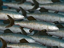
During the Early Jurassic, concretely towards the Toarcian, the Lombardy Basin became a relatively deep, fully pelagic area, located between the so called Lugano High, at the west, and the Trento Plateau to the east, with several troughs and palaeohighs (West to east: Monte Nudo Trough, Lugano High, Generoso Trough, Corni di Canzo High, Albenza Plateau, Monte Cavallo High, Sebino Trough and Botticino High). [3] The formation is characterized by a disposition of regional deposition equivalent to the German Posidonia Shale, with a benthonic setting and deposition trends, mostly populated by marine fauna. [4] The environment of the formation was related to a marginal marine deposit, with probably epicontinetal deposition from near land environments, being connected to the central European seas and the North African currents of the Toarcian. [5] The formation is linked with the Toarcian Anoxic Event, that is measured in the “Fish Level”, that is also the most fossiliferous section. [6]

Environment

Two cores, the Colle di Sogno and Gajum are among the best sections that recovered the ecological changes in the Pliensbachian-Toarcian Lombardy Basin. [7] Carbon-and oxygen-isotope data calibrated against nannofossil biostratigraphy has shown that the palaeobathymetry of the deposits was about 1000 and 1500 m, being the deepest records of the T-OAE in the western Tethyan region. [8] As the Sogno Formation was deposited mostly on a Pelagic setting, influenced by both the European and African bioregions, taxa of several provenance mix on this layers. The Nannofosil assemblage, that ranges from moderate/poor to good decreasing in the Toarcian AOE (drastic decrease in total abundance is observed in the Fish Level), includes the taxa Lotharingius (L. hauffii, L. sigillatus, L. crucicentralis, L. velatus), Discorhabdus ignotus, Diductius constans, Carinolithus (C. poulnabronei, C. superbus), Mitrolithus jansae and Watznaueria sp.1 in the Gajum Core, while the Sogno Core shows abundance of the genera Biscutum , Calyculus , Carinolithus and Crepidolithus , whereas Bussonius , Diductius , Similiscutum , Parhabdolithus and Tubirhabdus are extremely rare. [9] The overall structure of this microtaxa assemblage trends to suggest a correlation with the biohorizon seen in coeval layers in the Lusitanian Basin, where is observed a common trend in the Western Tethys of north-south migration pathway for several organisms, including calcareous nannoplankton and ammonites. [9]

A local index genus for environment evolution is Schizosphaerella spp. (specially S. punctulata), showing a lower valve size than in coeval layers on connected basins (Lusitanian and Paris Basins), as local result of the Lower Toarcian Jenkyns Event, indicating changues in ocean acidification and fertility rather than temperature. [10]

Fossil content

Ichnofossils

GenusSpeciesLocationMaterialTypeOriginNotesImages

Planolites [7]

  • Planolites isp.
  • Colle di Sogno

Cylindrical burrows

Pascichnia

  • Polychaetes

Burrow-like ichnofossils referred to vermiform deposit-feeders. Sometimes considered a junior synonym of Palaeophycus . [11]

Planolites fossil Planolites.jpg
Planolites fossil

Molluscs

GenusSpeciesStratigraphic positionMaterialNotesImages

Bositra [1] [4]

  • Bositra buchii
  • All the Formation

Shells

A posidoniid ostreoidan. The habitat and mode of life of Bositra has been debated for more than a century. There have been different interpretations, such as a pseudoplanktonic organism, [12] a benthic organism related to open marine floor, where it was the main inhabitant of the basinal settings, and a hybrid mode, where it has a life cycle with holopelagic reproduction controlled by the change on Oxygen levels, and even a chemosymbiotic lifestile, related to the large crinoid rafts, being the main "Safe conduct" to evade anoxic events. All the opinions along the years led to a large study in 1998, where the size/frequency distribution, the density of growth thanks to the lines related to the shell size and the position of the redox boundary by total organic carbon diagrams has revealed that Bositra probably had a benthic mode of life. [13]

Thousands of specimens in one matrix Bositra buchi 45.jpg
Thousands of specimens in one matrix

Collina [1] [4]

Collina gemma

  • Mount Brughetto
  • Mount Cornizzolo

Shells

A Dactylioceratidae ammonite. Present and abundant on the Mediterranean Toarcian realm.

Cornaptychus [1] [4]

Cornaptychus lythensis

  • Mount Brughetto
  • Mount Cornizzolo
Shells

An indeterminate ammonite. Some of the specimens found are very fragmentary, making its identification complex. [4]

Cornaptychus lythensis.jpg

Dactylioceras [1] [4]

Dactylioceras polymorphus

  • Mount Brughetto
  • Mount Cornizzolo
Shells

Type member Dactylioceratinae family of Ammonites. A common mediterranean genera, found on deposits along all europe.

Dactylioceras group.jpg

Harpoceras [1] [4]

Harpoceras sp.

  • Mount Brughetto
  • Mount Cornizzolo
Shells

Type reprensentative genus of the Harpoceratinae ammonite family

Harpoceras NT.jpg

Hildaites [1] [4]

Hildaites sp.

  • Mount Brughetto
  • Mount Cornizzolo
Shells

A Hildoceratidae ammonite

Hildaites fasciculatus.jpg

Mesodactylites [1] [4]

  • Mesodactylites sapphicus
  • Mesodactylites sp.
  • Mount Brughetto
  • Mount Cornizzolo
Shells

A Nodicoeloceratinae ammonite

Arthropods

GenusSpeciesStratigraphic positionMaterialNotesImages

?Antrimpos [14] [15]

?Antrimpos sp.

  • Mount Cornizzolo

1 complete specimen, MSNM i10852

A Penaeidae Decapodan.

Antrimpos undenarius detail 34.jpg

Archaeopalinurus [16]

Archaeopalinurus cfr. A. levis

  • Mount Cornizzolo

Various specimens

A Palinuroidean Decapodan.

Archaeopalinurus laevis Cene.JPG

Coleia [14]

Coleia cf.banzensis

  • Mount Cornizzolo

15 specimens, complete and incomplete

An Erymidae Decapodan.

?Etallonia [14] [15]

?Etallonia sp.

  • Mount Cornizzolo

Single Isolated chelae, MSNM i10855

An Axiidae Decapodan.

Etallonia raineralberti.JPG

Gabaleryon [15]

Gabaleryon garassinoi

  • Mount Brughetto
  • Mount Cornizzolo

Various specimens

A Coleiidae Decapodan. Was confussed with Proeryon hartmanni specimens.

Proeryon [1] [14] [16]

Proeryon hartmanni

  • Mount Brughetto
  • Mount Cornizzolo

Various specimens

An Erymidae Decapodan Crustacean, common on the mediterranean rocks.

Proeryon.JPG

Uncina [17]

Uncina cf.posidoniae

Uncina alpina

  • Mount Cornizzolo

Isolated chelae, MSNM i10851, il0863, i10864

An Astacidean Decapodan of the family Uncinidae. A large decapodan, with sizes up to 40 cm.

Uncina.JPG

Fish

GenusSpeciesStratigraphic positionMaterialNotesImages

Leptolepis [2] [18]

  • Leptolepis coryphaenoides
  • Leptolepis sp.

Monte Cornizzolo

+100 specimens

Type member of the family Leptolepidae inside Leptolepiformes. It is the most abundant fish found on the formation.

Leptolepis NT.jpg

Pachycormus [2] [18]

  • Pachycormus sp.

Monte Cornizzolo

Several Especimens

The main member of the family Pachycormidae inside Pachycormiformes. Large sized fish, able to reach near 1.4 m long.

Pachycormus.jpg

Pholidophorus [2] [18]

  • Pholidophorus sp.

Monte Cornizzolo

Several Especimens

Type member of the family Pholidophoridae inside Pachycormiformes. A small sized fish, mostly related to marine deposits, associated with various predatory behaviours, including coeloids and Crocodrylomorphs.

Pholidophorus NT.jpg

Crocodyliformes

GenusSpeciesLocationMaterialNotesImages

cf. Pelagosaurus [2]

cf. Pelagosaurus sp.

  • Monte Cornizzolo

Various specimens MSNM V4012, MSNM V4013.

A Thalattosuchian marine crocodrylomorph of the family Teleosauridae.The specimens found where of small size, with several characters such as opened neurocentral vertebral sutures and non sutured caudal pleurapophyses, that led to expeculate a possible juvenile or subadult status.

Pelagosaurus BW.jpg

Flora

Several plant leaves and fragments of wood were not identified. [18]

GenusSpeciesStratigraphic positionMaterialNotesImages

Ginkgo [14] [18]

  • Ginkgo digitata
  • Mount Brughetto
  • Mount Cornizzolo

Leaves

Affinities with the Ginkgoaceae. Arboreal plants related to the modern Ginkgo species.

Ginkgo digitata 2.jpg

Pagiophyllum [14] [18]

  • Pagiophyllum kurri
  • Mount Brughetto
  • Mount Cornizzolo

Leaves

Affinities with the Cheirolepidiaceae and Araucariaceae. Arbustive to arboreal plants with several leaf morphotypes, probably from nearshore environments.

Pagiophyllum rotzoanum.JPG

See also

Notes and references

Notes

  1. Bioturbed hazel-gray limestones in planar layers of about 20 cm, with concentration of gray flint and gray & reddish marls, along with calcareous marl. [1]

Related Research Articles

<span class="mw-page-title-main">Jurassic</span> Second period of the Mesozoic Era 201-145 million years ago

The Jurassic is a geologic period and stratigraphic system that spanned from the end of the Triassic Period 201.4 million years ago (Mya) to the beginning of the Cretaceous Period, approximately 145 Mya. The Jurassic constitutes the middle period of the Mesozoic Era and is named after the Jura Mountains, where limestone strata from the period were first identified.

<span class="mw-page-title-main">Tethys Ocean</span> Prehistoric ocean between Gondwana and Laurasia

The Tethys Ocean, also called the Tethys Sea or the Neo-Tethys, was a prehistoric ocean during much of the Mesozoic Era and early-mid Cenozoic Era. It was the predecessor to the modern Indian Ocean, the Mediterranean Sea, and the Eurasian inland marine basins.

The Toarcian is, in the ICS' geologic timescale, an age and stage in the Early or Lower Jurassic. It spans the time between 184.2 Ma and 174.7 ±0.8 Ma. It follows the Pliensbachian and is followed by the Aalenian.

<span class="mw-page-title-main">Posidonia Shale</span> Early Jurassic geological formation of south-western Germany

The Posidonia Shale geologically known as the Sachrang Formation, is an Early Jurassic geological formation of southwestern and northeast Germany, northern Switzerland, northwestern Austria, southern Luxembourg and the Netherlands, including exceptionally well-preserved complete skeletons of fossil marine fish and reptiles.

The Cenomanian-Turonian boundary event, also known as the Cenomanian-Turonian extinction, Cenomanian-Turonian Oceanic Anoxic Event, and referred to also as the Bonarelli Event or Level, was an anoxic extinction event in the Cretaceous period. The Cenomanian-Turonian oceanic anoxic event is considered to be the most recent truly global oceanic anoxic event in Earth's geologic history. There was a large carbon cycle disturbance during this time period, signified by a large positive carbon isotope excursion. However, apart from the carbon cycle disturbance, there were also large disturbances in the ocean's nitrogen, oxygen, phosphorus, sulphur, and iron cycles.

This list of fossil arthropods described in 2015 is a list of new taxa of trilobites, fossil insects, crustaceans, arachnids and other fossil arthropods of every kind that have been described during the year 2015. The list only includes taxa at the level of genus or species.

<span class="mw-page-title-main">Rotzo Formation</span> Jurassic geological formation in Italy

The Rotzo Formation is a geological formation in Italy, dating to roughly between 192 and 186 million years ago and covering the Pliensbachian stage of the Jurassic Period in the Mesozoic Era. Has been traditionally classified as a Sinemurian-Pliensbachian Formation, but a large and detailed dataset of isotopic 13C and 87Sr/86Sr data, estimated the Rotzo Formation to span only over the Early Pliensbachian, bracketed between the Jamesoni-Davoei biozones, marked in the Loppio Oolitic Limestone–Rotzo Fm contact by a carbon isotope excursion onset similar to the Sinemu-Pliens boundary event, while the other sequences fit with the a warm phase that lasts until the Davoei biozone. The Rotzo Formation represented the Carbonate Platform, being located over the Trento Platform and surrounded by the Massone Oolite, the Fanes Piccola Encrinite, the Lombadian Basin Medolo Group and Belluno Basin Soverzene Formation, and finally towards the south, deep water deposits of the Adriatic Basin. The also Pliensbachian Aganane Formation of Morocco represents a regional equivalent, both in deposition and faunal content.

<span class="mw-page-title-main">Paleobiota of the Posidonia Shale</span>

The Sachrang Formation or "Posidonienschiefer" Formation is a geological formation of southwestern Germany, northern Switzerland, northwestern Austria, southeast Luxembourg and the Netherlands, that spans about 3 million years during the Early Jurassic period. It is known for its detailed fossils, especially sea fauna, listed below. Composed mostly by black shale, the formation is a Lagerstätte, where fossils show exceptional preservation, with a thickness that varies from about 1 m to about 40 m on the Rhine level, being on the main quarry at Holzmaden between 5 and 14 m. Some of the preserved material has been transformed into fossil hydrocarbon Jet, specially wood remains, used for jewelry. The exceptional preservation seen on the Posidonia Shale has been studied since the late 1800s, finding that a cocktail of chemical and environmental factors let to such an impressive conservation of the marine fauna. The most common theory is the changes in the oxygen level, where the different anoxic events of the Toarcian left oxygen-depleted bottom waters, with the biota dying and falling to the bottom without any predator able to eat the dead bodies.

<span class="mw-page-title-main">Ciechocinek Formation</span> Jurassic geologic formation in Europe

The Ciechocinek Formation, known in Germany as the Green Series is a Jurassic geologic formation that extends across the Baltic coast, from Grimmen, Germany, to Lithuania, with its major sequence in Poland and a few boreholes in Kaliningrad. It represents the largest continental area defined as deltaic in the fossil record, estimated to cover ~7.1 × 100,000 km2 (39,000 sq mi) only in the Polish realm. It is mostly known by its diverse entomofauna, composed of more than 150 species of different groups of insects, as well its marine vertebrate fossils, including remains of sharks, actinopterygians and marine reptiles, along terrestrial remains of dinosaurs, including the early thyreophoran Emausaurus and others not yet assigned to a definite genus. Its exposures are mostly derived from active clay mining of a dislocated glacial raft with exposed Upper Pliensbachian to late Toarcian shallow-marine sediments. Starting with coarse and fine sand deposits with concretions, the pure clay of the Ciechocinek Formation, after the falciferum zone, was deposited in a restricted basin south of the Fennoscandian mainland. It hosts a layer full of carbonate concretions, where a great entomofauna is recovered.

<span class="mw-page-title-main">Marne di Monte Serrone</span> Geological formation in Italy

The Marne di Monte Serrone is a geological formation in Italy, dating to roughly between 181 and 178 million years ago, and covering the early and middle Toarcian stage of the Jurassic Period of central Italy. It is the regional equivalent to the Toarcian units of Spain such as the Turmiel Formation, units in Montenegro, such as the Budoš Limestone and units like the Tafraout Formation of Morocco.

<span class="mw-page-title-main">Budoš Limestone</span> Geological formation in Montenegro

The Budoš Limestone is a geological formation in Montenegro, dating to 180 million years ago, and covering the Toarcian stage of the Jurassic Period. It has been considered an important setting in Balkan paleontology, as it represents a unique terrestrial setting with abundant plant material, one of the few know from the Toarcian of Europe. It is the regional equivalent to the Toarcian units of Spain such as the Turmiel Formation, units like the Azilal Formation of Morocco and others from the Mediterranean such as the Posidonia Beds of Greece and the Marne di Monte Serrone of Italy. In the Adriatic section, this unit is an equivalent of the Calcare di Sogno of north Italy, as well represents almost the same type of ecosystem recovered in the older (Pliensbachian) Rotzo Formation of the Venetian region, know also for its rich floral record.

<span class="mw-page-title-main">Azilal Formation</span> Geological unit in Morocco

The Azilal Formation, also known as Toundoute Continental Series and Wazzant Formation, is a geological unit in the Azilal, Béni-Mellal, Imilchil, Zaouiat Ahansal, Ouarzazate, Tinerhir and Errachidia areas of the High Atlas of Morocco, that cover the Early Toarcian to Middle Aalenian stages of the Jurassic Period. While there have been atributions of it´s lowermost layers to the Latest Pliensbachian, the current oldest properly measured are part of the Earliest Toarcian regresion ("MRST10"), part of the Lower-Middle Palymorphum biozone. The Azilal Formation consists mainly of claystones rich in continental plant debris and laminated microbial facies. It is a continental deposit which overlies marine dolomites of equivalent age to the Rotzo Formation of Italy, mostly part of the Aganane Formation. The formation is best assigned to an alluvial environment occasionally interrupted by shallow marine incursions and marks a dramatic decrease of the carbonate productivity under increasing terrigenous sedimentation. Dinosaur remains, such the sauropod Tazoudasaurus and the basal ceratosaur Berberosaurus are known from the unit, along with several undescribed genera. The strata of the group extends towards the Central High Atlas, covering different anticlines, and topographic accidents along the range of the Mountains. Although new studies have suggested that the strata is coeval in age, and should be referred to as a unique unit. The toarcian High Atlas is divided in 5 units: the continental layers with paralic deposits belong to the Azilal, along the shoreface layers of the Tagoudite Formation and Tafraout Formation, both connected with the offshore Ait Athmane Formation and the deeper shelf deposits of the Agoudim 1 Formation.

<span class="mw-page-title-main">Krempachy Marl Formation</span> Geological formation in Poland and Slovakia

The Krempachy Marl Formation is a geological formation in Poland and Slovakia, dating to about 179 million years ago, and covering the middle Toarcian stage of the Jurassic Period. It is among the most important formations of the Toarcian boundary on the Carpathian realm, being the regional equivalent of the Posidonia Shale.

The Blanowice Formation is a geologic formation in Częstochowa, Poland. It is late Pliensbachian-Lowermost Toarcian age. Plant fossils have been recovered from this formation. Along with the Drzewica Formation is part of the Depositional sequence IV-VII of the late lower Jurassic Polish Basin. Deposits of sequences IV, V, VI and VII make up the Blanowice Formation, being all four sequences are of Pliensbachian age, documented by megaspores (Horstisporites). On the upper strata, “sub-coal beds" cover the sequence VII-lower VIII, while the uppermost part of VIII is identified with the Ciechocinek Formation. The Blanowice Formation has been known for decades thanks to the abundant plant fossils and plant roots, but mostly due to the Blanowice Brown Coals, where the oldest Biomolecules found worldwide have been recovered. The Mrzygłód mine dinocyst assemblage is taxonomically undiversified, containing specimens that are good age indicators allowing relatively precise suggestion of its age. Luehndea spinosa, with a single recovered specimen spans between the Late Pliensbachian (Margaritaus) to the Lowermost Toarcian (Tenuicostatum). Other ocal dinocysts such as Mendicodinium range Late Pliensbachian–Aalenian, a wider stratigraphic range. The lower part of the formation is coeval in age with the Gielniów Formation and Drzewica Formation, Lobez Formation and Komorowo Formation (Pomerania), Olsztyn Formation, the lower part of the Rydeback Member of the Rya Formation, lower Fjerritslev or Gassum Formation, lower and middle Sorthat Formation (Bornholm), Neringa Formation (Lithuania). The upper part is coeval with the lowermost upper Rydeback Member, upper Gassum Formation and lower Lava Formation (Lithuania).

<span class="mw-page-title-main">Sorthat Formation</span>

The Sorthat Formation is a geologic formation on the island of Bornholm, Denmark and in the Rønne Graben in the Baltic Sea. It is of Latest Pliensbachian to Late Toarcian age. Plant fossils have been recovered from the formation, along with several traces of invertebrate animals. The Sorthat Formation is overlain by fluvial to lacustrine gravels, along with sands, clay and in some places coal beds that are part of the Aalenian-Bathonian Bagå Formation. Until 2003, the Sorthat Formation was included as the lowermost part of the Bagå Formation, recovering the latest Pliensbachian to lower Aalenian boundary. The Sorthat strata reflect a mostly marginally deltaic to marine unit. Large streams fluctuated to the east, where a large river system was established at the start of the Toarcian. In the northwest, local volcanism that started in the lower Pliensbachian extended along the North Sea, mostly from southern Sweden. At this time, the Central Skåne Volcanic Province and the Egersund Basin expelled most of their material, with influences on the local tectonics. The Egersund Basin has abundant fresh porphyritic nephelinite lavas and dykes of lower Jurassic age, with a composition nearly identical to those found in the clay pits. That indicates the transport of strata from the continental margin by large fluvial channels of the Sorthat and the connected Röddinge Formation that ended in the sea deposits of the Ciechocinek Formation green series.

<span class="mw-page-title-main">Moltrasio Formation</span> Geological formation in Italy and Switzerland

The Moltrasio Formation also known as the Lombardische Kieselkalk Formation is a geological formation in Italy and Switzerland. This Formation mostly developed in the Lower or Middle Sinemurian stage of the Lower Jurassic, where on the Lombardian basin tectonic activity modified the current marine and terrestrial habitats. Here it developed a series of marine-related depositional settings, represented by an outcrop of 550–600 m of grey Calcarenites and Calcilutites with chert lenses and marly interbeds, that recovers the Sedrina, Moltrasio and Domaro Formations. This was mostly due to the post-Triassic crisis, that was linked locally to tectonics. The Moltrasio Formation is considered a continuation of the Sedrina Limestone and the Hettangian Albenza Formation, and was probably a shallow water succession, developed on the passive margin of the westernmost Southern Alps. It is known due to the exquisite preservation observed on the Outcrop in Osteno, where several kinds of marine biota have been recovered.

The Rya Formation is a geologic formation in Skåne County, southern Sweden. It is Early to early Middle Jurassic in age. The Rya Formation comprises siltstones, claystones, sandstones, mudstones and rare coal beds. The formation overlies the Höganäs Formation and is overlain by the Vilhelmsfält and Mariedal Formations.

The Röddinge Formation is a geologic formation in Skåne County, southern Sweden. It is Early Jurassic (Sinemurian-Toarcian) in age. It is a unit with a limited degree of exposure, being identified mostly by its deposits on the Fyledalen Fault Zone, specially on Kurremölla, where is present the main fossil deposit. It is a unit known mostly for large museum collections and estimated to have a thickness of several hundreds of meters. It is also known for its large iron deposits. It is correlated with the mostly marine Rya Formation of western Skåne County, the Volcanic deposits of the Djupadal Formation and specially the Sorthat Formation of Bornholm. Most likely, the coarse-grained nature of the Röddinge Formation is linked to rapid erosion of a tectonically active hinterland.

The Toarcian extinction event, also called the Pliensbachian-Toarcian extinction event, the Early Toarcian mass extinction, the Early Toarcian palaeoenvironmental crisis, or the Jenkyns Event, was an extinction event that occurred during the early part of the Toarcian age, approximately 183 million years ago, during the Early Jurassic. The extinction event had two main pulses, the first being the Pliensbachian-Toarcian boundary event (PTo-E). The second, larger pulse, the Toarcian Oceanic Anoxic Event (TOAE), was a global oceanic anoxic event, representing possibly the most extreme case of widespread ocean deoxygenation in the entire Phanerozoic eon. In addition to the PTo-E and TOAE, there were multiple other, smaller extinction pulses within this span of time.

The Breistroffer Event (OAE1d) was an oceanic anoxic event (OAE) that occurred during the middle Cretaceous period, specifically in the latest Albian, around 101 million years ago (Ma).

References

  1. 1 2 3 4 5 6 7 8 9 10 SGN (2000). "Carta Geologica d'Italia 1:50.000 – Catalogo delle Formazioni (Fascicolo I)". Quaderni, Serie III, del SGI. 7 (1): 22–31. Retrieved 10 May 2022.
  2. 1 2 3 4 5 Delfino, M.; Dal Sasso, C. (2006). "Marine reptiles (Thalattosuchia) from the Early Jurassic of Lombardy (northern Italy)". Geobios. 39 (2): 346–354. doi:10.1016/j.geobios.2005.01.001. hdl: 2318/79280 . S2CID   128423512 . Retrieved 10 May 2022.
  3. Gaetani, M. (2010). "From Permian to Cretaceous: Adria as pivotal between extensions and rotations of Tethys and Atlantic Oceans" (PDF). Journal of the Virtual Explorer. 36 (5): 13–24. doi:10.3809/jvirtex.2010.00235 . Retrieved 10 May 2022.
  4. 1 2 3 4 5 6 7 8 9 Gaetani, Maurizio; Poliani, Giuseppe (1978). Il Toarciano ed il Giurassico medio in Albenza (Bergamo) (84 ed.). Milan: Riv. It. Pal. Strat. pp. 349–382. Retrieved 10 May 2022.
  5. Gaetani Escursione, M.; Erba, E. (1990). "Il Bacino Lombardo: un sistema paleo alto/fossa in un margine continentale passivo durante il Giurassico" (PDF). Congr. Naz. Soc. Geol. It. 75 (2): 1–23. Retrieved 10 May 2022.
  6. Channell, J. E. T.; Casellato, C. E.; Muttoni, G.; Erba, E. (2010). "Magnetostratigraphy, nannofossil stratigraphy and apparent polar wander for Adria-Africa in the Jurassic–Cretaceous boundary interval". Palaeogeography, Palaeoclimatology, Palaeoecology. 293 (1): 51–75. doi:10.1016/j.palaeo.2010.04.030 . Retrieved 10 May 2022.
  7. 1 2 Erba, E.; Gambacorta, G.; Visentin, S.; Cavalheiro, L.; Reolon, D.; Faucher, G.; Pegoraro, M. (2019). "Coring the sedimentary expression of the early Toarcian Oceanic Anoxic Event: new stratigraphic records from the Tethys Ocean". Scientific Drilling. 26 (4): 17–27. doi: 10.5194/sd-26-17-2019 . hdl: 2434/698406 . S2CID   210961368 . Retrieved 10 May 2022.
  8. Erba, E.; Cavalheiro, L.; Dickson, A. J.; Faucher, G.; Gambacorta, G.; Jenkyns, H. C.; Wagner, T. (2022). "Carbon-and oxygen-isotope signature of the Toarcian Oceanic Anoxic Event: insights from two Tethyan pelagic sequences (Gajum and Sogno Cores-Lombardy Basin, northern Italy)". Newsletters on Stratigraphy. 321 (2): 451–477. doi:10.1127/nos/2022/0690. hdl: 2434/923620 . S2CID   246990063 . Retrieved 10 May 2022.
  9. 1 2 Visentin, S.; Erba, E. (2021). "High-resolution calcareous nannofossil biostratigraphy across the Toarcian Oceanic Anoxic Event in Northern Italy: clues from the Sogno and Gajum Cores (Lombardy Basin, Southern Alps)". Rivista Italiana di Paleontologia e Stratigrafia (Research in Paleontology and Stratigraphy). 127 (3): 539–556. Retrieved 10 May 2022.
  10. Faucher, G.; Visentin, S.; Gambacorta, G.; Erba, E. (2022). "Schizosphaerella size and abundance variations across the Toarcian Oceanic Anoxic Event in the Sogno Core (Lombardy Basin, Southern Alps)". Palaeogeography, Palaeoclimatology, Palaeoecology. 595 (3): 110969. doi:10.1016/j.palaeo.2022.110969. hdl: 2434/969201 . S2CID   247983702 . Retrieved 10 May 2022.
  11. Keighley, D. G.; Pickerill, R. K (1995). "The ichnotaxa Palaeophycus and Planolites_ historical perspectives and recommendations". Ichnos. 3 (4). doi:10.1080/10420949509386400.
  12. Hauff, B. (1921). "Untersuchung der Fossilfundstätten von Holzmaden im Posidonienschiefer des Oberen Lias Württembergs". Palaeontographica. 64 (1): 1–42. Retrieved 3 March 2022.
  13. Röhl, H. J. (1998). "Hochauflösende palökologische und sedimentologische Untersuchungen im Posidonienschiefer (Lias e)[epsilon)] von SW-Deutschland". Tübinger Geowissenschaftliche Arbeiten, Reihe A. 48 (1): 1–189. Retrieved 3 March 2022.
  14. 1 2 3 4 5 6 Garassino, A. (2001). "I crostacei decapodi del Toarciano (Giurassico inferiore) di Sogno (Bergamo, N Italia)". Atti della Società italiana di scienze naturali e del museo civico di storia naturale di Milano. 141 (3): 187–197. Retrieved 10 May 2022.
  15. 1 2 3 Audo, D.; Williams, M.; Charbonnier, S.; Schweigert, G. (2017). "Gabaleryon, a new genus of widespread early Toarcian polychelidan lobsters". Journal of Systematic Palaeontology. 15 (3): 205–222. doi:10.1080/14772019.2016.1167786. S2CID   87613086 . Retrieved 10 May 2022.
  16. 1 2 Garassino, A.; Gironi, B. (2005). "Proeryon hartmanni (v. Meyer, 1835)(Crustacea, Decapoda, Eryonoidea) and Archaeopalinurus cfr. A. levis Pinna, 1974 (Crustacea, Decapoda, Palinuroidea) from the Lower Jurassic (Toarcian) of Cesana Brianza-Suello (Lecco, N Italy)". Atti della Società italiana di Scienze naturali e del Museo civico di Storia naturale in Milano. 146 (1): 53–68. Retrieved 10 May 2022.
  17. Schweigert, G. (2003). "The lobster genus Uncina Quenstedt, 1851 (Crustacea: Decapoda: Astacidea: Uncinidae) form the Lower Jurassic". Stuttgarter Beiträge zur Naturkunde. 332 (4): 1–43.
  18. 1 2 3 4 5 6 Tintori, A. (1977). "Toarcian fishes from the Lombardian basin". Bolletino della Società Paleontologica Italiana. 16 (4): 143–152. Retrieved 10 May 2022.