Calico Rock, Arkansas | |
---|---|
Coordinates: 36°07′07″N92°08′12″W / 36.11861°N 92.13667°W | |
Country | United States |
State | Arkansas |
County | Izard |
Incorporated | 1905 |
Area | |
• Total | 4.81 sq mi (12.47 km2) |
• Land | 4.76 sq mi (12.32 km2) |
• Water | 0.06 sq mi (0.15 km2) |
Elevation | 584 ft (178 m) |
Population (2020) | |
• Total | 888 |
• Density | 186.71/sq mi (72.08/km2) |
Time zone | UTC-6 (CST) |
• Summer (DST) | UTC-5 (CDT) |
ZIP code | 72519 |
Area code | 870 |
FIPS code | 05-10570 |
GNIS feature ID | 2403968 [2] |
Website | www |
Calico Rock is a city in Izard County, Arkansas, United States. The population was 1,545 at the 2010 census, [3] up from 991 in 2000.
Calico Rock was named from a colorful rock formation said by pioneers to resemble the textile calico. [4]
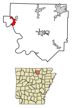
Calico Rock is located in northwestern Izard County at 36°7′21″N92°8′1″W / 36.12250°N 92.13361°W (36.122612, -92.133481), [5] on the north bank of the White River. It is bordered to the north by the town of Pineville.
According to the United States Census Bureau, the city has a total area of 4.84 square miles (12.53 km2), of which 4.78 square miles (12.37 km2) are land and 0.06 square miles (0.16 km2), or 1.26%, are water. [3]
Census | Pop. | Note | %± |
---|---|---|---|
1910 | 401 | — | |
1920 | 479 | 19.5% | |
1930 | 659 | 37.6% | |
1940 | 738 | 12.0% | |
1950 | 963 | 30.5% | |
1960 | 773 | −19.7% | |
1970 | 723 | −6.5% | |
1980 | 1,046 | 44.7% | |
1990 | 938 | −10.3% | |
2000 | 991 | 5.7% | |
2010 | 1,545 | 55.9% | |
2020 | 888 | −42.5% | |
U.S. Decennial Census [6] |
Race | Number | Percentage |
---|---|---|
White (non-Hispanic) | 841 | 94.71% |
Black or African American (non-Hispanic) | 3 | 0.34% |
Native American | 6 | 0.68% |
Asian | 2 | 0.23% |
Other/Mixed | 31 | 3.49% |
Hispanic or Latino | 5 | 0.56% |
As of the 2020 United States census, there were 888 people, 510 households, and 373 families residing in the city.
As of the census [8] of 2000, there were 991 people, 428 households, and 264 families residing in the city. The population density was 277.0 inhabitants per square mile (107.0/km2). There were 526 housing units at an average density of 147.0 per square mile (56.8/km2). The racial makeup of the city was 97.07% White, 0.20% Black or African American, 0.71% Native American, 0.20% Asian, 0.10% Pacific Islander, 0.40% from other races, and 1.31% from two or more races. 2.22% of the population were Hispanic or Latino of any race.
There were 428 households, out of which 27.8% had children under the age of 18 living with them, 45.8% were married couples living together, 12.6% had a female householder with no husband present, and 38.3% were non-families. 35.5% of all households were made up of individuals, and 17.1% had someone living alone who was 65 years of age or older. The average household size was 2.20 and the average family size was 2.85.
In the city, the population was spread out, with 23.9% under the age of 18, 6.8% from 18 to 24, 24.6% from 25 to 44, 21.9% from 45 to 64, and 22.8% who were 65 years of age or older. The median age was 40 years. For every 100 females, there were 90.6 males. For every 100 females age 18 and over, there were 76.2 males.
The median income for a household in the city was $23,200, and the median income for a family was $31,328. Males had a median income of $20,833 versus $18,125 for females. The per capita income for the city was $14,305. About 20.2% of families and 26.2% of the population were below the poverty line, including 41.9% of those under age 18 and 15.1% of those age 65 or over.
Public education for elementary and secondary students is primarily provided by the Calico Rock School District, which includes:
The climate in this area is characterized by hot, humid summers and generally mild to cool winters. According to the Köppen Climate Classification system, Calico Rock has a humid subtropical climate, abbreviated "Cfa" on climate maps. [9]
Climate data for Calico Rock, Arkansas (1991–2020 normals, extremes 1915–1937, 1964–present) | |||||||||||||
---|---|---|---|---|---|---|---|---|---|---|---|---|---|
Month | Jan | Feb | Mar | Apr | May | Jun | Jul | Aug | Sep | Oct | Nov | Dec | Year |
Record high °F (°C) | 79 (26) | 87 (31) | 94 (34) | 95 (35) | 99 (37) | 110 (43) | 111 (44) | 114 (46) | 108 (42) | 96 (36) | 87 (31) | 82 (28) | 114 (46) |
Mean maximum °F (°C) | 70.8 (21.6) | 74.5 (23.6) | 81.1 (27.3) | 85.2 (29.6) | 88.4 (31.3) | 93.0 (33.9) | 97.1 (36.2) | 97.2 (36.2) | 93.3 (34.1) | 86.8 (30.4) | 77.9 (25.5) | 70.5 (21.4) | 99.2 (37.3) |
Mean daily maximum °F (°C) | 46.1 (7.8) | 50.8 (10.4) | 59.9 (15.5) | 69.5 (20.8) | 75.8 (24.3) | 83.8 (28.8) | 87.6 (30.9) | 87.5 (30.8) | 80.8 (27.1) | 70.9 (21.6) | 58.7 (14.8) | 48.5 (9.2) | 68.3 (20.2) |
Daily mean °F (°C) | 35.4 (1.9) | 38.9 (3.8) | 47.3 (8.5) | 56.4 (13.6) | 64.8 (18.2) | 72.7 (22.6) | 76.5 (24.7) | 75.8 (24.3) | 68.7 (20.4) | 58.1 (14.5) | 46.8 (8.2) | 38.2 (3.4) | 56.6 (13.7) |
Mean daily minimum °F (°C) | 24.7 (−4.1) | 27.1 (−2.7) | 34.6 (1.4) | 43.3 (6.3) | 53.7 (12.1) | 61.6 (16.4) | 65.3 (18.5) | 64.2 (17.9) | 56.5 (13.6) | 45.3 (7.4) | 35.0 (1.7) | 27.9 (−2.3) | 44.9 (7.2) |
Mean minimum °F (°C) | 8.0 (−13.3) | 12.1 (−11.1) | 17.6 (−8.0) | 27.9 (−2.3) | 38.1 (3.4) | 51.1 (10.6) | 56.5 (13.6) | 53.7 (12.1) | 42.6 (5.9) | 30.3 (−0.9) | 20.4 (−6.4) | 13.2 (−10.4) | 5.1 (−14.9) |
Record low °F (°C) | −20 (−29) | −9 (−23) | 6 (−14) | 17 (−8) | 30 (−1) | 36 (2) | 45 (7) | 40 (4) | 31 (−1) | 19 (−7) | 4 (−16) | −19 (−28) | −20 (−29) |
Average precipitation inches (mm) | 3.35 (85) | 3.27 (83) | 4.75 (121) | 5.47 (139) | 5.13 (130) | 3.61 (92) | 3.82 (97) | 3.63 (92) | 3.76 (96) | 3.83 (97) | 4.34 (110) | 3.93 (100) | 48.89 (1,242) |
Average snowfall inches (cm) | 2.0 (5.1) | 1.9 (4.8) | 1.7 (4.3) | 0.0 (0.0) | 0.0 (0.0) | 0.0 (0.0) | 0.0 (0.0) | 0.0 (0.0) | 0.0 (0.0) | 0.0 (0.0) | 0.0 (0.0) | 1.1 (2.8) | 6.7 (17) |
Average precipitation days (≥ 0.01 in) | 7.8 | 7.0 | 9.5 | 8.3 | 10.2 | 8.0 | 7.8 | 7.5 | 6.3 | 7.7 | 7.4 | 7.7 | 95.2 |
Average snowy days (≥ 0.1 in) | 0.8 | 0.9 | 0.6 | 0.0 | 0.0 | 0.0 | 0.0 | 0.0 | 0.0 | 0.0 | 0.1 | 0.6 | 3.0 |
Source: NOAA [10] [11] |
Sharp County is a county located in the U.S. state of Arkansas. As of the 2020 census, the population was 17,271. The county seat is Ash Flat. The county was formed on July 18, 1868, and named for Ephraim Sharp, a state legislator from the area.
Izard County is a county located in the U.S. state of Arkansas. As of the 2020 census, the population was 13,577. The county seat is Melbourne. Izard County is Arkansas's 13th county, formed on October 27, 1825, and named for War of 1812 General and Arkansas Territorial Governor George Izard. It is an alcohol prohibition or dry county.
Independence County is a county located in the U.S. state of Arkansas. As of the 2020 census, the population was 37,938. The county seat is Batesville. Independence County is Arkansas's ninth county, formed on October 20, 1820, from a portion of Lawrence County and named in commemoration of the Declaration of Independence. It is an alcohol prohibition or dry county.
Fulton County is a county located in the U.S. state of Arkansas. As of the 2020 census, the population was 12,075. The county seat is Salem. Fulton County was formed on December 21, 1842, and named for William Fulton, the last governor of the Arkansas Territory. It is an alcohol prohibition or dry county.
Conway County is a county located in the U.S. state of Arkansas. Created as Arkansas's 11th county on October 20, 1825, Conway County has four incorporated municipalities, including Morrilton, the county seat and most populous city. The county is also the site of numerous unincorporated communities and ghost towns. The county is named for Henry Wharton Conway, a politician from a powerful political family who served as the delegate from the Arkansas Territory to the U.S. Congress from 1823 to 1827.
Horseshoe Bend is a city in Fulton, Izard, and Sharp counties in the U.S. state of Arkansas. The population was 2,184 at the 2010 census. It is named for the large loop or horseshoe bend in the nearby Strawberry River.
Salem is the county seat of Fulton County, Arkansas, United States. Salem was first incorporated in 1900. As of the 2010 census the population stood at 1,635.
Batesville is the county seat and largest city of Independence County, Arkansas, United States, 80 miles (183 km) northeast of Little Rock, the state capital. According to the 2010 Census, the population of the city was 10,268. The city serves as a regional manufacturing and distribution hub for the Ozark Mountain region and Northeast Arkansas.
Franklin is a town in Izard County, Arkansas, United States. The population was 198 at the 2010 census.
Melbourne is a city and county seat of Izard County, Arkansas, United States. The population was 1,848 at the 2010 census. It is home to the main campus of Ozarka College.
Oxford is a city in Izard County, Arkansas, United States. The population was 670 at the 2010 census.
Pineville is a town in Izard County, Arkansas, United States. The population was 238 at the 2010 census.
Newport is a city in and the county seat of Jackson County, Arkansas, United States located on the White River, 84 miles (135 km) northeast of Little Rock. The population was 7,879 at the 2010 census.
Lamar is a city in Johnson County, Arkansas, United States. The population was 1,605 at the 2010 census, up from 1,415 at the 2000 census.
Walnut Ridge is a city in and the county seat of Lawrence County, Arkansas, United States. The population was 5,098 at the United States Census's 2019 estimate. Walnut Ridge lies immediately north of Hoxie. The two towns form a contiguous urban area with approximately 8,000 residents. Williams Baptist University is in College City, a formerly separate community that merged into Walnut Ridge in 2017.
Gravel Ridge is a former census-designated place (CDP) in Pulaski County, Arkansas, United States. The population was 3,232 at the 2000 census. It has been annexed into the city of Sherwood and is part of the Little Rock–North Little Rock–Conway Metropolitan Statistical Area.
Benton is a city in and the county seat of Saline County, Arkansas, United States and a suburb of Little Rock. It was established in 1837. At the 2020 census, the city had a population of 35,014, making it the 12th most populous city in Arkansas. It is part of the Little Rock–North Little Rock–Conway Metropolitan Statistical Area. The city of Benton, first settled in 1833 and named after Missouri Senator Thomas Hart Benton, was formally chartered in 1836 when Arkansas became a state.
Ola is a city in Yell County, Arkansas, United States. The population was 1,281 at the 2010 census. It is roughly 15 miles south of the Russellville Metropolitan area.
Plymouth is a city in Cerro Gordo County, Iowa, United States, along the Shell Rock River. The population was 375 at the time of the 2020 census. It is part of the Mason City Micropolitan Statistical Area.
Fallon is an unincorporated small town in Prairie County, Montana, United States. The population was 164 at the 2010 census., although, as the town name has been co-opted for use by the United States Census Bureau as a census-designated place, this figure may include persons living well outside the town's limits. Fallon's current mayor is Colin Armould.