Harvard Square is a triangular plaza at the intersection of Massachusetts Avenue, Brattle Street and John F. Kennedy Street near the center of Cambridge, Massachusetts, United States. The term "Harvard Square" is also used to delineate the business district and Harvard University surrounding that intersection, which is the historic center of Cambridge. Adjacent to Harvard Yard, the historic heart of Harvard University, the Square functions as a commercial center for Harvard students, as well as residents of western Cambridge, the western and northern neighborhoods and the inner suburbs of Boston. The Square is served by Harvard station, a major MBTA Red Line subway and a bus transportation hub.

Christ Church, at Zero Garden Street in Cambridge, Massachusetts, U.S., is a parish of the Episcopal Diocese of Massachusetts. Built in 1760–61, it was designated a National Historic Landmark as one of the few buildings unambiguously attributable to Peter Harrison, the first formally trained architect to work in the British colonies.

The Park Street District is a historic district encompassing a small cluster of historic properties on or near Park Street in the heart of Boston, Massachusetts. The district covers an entire city block delineated by Park Street, Beacon Street, School Street, and Tremont Street, just east of the Boston Common. The district reflects an early design of the area by architect Charles Bulfinch, although only a few buildings from his period survive.

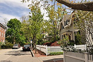
The Ash Street Historic District Cambridge, Massachusetts is a residential historic district on Ash Street and Ash Street Place between Brattle and Mount Auburn Streets in Cambridge, Massachusetts, off Brattle Street just west of Harvard Square. The district consists of ten well-preserved houses, most of which were built between 1850 and 1890. The district was listed on the National Register of Historic Places in 1982.

The William Brattle House is an historic house in Cambridge, Massachusetts. It is one of the seven Colonial mansions described by historian Samuel Atkins Eliot as making up Tory Row, housing several prominent figures in early colonial history. It remains in use by the Cambridge Center for Adult Education.

The Follen Street Historic District is a historic district in Cambridge, Massachusetts, just northwest of the Cambridge Common. Follen Street is a quiet residential street, isolated from through streets by large masonry buildings that front on Waterford Street and Garden Street. All but three of the houses on the street were built no later than 1900, and show a remarkable quality of workmanship, despite being diverse in their styles. A number of the houses are specifically associated with educators, including a number of Harvard University professors. The Edwin Abbot House at 1 Follen Street is now the main building of the Longy School of Music of Bard College, and is separately listed on the National Register. Other houses listed separately include the Theodore W. Richards House at 15 Follen, the Second Waterhouse House at 9 Follen, and 10 Follen Street.

The Hubbard Park Historic District encompasses a residential development and park west of Harvard Square in Cambridge, Massachusetts. The area was originally the estate of Gardiner Hubbard, who had a 6-acre (2.4 ha) estate and house on nearby Brattle Street. In the 1880s Hubbard commissioned architects to build a ring of high quality homes around his mansion, which was demolished in 1939 and is now the site of Hubbard Park. The houses in this development are now located on Mercer Circle, Sparks Street, and Hubbard Park Road.

The Old Cambridge Historic District is a historic district encompassing a residential neighborhood of Cambridge, Massachusetts that dates to colonial times. It is located just west of Harvard Square, and includes all of the properties on Brattle Street west of Mason Street to Fresh Pond Parkway, all of the properties on Mason Street and Elmwood Avenue, and nearby properties on Craigie Street. The district includes five National Historic Landmarks: Elmwood, the Reginald A. Daly House, the Oliver Hastings House, the Mary Fiske Stoughton House, and the Longfellow House–Washington's Headquarters National Historic Site, as well as several other houses listed separately on the National Register. The district follows the general route of the Watertown Path, an early colonial road that supposedly followed a Native American trail. This portion of the way became known as Tory Row during the American Revolution, because many of the fine mansions lining it were owned by Loyalists. In the 19th and early 20th centuries it continued by a fashionable location, and now features a number of architecturally significant buildings. It includes 215 contributing buildings and one other contributing sites over an area of 52 acres (21 ha). One included building is the Cambridge Historical Society's offices, which are in the NRHP-listed Hooper-Lee Nichols House, located at 159 Brattle Street.

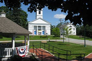
The Sturbridge Common Historic District encompasses the historic center of Sturbridge, Massachusetts. Encompassing some 138 acres (56 ha), the district is focused around the town common, which was laid out when the town established in 1738. The district is roughly linear, extending along Main Street from its junction with Interstate 84 eastward to Hall Road. The district also extends for short distances along Haynes, Maple, and Charlton Streets. Although most of the properties in the district are residential, the institutional properties, including the 1838 Greek Revival Town Hall, the 1896 Joshua Hyde Library building, and the 1922 Federated Church. The oldest building in the district is the c. 1772 Publick House, a tavern which has dominated the south side of the district since its construction.

The Gardner Uptown Historic District is a historic district encompassing the former civic heart of Gardner, Massachusetts. The 65-acre (26 ha) area includes the old town common, an early cemetery, and a modest number of non-residential buildings among a larger number of houses. The area was the center of civic life from the incorporation of Gardner in 1785 until municipal functions were moved to West Gardner beginning in the late 1920s. The district was listed on the National Register of Historic Places in 1999.

The Shrewsbury Historic District encompasses the historic early center of the town of Shrewsbury, Massachusetts. It consists of the town common, laid out in 1721 at what are now Main and Prospect Streets, and buildings adjacent or nearby. The district was declared locally in 1972, and was added to the National Register of Historic Places in 1976.

The Newbury Historic District encompasses the historic town center of Newbury, Massachusetts. Centered on the town's upper green, the area has a history of more than 350 years, and includes buildings dating to the 17th century. It extends from the green northward on High Street to the town line with Newburyport. It was listed on the National Register of Historic Places in 1976.

The Common Historic District is a historic district encompassing the civic and institutional heart of Reading, Massachusetts. The district is centered on the town common, at the intersection of Main and Salem Streets. The common has been communally owned since at least 1737, with the original burying ground to the north. In 1769 the area's first meeting house was built, giving the area a sense of identity separate from portions of Reading that would later be set off as Wakefield and North Reading. Since then the area has become a focal point for religious and civic institutions in the town.

The Baptist Society Meeting House is a historic former Baptist meeting house in Arlington, Massachusetts. Built in 1790, it is the town's oldest surviving church building. Now in residential use, the building was listed on the National Register of Historic Places in 1985.

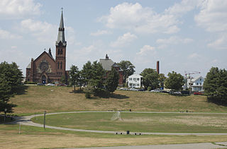
The South Common Historic District of Lowell, Massachusetts, encompasses the city's South Common and the various public, religious, and private residential buildings that flank its borders. The South Common, about 22.5 acres (9.1 ha) in size, was purchased by the city in 1845 in an auction by the Proprietors of Locks and Canals, who owned much of the city's industrial area. Although the common was landscaped, it was not apparently done so to a plan. It quickly became lined with fashionable residences, and several iconic public buildings, including the 1850 courthouse, a Romantic Revival structure designed by Ammi Young, and a series of Gothic Revival churches. Highland Avenue was built out with a series of fine Italianate houses.

The Brattle Street Church (1698–1876) was a Congregational and Unitarian church on Brattle Street in Boston, Massachusetts.

Brattle Street in Cambridge, Massachusetts, called the "King's Highway" or "Tory Row" before the American Revolutionary War, is the site of many buildings of historical interest, including the modernist glass-and-concrete building that housed the Design Research store, and a Georgian mansion where George Washington and Henry Wadsworth Longfellow both lived, as well as John Vassall and his seven slaves including Darby Vassall. Samuel Atkins Eliot, writing in 1913 about the seven Colonial mansions of Brattle Street's "Tory Row," called the area "not only one of the most beautiful but also one of the most historic streets in America." "As a fashionable address it is doubtful if any other residential street in this country has enjoyed such long and uninterrupted prestige."

The Old Burying Ground, or Old Burial Ground, is a historic cemetery in Cambridge, Massachusetts, United States, located just outside Harvard Square. The cemetery opened in 1635.

The Oakham Center Historic District encompasses a portion of the historic town center of Oakham, Massachusetts. Roughly bounded by Coldbrook Rd., Maple St., Barre Rd., and Deacon Allen Drive, the area was formed as a civic center about 1770, with town incorporation following in 1775. It includes a well-preserved variety of early 19th-century residential architecture, as well as the town's Greek Revival Congregational church, and its 1908 library. The district was listed on the National Register of Historic Places in 2020.


