Campbell Township | |
|---|---|
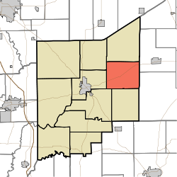 Location in Jennings County | |
| Coordinates: 39°02′14″N85°30′01″W / 39.03722°N 85.50028°W | |
| Country | United States |
| State | Indiana |
| County | Jennings |
| Government | |
| • Type | Indiana township |
| Area | |
• Total | 32.35 sq mi (83.8 km2) |
| • Land | 32.06 sq mi (83.0 km2) |
| • Water | 0.28 sq mi (0.73 km2) 0.87% |
| Elevation | 791 ft (241 m) |
| Population (2020) | |
• Total | 1,129 |
| • Density | 35.22/sq mi (13.60/km2) |
| GNIS feature ID | 0453155 |
Campbell Township is one of eleven townships in Jennings County, Indiana, United States. As of the 2020 census, its population was 1,129 (slightly down from 1,191 at 2010 [1] ) and it contained 498 housing units. [2]
Contents
- History
- Geography
- Unincorporated towns
- Adjacent townships
- Cemeteries
- Major highways
- References
- External links
Campbell Township was established in 1825. [3]
| Census | Pop. | Note | %± |
|---|---|---|---|
| 1890 | 1,268 | — | |
| 1900 | 1,281 | 1.0% | |
| 1910 | 1,035 | −19.2% | |
| 1920 | 931 | −10.0% | |
| 1930 | 1,202 | 29.1% | |
| 1940 | 2,025 | 68.5% | |
| 1950 | 2,589 | 27.9% | |
| 1960 | 2,919 | 12.7% | |
| 1970 | 2,653 | −9.1% | |
| 1980 | 2,164 | −18.4% | |
| 1990 | 1,790 | −17.3% | |
| 2000 | 1,588 | −11.3% | |
| 2010 | 1,191 | −25.0% | |
| 2020 | 1,129 | −5.2% | |
| Source: US Decennial Census [4] | |||
