
The City of Lake Macquarie is a local government area in the Hunter Region in New South Wales, Australia. It was proclaimed a city from 7 September 1984. The city is situated adjacent to the city of Newcastle and is widely considered as a part of the Greater Newcastle area. The city is approximately 150 km (93 mi) north of Sydney. One of its major tourist attractions is its lake, also named Lake Macquarie.

Toronto is a lakeside suburb within the City of Lake Macquarie, Greater Newcastle in New South Wales, Australia, approximately 28 kilometres (17 mi) from Newcastle's central business district and is a commercial hub for the sprawling suburbs on the western shore of the lake. It is one of the major centres in the City of Lake Macquarie.
Swansea is a town at the entrance to Lake Macquarie from the Pacific Ocean in New South Wales, Australia. It is part of the City of Lake Macquarie local government area and is regarded as part of Greater Newcastle.
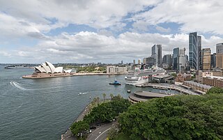
Circular Quay is a harbour, former working port and now international passenger shipping terminal, public piazza and tourism precinct, heritage area, and transport node located in Sydney, New South Wales, Australia on the northern edge of the Sydney central business district on Sydney Cove, between Bennelong Point and The Rocks. It is part of the local government area of the City of Sydney.

Sullivans Cove is on the River Derwent adjacent to the Hobart City Centre in Tasmania. It was the site of initial European settlement in the area, and the location of the earlier components of the Port of Hobart.
Mount Hutton is a suburb of the City of Lake Macquarie, New South Wales, Australia, located 14 kilometres (9 mi) from Newcastle's central business district on the eastern side of Lake Macquarie. It is part of the City of Lake Macquarie North Ward.
Gregory Michael Piper is an Australian politician, who is an independent member of the New South Wales Legislative Assembly, representing Lake Macquarie since 2007. Piper was mayor of City of Lake Macquarie between 2004 and 2012, before the enactment of the Local Government Amendment Act, 2012 (NSW) preventing dual membership of state parliament and local council.

Catherine Hill Bay is a coastal bay and village on the southern peninsula forming Lake Macquarie, south of the Pacific Ocean entrance channel at Swansea in New South Wales, Australia. It is part of the City of Lake Macquarie local government area. The village is the oldest continuous settlement in the City of Lake Macquarie. The Aboriginal people in this area, the Awabakal were the first people of this land.

RAAF Base Rathmines is a heritage-listed former RAAF Second World War seaplane base and now used as community venues, sports venues and a visitor attraction at Dorrington Road, Rathmines, City of Lake Macquarie, New South Wales, Australia. It was in use as an RAAF base from 1939 to 1961. It is also known as Rathmines Park, former RAAF Seaplane Base, Flying Boat Base, Rathmines Aerodrome and Catalina Base. The property is owned by Australian Christadelphian Bible School, Disability Life Enrichment, Don Geddes Nursing Home and Lake Macquarie City Council. The remains of the former air base was added to the New South Wales State Heritage Register on 25 November 2005.
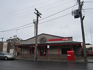
Speers Point is a suburb of Greater Newcastle, and the location of the council seat of the City of Lake Macquarie local government area in New South Wales, Australia. It is 17 kilometres (10.6 mi) west-southwest of the city of Newcastle on the northern shore of Lake Macquarie, in Cockle and Warners Bays, between the suburbs of Cardiff and Warners Bay.
Lake Macquarie is Australia's largest coastal lagoon. Located in the City of Lake Macquarie and Central Coast Council local government areas in the Hunter and Central Coast regions of New South Wales, Australia, it covers an area of 110 square kilometres (42.5 sq mi) and is connected to the Tasman Sea by a short channel. Most of the residents of the City of Lake Macquarie live near the shores of the lagoon.
Hillsborough is a suburb of the City of Lake Macquarie, New South Wales, Australia 13 kilometres (8 mi) from Newcastle's central business district on the eastern side of Lake Macquarie. It is part of the City of Lake Macquarie north ward.
Nords Wharf is a locality south of Swansea on the shore of Lake Macquarie in New South Wales, Australia. It is part of the City of Lake Macquarie local government area.
Kilaben Bay is a suburb of the city of Lake Macquarie in the Hunter Region of New South Wales, Australia.

Newcastle bus routes connect suburbs in and around Newcastle and Lake Macquarie, about 100 kilometres north of Sydney.
Silverwater is a suburb of the City of Lake Macquarie in New South Wales, Australia, and is located on a peninsula east of the town of Morisset on the western side of Lake Macquarie. The Aboriginal people, in this area, the Awabakal, were the first people of this land.
Macquarie Hills is a residential suburb of the City of Lake Macquarie, New South Wales, Australia, located 15 kilometres (9 mi) west of Newcastle's central business district near the northern end of Lake Macquarie between the town centres of Cardiff and Warners Bay. It is part of the City of Lake Macquarie north ward.

Sydney Cove West Archaeological Precinct is a heritage-listed precinct that contains The Rocks police station, the Museum of Contemporary Art Australia, car park, parks, shops and roads located at 112–156 George Street, in the inner city Sydney suburb of The Rocks in the City of Sydney local government area of New South Wales, Australia. The precinct previously contained a commissariat store, Maritime Services Board offices, dockyard and Department of Labour & Industry offices. Buildings in the precinct were developed in various stages since 1797 to date, with heritage-listed buildings dating from 1797 to 1939. The precinct is also known as the Museum of Contemporary Art, Maritime Services Board, Colonial Government naval dockyard, Commissariat Stores, Colonial Hospital, Kings and Queens Wharf and First Fleet Park. The property is owned by Property NSW, an agency of the Government of New South Wales. It was added to the New South Wales State Heritage Register on 5 August 2011.
