Canute, Oklahoma

Last updated

Canute, Oklahoma
Canute, Oklahoma.JPG
Old U.S. Highway 66 in Canute.
OKMap-doton-Canute.PNG
Location of Canute, Oklahoma
Coordinates: 35°25′19″N99°16′41″W / 35.42194°N 99.27806°W / 35.42194; -99.27806
Country United States
State Oklahoma
County Washita
Area
[1]
  Total0.63 sq mi (1.63 km2)
  Land0.63 sq mi (1.63 km2)
  Water0.00 sq mi (0.00 km2)
Elevation
[2]
1,887 ft (575 m)
Population
 (2020)
  Total494
  Density782.88/sq mi (302.18/km2)
Time zone UTC-6 (Central (CST))
  Summer (DST) UTC-5 (CDT)
ZIP code
73626
Area code 580
FIPS code 40-11650 [3]
GNIS feature ID2413161 [2]

Canute is a town in Washita County, Oklahoma, United States. The population was 541 at the 2010 census.

Contents

History

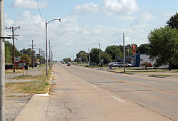
Canute was established in the early 1900s and is located on the now-defunct Rock Island Railroad. Following the advent of the automobile, Canute became a popular stop along U.S. Route 66 and a large number of tourist businesses were established, including gasoline service stations, motels and restaurants. However, when Interstate 40 bypassed the small village to the north in May 1970 and received only one exit from the freeway, the local economy went into a decline due to the bypass and the concurrent closure of nearby Clinton-Sherman Air Force Base at Burns Flat, leading most of those businesses to shut down. Today, Canute businesses include a bank and auto repair shop on Route 66, [4] along with a gas station/convenience store. Former Oklahoma governor David Walters was born in Canute.

Geography

According to the United States Census Bureau, the town has a total area of 0.6 square miles (1.6 km2), all land.

Climate

Climate data for Canute, Oklahoma
MonthJanFebMarAprMayJunJulAugSepOctNovDecYear
Average high °F (°C)48.9
(9.4)
54.3
(12.4)
63.8
(17.7)
74.1
(23.4)
81.5
(27.5)
89.5
(31.9)
94.8
(34.9)
93.1
(33.9)
85
(29)
74.9
(23.8)
60.8
(16.0)
50.5
(10.3)
72.6
(22.6)
Average low °F (°C)23.6
(−4.7)
27.9
(−2.3)
36.3
(2.4)
46.5
(8.1)
55.7
(13.2)
64.5
(18.1)
68.9
(20.5)
67.1
(19.5)
59.5
(15.3)
48.1
(8.9)
36.4
(2.4)
26.8
(−2.9)
46.8
(8.2)
Average precipitation inches (mm)0.7
(18)
1.2
(30)
2
(51)
2.1
(53)
4.6
(120)
3.9
(99)
1.9
(48)
2.9
(74)
3.3
(84)
2
(51)
1.7
(43)
0.8
(20)
26.9
(680)
Source: Weatherbase.com [5]

Demographics

Historical population
CensusPop.Note
1930 366
1940 3742.2%
1950 355−5.1%
1960 3704.2%
1970 42013.5%
1980 67661.0%
1990 542−19.8%
2000 524−3.3%
2010 5413.2%
2020 494−8.7%
U.S. Decennial Census [6]

As of the census [3] of 2000, there were 524 people, 214 households, and 145 families residing in the town. The population density was 854.2 inhabitants per square mile (329.8/km2). There were 242 housing units at an average density of 394.5 per square mile (152.3/km2). The racial makeup of the town was 88.36% White, 0.57% African American, 1.91% Native American, 0.19% Asian, 7.25% from other races, and 1.72% from two or more races. Hispanic or Latino of any race were 7.63% of the population.

There were 214 households, out of which 29.4% had children under the age of 18 living with them, 54.7% were married couples living together, 9.3% had a female householder with no husband present, and 31.8% were non-families. 28.0% of all households were made up of individuals, and 14.5% had someone living alone who was 65 years of age or older. The average household size was 2.45 and the average family size was 3.01.

In the town, the population was spread out, with 24.2% under the age of 18, 12.2% from 18 to 24, 25.4% from 25 to 44, 21.0% from 45 to 64, and 17.2% who were 65 years of age or older. The median age was 38 years. For every 100 females, there were 97.7 males. For every 100 females age 18 and over, there were 90.0 males.

The median income for a household in the town was $32,321, and the median income for a family was $38,036. Males had a median income of $26,406 versus $15,500 for females. The per capita income for the town was $20,283. About 13.7% of families and 15.6% of the population were below the poverty line, including 16.7% of those under age 18 and 22.5% of those age 65 or over.

Canute Public Schools

Canute Elementary School is located at Third and Walk Street. The elementary serves students in Pre-K through 6th grade with an average of 32 students per class.

Canute Junior High and High School is located at 506 Third Street. The junior high serves students in 7th through 9th grades with 34 students per class on average. The high school serves students in 10th grade through 12th grade with an average of 30 students per class.

Related Research Articles

<span class="mw-page-title-main">Ollie, Iowa</span> City in Iowa, United States

Ollie is a city in Keokuk County, Iowa, United States. The population was 201 at the time of the 2020 census. Originally known as Hemingford, the town voted to change the name to Ollie in 1892.

<span class="mw-page-title-main">Muscotah, Kansas</span> City in Kansas, United States

Muscotah is a city in Atchison County, Kansas, United States. As of the 2020 census, the population of the city was 155. Muscotah was named for the Kickapoo Native American word for "prairie"

<span class="mw-page-title-main">Warrensburg, Missouri</span> City in Missouri

Warrensburg is a city in and the county seat of Johnson County, Missouri, United States. The population was 20,313 at the 2020 census. The Warrensburg Micropolitan Statistical Area consists of Johnson County. The city is a college town as it is home to the University of Central Missouri.

<span class="mw-page-title-main">Arapaho, Oklahoma</span> Town in Oklahoma, United States

Arapaho is a town in, and the county seat of, Custer County, Oklahoma, United States. The population was 796 at the 2010 census, a 6.4 percent increase from the figure of 748 in 2000. The town lies long U.S. Route 183 and is named for the Arapaho Native American tribe.

<span class="mw-page-title-main">Kansas, Oklahoma</span> Town in Oklahoma, United States

Kansas is a town in Delaware County, Oklahoma, United States. The population was 802 at the 2010 census.

<span class="mw-page-title-main">Bradley, Oklahoma</span> Town in Oklahoma, United States

Bradley is a town in Grady County, Oklahoma, United States. The population was 78 at the 2020 United States census.

<span class="mw-page-title-main">Pocasset, Oklahoma</span> Town in Oklahoma, United States

Pocasset is a town in Grady County, Oklahoma, United States. The population was 183 at the 2020 census, a 17.3% increase from 2010.

<span class="mw-page-title-main">East Duke, Oklahoma</span> Town in Oklahoma, United States

East Duke is a town in Jackson County, Oklahoma, United States. The population was 424 at the 2010 census.

<span class="mw-page-title-main">Cameron, Oklahoma</span> Town in Oklahoma, United States

Cameron is a town in Le Flore County, Oklahoma, United States. It is part of the Fort Smith, Arkansas-Oklahoma Metropolitan Statistical Area. The population was 302 at the 2010 census, a decline of 3.2 percent from the figure of 312 recorded in 2000.

<span class="mw-page-title-main">Carney, Oklahoma</span> Town in Oklahoma, United States

Carney is a town in Lincoln County, Oklahoma, United States. The population was 647 at the 2010 census.

<span class="mw-page-title-main">Davenport, Oklahoma</span> Town in Oklahoma, United States

Davenport is a town in Lincoln County, Oklahoma, United States. The population was 814 at the 2010 census.

<span class="mw-page-title-main">Lake Aluma, Oklahoma</span> Town in Oklahoma, United States

Lake Aluma is a town in Oklahoma County, Oklahoma, United States, and a part of the Oklahoma City Metropolitan Area. The population was 88 at the 2010 census.

<span class="mw-page-title-main">Shidler, Oklahoma</span> City in Oklahoma, United States

Shidler is a city in Osage County, Oklahoma, United States. The population was 328 in the 2020 census, a decline from the figure of 441 recorded in 2010.

<span class="mw-page-title-main">Central High, Oklahoma</span> Town in Oklahoma, United States

Central High is a town in Stephens County, Oklahoma, United States. The population was 1,199 at the 2010 census, an increase of 25.7 percent from the figure of 954 in 2000.

<span class="mw-page-title-main">Porter, Oklahoma</span> Town in Oklahoma, United States

Porter is a town in Wagoner County, Oklahoma, United States. It promotes itself as "The Peach Capital of Oklahoma." The population was 566 at the 2010 census, a loss of 1.4 percent, compared to 574 at the 2000 census.

<span class="mw-page-title-main">Foss, Oklahoma</span> Town in Oklahoma, United States

Foss is a town in Washita County, Oklahoma, United States. As of the 2010 census, the town population was 151, an 18.9 percent increase from 127 at the 2000 census.

<span class="mw-page-title-main">Sentinel, Oklahoma</span> Town in Oklahoma, United States

Sentinel is a town in Washita County, in the U.S. state of Oklahoma. The population was 901 in the 2010 census, an increase of 4.9 percent from the figure of 859 residents in 2000. Towns near Sentinel are Rocky, Cordell, Canute, and Burnsflat.

<span class="mw-page-title-main">Texhoma, Texas</span> City in Texas, United States

Texhoma is a city in Sherman County, Texas, United States. The population was 258 at the 2020 census, declining from 364 in 2010. Texhoma is a divided city, with the Texas-Oklahoma state border separating the city from Texhoma, Oklahoma. It is also the northernmost settlement in the entire state of Texas.

<span class="mw-page-title-main">Rock River, Wyoming</span> Town in Wyoming, United States

Rock River is a town in Albany County, Wyoming, United States. As of the 2010 census, the town population was 245.

Sherman is a village in the town of Sherman, Chautauqua County, New York, United States. The village lies in the northern part of the town at intersections of County Routes 15 and 18, NY-76 and NY-430. The population was 681 at the 2020 census.

References

  1. "ArcGIS REST Services Directory". United States Census Bureau. Retrieved September 20, 2022.
  2. 1 2 U.S. Geological Survey Geographic Names Information System: Canute, Oklahoma
  3. 1 2 "U.S. Census website". United States Census Bureau . Retrieved January 31, 2008.
  4. http://www.allbusiness.com/population-demographics/demographic-groups-parents-single/13738410-1.html [ dead link ]
  5. "Historical Weather for Canute, Oklahoma, United States".
  6. "Census of Population and Housing". Census.gov. Retrieved June 4, 2015.