Related Research Articles

Miranda is a suburb in southern Sydney, in the state of New South Wales, Australia. The suburb is known as a commercial centre for the southern suburbs. Miranda is 24 kilometres south of the Sydney central business district, in the Sutherland Shire.

Caringbah is a suburb in Southern Sydney, in the state of New South Wales, Australia. Caringbah is 24 kilometres (15 mi) south of the Sydney central business district in the local government area of Sutherland Shire.

Gymea is a suburb in southern Sydney, in the state of New South Wales, Australia. Gymea is located 26 kilometres south of the Sydney central business district in the local government area of the Sutherland Shire. The postcode is 2227, which it shares with adjacent suburb Gymea Bay.

Sutherland is a suburb in southern Sydney, in the state of New South Wales, Australia. Sutherland is located 26 kilometres south of the Sydney central business district and is the administrative centre for the local government area of the Sutherland Shire.

Menai is a suburb in southern Sydney, in the state of New South Wales, Australia 29 kilometres south of the Sydney central business district in the local government area of the Sutherland Shire.
Grays Point is a small suburb in Southern Sydney, in the state of New South Wales, Australia 29 kilometres south of the Sydney central business district, in the local government area of the Sutherland Shire.

Alfords Point is a suburb in southern Sydney, in the state of New South Wales, Australia. Alfords Point is 28 kilometres south of the Sydney central business district, within the local government area of the Sutherland Shire. Alfords Point shares the postcode of 2234 with neighbouring suburbs of Menai, Bangor and Illawong.

Jannali is a suburb in southern Sydney, in the state of New South Wales, Australia. Jannali is located 28 kilometres south of the Sydney central business district in the local government area of the Sutherland Shire. The majority of land use in Jannali is residential and bushland reserve, while the suburb is bisected by the north–south railway line. The majority of Jannali's enterprises are located close to the suburb's railway station.

Barden Ridge is a suburb in southern Sydney, in the state of New South Wales, Australia. Barden Ridge is located 29 kilometres south of the Sydney central business district in the local government area of the Sutherland Shire. Barden Ridge is colloquially known to locals as 'The Ridge'.

Woronora Heights is a suburb in southern Sydney, in the state of New South Wales, Australia. Woronora Heights is located 29 kilometres south of the Sydney central business district, in the local government area of the Sutherland Shire. Woronora is a separate suburb, to the north. Most streets in Woronora Heights are named after birds.

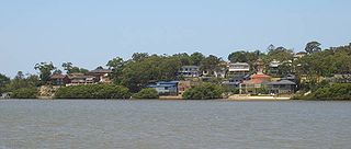
Oyster Bay is a suburb in Southern Sydney, in the state of New South Wales, Australia. It is located 26 kilometres south of the Sydney central business district in the local government area of the Sutherland Shire.

Maianbar is a village on the outskirts of southern Sydney, in the state of New South Wales, Australia 29 kilometres south of the Sydney central business district. It is part of the Sutherland Shire.

Kareela is a suburb in southern Sydney, in the state of New South Wales, Australia.
Kangaroo Point is a tiny suburb in southern Sydney, in the state of New South Wales, Australia. It is 22 kilometres south of the Sydney central business district in the local government area of the Sutherland Shire.

Dolans Bay is a bayside suburb in Southern Sydney, in the state of New South Wales, Australia, that is located 26 kilometres (16 mi) south of the Sydney central business district, in the local government area of the Sutherland Shire.

Bardwell Park is a suburb in southern Sydney, in the state of New South Wales, Australia. The suburb is located 12 kilometres south-west of the Sydney central business district and is part of the St George area. Bardwell Park is in the local government area of the Bayside Council. Bardwell Valley is a separate suburb, to the east.

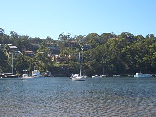
Bonnet Bay is a suburb in southern Sydney, in the state of New South Wales, Australia that is located 29 kilometres (18 mi) south of the Sydney central business district in the local government area of the Sutherland Shire. Its postcode is 2226, which it shares with neighboring Jannali and Como. Bonnet Bay is located on the eastern bank of the Woronora River, which flows north into the Georges River.
Port Hacking High School is a high school situated in the Sutherland Shire, in the south east region of Sydney, New South Wales. It was opened in 1959 and was the first comprehensive high school within the Sutherland Shire Council that provides education up to and including the Higher School Certificate level.

Caravan Head Bushland Reserve is a reserve approximately 2.2ha located in Sutherland Shire, southern Sydney, in the state of New South Wales, Australia.

Joseph Banks Native Plants Reserve is one of the few specialised gardens in Sydney to focus entirely on Australian native plants. Located at Kareela in Sutherland Shire and established in 1970 as a tribute to Joseph Banks, the landscaped garden covers an area of 2.2 hectares, with 4 kilometres of sealed paths.
References
- ↑ Curby, Pauline (2004). Pictorial History Sutherland Shire. Alexandria: Kingsclear Books. ISBN 0908272790.