Bundeena, New South Wales

Last updated

Bundeena
Sydney,  New South Wales
Bundeena, town centre.jpg
Town centre, November 2009
Location map Australia Sydney.png
Red pog.svg
Bundeena
Bundeena, New South Wales
Coordinates 34°5′17.02″S151°9′14.62″E / 34.0880611°S 151.1540611°E / -34.0880611; 151.1540611
Population2,103 (2021 census) [1]
 • Density1,107/km2 (2,870/sq mi)
Postcode(s) 2230 [2]
Elevation16 m (52 ft)
Area1.9 km2 (0.7 sq mi)
Location29 km (18 mi) south of Sydney CBD
LGA(s) Sutherland Shire
State electorate(s) Heathcote
Federal division(s) Hughes
Suburbs around Bundeena:
Burraneer Cronulla
Maianbar Bundeena Tasman Sea
Royal National Park

Bundeena is a village and suburb on the outskirts of southern Sydney, in the state of New South Wales, Australia. Bundeena is located 29 kilometres (18 miles) south of the Sydney central business district and is part of the local government area of the Sutherland Shire.

Contents

Bundeena is adjacent to the village of Maianbar and lies on the southern side of Port Hacking, opposite the suburbs of Cronulla and Burraneer. The village is surrounded by the Royal National Park.

The beaches at Bundeena are Jibbon Beach, Gunyah Beach, Horderns Beach and Bonnie Vale Beach. Cabbage Tree Creek and 'The Basin' separate Bundeena from the smaller village of Maianbar. A bush track and footbridge link the two villages. Bonnie Vale is also one of the few camp grounds within the Royal National Park.

Transport

Passenger ferry from Cronulla Ferry from Cronulla to Bundeena.jpg
Passenger ferry from Cronulla

Bundeena may be reached by passenger ferry from Cronulla or by road through the Royal National Park from Sutherland or Waterfall. Cronulla and National Park Ferry Cruises provides regular ferry services between Cronulla and Bundeena. The wharf at Cronulla is located on Gunnamatta Bay, near Cronulla railway station. Ferry trips vary from 20 to 30 minutes depending on the weather. Many people from Bundeena drive to the railway station at Sutherland, as it is only a 25-minute drive as opposed to 30 minutes by ferry to Cronulla and then a 15-minute train trip to Sutherland.

Maianbar Bundeena Bus Service operates bus route 989 for local bus services between Bundeena and Maianbar on school days only. In addition there is one return trip every Wednesday to Engadine and one return trip every Friday to Miranda both via Maianbar.

Environment

During early colonial settlement, Indonesian rusa deer were introduced and have since become a large population in the area. Many residents see the deer as pests, but they are a protected species, although the National Parks & Wildlife Service are permitted a small yearly cull. However many residents also take delight in the deer, which causes much division and emotion in the affected townships. [3]

History

Aerial image looking to the south-east. The three peninsulas, from left to right, are Yenabilli, Maianbar and Bundeena Yenabilli Maianbar Bundeena.jpg
Aerial image looking to the south-east. The three peninsulas, from left to right, are Yenabilli, Maianbar and Bundeena

Bundeena is an Aboriginal word meaning "noise like thunder" (presumed to be a reference to the sound of the waves crashing on Horderns Beach). Aboriginal rock engravings made by Dharawal people can be found at Jibbon Head.

Bass and Flinders investigated the area in 1796, deciding that it was not a suitable location for a settlement. In 1815 there were reports of criminals in the Cabbage Tree Creek region who were producing sly grog. They used the caves along the foreshore for storage.

Bundeena's first authorised white settler, Owen Byrne, was granted land at the site in 1832. George Simpson received a land grant at the adjacent Bonnie Vale in 1863. Simpson's Hotel was opened in the area now known as Simpsons Bay by George's son, William, in the 1870s. The sandstone Simpson's House (1870s) is still standing at what is now Bonnie Vale Campground.

A wharf was built in 1890 and W.A. Hodgkinson conducted a launch service from Gunnamatta Bay in 1908. Captain R.R. Ryall commenced the Cronulla to Bundeena ferry service in 1915. The Wharf was reconstructed in 1920. The district's first store commenced operations at the beginning of the 1930s. Bundeena Public School opened on 14 September 1948. [4]

Bundeena 1.jpg
Bundeena.jpg
Horderns Beach, Bundeena. As viewed from Bundeena ferry wharf.

Education

Bundeena Public School began in September 1948, with classes initially held in the RSL hall. [5] Bundeena Library operates out of Bundeena Public School on Mondays and Wednesdays after school hours and Saturday mornings. [6]

Sport

Bundeena is home to the soccer club Bundeena-Mainbar FC, who play at Bundeena Oval. Bundeena Oval also hosts Bundeena Little Athletics.

Demographics

According to the 2021 census of Population, there were 2,103 residents in Bundeena. 73.5% of people were born in Australia. The next most common country of birth was England at 6.7%. 88.6% of people only spoke English at home. The most common responses for religion were No Religion 48.3%, Catholic 18.8% and Anglican 13.0%. [1]

Related Research Articles

<span class="mw-page-title-main">Royal National Park</span> Protected area in New South Wales, Australia

The Royal National Park is a protected national park that is located in Sutherland Shire local government area in the southern portion of Sydney, New South Wales, Australia.

<span class="mw-page-title-main">Miranda, New South Wales</span> Suburb of Sydney, New South Wales, Australia

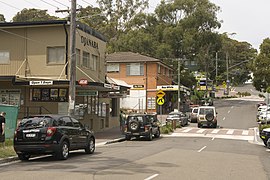
Miranda is a suburb in southern Sydney, in the state of New South Wales, Australia. The suburb is known as a commercial centre for the southern suburbs. Miranda is 24 kilometres south of the Sydney central business district, in the Sutherland Shire.

<span class="mw-page-title-main">Palm Beach, New South Wales</span> Suburb of Sydney, New South Wales, Australia

Palm Beach is a suburb in the Northern Beaches region of Greater Sydney, in the state of New South Wales, Australia. Palm Beach is located 41 kilometres (25 mi) north of the Sydney central business district, in the local government area of Northern Beaches Council. Palm Beach sits on a peninsula at the end of Barrenjoey Road near Pittwater and is the northernmost beach in the Greater Sydney Metropolitan area. The population of Palm Beach was 1,593 as at the 2016 census.

<span class="mw-page-title-main">Sutherland Shire</span> Local government area in New South Wales, Australia

Sutherland Shire is a local government area in the southern region of Sydney, in the state of New South Wales, Australia. The Sutherland Shire is located south of the Sydney CBD, and comprises an area of 370 square kilometres (140 sq mi) and as at the 2016 census and has an estimated population of 218,464. The Sutherland Shire is colloquially known as "The Shire" which has been featured in several reality television series.

<span class="mw-page-title-main">Southern Sydney</span> Region in New South Wales, Australia

Southern Sydney is the southern metropolitan area of Greater Sydney, in the state of New South Wales, Australia.

<span class="mw-page-title-main">Cronulla, New South Wales</span> Suburb of Sydney, New South Wales, Australia

Cronulla is a suburb of Sydney, in the state of New South Wales, Australia. Boasting numerous surf beaches and swimming spots, the suburb attracts both tourists and Greater Sydney residents. Cronulla is 26 kilometres south of the Sydney central business district, in the local government area of the Sutherland Shire.

<span class="mw-page-title-main">Miranda railway station</span> Railway station in Sydney, New South Wales, Australia

Miranda railway station is a heritage-listed railway station located on the Cronulla line, serving the Sydney suburb of Miranda. It is served by Sydney Trains' T4 Eastern Suburbs & Illawarra Line services.

<span class="mw-page-title-main">Woolooware</span> Suburb of Sydney, New South Wales, Australia

Woolooware is a suburb in southern Sydney, in the state of New South Wales, Australia. Woolooware is located 24 kilometres (15 mi) south of the Sydney central business district in the Sutherland Shire. It shares the 2230 postcode with Cronulla.

<span class="mw-page-title-main">Port Hacking</span> Estuary in southern Sydney, Australia

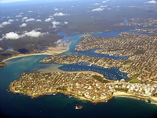
Port Hacking Estuary, an open youthful tide dominated, drowned valley estuary, is located in southern Sydney, New South Wales, Australia approximately 30 kilometres (19 mi) south of Sydney central business district. Port Hacking has its source in the upper reaches of the Hacking River south of Helensburgh, and several smaller creeks, including South West Arm, Bundeena Creek and The Basin and flows generally to the east before reaching its mouth, the Tasman Sea, south of Cronulla and north–east of Bundeena. Its tidal effect is terminated at the weir at Audley, in the Royal National Park. The lower estuary features a substantial marine delta, which over time has prograded upstream. There is also a substantial fluvial of the Hacking River at Grays Point. The two deltas are separated by a deep basin.

<span class="mw-page-title-main">Maianbar</span> Suburb of Sydney, New South Wales, Australia

Maianbar is a village on the outskirts of southern Sydney, in the state of New South Wales, Australia 29 kilometres south of the Sydney central business district. It is part of the Sutherland Shire.

<span class="mw-page-title-main">Kurnell, New South Wales</span> Suburb of Sydney, New South Wales, Australia

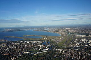
Kurnell is a suburb in Sydney, in the state of New South Wales, Australia. It is 21.4 kilometres (13.3 mi) south of the Sydney central business district, in the local government area of the Sutherland Shire along the east coast. Cronulla and Woolooware are the only adjacent suburbs. La Perouse is located opposite, on the northern headland of Botany Bay. The Cronulla sand dunes are on the south eastern headland of Botany Bay. The eastern side of the peninsula is part of Botany Bay National Park, and Towra Point Nature Reserve is located on the western side of the suburb.

<span class="mw-page-title-main">Lilli Pilli, New South Wales</span> Suburb of Sydney, New South Wales, Australia

Lilli Pilli is a small suburb in southern Sydney, in the state of New South Wales, Australia. Lilli Pilli is located 26 kilometres south of the Sydney central business district, in the local government area of the Sutherland Shire.

<span class="mw-page-title-main">Burraneer, New South Wales</span> Suburb of Sydney, New South Wales, Australia

Burraneer is a bayside suburb in southern Sydney, in the state of New South Wales, Australia. Burraneer is 26 kilometres south of the Sydney central business district, in the local government area of the Sutherland Shire.

<span class="mw-page-title-main">Dolans Bay, New South Wales</span> Suburb of Sydney, New South Wales, Australia

Dolans Bay is a bayside suburb in Southern Sydney, in the state of New South Wales, Australia, that is located 26 kilometres (16 mi) south of the Sydney central business district, in the local government area of the Sutherland Shire.

<span class="mw-page-title-main">Gunnamatta Bay</span> Bay in New South Wales, Australia

The Gunnamatta Bay is a small bay in southern Sydney, New South Wales, Australia.

Alura Coaches, formerly Crowthers. is an Australian coach charter coach company in Sydney. Until January 2009 it operated route bus services in the Sutherland Shire.

<span class="mw-page-title-main">Cronulla and National Park Ferry Cruises</span>

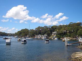
Cronulla and National Park Ferry Cruises is a ferry operator on Port Hacking in Southern Sydney Australia.

<span class="mw-page-title-main">Cronulla sand dunes</span> Sand dunes in Sydney, New South Wales, Australia

The Cronulla sand dunes, also known officially as the Cronulla Sand Dune and Wanda Beach Coastal Landscape, are an open space, heritage-listed nature conservation, and visitor attraction located on the Kurnell Peninsula at Lindum Road, Kurnell within the Sutherland Shire local government area of Sydney, New South Wales, Australia. Formerly, it was a site for sand mining, film making, and had use as pastoral property. It is also known as part of Kurnell Peninsula Headland and Cronulla Sand Hill. It was added to the New South Wales State Heritage Register on 26 September 2003.

Maianbar Bundeena Bus Service is an Australian bus company operating services in southern Sydney.

<span class="mw-page-title-main">Cronulla Fisheries Centre</span> Historic site in New South Wales, Australia

The Cronulla Fisheries Centre or Cronulla Fisheries Research Centre is a heritage-listed former fisheries research centre and now public reserve and marine rescue base located at the Southern end of Nicholson Parade, Cronulla, Sydney, New South Wales, Australia. It was built from 1904. It is also known as The Cronulla Fisheries Centre and Hungry Point Reserve; NSW Fisheries Research Institute; CSIRO Fisheries Division and the CSIRO Division of Fisheries & Oceanography. The property is owned by the NSW Department of Primary Industries, a department of the Government of New South Wales. The site has heritage listed buildings and several Australian Aboriginal sites. It was added to the New South Wales State Heritage Register on 2 April 1999.

References

  1. 1 2 Australian Bureau of Statistics (28 June 2022). "Bundeena (State Suburb)". 2021 Census QuickStats. Retrieved 6 August 2024. OOjs UI icon edit-ltr-progressive.svg CC-BY icon.svg Material was copied from this source, which is available under a Creative Commons Attribution 4.0 International License.
  2. Bundeena Postcode Australia Post
  3. Sydney Morning Herald 21 December 2007 The Deer Hunters
  4. Australian Heritage Historical Towns Directory Archived 24 July 2008 at the Wayback Machine
  5. "Bundeena Public School | Our history". www.bundeena-p.schools.nsw.edu.au. Archived from the original on 20 February 2018. Retrieved 20 February 2018.
  6. "Bundeena Library". Sutherland Shire Council Libraries.