
Bangor is a suburb in southern Sydney, in the state of New South Wales, Australia. Bangor is located 28 kilometres south of the Sydney central business district, in the local government area of the Sutherland Shire in the area commonly called Menai. Bangor sits south of the Georges River and to the west of the Woronora River.
Holsworthy is a suburb in south-western Sydney, in the state of New South Wales, Australia 31 kilometres south-west of the Sydney central business district, in the local government area of the City of Liverpool.

Sutherland Shire is a local government area in the southern region of Sydney, in the state of New South Wales, Australia. The Sutherland Shire is located south of the Sydney CBD, and comprises an area of 370 square kilometres (140 sq mi) and as at the 2016 census and has an estimated population of 218,464. The Sutherland Shire is colloquially known as "The Shire" which has been featured in several reality television series.
Southern Sydney is the southern metropolitan area of Greater Sydney, in the state of New South Wales, Australia.

The Australian Atomic Energy Commission (AAEC) was a statutory body of the Australian Government devoted to nuclear science, engineering and research.
The High Flux Australian Reactor (HIFAR) was Australia's first nuclear reactor. It was built at the Australian Atomic Energy Commission Research Establishment at Lucas Heights, Sydney. The reactor was in operation between 1958 and 2007, when it was superseded by the Open-pool Australian lightwater reactor, also in Lucas Heights.

The Open-pool Australian lightwater reactor (OPAL) is a 20 megawatt (MW) swimming pool nuclear research reactor. Officially opened in April 2007, it replaced the High Flux Australian Reactor as Australia's only nuclear reactor, and is located at the Australian Nuclear Science and Technology Organisation (ANSTO) Research Establishment in Lucas Heights, New South Wales, a suburb of Sydney. Both OPAL and its predecessor have been known simply as the Lucas Heights reactor.
MOATA was a 100 kW thermal Argonaut class reactor built at the Australian Atomic Energy Commission Research Establishment at Lucas Heights, Sydney. MOATA went critical at 5:50am on 10 April 1961 and ended operations on 31 May 1995. MOATA was the first reactor to be decommissioned in Australia in 2009.

Kimba is a rural service town on the Eyre Highway at the top of Eyre Peninsula in the Australian state of South Australia with an annual rainfall of 348 millimetres (13.7 in). There is an 8-metre (26 ft) tall statue of a galah beside the highway, marking halfway between the east and west coasts of Australia. The Gawler Ranges are north of the highway near the town.
The Australian Nuclear Science and Technology Organisation (ANSTO) is Australia's national nuclear organisation and the centre of Australian nuclear expertise. It is a statutory authority under the Australian Government formed in 1987 to replace the Australian Atomic Energy Commission.

Illawong is a suburb in southern Sydney, in the state of New South Wales, Australia. Illawong is located 27 kilometres south of the Sydney Central Business District, in the local government area of the Sutherland Shire in the area commonly called Menai. The post code is 2234, which is also assigned to the contiguous suburbs of Menai, Bangor Barden Ridge and Alfords Point.

Barden Ridge is a suburb in southern Sydney, in the state of New South Wales, Australia. Barden Ridge is located 29 kilometres south of the Sydney central business district in the local government area of the Sutherland Shire. Barden Ridge is colloquially known to locals as 'The Ridge'.
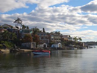
Woronora is a suburb in southern Sydney, in the state of New South Wales, Australia. Woronora is located 27 kilometres south of the Sydney central business district, in the local government area of the Sutherland Shire. Woronora Heights is a separate suburb, to the south-west.

Woronora Heights is a suburb in southern Sydney, in the state of New South Wales, Australia. Woronora Heights is located 29 kilometres south of the Sydney central business district, in the local government area of the Sutherland Shire. Woronora is a separate suburb, to the north. Most streets in Woronora Heights are named after birds.
Sylvania is a suburb in southern Sydney, New South Wales, Australia, 22 kilometres south of the Sydney central business district in the Sutherland Shire. It is well known for its large waterfront properties and restaurants.

Mortdale is a suburb located in southern Sydney, in the state of New South Wales, Australia. Mortdale is located 20 kilometres south of the Sydney central business district and is part of the St George area. Mortdale is situated in the local government area of Georges River Council. Mortdale extends south to Lime Kiln Bay, on the Georges River. Mortdale Heights is a locality in the western corner of the suburb.

Australia does not possess weapons of mass destruction, although it has participated in extensive research into nuclear, biological and chemical weapons in the past.
Jim Green is an anti-nuclear campaigner with Friends of the Earth Australia. Green is a regular media commentator on nuclear issues. He has an honours degree in public health from the University of Wollongong and was awarded a PhD in science and technology studies for his analysis of the Lucas Heights research reactor debates.
The Australian Centre for Neutron Scattering (ACNS), formerly the Bragg Institute, is a landmark neutron and X-ray scattering facility in Australia. It is located at the Australian Nuclear Science and Technology Organisation's (ANSTO) Lucas Heights site, 40 km south-west of Sydney, in New South Wales, Australia.
The Australian Radiation Protection and Nuclear Safety Agency (ARPANSA) is a regulatory agency under the Commonwealth of Australia that aims to protect Australian citizens from both ionising and non-ionising radiation. ARPANSA works under the guidance of the Australian Radiation Protection and Nuclear Safety Act of 1998 as the national regulatory body of radiation in Australia, with independent departments within each state and territory that regulate radiation within each of their jurisdictions.

