Cedar Springs, Texas | |
|---|---|
 Cedar Springs, Texas | |
| Coordinates: 31°11′31″N96°55′31″W / 31.19194°N 96.92528°W | |
| Country | |
| State | |
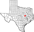
| County | |
| Named after | Spring, cedar grove |
| Elevation | 410 ft (120 m) |
| Population (1990; as per Handbook of Texas ) | |
• Total | 90 |
| Time zone | UTC-6 (Central (CST)) |
| • Summer (DST) | UTC-5 (CDT) |
| ZIP code | 76570 |
| Area code | 254 |
| GNIS feature ID | 1998552 [1] |
Cedar Springs, formerly Mill Tract, is an unincorporated community in west Falls County, Texas, United States. [2] [3]