Centerview, Missouri | |
---|---|
Coordinates: 38°44′45″N93°50′44″W / 38.74583°N 93.84556°W | |
Country | United States |
State | Missouri |
County | Johnson |
Area | |
• Total | 0.20 sq mi (0.51 km2) |
• Land | 0.20 sq mi (0.51 km2) |
• Water | 0.00 sq mi (0.00 km2) |
Elevation | 873 ft (266 m) |
Population (2020) | |
• Total | 189 |
• Density | 964.29/sq mi (373.10/km2) |
Time zone | UTC-6 (Central (CST)) |
• Summer (DST) | UTC-5 (CDT) |
ZIP code | 64019 |
Area code | 660 |
FIPS code | 29-12682 [3] |
GNIS feature ID | 0729717 [2] |
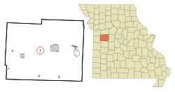
Centerview is a village in Johnson County, Missouri, United States. The population was 267 at the 2010 census.
Centerview was originally called Graham, and under the latter name was laid out in 1865, and named after Samuel C. Graham, the original owner of the town site. [4] A post office called Centerview has been in operation since 1868. [5]
Centerview is located at 38°44′45″N93°50′44″W / 38.74583°N 93.84556°W (38.745727, -93.845430). [6]
According to the United States Census Bureau, the town has a total area of 0.12 square miles (0.31 km2), all land. [7]
Centerview lies on Route 58, about seven miles west of the city of Warrensburg.
Census | Pop. | Note | %± |
---|---|---|---|
1880 | 227 | — | |
1920 | 268 | — | |
1930 | 175 | −34.7% | |
1940 | 198 | 13.1% | |
1950 | 179 | −9.6% | |
1960 | 208 | 16.2% | |
1970 | 234 | 12.5% | |
1980 | 223 | −4.7% | |
1990 | 214 | −4.0% | |
2000 | 249 | 16.4% | |
2010 | 267 | 7.2% | |
2020 | 189 | −29.2% | |
U.S. Decennial Census [8] |
As of the census [9] of 2010, there were 267 people, 94 households, and 65 families living in the town. The population density was 2,225.0 inhabitants per square mile (859.1/km2). There were 114 housing units at an average density of 950.0 per square mile (366.8/km2). The racial makeup of the town was 94.4% White, 0.4% African American, 0.4% Native American, 1.9% Asian, 1.5% from other races, and 1.5% from two or more races. Hispanic or Latino of any race were 3.7% of the population.
There were 94 households, of which 48.9% had children under the age of 18 living with them, 35.1% were married couples living together, 23.4% had a female householder with no husband present, 10.6% had a male householder with no wife present, and 30.9% were non-families. 21.3% of all households were made up of individuals, and 5.4% had someone living alone who was 65 years of age or older. The average household size was 2.84 and the average family size was 3.29.
The median age in the town was 29.4 years. 36.7% of residents were under the age of 18; 7.9% were between the ages of 18 and 24; 30.3% were from 25 to 44; 18.7% were from 45 to 64; and 6.4% were 65 years of age or older. The gender makeup of the town was 43.8% male and 56.2% female.
As of the census [3] of 2000, there were 249 people, 89 households, and 67 families living in the town. The population density was 2,148.1 inhabitants per square mile (829.4/km2). There were 107 housing units at an average density of 923.1 per square mile (356.4/km2). The racial makeup of the town was 92.37% White, 3.21% Native American, 0.40% Asian, 0.80% from other races, and 3.21% from two or more races. Hispanic or Latino of any race were 4.42% of the population.
There were 89 households, out of which 41.6% had children under the age of 18 living with them, 47.2% were married couples living together, 24.7% had a female householder with no husband present, and 23.6% were non-families. 19.1% of all households were made up of individuals, and 7.9% had someone living alone who was 65 years of age or older. The average household size was 2.80 and the average family size was 3.15.
In the town the population was spread out, with 34.5% under the age of 18, 8.8% from 18 to 24, 30.9% from 25 to 44, 17.3% from 45 to 64, and 8.4% who were 65 years of age or older. The median age was 30 years. For every 100 females there were 79.1 males. For every 100 females age 18 and over, there were 79.1 males.
The median income for a household in the town was $28,333, and the median income for a family was $31,250. Males had a median income of $32,500 versus $16,042 for females. The per capita income for the town was $12,696. About 28.9% of families and 28.6% of the population were below the poverty line, including 41.7% of those under the age of eighteen and 16.7% of those 65 or over.
Romoland is a census-designated place (CDP) in Riverside County, California, United States. The population was 2,005 at the 2020 census, up from 1,684 at the 2010 census.
Simonton Lake is a census-designated place (CDP) in Elkhart County, Indiana, United States. The population was 4,678 at the 2010 census.
Brownell is a city in Ness County, Kansas, United States. As of the 2020 census, the population of the city was 23.
Chesterville is a town in Franklin County, Maine, United States. The population was 1,328 at the 2020 census.
Benton is a town in Kennebec County, Maine, United States. It was formed in 1842, as a subdivision of the town of Clinton. The population was 2,715 at the 2020 census. The town was named for Missouri Senator Thomas Hart Benton.
Maugansville is a census-designated place (CDP) in Washington County, Maryland, United States. The population was 2,295 at the 2000 census.
Seville Township is a civil township of Gratiot County in the U.S. state of Michigan. The population was 2,375 at the 2000 census.
Regal is a city in northeast Kandiyohi County, Minnesota, United States, along the North Fork of the Crow River. The population was 34 at the 2010 census.
McGrew is a village in Scotts Bluff County, Nebraska, United States. It is part of the Scottsbluff, Nebraska Micropolitan Statistical Area. The population was 105 at the 2010 census.
Rutherford College is a town in Burke County, North Carolina, United States. As of the 2010 census, the town population was 1,341. It is part of the Hickory–Lenoir–Morganton Metropolitan Statistical Area.
North Bend is a village in Miami Township, Hamilton County, Ohio, United States, along the Ohio River. It is a part of the Greater Cincinnati area. The population was 835 at the 2020 census.
New Lebanon is a village in Montgomery County, Ohio, United States. The population was 3,796 at the 2020 census. It is part of the Dayton Metropolitan Statistical Area.
Adelphi is a village in Ross County, Ohio, United States. The population was 380 at the 2010 census.
Beccaria Township is a township in Clearfield County, Pennsylvania, United States. The population was 1,769 at the 2020 census. It is named in honor of Cesare Beccaria, an Enlightenment thinker.
Gustine is a town located in Comanche County in Central Texas. The population was 476 at the 2010 census. The town, formerly known as Cora, was the county seat in the 1850s.
Riverpoint is an unincorporated community and census-designated place (CDP) in east King County, Washington, United States. As of the 2020 census, it had a population of 774. At the 2010 census, the area was listed as the Tanner CDP and had a population of 1,018 over a larger area.
North Hills is a town in Wood County, West Virginia, United States. It is a suburb of Parkersburg. The population was 837 at the 2020 census. North Hills was incorporated on February 15, 1979.
Stone Lake is a town in Washburn County, Wisconsin, United States. The population was 544 at the 2000 census. The census-designated place of Stone Lake is located partially in the town.
Peshtigo is a city in Marinette County, Wisconsin, United States. The population was 3,420 at the 2020 census The city is surrounded by the Town of Peshtigo. It is part of the Marinette, WI–MI Micropolitan Statistical Area. Peshtigo is known for being the site of the Peshtigo fire of 1871, in which more than 1,200 people perished.
Chatfield is a city in Fillmore and Olmsted counties in the U.S. state of Minnesota. The population was 2,779 at the 2010 census. The city's area is split almost equally between the two counties. Chatfield is known as "The Gateway to Bluff Country" and "The Chosen Valley".
{{cite web}}
: CS1 maint: bot: original URL status unknown (link)