
The Boston Public Library is a municipal public library system in Boston, Massachusetts, founded in 1848. The Boston Public Library is also Massachusetts' Library for the Commonwealth, meaning all adult residents of the state are entitled to borrowing and research privileges, and the library receives state funding. The Boston Public Library contains approximately 24 million items, making it the third-largest public library in the United States behind the federal Library of Congress and New York Public Library, which is also privately endowed. In 2014, the library held more than 10,000 programs, all free to the public, and lent 3.7 million materials.

East Boston, nicknamed Eastie, is a neighborhood of Boston, Massachusetts that was annexed by the city of Boston in 1637. Neighboring communities include Winthrop, Revere, and Chelsea. It is separated from the Boston neighborhood of Charlestown and downtown Boston by Boston Harbor. The footprint of the East Boston neighborhood as it is known today was created in the 1940s by connecting five of the inner harbor islands using land fill. Logan International Airport is located in East Boston, connecting Boston to domestic and international locations.
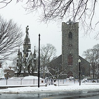
Jamaica Plain is a neighborhood of 4.4 square miles (11 km2) in Boston, Massachusetts. Settled by Puritans seeking farmland to the south, it was originally part of Roxbury, Massachusetts. The community seceded from Roxbury during the formation of West Roxbury in 1851 and became part of Boston when West Roxbury was annexed in 1874. In the 19th century, Jamaica Plain became one of the first streetcar suburbs in America and home to a significant portion of Boston's Emerald Necklace of parks, designed by Frederick Law Olmsted.
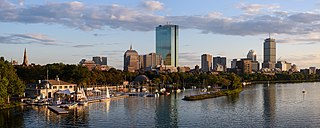
Back Bay is an officially recognized neighborhood of Boston, Massachusetts, built on reclaimed land in the Charles River basin. Construction began in 1859, as the demand for luxury housing exceeded the availability in the city at the time, and the area was fully built by around 1900. It is most famous for its rows of Victorian brownstone homes—considered one of the best preserved examples of 19th-century urban design in the United States—as well as numerous architecturally significant individual buildings, and cultural institutions such as the Boston Public Library, and Boston Architectural College. Initially conceived as a residential-only area, commercial buildings were permitted from around 1890, and Back Bay now features many office buildings, including the John Hancock Tower, Boston's tallest skyscraper. It is also considered a fashionable shopping destination and home to several major hotels.

Copley Square, is a public square in Boston's Back Bay neighborhood, bounded by Boylston Street, Clarendon Street, St. James Avenue, and Dartmouth Street. The square is named for painter John Singleton Copley. Prior to 1883 it was known as Art Square due to its many cultural institutions, some of which remain today.

Davis Square is a major intersection in the northwestern section of Somerville, Massachusetts, where several streets meet: Holland Street, Dover Street, Day Street, Elm Street, Highland Avenue, and College Avenue. The name is often used to refer to the West Somerville neighborhood surrounding the square as well.
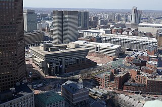
Government Center is an area in downtown Boston, centered on City Hall Plaza. Formerly the site of Scollay Square, it is now the location of Boston City Hall, courthouses, state and federal office buildings, and a major MBTA subway station, also called Government Center. Its development was controversial, as the project displaced thousands of residents and razed several hundred homes and businesses.

Downtown Pittsburgh, colloquially referred to as the Golden Triangle, and officially the Central Business District, is the urban downtown center of Pittsburgh, Pennsylvania, United States. It is located at the confluence of the Allegheny River and the Monongahela River whose joining forms the Ohio River. The triangle is bounded by the two rivers.

Wallingford is a neighborhood in north central Seattle, lying on a hill above the north shore of Lake Union about four miles from the downtown core. The neighborhood developed quickly during the early 20th century after the establishment of the University of Washington to the east. With trolley tracks laid through the neighborhood as early as 1907, Wallingford is a classic streetcar suburb, typified by its many 1920s era box houses and bungalows. Commercial development is primarily concentrated along North 45th Street where a number of iconic structures stand including the neon "WALLINGFORD" sign, the Wallingford Center, and the original Dick's Drive-In. With its central location, numerous public amenities, including the world-renowned Gas Works Park, and views of both the Olympic and Cascade mountains, Wallingford has long been home to many middle and upper-class families. While Wallingford is mostly residential in nature, the neighborhood's southern edge, along Lake Union, has historically been an industrial and commercial business strip. In recent years, numerous office buildings have been developed as an extension of the burgeoning business center in neighboring Fremont. In 2014 Brooks Sports moved its headquarters from Bothell to a new six-story office building at the southwestern edge of Wallingford.

Post Office Square in Boston, Massachusetts is a square located in the financial district at the intersection of Milk, Congress, Pearl and Water Streets. It was named in 1874 after the United States Post Office and Sub-Treasury which fronted it, now replaced by the John W. McCormack Post Office and Courthouse.

Downtown Crossing is a shopping district within downtown Boston, Massachusetts, located east of Boston Common, west of the Financial District, south of Government Center, and north of Chinatown and the old Combat Zone. It features large department stores as well as restaurants, souvenir sellers, general retail establishments, and street vendors. The Downtown Crossing MBTA station lies in the center of the district.
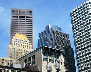
Dewey Square is a square in downtown Boston, Massachusetts which lies at the intersection of Atlantic Avenue, Summer Street, Federal Street, Purchase Street and the John F. Kennedy Surface Road, with the Central Artery (I-93) passing underneath in the Dewey Square Tunnel, which was built in the Big Dig. South Station is on the southeast corner of the square, with Amtrak and MBTA Commuter Rail services, as well as Red Line subway trains and Silver Line bus rapid transit underneath.

The Tremont Street subway in Boston's MBTA subway system is the oldest subway tunnel in North America and the third-oldest still in use worldwide to exclusively use electric traction, opening on September 1, 1897. It was originally built, under the supervision of Howard A. Carson as chief engineer, to get streetcar lines off the traffic-clogged streets, instead of as a true rapid transit line. It now forms the central part of the Green Line, connecting Boylston Street to Park Street and Government Center stations.

Newtonville is one of the thirteen villages within the city of Newton in Middlesex County, Massachusetts, United States.
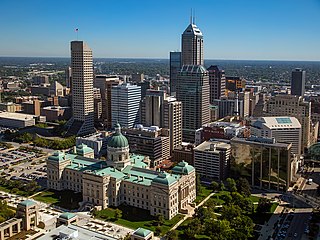
Downtown Indianapolis is a neighborhood area and the central business district of Indianapolis, Indiana, United States. Downtown is bordered by Interstate 65, Interstate 70, and the White River, and is situated near the geographic center of Marion County. Downtown has grown from the original 1821 town plat—often referred to as the Mile Square—to encompass a broader geographic area of central Indianapolis, containing several smaller historic neighborhoods.

Boylston Street is a major east–west thoroughfare in the city of Boston, Massachusetts and its western suburbs. The street begins in Boston's Chinatown neighborhood, forms the southern border of the Boston Public Garden and Boston Common, runs through Back Bay and Boston's Fenway neighborhood, merges into Brookline Ave and then Washington Street, emerging again contiguous with Route 9 out to where it crosses Route 128, after which it becomes Worcester Street.
Park Square in downtown Boston, Massachusetts, is bounded by Stuart, Charles Street South, Boylston, and Arlington Streets.

Downtown Boston is the central business district of Boston, Massachusetts, United States. Boston was founded in 1630. The largest of the city's commercial districts, Downtown is the location of many corporate or regional headquarters; city, county, state and federal government facilities; and many of Boston's tourist attractions. Similar to other central business districts in the U.S., Downtown has recently undergone a transformation that included the construction of new condos and lofts, renovation of historic buildings, and arrival of new residents and businesses. It is represented in the Boston City Council by District 2's Bill Linehan.
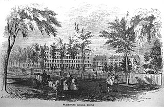
Blackstone and Franklin Squares are public parks located in the South End neighborhood of Boston, Massachusetts.
Brigham Circle is located at the intersection of Tremont Street and Huntington Avenue in the Mission Hill neighborhood of Boston, Massachusetts. The commercial center of Mission Hill, it forms the southern tip of the Longwood Medical Area.


