Transportation in the Philippines covers the transportation methods within the archipelagic nation of over 7,600 islands. From a previously underdeveloped state of transportation, the government of the Philippines has been improving transportation through various direct infrastructure projects, and these include an increase in air, sea, road, and rail transportation and transport hubs.

Rizal, officially the Province of Rizal, is a province in the Philippines located in the Calabarzon region in Luzon. Its capital is the city of Antipolo. It is about 16 kilometers (9.9 mi) east of Manila. The province is named after José Rizal, one of the main national heroes of the Philippines. It is bordered by Metro Manila to the west, Bulacan to the north, Quezon to the east and Laguna to the southeast. The province also lies on the northern shores of Laguna de Bay, the largest lake in the country. Rizal is a mountainous province perched on the western slopes of the southern portion of the Sierra Madre mountain range.

Palawan, officially the Province of Palawan, is an archipelagic province of the Philippines that is located in the region of Mimaropa. It is the largest province in the country in terms of total area of 14,649.73 km2 (5,656.29 sq mi). The capital and largest city is Puerto Princesa which is geographically grouped with but administered independently from the province. Palawan is known as the Philippines' Last Frontier and as the Philippines' Best Island.

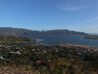
Coron, officially the Municipality of Coron, is a 1st class municipality in the province of Palawan, Philippines. According to the 2020 census, it has a population of 65,855 people.

El Nido, officially the Municipality of El Nido, is a 1st class municipality in the province of Palawan, Philippines. According to the 2020 census, it has a population of 50,494 people.

Culion, officially the Municipality of Culion, is a 3rd class municipality in the province of Palawan, Philippines. According to the 2020 census, it has a population of 23,213 people.

San Vicente, officially the Municipality of San Vicente, is a 1st class municipality in the province of Palawan, Philippines. According to the 2020 census, it has a population of 33,507 people.

Taytay, officially the Municipality of Taytay, is a 1st class municipality in the province of Palawan, Philippines. According to the 2020 census, it has a population of 83,357 people.

The Department of Transportation is the executive department of the Philippine government responsible for the maintenance and expansion of viable, efficient, and dependable transportation systems as effective instruments for national recovery and economic progress. It is responsible for the country's land, air, and sea communications infrastructure.

Laguindingan Airport, also referred to as Laguindingan International Airport, is an international airport in Northern Mindanao that serves the cities of Cagayan de Oro, Iligan and Marawi, as well as the provinces of Misamis Oriental, Lanao del Norte and Bukidnon in the Philippines. The airport is Mindanao's second-busiest airport after Francisco Bangoy International Airport in Davao City.

Marinduque Airport is the only airport located on and serving the island province of Marinduque in the Philippines. It is in Barangay Masiga in the town of Gasan, near the border with the provincial capital, Boac. It is classified as a Class 2 principal airport by the Civil Aviation Authority of the Philippines (CAAP), an attached agency of the Department of Transportation that is responsible for the operations of airports in the Philippines.

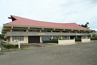
Puerto Princesa International Airport is an airport serving the general area of Puerto Princesa, located in the province of Palawan in the Philippines. It is classified as an international airport by the Civil Aviation Authority of the Philippines.

Bicol International Airport, also referred by some sources as Southern Luzon International Airport, is an airport serving the vicinity of Legazpi, the capital city of Albay and the regional center of Bicol Region, in the Philippines. Dubbed as the Philippines' "Most Scenic Gateway", the airport is located in Daraga, an adjacent municipality of Legazpi. The ₱4.7 billion project is on a 200-hectare (490-acre) plateau 15 kilometers (9.3 mi) from Mayon Volcano. It replaced the old Legazpi Airport, which is only 2 to 3 kilometers from the BIA.

Sanga-Sanga Airport, also known as Tawi-Tawi Airport, is an airport serving the general area of Bongao, the capital of the province of Tawi-Tawi in the Philippines. The airport is classified as a Class 2 principal airport by the Civil Aviation Authority of the Philippines. It is not an international airport, contrary to its classification by the Tawi-Tawi provincial government. It is located in Sanga-Sanga Island. The airport was formerly referred by the IATA with the code SGS until the end of 2011, when its IATA code was finally changed to TWT.

Iloilo International Airport is the main international airport serving Metro Iloilo–Guimaras, as well as the rest of Province of Iloilo in the Western Visayas region of the Philippines. It is the fifth-busiest airport in the Philippines and is located in the municipality of Cabatuan, Iloilo, approximately 24 kilometers (15 mi) northwest of Iloilo City proper, on a 188-hectare (460-acre) site.

Bohol–Panglao International Airport — also known as New Bohol International Airport or Panglao Island Airport — is an international airport on Panglao Island in the province of Bohol, Philippines. The airport opened on November 28, 2018 after decades of planning and three years of construction, replacing Tagbilaran Airport to support Bohol's increased passenger traffic due to tourism. The airport serves as the gateway to Tagbilaran and the rest of mainland Bohol for domestic air travellers. It also is less than an hour's flight from Mactan–Cebu International Airport, which is a gateway to central Philippines for international tourists.

Bacolod–Silay International Airport, is an airport serving the general area of Metro Bacolod, located in the Negros Island Region of the Philippines.

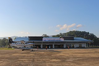
San Vicente Airport is an airport in San Vicente, Palawan, Philippines. The airport was opened for general aviation flights on 22 June 2017, and opened for commercial flights by the end of 2017. The airport was built to boost tourism in the town and as an alternative to much smaller El Nido Airport.

The Metro Manila Subway, formerly known as the Mega Manila Subway (MMS) is an under-construction underground rapid transit line in Metro Manila, Philippines. The 33-kilometer (21 mi) line, which will run north–south between Valenzuela, Quezon City, Pasig, Taguig, Parañaque and Pasay, consists of 17 stations between the East Valenzuela and Bicutan stations. It will become the country's second direct airport rail link after the North–South Commuter Railway, with a branch line to Ninoy Aquino International Airport.


