Mont Blanc is the highest mountain in the Alps and Western Europe, and the highest mountain in Europe outside the Caucasus Mountains, rising 4,805.59 m (15,766 ft) above sea level, located on the Franco-Italian border. It is the second-most prominent mountain in Europe, after Mount Elbrus, and the 11th most prominent mountain in the world.

The mountains of the Massif des Écrins form the core of Écrins National Park in Hautes-Alpes and Isère in the French Alps.
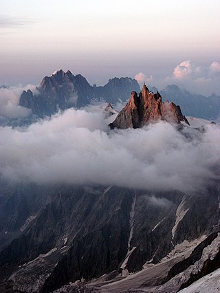
The Aiguille du Midi is a 3,842-metre-tall (12,605 ft) mountain in the Mont Blanc massif within the French Alps. It is a popular tourist destination and can be directly accessed by cable car from Chamonix that takes visitors close to Mont Blanc.
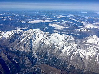
The Mont Blanc massif is a mountain range in the Alps, located mostly in France and Italy, but also straddling Switzerland at its northeastern end. It contains eleven major independent summits, each over 4,000 metres (13,123 ft) in height. It is named after Mont Blanc, the highest point in western Europe and the European Union. Because of its considerable overall altitude, a large proportion of the massif is covered by glaciers, which include the Mer de Glace and the Miage Glacier – the longest glaciers in France and Italy, respectively.

The Ubaye Valley is an area in the Alpes de Haute-Provence département, in the French Alps, having approximately 7,700 residents. Its residents are called Ubayens. Its principal town is the sous-préfecture of Barcelonnette.

The Vallée Blanche Cable Car is a passenger cable car linking a mountain peak above Courmayeur (Italy) to a peak above Chamonix (France) by passing over the Mont Blanc massif, in the Alps. The engineering was developed by Vittorio Zignoli of Polytechnic University of Turin. No helicopters were used, and all the workers were chosen among locals and alpine guides. After a construction period of four years, it began service in 1958.

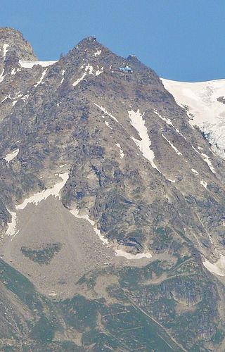
The Dent du Géant is a mountain in the Mont Blanc massif in France and Italy.

The Vanoise massif is a mountain range of the Graian Alps, located in the Western Alps. After the Mont Blanc Massif and the Écrins Massif it is the third-highest massif in France, reaching a height of 3,885 m at the summit of Grande Casse. It lies between Tarentaise Valley to the north and the Maurienne Valley in the south. The range is the site of France's first national park, established in 1963, Vanoise National Park. The ski resorts of Tignes and Val-d'Isère and the 2,770-metre-high Col de l'Iseran are located in the eastern part of the range.
Pointe Helbronner is a mountain in the Mont Blanc massif in the Graian Alps on the watershed between France and Italy.

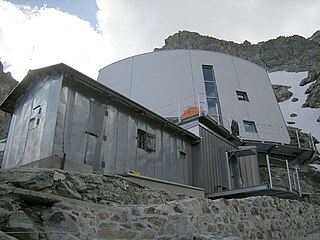
The Torino Hut is a high mountain refuge in the Alps in northwestern Italy. Located near the border with France, it is about 15 km (10 mi) southwest of Mont Dolent, the tripoint with Switzerland. The refuge is in the Mont Blanc massif above the town of Courmayeur in the Aosta Valley, Italy. It can be most easily accessed from the Italian side by the Skyway Monte Bianco cable car from La Palud in Courmayeur, with a change at the Pavilion du Mont Fréty. It can also be reached from Chamonix via the Aiguille du Midi, either by cable car which crosses the massif, or by a long crossing of the Glacier du Gèant. The refuge lies nearly directly above the 11.6 km (7.2 mi) Mont Blanc Tunnel, which passes deep underground, and connects Courmayeur to Chamonix.
The Gonella Hut, sometimes called in Italian Rifugio del Dôme or in French Refuge du Dôme, is a high elevation mountain hut in the Aosta Valley in the Mont Blanc massif area of the Alps. It lies at an elevation of 3071 metres, above Val Veny near Courmayeur in Italy. The refuge is located on the Italian normal route to Mont Blanc.

Aiguille de Chambeyron (3,412m) is a mountain of the Cottian Alps and is the highest mountain of Alpes-de-Haute-Provence in southeast France. Together with its neighbour Brec de Chambeyron, it is the dominant peak of the upper Ubaye Valley. The mountain is located near the border with Italy, just west of the Main chain of the Alps. It is the culminating point of the Massif du Chambeyron and is also the highest peak in the Alps south of Monte Viso.

The Aiguille de Tré-la-Tête is a mountain in the south of the Mont Blanc massif. Its highest point, the central southeast pinnacle, is 3,930 metres (12,894 ft) above sea level and is located in Italy. Only the northwest pinnacle is situated on the border with France. It forms a chain with the Dômes de Miage.

Brec de Chambeyron (3,389) is a mountain of the Cottian Alps on the border between France and Italy. It is the second highest summit of the Chambeyron Massif, after Aiguille de Chambeyron and its sharp, rocky peak dominates the Upper Ubaye Valley. The word "Brec" or "Bric" in French is used for a mountain resembling a rocky tooth. It was first climbed in 1878 by Paul Agnel and Joseph Risoul.

The Cima Mongioia or simply Mongioia or Bric de Rubren is a 3,340 metres high mountain of the Cottian Alps.

The Mercantour-Argentera massif is a massif in the Maritime Alps located astride the French departments of Alpes-Maritimes and Alpes-de-Haute-Provence and the Italian region of Piedmont. The name of the massif comes respectively from the summit of Mercantour, a secondary central summit, and from Mount Argentera, the highest point of the massif, entirely in Italy.

The Arves massif are a massif in the French Alps located in the departments of Savoie, Isère and Hautes-Alpes. Oisans covers part of the massif.
The Escreins massif are a massif in the French and Italian Alps located in the French departments of Hautes-Alpes and Alpes-de-Haute-Provence, as well as in the Italian region of Piedmont.
The Parpaillon massif are a massif in the French Alps. It serves as the boundary between the departments of Hautes-Alpes to the north and the Alpes-de-Haute-Provence to the south. Additionally, it separates the Embrun region from the Ubaye valley. The massif extends from the Serre-Ponçon lake in the west to the Col de Vars, which distinguishes it from the Escreins massif, and to the middle Ubaye valley in the southeast, near Saint-Paul-sur-Ubaye, where it is bordered by the Mercantour-Argentera massif and the Chambeyron massif.