Balasore, also known as Baleswar, is a city in the state of Odisha, about 194 km (121 mi) north of the state capital Bhubaneswar and 300 km (186 mi) from Kolkata, in eastern India. It is the largest town of northern Odisha and the administrative headquarters of Balasore district. It is best known for Chandipur beach. It is also called 'missile city'. The Indian Ballistic Missile Defence Programme's Integrated Test Range is located 18 km south of Balasore.

Purba Medinipur district is an administrative unit in the Indian state of West Bengal. It is the southernmost district of Medinipur division – one of the five administrative divisions of West Bengal. The headquarters in Tamluk. It was formed on 1 January 2002 after the Partition of Medinipur into Purba Medinipur and Paschim Medinipur which lies at the northern and western border of it. The state of Odisha is at the southwest border; the Bay of Bengal lies in the south; the Hooghly river and South 24 Parganas district to the east; Howrah district to the north-east; Paschim Medinipur district to the west.
Balasore District, also known as Baleswar District, is an administrative district of Odisha state, in eastern India. Balasore is one of the coastal districts of Odisha and lies on the northernmost part of the state.
Chandipur, is a resort town in Balasore District, Odisha, India. The town is located on the shore of Bay of Bengal and is approximately 16 kilometers from the Balasore Railway Station. Its beach is unique in a way that the water recedes up to 5 kilometers during the ebb tide. Due to its unique circumstances, the beach supports biodiversity. Horseshoe crab is also found here on the beach towards Mirzapur, the nearby fishing market and community at the confluence of the Budhabalanga River (Balaramgadi). It is a suitable picnic spot. One of Odisha Tourism's Panthanivas is situated here.

Ramnagar I is a community development block that forms an administrative division in Contai subdivision of Purba Medinipur district in the Indian state of West Bengal.
Salepur is a town in the district of Cuttack. It is situated near the bank of holy river Chitrotpala mother of Ganga, 25 km from the city of Cuttack and 55 km from the state capital Bhubaneswar.

Mandarmani is a seaside resort village in the state of West Bengal, India, and lies in East Midnapore district, at the northern end of the Bay of Bengal. It is one of the largest seaside resorts of West Bengal, fast-developing.
Tourism in Odisha is one of the main contributors to the economy of Odisha, India, with a 500 km (310 mi) long coastline, mountains, lakes, natural biodiversity and rivers. Odisha is a major tourist destination in India, with various tourist attractions, including wildlife reserves, beaches, temples, monuments, the arts and festivals. Other than wildlife reserves, beaches, temples, monuments, the arts and festivals, the Odisha Tourism Development Corporation, a public sector undertaking of the Government of Odisha, is also developing the tourism sector of Odisha and India.
Talasari Beach is a beach in the Baleswar district of Odisha, India. It lies on the north-eastern coast of India.

Shankarpur is a beach village located 14 km east of Digha in West Bengal, India. It is also a regular fishing harbour. Shankarpur contains a number of temples.

Chandipur is a community development block that forms an administrative division in Tamluk subdivision of Purba Medinipur district in the Indian state of West Bengal.

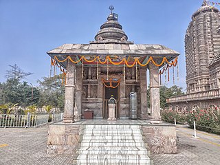
Panchalingeswar Temple is in Balasore district of Odisha, India. It named after the five Shivalinga that are enshrined inside. The temple is on top of a hillock near the Nilagiri hill.

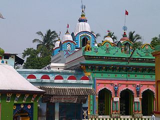
Chandaneswar Temple is a famous Shiva temple located in Chandaneswar, Baleswar district of Odisha, India. A huge annual fair on the Pana Sankranti, the first day of the Odia calendar, is celebrated on the premises. Many Indian pilgrims visit the temple during this period.
Dagara is a village situated in the Baleswar district of Odisha, in eastern India. The village, with a beach on the Bay of Bengal, is a well-known spot for local tourists. In 2006, the Government of Odisha signed a memorandum of understanding (MOU) with Chennai-based Creative Port Development Pvt Ltd. for the development of a deep-water, all-weather project, Kirtania port, at the mouth of the Subarnarekha River.

Tajpur is located in Purba Medinipur, in the state of West Bengal, India on the shore of Bay of Bengal. Tajpur is set between Mandarmani and Shankarpur. Tajpur is 172.9 km via NH16 and NH116B from the state capital Kolkata. It is located under Contai Sub division area.

The Kharagpur–Puri Line is a railway line connecting Kharagpur in the Indian state of West Bengal and Puri in Odisha. The total line can be divided into sections. The Kharagpur–Khurda Road portion of this line, which is a part of the Howrah–Chennai main line and Khurda Road - Puri portion.
Balasore railway station serves Balasore, Remuna, Chandipur, Bhograi, Nilagiri, Odisha in Balasore district and other districts like Mayurbhanj, Kendujhargarh and Bhadrak for boarding major trains like Duronto, Rajdhani, Shatabdi, Humsafar Express and many more trains that do not stop at Bhadrak station in the Indian state of Odisha.

State Highway 4 is a state highway in West Bengal, India.
22889 / 90 Samudra Kanya Express is a Express train belonging to Indian Railways East Coast Railway zone that run between Puri and Digha in India.
Khireitangiri is a village located in Patna Tehsil in the Kendujhar District in the Indian state of Odisha.

